Conquer the Virtual London to Paris Challenge: Ride the Avenue Verte
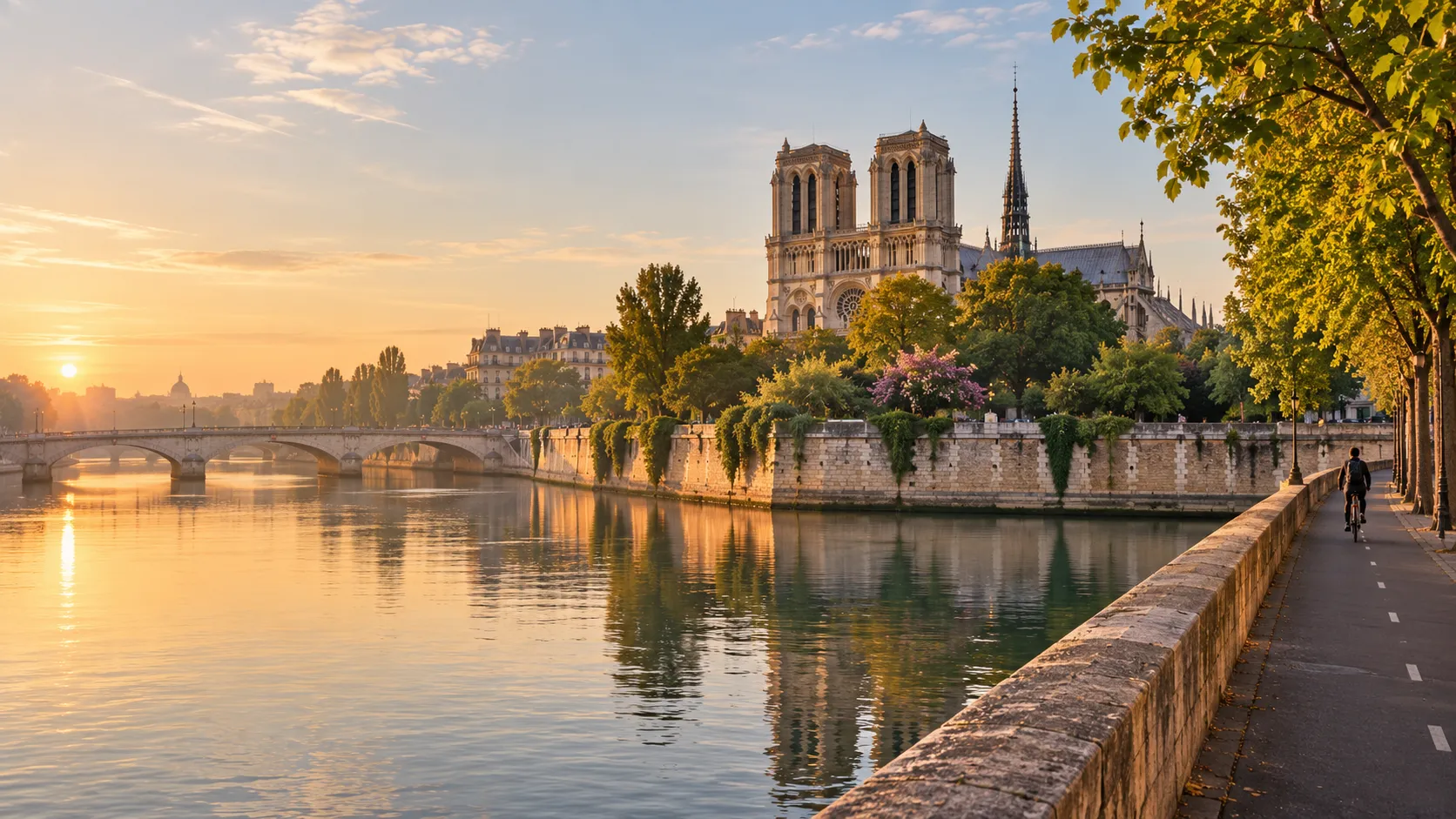
Ride from the London Eye to Notre-Dame without leaving home. The Avenue Verte, the signed cycle route between the two capitals, runs about 395 km (roughly 246 miles) south through Surrey and the Sussex Weald to the sea at Newhaven, then on from Dieppe through the Pays de Bray, Gisors and the Vexin to the Seine and the heart of Paris. Route Rally turns your synced rides into progress along it, and your ride skips the ferry from Newhaven to Dieppe, so only the road and path on either side count.
- Route: London to Paris
- Distance: 395.1 km
- Elevation gain: 3457 m
- Capital-to-capital ride across the Channel
- Best for: Cyclists training for a London to Paris ride, winter turbo blocks, and month-long rallies of your own
Planning your challenge
A cyclist averaging 100 km/week reaches Paris in about four weeks; at 150 km/week it takes under three, while runners at 40 km/week arrive in around ten weeks.
This is a Medium route by Route Rally distance bands, at the long end of the band, so it fills a focused training block without the commitment of an end-to-end epic.
Works well for cyclists who want a recognised two-country goal, and for clubs or workplace teams riding towards one shared finish in Paris.
Create your own rally for your own London to Paris target, solo or with a group sharing one leaderboard.
Why this route
- The Avenue Verte, opened in 2012, is the signed cycle route linking London and Paris, and the Route Rally line follows it for about 395 km (246 miles) from the London Eye to the Île de la Cité.
- Long stretches run on old railway lines turned into paths: the Worth Way, the Forest Way and the Cuckoo Trail in Sussex, then the greenway on the old Dieppe to Forges-les-Eaux line in Normandy.
- It is a natural step up from London to Brighton: the same capital at the start, more than four times the distance, and a finish in another country.
- As a virtual challenge you ride it in your own time, so a winter of turbo sessions and weekend club runs can carry you all the way to Notre-Dame.
- Taken on as a Conquest, one route reaches two countries on your passport map: the United Kingdom, then France.
Highlights
- Set off from the London Eye on the South Bank of the Thames
- Ride the Sussex railway paths: the Worth Way, the Forest Way and the Cuckoo Trail
- Reach the sea at Newhaven, skip the ferry, and carry on from the harbour at Dieppe
- Follow the old railway greenway past the castle at Arques-la-Bataille to Forges-les-Eaux, then cross the Pays de Bray to Gisors
- Cross the Vexin to the Seine at Conflans-Sainte-Honorine and finish on the Île de la Cité, a short walk from Notre-Dame
Places along the route
Every place below is measured onto the route line, so the distance shown is where you actually reach it.
Places are researched from published sources. The distances are measured rather than estimated: we find the point on the route's own recorded line that lies nearest the place, and give the distance along the route to that point.
London
0–17 km · 6 places
0 km (0 miles) · engineering
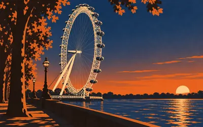
The London Eye
Where the Avenue Verte begins
The ride to Paris starts beside the London Eye, a wheel 135 metres high on the South Bank of the Thames.
- The London Eye is 135 metres high, according to both its operator and its architects.
- Its 32 capsules are numbered from 1 to 33, with no number 13.
- It was designed as a temporary structure on a five-year lease and was never taken down.
2 km (1 mile) · heritage
Vauxhall Pleasure Gardens
Farewell for ever, 1859
A public park now, and for two centuries one of London's pleasure gardens. John Evelyn visited the New Spring Garden at Lambeth in 1661. From 1728 Jonathan Tyers opened it at night in summer, with Hogarth among the artists he employed. The last entertainment was given on 25 July 1859, when the fireworks displayed the words Farewell for Ever. Within five years the site had been built over.
4 km (3 miles) · engineering
Battersea Power Station
Two power stations and four chimneys
Four chimneys, because these are two power stations side by side: Station A of 1929 to 1935 and Station B of 1937 to 1941, whose last chimney came in 1955. Giles Gilbert Scott was brought in after building began, to win round a doubtful public. Historic England says that when finished it supplied almost a fifth of London's electricity. It closed in 1983 and opened to the public in 2022.
10 km (6 miles) · heritage
Royal Victoria Patriotic Building
A castle built for the orphans of the Crimea
A Scottish baronial castle in yellow brick on Wandsworth Common, with St George and the Dragon crowning its main front. It was built in 1857 to 1859 for the girls' school of the Royal Victoria Patriotic Fund, raised by public appeal for the widows and orphans of the Crimean War. The school left London in 1938; since 1987 the building has held studios and offices.
15 km (9 miles) · heritage
Merton Abbey Mills
Merton, where the Strawberry Thief was first printed
William Morris opened his works at Merton Abbey in 1881, making printed and woven fabrics, tapestry, carpets and stained glass. In May 1883 he spent days there anxiously watching over the first printing of the Strawberry Thief. From 1904 Merton Abbey Mills was Liberty's base for printing luxury silks. Merton Priory, founded in 1117 where the Roman road crossed the Wandle, stood on this ground.
17 km (10 miles) · heritage
Morden Hall Park
A snuff fortune, given away free
Water wheels on the Wandle turned the snuff mills here, leased from 1831 by Taddy and Co, whose tobacco came from Virginia plantations where enslaved people grew it. The National Trust tells that history plainly. Milling ended after a strike in the early 1920s, and Gilliat Edward Hatfeild, who died in 1941, left the estate to the Trust on condition that nobody is ever charged to come in.
Surrey and the North Downs
25–47 km · 4 places
25 km (15 miles) · heritage
Little Holland House
One man's Arts and Crafts house
A plain roughcast house in Carshalton Beeches with an Arts and Crafts interior made almost entirely by one man. Frank Dickinson designed it for himself and it was built in 1903 to 1904; he then designed and mostly made the fittings: carved beams with an owl, squirrels and rabbits, hand-painted tiles, hammered copper. One beam reads Serve Humanity the Gods we know not. It is listed for its interior.
34 km (21 miles) · heritage
Farthing Downs
Saxon graves the plough did not reach
A ridge of open chalk grassland above Coulsdon, looked after by the City of London, which acquired a large part of it in 1883. Fifteen Anglo-Saxon burial mounds can still be seen, among the banks of fields first ploughed in the first century BC. In 1947 the Downs were allocated for cultivation; Brian Hope Taylor's archaeological finds and the City's resistance kept them as they are.
36 km (23 miles) · heritage
St Peter and St Paul, Chaldon
A ladder to heaven, painted about 1200
A flint church on the Downs holding what Historic England calls one of the most important English wall paintings of its date. Painted across the west wall in about 1200, it shows a ladder with Christ above, while below a cloudy band the wicked are punished and murderers boil in a cauldron. The seven deadly sins are in it, and the tree of knowledge with its serpent.
47 km (29 miles) · heritage
Royal Earlswood
Built on the belief that people could be taught
The tall Jacobean building at Earlswood was, in Historic England's words, the first asylum in the British Isles built specifically for people with learning disabilities. Until then they had been housed with the mentally ill in asylums or workhouses. Its founder, the Rev Dr Andrew Reed, believed careful teaching could let them work and care for themselves. Prince Albert laid the foundation stone in 1852.
The Weald
58–115 km · 11 places
58 km (36 miles) · engineering
The Beehive, Gatwick
Its first scheduled flight went to Paris
A round terminal on the edge of Gatwick, built in 1934 to 1936 with the control tower in a central drum and the restaurant and offices in the ring around it. Passengers walked to their aircraft along telescopic corridors run out on rails to the steps. Historic England rates it important in world airport design. Gatwick's own history says the Beehive's first scheduled flight, in 1936, took off for Paris.
66 km (41 miles) · heritage
St Nicholas, Worth
A Saxon church beside a railway path
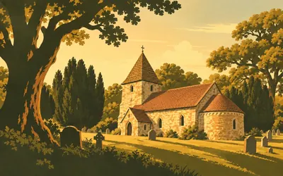
St Nicholas at Worth is a Saxon church that nobody ever got round to replacing.
- Historic England says Worth has the largest Saxon chancel arch in the country.
- Crawley Borough Council dates the church to between 950 and 1050.
- The tower and spire were added by the architect Anthony Salvin in 1871.
77 km (48 miles) · heritage
East Grinstead
The town that didn't stare
In 1939 the surgeon Archibald McIndoe began work at the Queen Victoria Hospital here, treating Allied airmen with terrible burns. In 1941 his patients formed the Guinea Pig Club. McIndoe asked the town to welcome them, and East Grinstead became known as the town that didn't stare. His statue on the High Street shows his hands resting on the shoulders of a burned airman.
81 km (51 miles) · heritage
The Forest Way
The railway Dr Beeching used to ride
East of East Grinstead the route runs on the old railway to Tunbridge Wells, opened in 1866 and closed under the Beeching cuts. East Sussex County Council bought the line in 1971 and designated it a country park in 1974. The council points out the irony itself: Dr Beeching lived near Forest Row and regularly took this line up to London.
87 km (54 miles) · landmark
Hartfield
Where the Hundred Acre Wood was written
A. A. Milne lived at Cotchford Farm, south of Hartfield, and Historic England's listing says all his Winnie-the-Pooh books were written there. The Conservators of Ashdown Forest call the forest the Hundred Acre Wood, and marked the stories' centenary in 2026. The bridge where Poohsticks was played stands just outside the forest near Chuck Hatch, a walk away from the route rather than on it.
89 km (55 miles) · heritage
St Michael, Withyham
Rebuilt after the lightning of 1663
St Michael's burned in 1663, after lightning that the church says melted its bells, and was rebuilt by 1672. Its Sackville Chapel of 1680 holds what Historic England calls a very fine series of family tombs, and singles out C. G. Cibber's monument to Thomas Sackville, who died in 1677 at the age of thirteen, and to his parents, the Earl and Countess of Dorset.
92 km (57 miles) · heritage
Groombridge Place
A seventeenth-century house in a medieval moat
A brick manor house standing in a moat older than itself, just over the border in Kent. Historic England dates the house to between 1652 and 1674, going by John Evelyn's diary, when it was built for Philip Packer, and finds no medieval fabric in it, though the moat is medieval. A narrow stream channel across the estate marks the boundary between Kent and East Sussex.
94 km (58 miles) · nature
Harrison's Rocks
The busiest crag on the southern sandstone
A line of sandstone outcrops in the woods between Groombridge and Eridge, which the British Mountaineering Council, its owner, calls the most popular southern sandstone crag. It runs for around 700 metres and is never higher than 12 metres, with over 380 climbs. Local climbers bought it in 1959, and it passed to the Council's land trust in 2009.
103 km (64 miles) · heritage
St Denys, Rotherfield
A medieval church, not much restored
A medieval church, not much restored, with box pews, an early seventeenth-century pulpit and wall paintings of about 1300, in Historic England's description. A plaque by the south door dates its founding to 792. The church says its east window was designed mainly by Burne-Jones and made by William Morris in 1878, and that its spire, felled by the storm of October 1987, went back up by helicopter in 1989.
108 km (67 miles) · heritage
The Old Palace, Mayfield
A school that began with a picnic
On 26 May 1863 Mother Cornelia Connelly took a group of girls for a picnic among the ruins of the archbishops' palace at Mayfield. Within weeks the Duchess of Leeds had bought the estate. The ruined fourteenth-century hall became the chapel of a school, which says it may be unique in owing its existence to a picnic.
115 km (72 miles) · heritage
The Cuckoo Trail, Heathfield
Named for a bird let out at a fair
The Cuckoo Trail starts here, on the line of a railway that opened through Heathfield in 1880 and closed in 1968. East Sussex County Council explains the name: traditionally, the first cuckoo of spring was released from a cage at Heathfield Fair. Improvements to the path began in 1990. Heathfield is twinned with Forges-les-Eaux, which the route reaches in Normandy.
The Cuckoo Trail and the coast
125–157 km · 9 places
125 km (78 miles) · heritage
St Peter and St Paul, Hellingly
A round churchyard on an older mound
Hellingly's church stands in a circular churchyard on a mound that Historic England's listing describes as dating from pre-Christian times. The chancel and the north chapel, called the Horselunges chapel, are transitional Norman and early English work. The nave is thirteenth century, the tower was rebuilt in 1836, and the remains of a Norman font survive inside.
127 km (79 miles) · heritage
Michelham Priory
A moat younger than the priory it guards
West of the trail, off the route, a priory of Augustinian canons founded in 1229 stands inside what its owner, the Sussex Archaeological Society, calls England's longest medieval water-filled moat. The moat came later than the canons: an excavation recorded by Historic England suggests it was dug in the late fourteenth or early fifteenth century. The gatehouse tower that guards it is fifteenth century too.
133 km (83 miles) · heritage
Polegate Windmill
A good tower mill, says the listing
A red-brick tower mill of 1817 beside the Cuckoo Trail at Polegate, listed Grade II*, which Historic England describes with admirable economy as a good tower mill. It has had other names: Mockett's Mill and Ovenden Mill, after past owners, and Willingdon Mill, because it was moved from the parish of Willingdon.
137 km (85 miles) · heritage
Wilmington Priory
A Norman abbey's office on the road to Normandy
Not quite a priory. The Landmark Trust, which cares for it, explains that it was a cell of the Benedictine abbey of Grestain, near the mouth of the Seine, used to manage the abbey's English estates and handily placed for the journey to Normandy; its few monks worked chiefly as land agents. It was suppressed in 1414. The Long Man of Wilmington is on the hill above.
141 km (88 miles) · heritage
Lullington church
Said to be the smallest, and honest about why
Historic England's listing says this is said to be the smallest parish church in England, then adds that it is only part of the chancel of a larger building whose remainder has gone. It is flint, thirteenth or early fourteenth century, with a weatherboarded bell turret, and its dedication is unknown. Across the Cuckmere, Alfriston's church is sometimes called the Cathedral of the Downs.
145 km (90 miles) · nature
Cuckmere Haven
An estuary nobody built on
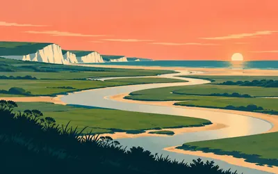
Below Exceat the Cuckmere's old meanders loop across the flat valley floor on the way to the sea.
- The South Downs National Park Authority calls the Cuckmere the only undeveloped estuary in South East England.
- The authority took ownership of Seven Sisters Country Park in July 2021.
- The Seven Sisters National Nature Reserve, declared in 2026, takes in the Cuckmere Valley.
150 km (93 miles) · heritage
Martello Tower No. 74, Seaford
The last tower in the chain
Historic England calls this the most westerly of the 103 Martello towers built around England's south-east coast against a Napoleonic invasion. It was a late addition, built around 1810 to guard the coast between the Ouse and the Cuckmere, and Seaford Museum, in it since 1979, says it took half a million bricks. The invasion never came, so the towers were never tested.
153 km (95 miles) · heritage
Tide Mills
A village the sea mill left behind
Flint walls in the shingle are what is left of a village built around a tide mill. The South Downs National Park Authority records that permission for the dam and mill was given in 1761, that the mill closed in 1883 and that a seaplane base flew from here from 1917. Racing stables and a children's hospital followed in the 1920s, and the villagers had gone by 1941.
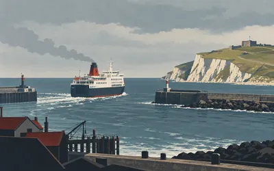
157 km (97 miles) · landmark
Newhaven to Dieppe
Where the ride skips the ferry
England ends for this ride at the ferry port in Newhaven, and the route goes straight on to France.
- The Port of Newhaven dates the town's ferry link with the continent to 1825.
- The port puts the typical sailing to Dieppe at about four hours.
- One of the two ferries on the route shares its name with the Seven Sisters cliffs.
Dieppe and the Pays de Bray
159–248 km · 9 places
159 km (99 miles) · heritage
Château de Dieppe
A castle museum over the beach
The castle on the cliff at the west end of Dieppe grew out of the town walls of about 1360 and was extended in 1435 to 1442, according to the French heritage register. The town bought it in 1903, and its museum has been there since 1923, with ship models, ivories and copies of the world maps Pierre Desceliers signed as made at Arques, the next village on the route.
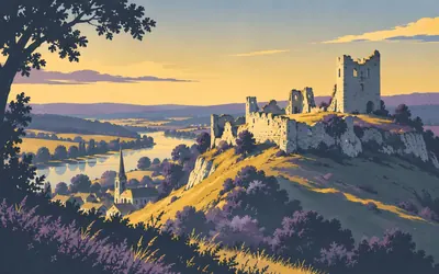
166 km (103 miles) · heritage
Château d'Arques
The castle that gave the village its battle
The first great castle ruin of the French half of the ride stands above Arques-la-Bataille, roofless and still enormous.
- Henry I built the castle's great keep in 1123, according to the culture ministry.
- Henri IV's victory over the Duke of Mayenne at Arques came on 21 September 1589.
- The village added la Bataille to its name by a decree published in 1882.
186 km (115 miles) · heritage
Bures-en-Bray church
A spire that turns as it rises
The church at Bures-en-Bray carries a twisted spire. The commune describes the timber frame of the steeple as helical, the slate-covered spire as turning from left to right, and the whole as 60 metres high. The church is twelfth and thirteenth century and was partly destroyed in 1940; its steeple was completely restored in 2000. It has been a protected historic monument since 1926.
189 km (117 miles) · heritage
Château de Mesnières
A Renaissance château that became a school
A Renaissance château in the valley of the Béthune, begun about 1500 and finished in 1546 with its chapel, according to the French heritage register. In the 1830s a priest, the abbé Eude, bought it and set up an orphanage, and the buildings added from 1865 are still used by the Institution Saint-Joseph, the school based there today. The château's own history records a great fire in 2004.
194 km (121 miles) · heritage
Neufchâtel-en-Bray
A cheese that sometimes comes as a heart
Neufchâtel is among the oldest cheeses in Normandy, in the words of INAO, which runs French appellations, and the agriculture ministry says it was the first Norman cheese to win an AOC, in 1969. It comes in six shapes, one a heart; the commune repeats the legend that girls of the Pays de Bray gave heart-shaped cheeses to English soldiers. Farms still make about thirty per cent of it.
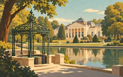
212 km (132 miles) · heritage
Forges-les-Eaux
Where a king came to take the waters
Forges-les-Eaux owes its name to iron and water, and its motto says so: AQUA ET FERRO.
- The three main springs were given royal names: Reinette, Royale and Cardinale.
- Faïence was first made at Forges in 1797, by an English potter, Georges Wood.
- Forges-les-Eaux is twinned with Heathfield in East Sussex.
233 km (145 miles) · heritage
Beuvreuil church
Herringbone walls and painted from end to end
A small church in the hamlet of Beuvreuil whose walls, the French heritage register suggests, may go back to the tenth century, with their stones laid in herringbone courses. Inside it is painted throughout, the work of six separate campaigns of decoration, and its Renaissance porch is of the kind the register calls a caquetière. The church has been a protected historic monument since 1920.
240 km (149 miles) · heritage
Gournay-en-Bray
Capitals the register singles out
Gournay's collegiate church of Saint-Hildevert was built in the twelfth century over an older one; the local tourist office says it burned in 1174 and was consecrated again in 1192. Its west front has two square towers that were never finished. Inside, the French heritage register counts the carved capitals of the south piers of the nave and choir among the most famous in Norman medieval art.
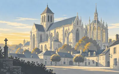
248 km (154 miles) · heritage
Saint-Germer-de-Fly
The Sainte-Chapelle, copied in the Pays de Bray
At the edge of the Pays de Bray an abbey church rises over a village square, far too big for the village.
- The Oise tourism agency dates the abbey's foundation by Saint Germer to 655.
- The abbey church was built between 1135 and 1206, between Romanesque and Gothic.
- Its chapel, begun in 1259, was modelled on the Sainte-Chapelle in Paris.
The Epte and the Vexin
255–333 km · 8 places
255 km (159 miles) · heritage
Neuf-Marché
A priory church where three départements meet
Monks from the abbey of Saint-Évroult founded a priory here around 1080, the French heritage register says, and the choir of its church of Saint-Pierre was rebuilt in 1128. Sold off as national property in the Revolution, its nave restored between 1863 and 1872 and damaged in 1944, it was protected as a historic monument in 2004. Neuf-Marché sits where Seine-Maritime, the Oise and the Eure meet.
272 km (169 miles) · heritage
Pissarro's house, Éragny-sur-Epte
Bought with a loan from Monet
Camille Pissarro rented a house at Éragny in 1884 and bought it in 1892 with money borrowed from Monet, the French heritage register records, calling it a high place of Impressionist painting. In 1893 he turned the barn into a studio lit from the north. Cézanne, Monet, Sisley and Renoir all came to visit. The house is private.
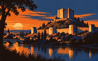
276 km (172 miles) · heritage
Château de Gisors
The bolt on Normandy's eastern door
Gisors castle was built to watch a river.
- Philippe Auguste captured Gisors in 1193.
- Henry II's curtain wall at Gisors is more than 800 metres long and once had eight towers.
- Gisors castle has been a classified historic monument since 1862.
289 km (180 miles) · heritage
Saint-Clair-sur-Epte
Where Normandy is said to have begun
By tradition Normandy began here, in 911, when King Charles the Simple granted the Viking Rollo the land between the Epte and the sea. The treaty is known only from Dudo of Saint-Quentin, writing a century later, whose account of the ceremony reads almost as farce. A royal charter of 918 mentioning land given to the Normans of the Seine shows the deal was real.
302 km (188 miles) · heritage
Domaine de Villarceaux
A love story the region admits it remembers
A walled estate of two châteaux, gardens and park, a historic monument since 1941. The older manor is remembered for Ninon de Lenclos, born in Paris in 1620, who met the Marquis de Villarceaux around 1650; their affair lasted nearly four years. The Île-de-France region, which has run the estate on a 99-year lease since 1989, calls that memory tenacious. The newer château dates from 1754 to 1759.
313 km (195 miles) · heritage
Wy-dit-Joli-Village
A pretty village, the legend says
In 1975, while he and his wife Françoise were setting up a museum of tools in Wy, Claude Pigeard found Gallo-Roman baths on the site, and the hypocaust is now a protected monument. The Musée de l'Outil opened in 1977. The commune says the village's name comes from Henri IV exclaiming what a pretty village, then says it seems to be only a legend, born in the eighteenth century.
319 km (198 miles) · nature
Maison du Parc, Théméricourt
Headquarters of the Vexin plateau
The Vexin français regional nature park keeps its headquarters in the fifteenth-century château at Théméricourt. Created in 1995, it covers 97 communes, mostly farmland, on a plateau that stands on average 100 metres above the country around it, bounded by the Seine, the Oise and the Epte. In 2014 it became the first park labelled a Pays d'art et d'histoire across its whole territory.
333 km (207 miles) · landmark
Axe majeur, Cergy-Pontoise
A straight line from a tower to the Oise
A single straight line drawn across Cergy-Pontoise by the sculptor Dani Karavan, who first came here in 1980: twelve stations over 3.2 kilometres, from a 36-metre tower down to an island in the Oise. The tower went up first, in 1986, and in 2008 the footbridge was extended and the amphitheatre built. The local tourist office calls it unique of its kind in France.
The Seine into Paris
342–395 km · 11 places
342 km (213 miles) · heritage
Conflans-Sainte-Honorine
A chapel on a concrete coal barge
Conflans calls itself the capital of river barging, and the proof is moored below the quai de la République: Je Sers, a concrete coal barge built in 1919, which was turned into a floating chapel and social centre for barge families for the abbé Bellanger in 1936. Since 1960 the town has held the national barge-folk pardon here each June, where the Oise meets the Seine.
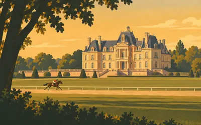
350 km (218 miles) · heritage
Château de Maisons
Mansart's masterpiece, and the town named for its banker
François Mansart's château at Maisons-Laffitte is, for the Centre des monuments nationaux, a masterpiece that marks the passage from the Renaissance to classical architecture.
- The boy king Louis XIV first visited the château on 20 April 1651.
- Charles Perrault called it one of the most beautiful things in France.
- Facing bankruptcy in 1833, Jacques Laffitte sold off two thirds of the park, and the town later took his name.
357 km (222 miles) · viewpoint
The Grande Terrasse, Saint-Germain-en-Laye
A thousand toises along the Seine
Above the river at Le Pecq runs Le Nôtre's Grande Terrasse, made between 1669 and 1674. The museum that runs the national domain gives its length as 1,945 metres, which was a thousand toises, and says it widens so gradually that the eye is fooled. Louis XIV was born at Saint-Germain, and in 1682 the court left it for Versailles.
364 km (226 miles) · heritage
Château de Malmaison
Napoleon and Joséphine's private home
From 1799 to 1814 Malmaison was the private home of Napoleon and Joséphine, in the culture ministry's words. Rare plants, a menagerie and roses, no fewer than 250 species of them, found a place in the grounds, and by 1814 the estate covered 726 hectares. A later owner, Osiris-Iffla, restored the house and gave it to the State, which opened it as a Napoleonic museum in 1906.
366 km (227 miles) · heritage
Maison Fournaise, Chatou
The balcony of the Boating Party
In 1857 the boat carpenter Alphonse Fournaise bought a small wine-seller's eatery and a boat-breaking yard on the island at Chatou. Renoir began painting the Luncheon of the Boating Party on its balcony in 1880; the picture hangs in the Phillips Collection in Washington. The town of Chatou bought the house in 1979, reopened the restaurant in 1990 and opened a museum in 1992.
374 km (232 miles) · landmark
Stade Yves-du-Manoir, Colombes
The 1924 Olympic stadium, back for 2024
Built where a racecourse had been, this was the main stadium of the 1924 Paris Olympic Games, which opened here on 5 July 1924, and the Games of 1924 had the first Olympic village in history. A hundred years later it hosted the hockey at Paris 2024. The Hauts-de-Seine department, which has owned it since 2002, calls it a mythical site of French sport.
384 km (238 miles) · heritage
Basilica of Saint-Denis
Where the kings of France were buried
The basilica was built over the tomb of Denis, a missionary bishop who died around 250; legend says he walked here carrying his own head. The Centre des monuments nationaux counts the tombs of 40 kings and 26 queens here, from Dagobert's in 639 onwards. Abbot Suger rebuilt its east end in 1140 to 1144, and the Centre calls the basilica the first monumental masterpiece of Gothic art.
389 km (242 miles) · landmark
Parc de la Villette
Red follies where the cattle market stood
Paris's slaughterhouses and cattle market opened here in 1867. The last ox was slaughtered on 15 March 1974, and Bernard Tschumi won the competition for a park in 1983, scattering it with red follies. President Mitterrand opened it on 12 October 1987. At 55 hectares, it describes itself as the largest urban park in Europe open to every kind of culture, sport and learning.
391 km (243 miles) · heritage
Rotonde de la Villette
A toll house for everything entering Paris
Claude-Nicolas Ledoux's rotunda was a toll office, built between 1782 and 1789 to tax goods coming into Paris. Behind it opens the Bassin de la Villette, which receives the water of the Ourcq canal, decreed in 1802, and from which the canals Saint-Martin and Saint-Denis branch away. The rotunda has been a historic monument since 1907.
392 km (244 miles) · engineering
Canal Saint-Martin
Hôtel du Nord, filmed somewhere else
Charles X opened the Canal Saint-Martin on 4 November 1825, three years after its first stone was laid. The city of Paris has owned it since 1861, and further south it vanishes for 2 kilometres under the streets towards the Bastille. The Hôtel du Nord, on the quai de Jemmapes, gave its name to Carné's 1938 film, though the footbridge scenes were shot on a rebuilt set at Billancourt.
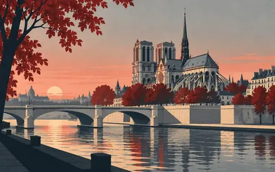
395 km (246 miles) · landmark
Île de la Cité
Where the distances from Paris begin
The ride ends on the Île de la Cité, which the French heritage register calls the ancient cradle of Paris, beside the Sainte-Chapelle and a short walk from Notre-Dame.
- Point zéro, in front of Notre-Dame, is the point from which distances between Paris and other cities are counted.
- The Point zéro plaque, too damaged after the 2019 fire, was remade identically and laid on 1 July 2025.
- Notre-Dame reopened in December 2024, five years after the fire of 15 April 2019.
Take on London to Paris and collect these places as you reach them
Common questions
How do my rides count towards Paris?
Link Strava or Apple Health and the counting takes care of itself: each activity your rally counts moves your marker on from the London Eye, down through Sussex to Newhaven and then from Dieppe towards Notre-Dame. A ride on a turbo trainer counts as fully as one on the road, so a winter indoors still gets you to France.
What happens at the Channel?
Your ride skips the ferry from Newhaven to Dieppe, and the sea never counts towards your distance. The route stops at the ferry terminal in Newhaven and starts again at the terminal in Dieppe: as soon as your total reaches the end of the English side, your marker carries straight on from the French coast. Every kilometre of the route is road or path, about 157 km in England and 238 km in France.
Do I have to ride in England and France?
No. The two capitals set the distance and your own roads supply it: your commute, your club run and your turbo sessions all move you towards Paris. You will miss the Sussex railway paths and the farmland of the Pays de Bray, but the 395 km between the London Eye and the Île de la Cité is the same distance from your front door.
How far is London to Paris on the Avenue Verte?
This route covers about 395 km, or roughly 246 miles: about 157 km from the London Eye to Newhaven and 238 km from Dieppe to the Île de la Cité. In France the Avenue Verte splits at Saint-Germer-de-Fly, and this line takes the shorter branch through Gisors and the Vexin; the other branch, by Beauvais, would make the whole ride about 459 km.
How long does it take to cycle London to Paris?
You set the finish date, and the weekly distance follows from it. Four weeks asks about 99 km a week, eight weeks about 49 km and twelve weeks around 33 km. A strong rider holding 150 km a week reaches Paris in under three weeks.
Can I run or walk it instead?
Yes. The Avenue Verte is a cycle route, but a rally can count runs or walks instead. A runner at 40 km a week reaches Paris in around ten weeks and a walker at 30 km a week in about thirteen, which makes it a solid season-long goal on foot.
What does a Conquest of London to Paris add to my passport?
Ride it as a Conquest and it reaches two countries on your passport map: the United Kingdom from the London Eye, and France the moment your marker arrives in Dieppe. Finish on the Île de la Cité and the route's own stamp joins them.
Can a club or workplace ride to Paris together?
Yes. Set up one rally and every member's synced rides move along the same line, so you can watch the group string out between the Thames and the Seine. It suits a team training for a real London to Paris ride, or anyone who wants a shared goal for the winter.
Start your London to Paris Conquest
Connect Strava or Apple Health once and every ride, run or walk you record syncs automatically, moving you along the route without anything else to log.