Virtual South Downs Way Challenge
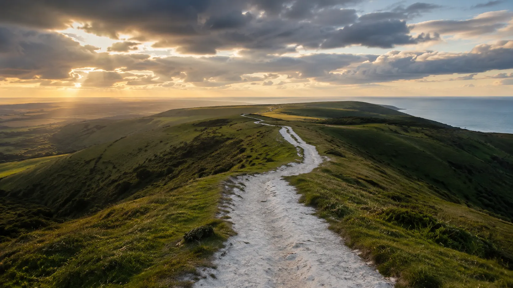
Follow one of England's best-loved trails from your own roads and tracks. The South Downs Way runs roughly 161 km (about 100 miles) along the chalk escarpment of the South Downs national park from Winchester in Hampshire to Eastbourne on the East Sussex coast, and Route Rally turns every synced cycle, run or walk into forward progress along it. You do not have to travel to the Downs to take it on: log your miles at home and watch your marker cross the chalk.
Part of the National Trails series
- Route: South Downs Way
- Distance: 161.2 km
- Elevation gain: 3590 m
- Rolling chalk ridge route
- Best for: Medium rallies of your own for cyclists, runners and walkers, and seasonal consistency goals
Planning your challenge
A cyclist averaging 150 km/week finishes in a week or so; a runner at 40 km/week takes about four weeks, and a walker at 30 km/week completes it in roughly five weeks.
This is a Medium route by Route Rally distance bands, which makes it a natural step up from a short route and achievable in a single season.
Works well for cyclists who want a route with real character, and for runners or walkers looking for a focused monthly goal.
Create your own rally for your own chalk ridge target, solo or with a group sharing one leaderboard.
Why this route
- The South Downs Way is one of England's most popular long-distance routes, running about 161 km (100 miles) along the chalk escarpment from Winchester to Eastbourne.
- As a virtual challenge you cover the distance in your own time, so your daily rides, runs and walks all count towards the finish.
- The medium distance makes it a realistic monthly or seasonal goal: long enough to feel substantial, short enough to finish in a single push.
- It suits cyclists, runners and walkers alike, and the rolling chalk hills give it a clear identity without the severity of the northern uplands.
- At a steady 150 km a week on the bike you finish in a week or so, while runners and walkers can treat it as a focused month-long target.
Highlights
- Start at Winchester, the historic Hampshire city at the western end of the trail
- Build distance along the chalk escarpment through the South Downs national park
- Pass above the Seven Sisters cliffs and the Beachy Head headland
- Finish at Eastbourne on the East Sussex coast
Places along the route
Every place below is measured onto the route line, so the distance shown is where you actually reach it.
Places are researched from published sources. The distances are measured rather than estimated: we find the point on the route's own recorded line that lies nearest the place, and give the distance along the route to that point.
Winchester and the Hampshire chalk
0–161 km · 31 places
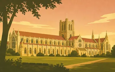
0 km (0 miles) · heritage
Winchester Cathedral
A hundred miles of chalk begin at the Close
The trail starts in a cathedral city, and the cathedral is worth standing still in front of before you go.
- Historic England dates the transepts, crypts and part of the nave to 1079-1095, under Bishop Walkelyn.
- The Dean and Chapter claim the longest nave and greatest overall length of any Gothic cathedral in Europe.
- The diver William Walker spent six years underpinning the waterlogged foundations with bags of concrete.
7 km (4 miles) · nature
Cheesefoot Head
A green bowl in the chalk, just outside the city
Natural England calls Cheesefoot Head a horseshoe-shaped dry valley. The South Downs National Park Authority calls it a natural amphitheatre. They are looking at the same green bowl below the road. The Park Authority says the site lays claim to a wartime part as well, with General Eisenhower addressing American troops here before D-Day.
18 km (11 miles) · heritage
Beacon Hill, Warnford
Six barrows and a fire lit for the Armada
Six bowl barrows and a saucer barrow lie along this spur, and Historic England records the hill's later job on top of them: a Spanish Armada beacon, watching Southampton Water and the Isle of Wight. The barrows and the hollow ways beside them appear in an Anglo-Saxon charter of AD 940, describing a boundary that followed the great ridgeway east out of Winchester.
21 km (13 miles) · landmark
Exton and the Meon
Down off the chalk to a clear river
The Way drops off the downs into the Meon valley. Exton's church of St Peter and St Paul is a thirteenth-century building heavily restored in 1847, with a shingled spire above a boarded bell turret. The South Downs National Park Authority counts the Meon among its chalk streams, fed by the same aquifer that supplies the drinking water.
25 km (16 miles) · heritage
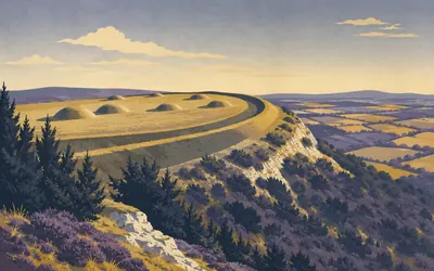
Old Winchester Hill
A hillfort, a burial ground and a firing range
A chalk spur with a hillfort on it, twenty kilometres from the city it is named after, and nobody ever wrote down why.
- Historic England schedules a hillfort, a Neolithic oval barrow and eleven Bronze Age round barrows here.
- Natural England calls this 'one of the richest botanical sites in southern England'.
- Natural England records that the army used the hill as a mortar firing range in the Second World War.

37 km (23 miles) · viewpoint
Butser Hill
The high point of the chalk, and the yew in its combes
A bare chalk dome with deep combes cut into its flanks fills the skyline for an hour before you reach it.
- The South Downs National Park Authority and Forestry England both call Butser Hill the highest point on the South Downs.
- The Park Authority gives the summit as 271 m; the Met Office gives 270 m.
- Natural England calls the yew woods in its combes 'among the finest examples known on the English chalkland'.
39 km (24 miles) · nature
Queen Elizabeth Country Park
Two thousand acres at the foot of the hill
Forestry England runs the country park on Butser's eastern side and gives it as over two thousand acres of open access woodland and downland, with three waymarked trails and a visitor centre at the bottom of the hill. Hampshire County Council runs the facilities. The trail passes through on its way to Sussex.
42 km (26 miles) · landmark
Buriton
Last village in Hampshire
Historic England lists St Mary's at Grade II star: a twelfth-century nave of four bays, a thirteenth-century chancel, a west tower of 1715 and a Purbeck font standing on five columns. Of everything in it, the detail the listing calls unusual is the open framed wooden chancel arch. A few fields further on, the county changes.
49 km (30 miles) · nature
Harting Down
Scarp, valleys and the best juniper in the county
Scarp slope and a run of parallel valleys, in the care of the National Trust, which calls it one of the largest areas of ancient chalk downland it looks after. Natural England's citation says the juniper stand above Bramshott Bottom is one of the best in West Sussex, and that this is the only place in Sussex where the moss Thuidium hystricosum has been found.
51 km (32 miles) · heritage
Harting Beacon
Six shutters, signalling to London
Not a hillfort: Historic England calls this a Late Bronze Age hilltop enclosure, its bank once reinforced with timber, with what excavation read as raised granaries inside. On the summit are the footings of something far later, a shutter telegraph of about 1796, one of a chain relaying coded signals between the naval base at Portsmouth and the Admiralty in London through the Napoleonic Wars.

54 km (34 miles) · heritage
The Devil's Jumps
Seven barrows in a line, and one that missed
Seven Bronze Age barrows along the south face of Treyford Hill: five bell barrows and two bowl barrows, one of them sitting fifteen metres off the line as though it turned up late.
- Historic England counts seven barrows here: five bell barrows and two bowl barrows.
- The largest stands 5.3 m high, with an overall diameter of 42 m including its ditch.
- Nineteenth-century excavation of two bell barrows found cremations laid on the old ground surface.
60 km (37 miles) · landmark
Cocking
A gap in the chalk, and a Grade I church below it
A village in a gap in the ridge, with a Grade I church down in it. Historic England dates the chancel and nave to the twelfth century and the south aisle and tower to the fourteenth, and of everything inside picks out two things: a thirteenth-century wall painting on the splay of a Norman window, and a tub font.
61 km (38 miles) · nature
Heyshott Down
Northern mosses on a Sussex down
Unimproved chalk grassland with something odd in it. Natural England's citation says the mosses and liverworts here form an assemblage not known from any other site on chalk in southern England, several of them subalpine species usually found in the north and north-west. The site is nationally important for spiders and harvestmen too.
71 km (44 miles) · heritage
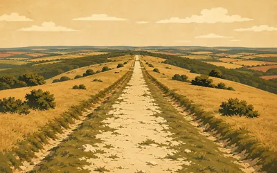
Stane Street on Bignor Hill
Chichester to London, still under your wheels
The trail meets a Roman road on top of the downs and for a while the two run together.
- Historic England gives the surviving agger here as up to 10 m wide and 1.8 m high.
- Excavations in 1913 and 1937 showed the level berms beside the road were metalled as well as the agger.
- Stane Street linked Chichester, the regional capital, to London.
73 km (45 miles) · heritage
Bignor Roman Villa
Found by a plough, open ever since
A plough struck a Roman water basin down in the fields in 1811, and the villa has been welcoming visitors since 1814. Historic England says it was built on a palatial scale and holds some of the finest mosaics in the country, and notes that of the four hundred to a thousand Roman villas recorded in England, fewer than ten are major ones.
77 km (48 miles) · engineering
Houghton Bridge
Victorian, doing an impression of medieval
The Arun splits around an island here and the bridge crosses both branches in ashlar, with blunt cutwaters and a pierced semicircular recess corbelled out above each pier. Historic England dates it to 1875 and describes it as built in the medieval tradition. A Victorian bridge doing an impression of an old one.
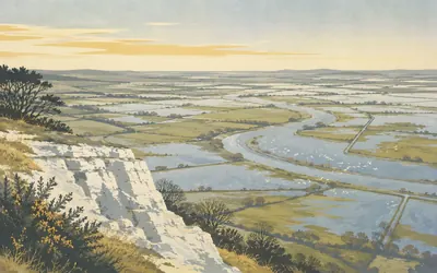
79 km (49 miles) · nature
Amberley Wild Brooks
Flooded ground, seen from dry chalk
From the scarp above Amberley you look straight down on flat wet ground that floods every winter, cut into strips by drainage ditches.
- Natural England records 156 species of flowering plant in the drainage ditches alone.
- The site is 'one of the most important wet meadow sites in the country for breeding redshank'.
- Its northern peat is 'the only sizeable example of a relict raised bog in the south east'.
81 km (51 miles) · heritage
Parham Park
Two hundred fallow deer, below the ridge
Historic England's listing for Parham opens with a judgement rather than a date: this is one of the finest houses in Sussex. Sir Thomas Palmer began the present building in 1577. The registered park around it is graded separately, and Historic England records two hundred fallow deer grazing every open part of it.

90 km (56 miles) · heritage
Chanctonbury Ring
A clump of beeches on an Iron Age bank
The trees on the skyline are younger than almost everything underneath them.
- Historic England says the beech clump was first planted in 1760 by Charles Goring, and replanted by his family since.
- At least two Romano-Celtic temples were built inside the hillfort.
- Pig skull and jaw fragments in the second temple suggest to Historic England a cult of the boar.
94 km (59 miles) · heritage
Cissbury Ring
Two hundred and seventy filled-in mine shafts
A spur running south off the Way, and Historic England's list of what is on it runs from the Neolithic to the Second World War. At least 270 filled-in flint mine shafts pit the hillfort's southern end, dug down to the flint seams with galleries radiating off them underground. The National Trust calls it the largest hillfort in Sussex.
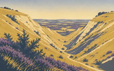
106 km (66 miles) · nature
Devil's Dyke
Thirty thousand people a day, up a hill with no water in it
A steep-sided cleft in the chalk, nearly a mile long, which the National Trust calls the longest, deepest and widest dry valley in the UK.
- The National Trust calls the Dyke 'the longest, deepest and widest dry valley in the UK'.
- Historic England records visitor numbers of up to 30,000 a day between 1885 and 1908.
- The National Trust calls the 1894 aerial cableway across the valley Britain's first.
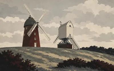
112 km (70 miles) · engineering
Jack and Jill
One post mill, one tower mill, one long argument about a date
Two windmills stand together on the down above Clayton and everybody calls them Jack and Jill.
- Historic England: Jill is a post mill of 1821, moved from Dyke Road, Brighton, about 1850.
- Jack is a tower mill of 1866, brick faced with tarred metal plates.
- A third mill, Duncton, was taken down in 1866; only its roundhouse survives.
115 km (71 miles) · viewpoint
Ditchling Beacon
A trig pillar standing on a beacon mound
The National Trust puts Ditchling Beacon at 248 metres and calls it the highest point in East Sussex. On the beacon mound itself, ten metres across, sits an Ordnance Survey trig pillar. Just north-west of the hillfort ditch is a dry dewpond of the eighteenth or nineteenth century, twenty metres wide inside its retaining bank.
119 km (74 miles) · landmark
Blackcap
Planted twice for a coronation, once for nothing in particular
The clump on the hill is a formal mixed-species plantation, which the National Trust's records date to after 1828 and before 1840, probably planted by Sir Henry Shiffner of Coombe. It was replanted in the 1890s, again in 1939, and again in 1953 for the Coronation. The Trust notes it was once a landmark possibly second only to Chanctonbury.
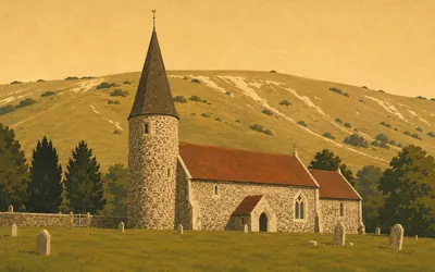
133 km (83 miles) · heritage
Southease Church
Grade I, nine hundred years old, dedication unknown
The Way comes off the downs, crosses the Ouse, and passes a small church on a green with a round tower.
- Historic England calls it one of three churches in the Ouse valley with a circular twelfth-century tower.
- The chancel and nave are eleventh century; the original chancel and transepts were demolished in the fourteenth.
- Historic England records the church's dedication as unknown.
141 km (87 miles) · heritage
Firle Beacon
The trail runs straight between the barrows
Three bowl barrows on the escarpment, and Historic England notes that the South Downs Way passes between them. The largest, 23 metres across and 1.5 high, is the one called Firle Beacon. It was opened in 1820 and gave up an inhumation, two cinerary urns, a bronze pin, an incense cup and a barbed arrowhead. The mound served as a beacon in the Napoleonic Wars.
146 km (91 miles) · heritage
Alfriston Clergy House
The first building, and the second property
A thatched Wealden hall-house on the green at Alfriston, carrying a claim people usually get slightly wrong. Historic England puts it exactly: this was the first building and second property acquired by the National Trust. The Trust bought it in 1896 for ten pounds. The stone tablet on the wall says 1898, which is the repair rather than the purchase.
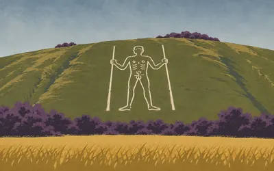
149 km (92 miles) · heritage
The Long Man of Wilmington
Nobody knows when he was cut, and his owner says so
A figure cut into the turf of a steep north-facing slope, about 62 metres long, holding a staff in each hand.
- Historic England gives the figure as approximately 62 m long and says its date is unknown.
- The Sussex Archaeological Society has owned the Long Man since 1925 and dates him only to at least 1710.
- A drawing of 1779 shows him holding a rake and a scythe rather than two staves.
152 km (94 miles) · heritage
Jevington
A Saxon tower, described in twelve words
A short entry, because Historic England's is short too. Jevington's church of St Andrew is Grade I: the tower is Saxon, the rest thirteenth century, the whole restored in 1873. Inside, a kingpost roof to the nave, a piscina and a squint. That is the entire official description of a nine-hundred-year-old building.

158 km (98 miles) · landmark
Beachy Head Lighthouse
Three thousand tons of granite, cut on the rocks
The trail runs the tops above Eastbourne; the lighthouse is two kilometres south of it, out at the foot of the cliff, standing in the sea.
- Historic England: the tower took 3,660 tons of Cornish granite from the De Lank quarries, shaped on site.
- It was lit for the first time on 2 October 1902 and is still operated by Trinity House.
- Its original bunk beds, curved to fit the round wall, were known as banana bunks.
161 km (100 miles) · landmark
Eastbourne Pier
The end of the chalk, and a camera obscura
Natural England's National Trails record puts the Way's own end at the western end of Eastbourne's promenade; the pier is the thing you will actually look at. Historic England lists it Grade II star, opened on 13 June 1870 to a design by Eugenius Birch, and says its camera obscura seems to be the only one on a seaside pier in the world.
Take on South Downs Way and collect these places as you reach them
Common questions
How does my walking, running or riding count towards Eastbourne?
You never have to record anything twice. Route Rally takes each activity from Strava or Apple Health and moves you east from Winchester. What it counts is distance rather than discipline, so a cyclist at 150 km a week and a walker at 30 km a week are chasing the same finish on different timescales.
Do I have to be near the South Downs?
No. The trail is a distance to cover, so your local streets, a treadmill or a canal towpath all move you along the chalk. People walking the real South Downs Way spend their days high on an exposed chalk escarpment; you can borrow the shape of that journey without borrowing the wind.
How far is the South Downs Way?
The Route Rally route covers about 161 km, or roughly 100 miles, tracking the South Downs from Winchester to Eastbourne.
How long does it take to cycle?
At a steady 150 km a week you finish in under two weeks of riding. Push to 250 km a week and you can complete it inside a week. The finishing date is set by you at creation, so the tempo is yours.
Is it good for walking?
Yes. The South Downs Way is officially a walking and cycling route, so it fits well as a walking challenge. At 30 km a week you finish in around five weeks, while 50 km a week brings it inside a month.
Start your South Downs Way Conquest
Connect Strava or Apple Health once and every ride, run or walk you record syncs automatically, moving you along the route without anything else to log.