Virtual Tuscany Trail Challenge
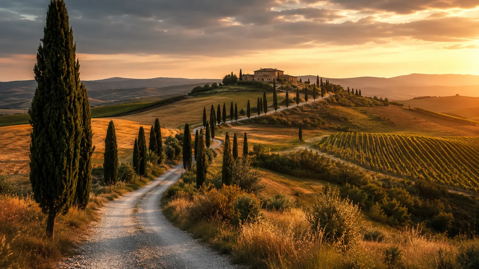
Take on one of Europe's most celebrated bikepacking and gravel routes from your own roads and trails. The Tuscany Trail covers roughly 443 km (about 276 miles) through Tuscany's hills, forests, vineyard valleys and medieval hilltop towns, linking remote gravel roads and ancient tracks across one of Italy's most scenic regions. Route Rally turns every synced ride, run or walk into progress along this epic Italian circuit.
- Route: Tuscany Trail
- Distance: 443.5 km
- Elevation gain: 8837 m
- Epic gravel and mountain bike adventure
- Best for: Longer rallies of your own for cyclists, runners and walkers, and multi-month endurance goals
Planning your challenge
A cyclist averaging 150 km/week finishes in about three weeks; a runner at 40 km/week takes around eleven weeks, and a walker at 30 km/week completes it in roughly fifteen weeks.
This is a Long route by Route Rally distance bands, and one of the longer international routes in the catalogue. Best for those who want a substantial multi-month goal with strong visual appeal.
Works well for cyclists, gravel riders and runners who want a long Italian route with real character as a sustained training target.
Create your own rally for your own Tuscany Trail target, solo or with a group sharing one leaderboard.
Why this route
- The Tuscany Trail is one of Europe's best-known bikepacking routes, covering about 443 km (276 miles) through the hills and forests of central Tuscany on gravel roads, tracks and trail.
- As a virtual challenge you cover the distance in your own time, with rides, runs and walks from wherever you train all counting towards the Italian circuit finish.
- The route passes through some of Tuscany's best-known landscapes: the Crete Senesi clay hills, the Maremma coast, the Apennine forest and the vineyards of the Chianti hills.
- Its long distance makes it a substantial multi-month goal for cyclists and a serious endurance target for runners and walkers.
- The strong visual appeal of Tuscany gives it broad attraction beyond the gravel cycling audience, and the distance means it works well as a flagship target for a longer rally.
Highlights
- Follow ancient gravel roads and tracks through the rolling hills and cypress avenues of central Tuscany
- Pass through medieval hilltop towns including Volterra, San Gimignano and Montalcino
- Descend to the Maremma coast and the Etruscan landscape of southern Tuscany
- Climb through the Apennine forests and the Chianti wine country on the return leg
Places along the route
Every place below is measured onto the route line, so the distance shown is where you actually reach it.
Places are researched from published sources. The distances are measured rather than estimated: we find the point on the route's own recorded line that lies nearest the place, and give the distance along the route to that point.
Val di Cornia: the start
0–7 km · 5 places
0 km (0 miles) · landmark
Venturina Terme
Kilometre zero, over hot water
A flat town in the Val di Cornia with warm springs under it, which is why anyone settled here in the first place.
- The comune dates settlement here to the Roman period, driven by the springs and the roads.
- A Roman mausoleum at Caldana lies just north of the town.
- The modern thermal establishments date only from the early 1900s.
0 km (0 miles) · heritage
Baratti and Populonia
The only Etruscan city built on the sea
Eight kilometres west of the start, on a bay of dark sand, is the one place the Etruscans put a major city directly on the coast rather than safely inland.
- The Ministero della Cultura registers Baratti and Populonia as one archaeological park.
- Iron ore was ferried from Elba and smelted on this shore.
- Slag from the smelting buried the necropolis, which is why its tombs survived.
7 km (4 miles) · heritage
Rocca San Silvestro
A village of miners and smelters, abandoned
Four hundred and fifty hectares of hillside behind Campiglia, holed and tunnelled for copper, lead and silver from the Etruscan period until the last mine shut in 1976.
- The Ministero dates mining in the Campigliese from the Etruscan period to 1976.
- The park covers 450 hectares behind Campiglia Marittima.
- Rocca San Silvestro is described as a village of miners and smelters founded a thousand years ago.
7 km (4 miles) · heritage
Campiglia Marittima
A rocca at 281 metres and a mason called Matteo
The first climb of the loop goes up to this. The comune calls the whole historic centre a monumental complex and gives its two anchors: a twelfth-century rocca on the highest hill in the town, 281 metres up, and the Pieve di San Giovanni below it, built around 1173. An inscription on the pieve's facade names the master who built it, which is unusual and worth knowing: Matteo.
7 km (4 miles) · heritage
The mineral museum, Campiglia
Why anybody came here
Campiglia is not on a hill for the view. Underneath these slopes is one of the oldest worked orefields in the Mediterranean, and the town has a museum of the minerals that came out of it. Copper, lead, silver, zinc: the Etruscans took them, the Romans took them, and the last mine closed in 1976.
The Maremma coast
34–83 km · 10 places
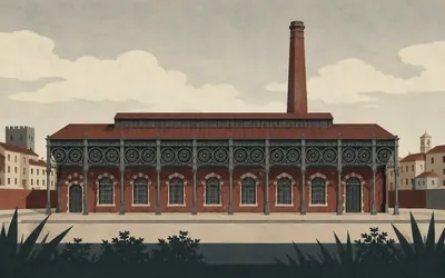
34 km (21 miles) · engineering
The cast-iron town
A whole town made of what it made
Follonica was a factory before it was a resort, and the factory made cast iron.
- The Comune di Follonica calls the ironworks the cradle of Italian iron and steel making.
- The museum occupies the former ILVA factory site in the middle of town.
- The foundry village's theatre was restructured in 2014 by Vittorio Gregotti.
35 km (22 miles) · heritage
The furnaces at Rondelli
Smelting iron here first
Ten metres off the line, under the edge of a modern town, is a registered archaeological area of Etruscan smelting furnaces. The ore came across the water from Elba and was reduced on this shore because this shore had the wood. Two and a half thousand years later the grand dukes built their foundries a few hundred metres away, for the same reason.
38 km (23 miles) · heritage
The Rocca Pisana, Scarlino
Fort, then graveyard, then theatre
On the hilltop above the plain, a fortress with an unusually complete biography. Excavation found people living on this summit from the eleventh century BC without a break. When Pisa took the place in the thirteenth century it pulled down the Romanesque buildings on the crown and put up a military rocca. Abandoned, it became the town cemetery in the nineteenth century. Restored, it is now an open-air theatre.
39 km (24 miles) · heritage
Portus Scabris
An ancient anchorage under a marina
Down on the point at Scarlino, where the yachts are now, ancient sources put an anchorage called Portus Scabris. The geopark registers a museum of it there. Everything metal that came out of the Colline Metallifere behind you had to leave from somewhere, and for a long time it left from here.
48 km (30 miles) · nature
Cala Violina
A beach with a name about sound
A small white bay in the woods between Follonica and Punta Ala, named for a noise: the sand is said to squeak underfoot like a bowed string. It is reached on foot or by bike, never by car. The comune caps how many may go each day and asks them to book. A beach with a waiting list is odd, and the reason is standing all round you.
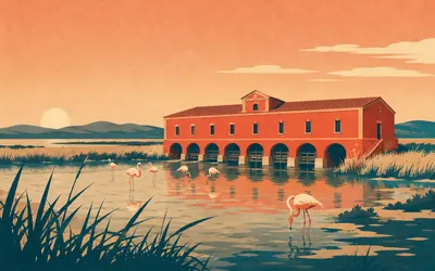
62 km (38 miles) · engineering
The Casa Rossa Ximenes
A machine for emptying a lagoon
A long red building standing in the water on the edge of the Diaccia Botrona marsh, built in 1765 by the engineer Leonardo Ximenes to drain it.
- The reserve's own operator dates the building to 1765 and names Leonardo Ximenes as its engineer.
- It now serves as the visitor centre for the Diaccia Botrona reserve.
- Regione Toscana's page dates the reserve's establishment to 1996.
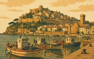
63 km (39 miles) · landmark
Castiglione della Pescaia
Forty-one kilometres in one comune
A walled town on a rock above a working fishing harbour, and the administrative middle of the longest single stretch on this whole loop: the line stays inside this one comune for forty-one kilometres, from the pine woods behind Punta Ala to the hills below Vetulonia.
- The line stays inside this one comune for 41 km, its longest single stretch.
- The Diaccia Botrona marsh behind the town has been a protected reserve since 1996.
- Vetulonia, in the hills above, is in the same comune.
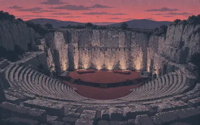
80 km (50 miles) · engineering
Gavorrano
A quarry that became a theatre
Somebody found pyrite near the public fountain at Gavorrano in 1898 and the hill was hollowed out for the next eighty-three years.
- Pyrite was found near the public fountain in 1898; Montecatini ran the mine until 1981.
- The comune estimates about 27 million tonnes of pyrite came out of the hill.
- The old limestone quarry is now a 2,000-seat open-air theatre.
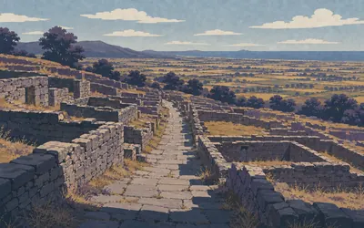
81 km (50 miles) · heritage
Vetulonia
A city that had to be found again
One of the great cities of the Etruscan league stood on this hill and then went so thoroughly missing that its location was argued about for centuries.
- The Ministero credits Isidoro Falchi with rediscovering the Etruscan city in the late nineteenth century.
- The museum began as the Antiquarium of Vetulonia and reopened, enlarged, in June 2000.
- A lagoon, the Lago Prile, once separated the city's hill from the sea.
83 km (52 miles) · heritage
The tombs below Vetulonia
A road of the dead
Below the living city, on the slope the road comes up, is the national archaeological area: excavated streets, and a necropolis with monumental chambered tombs under earth mounds, reached along what is still called the road of the sepulchres. The tombs have names of their own and the register does not publish where any of them is, which is its own kind of protection.
The Maremma interior
100–139 km · 3 places
100 km (62 miles) · heritage
Montemassi
The castle in the fresco
A village of barely two hundred people on a rock at two hundred and eighty metres, and a ruined castle stands on top of it. The comune's own description runs: famous for its rocca, immortalised by Simone Martini in the Guidoriccio, the fresco in Siena's council chamber showing a commander riding past this castle under siege. Who painted it is still argued about. The hill has not moved.
108 km (67 miles) · landmark
Roccastrada
A village on a spur of trachite
Roccastrada itself sits on a spur of trachite, the hard volcanic rock the geopark calls typical of this part of the Maremma. The geopark, which exists because of what is under this ground, notes that the territory is now largely farmed. It was mined instead.
139 km (86 miles) · heritage
Cinigiano
The nearest thing on fifteen kilometres
The Amiata foothills, where the line and the villages have nothing to do with each other. Cinigiano is up on its ridge with a parish church rebuilt in 1598; Monticello Amiata and the Poggio all'Olmo reserve are further up still. All are three to seven kilometres from where you are riding, which is the valley. It is beautiful and it is empty, and both of those are the point.
The Val d'Orcia
140–211 km · 9 places
140 km (87 miles) · heritage
Monticello Amiata
A house kept as it was
Up on the Amiata side, an ethnographic house museum that started in 1981 as one collection of objects and one exhibition, and grew into a whole dwelling kept the way people here actually lived: the hearth, the beds, the tools, the chestnut store. It is the mezzadria at Buonconvento seen from inside the tenant's half.
140 km (87 miles) · nature
Poggio all'Olmo
Over four hundred hectares, and no number after that
A nature reserve on the Amiata flank between two hill villages, chestnut and beech and old coppice, with wolves in it. Its operator says over four hundred hectares and will not be pinned to a figure beyond that, so neither will we. From the valley road you see the wooded shoulder of it and nothing else.
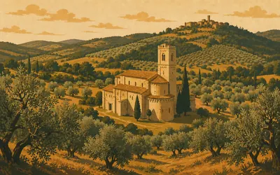
160 km (99 miles) · heritage
The Abbey of Sant'Antimo
Travertine with alabaster in it
A Romanesque abbey church standing on its own in a valley of olives below Castelnuovo dell'Abate, and one of the few buildings that is better than the photographs.
- The comune dates the present church to about 1118 from an inscription on the high altar.
- It is built of travertine veined with alabaster from the quarry at Castelnuovo dell'Abate.
- The comune says the abbey's history cannot be reconstructed precisely because the records burned.
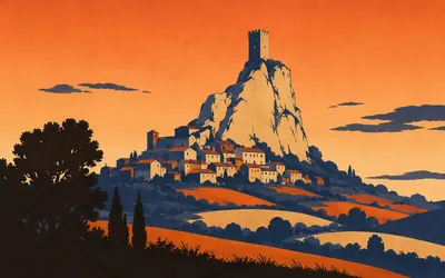
178 km (110 miles) · landmark
The Rocca di Tentennano
One tower, the whole valley
A single square tower on a limestone knuckle above the Orcia, visible from most of the valley and able to see all of it, which was the point: whoever held this rock controlled the Via Francigena where it came through.
- The Ministero calls it the medieval tower that dominates the village of Rocca d'Orcia.
- The Parco della Val d'Orcia is listed as its custodial contact.
- It watches the line of the Via Francigena through the valley.
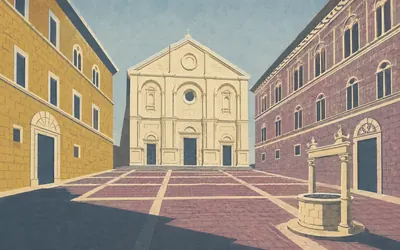
189 km (118 miles) · heritage
Pienza
A pope rebuilt his village as an argument
Enea Silvio Piccolomini was born in a hill village called Corsignano, became a humanist, and then in 1458 became Pope Pius II.
- UNESCO inscribed the historic centre in 1996 under criteria (i), (ii) and (iv).
- The citation calls it the first application of the Renaissance humanist concept of urban design.
- The inscribed property covers 4.41 hectares.
189 km (118 miles) · heritage
San Francesco, Pienza
The building the pope left alone
Pius II rebuilt his birthplace as a Renaissance demonstration and this church, which the comune dates to the thirteenth century, is what survived the demonstration. Gothic, plain, standing a hundred metres from a piazza designed to be perfect. It is worth going in to see what Corsignano looked like before it became Pienza.
198 km (123 miles) · heritage
San Quirico d'Orcia
A box-hedge garden inside the bastions
A walled town sits on the pilgrim road, its collegiate portals attributed to Giovanni Pisano, and attributed is the region's own word. Behind the walls is the Horti Leonini: a clipped-box garden laid out around 1581 inside the old bastions, on land the Grand Duke gave Diomede Leoni. It has been the town's since 1975, and is open. A medieval tower stood on the upper lawn until the last war.
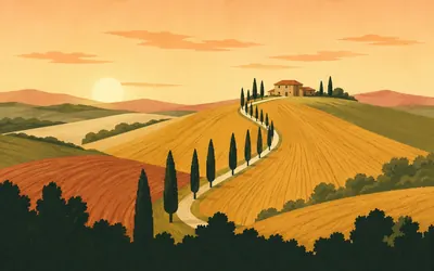
204 km (127 miles) · viewpoint
The Val d'Orcia
A landscape designed to look like good government
The cypress lines, the bare clay ridges, the single farmhouses at the top of long curved fields: this is not accidental scenery and UNESCO's citation says so plainly.
- UNESCO inscribed the Val d'Orcia in 2004 as a cultural landscape, under criteria (iv) and (vi).
- The inscribed property covers 61,187.96 hectares with a 5,660.08 hectare buffer zone.
- The citation says the landscape was redrawn to reflect the ideals of good government.
211 km (131 miles) · heritage
The fortress at Montalcino
Five sides, and a five-year wait
A pentagonal fortress on the town's high corner, which the Ministero calls an important example of military architecture, with ramparts open to walk. The hill's other product is closely regulated: Brunello di Montalcino has been a DOCG since 1980, must be grown in this comune, spend at least two years in oak, and stay unsold until 1 January after five years from the vintage. Six for the Riserva.
The Crete Senesi and the Arbia
220–237 km · 5 places
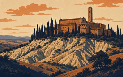
220 km (137 miles) · heritage
Monte Oliveto Maggiore
Thirty-five frescoes, or thirty-seven
Three men from Siena walked out into the clay badlands in 1313 with their tools and their books, in the words of a chronicle written a century later, to offer God a prompt service.
- A 1450 chronicle dates the founders' arrival to 1313; the charter followed in 1319.
- Signorelli began the cloister cycle in 1495 and Sodoma finished it in 1505.
- The abbey's own site counts 35 frescoes and the Ministero counts 37 episodes.
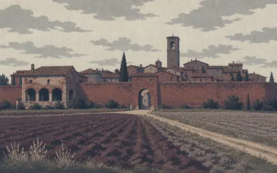
220 km (137 miles) · heritage
Buonconvento
Seven hundred years of splitting the crop in half
A small brick town still inside its medieval walls on the flat by the Arbia, and the place that decided to remember the thing everybody else wanted to forget.
- The museum of Sienese sharecropping opened in September 2002 in an old farm against the town walls.
- Under mezzadria the owner supplied the land and buildings and the tenant the labour, splitting the produce equally.
- The comune dates the system from about the thirteenth century to the later twentieth.
220 km (137 miles) · heritage
The Val d'Arbia sacred art museum
Two museums, eighty metres apart
Buonconvento keeps its two halves in two buildings a minute's walk from each other: the sharecroppers in one, and in the other the painting the same valley paid for, gathered in from the parish churches of the Arbia where it was no longer safe.
226 km (140 miles) · landmark
Ponte d'Arbia
A stage end on the pilgrim road
For a long stretch here the bike route and the Via Francigena are the same line, and Ponte d'Arbia is where the region's own itinerary breaks the walk between Siena and San Quirico. A crossing, a hostel, a day's distance. People have been measuring this valley in days on foot since the tenth century.
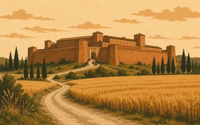
237 km (147 miles) · heritage
The Grancia di Cuna
A fortified barn the size of a village
A grancia is a granary farm, and this one was built like a castle because it held the grain that fed Siena.
- Construction began in September 1314, around an older castle on the knoll at Cuna.
- Its estate ran houses, farms, workshops, dovecotes, kilns, mills and inns.
- Walling and garrisoning it against mercenary companies took about twenty years.
Siena
257 km · 3 places
257 km (160 miles) · landmark
The Torre del Mangia
Eighty-seven metres, and a hundred and two to the lightning rod
The tower over the Palazzo Pubblico, begun by two brothers, Francesco and Muccio di Rinaldo, in 1325 and finished around 1348. The Ministero gives it as eighty-seven metres, and a hundred and two if you count up to the lightning conductor, which is the kind of precision a register cannot resist. The great bell went up in 1666.
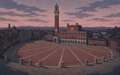
257 km (160 miles) · landmark
The Piazza del Campo
Seventy metres from the finest square in Europe
The route does not pass near Siena.
- UNESCO inscribed Siena's historic centre in 1995: 170 hectares inside seven kilometres of wall.
- Ten of the seventeen contrade run each Palio, three circuits of the Campo, bareback.
- Ambrogio Lorenzetti painted the Allegory of Good Government in 1338-1339 for the council chamber.
257 km (160 miles) · heritage
Santa Maria della Scala
A hospital facing the cathedral
Opposite the cathedral steps is a building that spent centuries as a hospital for pilgrims on the Via Francigena, then for the sick, then for foundlings. It is a museum now, and the interesting thing about it is the scale: a city that put its hospital directly across the square from its cathedral was making a statement about what it thought charity was worth.
The Elsa valley
271–314 km · 10 places
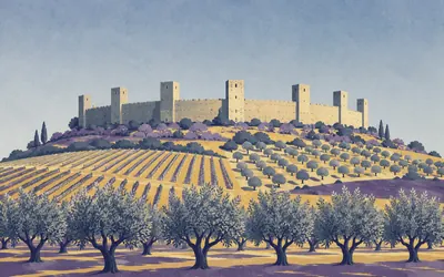
271 km (169 miles) · heritage
Monteriggioni
A crown of towers, according to Dante
A complete ring of wall on a low hill, with square towers standing up from it at intervals, and almost nothing inside but a square and a church.
- Dante compares the giants of Inferno XXXI to Monteriggioni crowned with towers.
- The town's own tourism company states fourteen towers.
- Neither the comune's history page nor the Ministero's record gives a tower count.
275 km (171 miles) · heritage
Abbadia a Isola
An island in a marsh, and forty-two farms
The name means the abbey on the island, and it was one: the plain here was marsh and the monastery stood on the dry rise in the middle of it. A widow called Ava founded it on 4 February 1001 with an endowment of forty-two farms, a serious gift. Pilgrims on the Francigena stopped here before the last day into Siena. The marsh has gone; the church has not.
284 km (177 miles) · engineering
The crystal museum, Colle di Val d'Elsa
Ninety-five per cent of Italy's, and fourteen or fifteen of the world's
Glass has been made here since at least 1331, when the town's statutes wrote it down. Lead crystal is still cut. The comune's own pages give two versions of its share: ninety-five per cent of all Italian crystal on both, but fourteen per cent of the world's on one page and almost fifteen on the other. We are not going to split the difference. The museum is the comune's.
302 km (188 miles) · heritage
The Collegiata, San Gimignano
Every wall painted
From outside it is the plainest building on the square, which is the joke. Inside, the whole church is frescoed: the Old Testament down one side, attributed by the museum operator to Bartolo di Fredi and dated 1367, and the New Testament down the other, attributed to Lippo and Federico Memmi. Nobody left a blank wall. There was not one to leave.
302 km (188 miles) · viewpoint
The Torre Grossa
The one you are allowed up
The tallest of San Gimignano's fourteen towers is the town's own, attached to the Palazzo Comunale, and the one you can climb. From the top the other thirteen are below you and the Val d'Elsa runs away in every direction. No authority we could reach publishes how high it is, so no figure is given here.
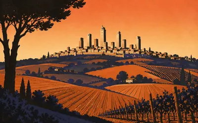
302 km (188 miles) · heritage
San Gimignano
Fourteen towers, and an argument about the rest
You see it from ten kilometres out and it does not look real.
- UNESCO inscribed the historic centre in 1990; the inscribed area is 13.88 hectares.
- The ministry's citation hedges the original count as probably 72; the comune gives no number.
- Both state that fourteen towers survive.
305 km (190 miles) · heritage
The pieve at Cellole
A country church with the towers behind it
Out of the gate and down into the fields, a Romanesque parish church standing on its own among cypresses with San Gimignano's towers small on the ridge behind. Pievi like this one were the working churches of the countryside, older than the walled towns that overshadowed them, and they are where the population actually was.
307 km (191 miles) · landmark
Pancole
The road goes under the church
A sanctuary built across the lane, so that the pilgrim road passes underneath it through an arch. Ten metres off the line. This is the Francigena stage between Gambassi Terme and San Gimignano and it has been walked continuously for a thousand years, which is why somebody eventually built a church over the top of it.
314 km (195 miles) · heritage
Santa Maria a Chianni
Written down by an archbishop in 990
A Romanesque pieve on the pilgrim road, and one of the places Sigeric the Serious, Archbishop of Canterbury, listed on his way home from Rome at the end of the tenth century. His itinerary is why we know the Francigena's stages at all. The comune notes, dryly, that the church is open by appointment.
314 km (195 miles) · engineering
Gambassi Terme
Murano, Altare and here
A hill town that made glass. The comune puts it without much modesty and without overreaching either: in its period this was one of the three known glassmaking centres in Italy, the others being Altare and Murano. Its glassmakers were called gambassini and they worked all over the country from the fourteenth century onwards, taking the name of this small place with them.
Volterra and the Cecina
334–395 km · 10 places
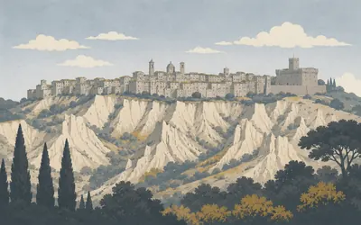
334 km (207 miles) · heritage
Volterra
Etruscan, Roman, medieval, and still quarrying alabaster
A grey town on a high ridge that has been continuously important for two and a half thousand years and has never been pretty about it.
- The comune dates the Palazzo dei Priori from 1208, by the master Riccardo da Como.
- An inscription in Leonine hexameters records its completion in 1257.
- The comune's own page for it makes no claim to be the oldest town hall in Tuscany.
334 km (207 miles) · heritage
The amphitheatre that wasn't there
Found by accident in 2015
In 2015 a machine digging a drainage channel below the town hit a curved wall, and Volterra turned out to have had a Roman amphitheatre nobody knew about, buried under several metres of hillside. The comune's own page calls it, with visible enjoyment, the amphitheatre that wasn't there. It is still being dug. A town this well studied is not supposed to have anything that size left to find.
334 km (207 miles) · heritage
The alabaster ecomuseum
Stone you can see daylight through
Volterra sits on alabaster and has carved it since the Etruscans, who made funerary urns of it with the dead reclining on the lids. The comune runs an ecomuseum of the trade in a palace in via dei Sarti, and the workshops around it still work: the giveaway is the white dust and the sound. Hold a finished piece up to a window and the light comes through it.
355 km (221 miles) · heritage
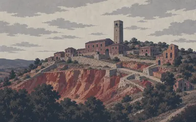
Montecatini Val di Cecina
A fourteenth-century town hall and an eleventh-century tower
A hill village above the Cecina with a fourteenth-century Palazzo Pretorio and, over it, a tower the comune dates to the eleventh century, passed from the Belforti to the Pannocchieschi to the Inghirami. It is privately owned; you get in if the owner says so. From up here you can see Volterra's cathedral tower on one ridge and the Sillana fortress on another, which is what the tower was for.
356 km (221 miles) · engineering
The Camporciano copper mine
Europe's largest, according to the people who run it
A hillside of headframes, engine houses, ramps and a great open cut, worked for copper from the 1830s until 1907.
- The museum operator calls Camporciano the largest copper mine in Europe in the nineteenth century.
- The first extraction shaft dates from the 1830s and the mine closed in 1907.
- The comune describes three thousand years of mining history in the upper Val di Cecina.
357 km (222 miles) · heritage
Buriano
Administratively Volterran until 1929
A hamlet that was a fief of the Saracini of Pisa and then belonged to Volterra until 1929, when somebody redrew the map. Nine hundred years of one arrangement, ended by an administrative reform within living memory of the people who were born there.
365 km (227 miles) · viewpoint
Casaglia
The last of the high ground
A scatter of stone houses on the ridge where the Val di Cecina stops being hills and starts being the run down towards the sea. There is nothing here and the register has almost nothing to say about it, which after Siena and San Gimignano is a relief rather than a disappointment.
370 km (230 miles) · heritage
Guardistallo
Three wreaths, every 29 June
A hill village above the coastal plain, with a long view. On 29 June 1944 people were killed here by German and Fascist forces, and the town has commemorated it every year since: wreaths at three places in the morning, a mass at the parish church, a ceremony at the theatre. The comune's notice names the day and the sites and does not count the dead. Neither will we.
377 km (234 miles) · heritage
The castle at Querceto
Six hundred armed men, on one day in 1252
A walled hamlet round a castle in the woods, forty metres off the line. The comune records one specific thing about it, and it is the kind of detail that makes a medieval place suddenly concrete: on 20 August 1252 Querceto supplied about six hundred armed men to the commune of Volterra. Six hundred, out of this.
395 km (245 miles) · heritage
Aquae Populoniae
The Roman baths that own the name
Up in the steaming ground near Sasso Pisano the ministry registers an archaeological area of Roman baths under the name Aquae Populoniae. It is worth knowing because the same name is confidently attached, at the other end of this loop, to the springs at Venturina, where no authority uses it at all. The Romans bathed in both. Only one of them is on the register under that name.
Back to the Val di Cornia
395–443 km · 5 places
395 km (246 miles) · nature
Monterotondo Marittimo
Ground that steams
North-west of the line, in the country the geopark exists for, the hillside at Le Biancane vents steam out of bare white ground, the rock bleached by it. The geopark's note on the village is drier: a medieval castle first appearing in written record in 1128. Both facts are about the same thing. People came up here because the earth was doing something useful, and never entirely stopped.
415 km (258 miles) · heritage
Castagneto Carducci
A town that took a poet's surname
Off to the west, beyond the ridge, is a hill town that was simply Castagneto until it took the poet Carducci's surname. The ministry registers two museums in it, a sacred-art collection and an archive of Carducci himself, two hundred and fifty metres apart. The line does not go in: it runs the wooded ridge above, three and a half kilometres away.
419 km (260 miles) · nature
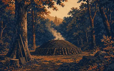
Sassetta
A museum of the wood you are riding through
The return leg climbs back into chestnut and cork oak, and Sassetta sits in the middle of it on its own small rock.
- The comune's own attraction here is an open-air museum of the woodland.
- The route re-enters chestnut and cork oak after the metalliferous hills.
- The pin used is the comune centroid FAI repeats on every Sassetta page, not one building's.
432 km (268 miles) · landmark
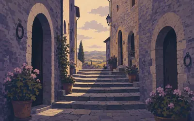
Suvereto
Cork oaks, and a DOCG of its own
The name comes from the cork oak and the town is built out of the hill in stepped stone lanes, eleven kilometres from the finish.
- Suvereto has held its own red-wine DOCG since a decree of 18 November 2011.
- It is a separate denomination from the broader Val di Cornia DOC.
- The comune's homepage displays five association memberships, from Città del Vino to Bandiere Arancioni.
443 km (276 miles) · landmark
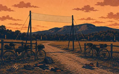
Back to the showground
Four hundred and forty-three kilometres, one field
The loop closes where it opened, on the fairground at Venturina Terme in the comune of Campiglia Marittima.
- The comune records 6,123 entries for the 2026 edition against 6,115 in 2025.
- Foreign participation rose from 54 per cent to 67 per cent, its thirteenth edition and second at Campiglia.
- The organisers claim a world record for participation in a bikepacking and gravel event.
Take on Tuscany Trail and collect these places as you reach them
Common questions
How do my rides count towards the Tuscan circuit?
The feed does it for you. With Strava or Apple Health linked, every ride, run or walk on it takes you further through the hills and gravel roads of the loop. At 150 km a week a cyclist finishes in about three weeks, while a runner at 40 km a week takes around eleven.
Do I have to ride gravel, or be in Italy?
Neither. The trail is a distance to cover rather than a surface or a place, so road miles, trail miles and treadmill miles all count the same. The real event is a bikepacking route through Volterra, Montalcino and the Chianti hills; the virtual version lends you its length and its map.
Is the Tuscany Trail a cycling-only route?
The real Tuscany Trail is a bikepacking and gravel cycling event, but Route Rally counts any discipline towards your virtual distance. Runners, walkers and road cyclists can all take on the same virtual route.
How long does it take to cycle?
At a steady 150 km a week you finish in about three weeks. Push to 250 km a week and you can complete the circuit in under two weeks. The end date is chosen when you create the rally, so the pace is up to you.
Start your Tuscany Trail Conquest
Connect Strava or Apple Health once and every ride, run or walk you record syncs automatically, moving you along the route without anything else to log.