Virtual Coast to Coast C2C Challenge
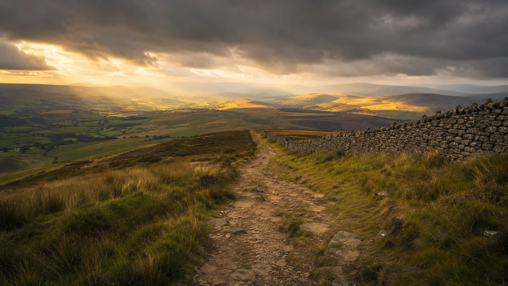
Cross England from coast to coast from your own roads and trails. The Coast to Coast C2C runs roughly 225 km (about 140 miles) from Whitehaven on the Cumbrian coast east through the Lake District, over the high Pennines and through the Tyne Valley to Sunderland on the North Sea. Route Rally turns every synced ride, run or walk into progress along one of England's most popular cycling routes.
- Route: Coast to Coast (C2C)
- Distance: 224.8 km
- Elevation gain: 3800 m
- Classic cross-England cycling challenge
- Best for: Medium rallies of your own for cyclists, runners and walkers, and coast-to-coast crossing goals
Planning your challenge
A cyclist averaging 150 km/week finishes in around a week and a half; a runner at 40 km/week takes about six weeks, and a walker at 30 km/week completes it in roughly eight weeks.
This is a Medium route by Route Rally distance bands, long enough to feel substantial and achievable in a focused month at a cycling pace.
Works well for cyclists who want a clear coast-to-coast goal, and for walkers and runners who want a cross-England route that is more accessible than the longer Pennine Way.
Create your own rally for your own C2C target, solo or with a club, workplace or group of friends.
Why this route
- The Coast to Coast C2C is one of England's most popular cycling routes, covering about 225 km (140 miles) from Whitehaven on the Irish Sea to Sunderland on the North Sea.
- As a virtual challenge you cover the distance in your own time, with rides, runs and walks from anywhere pushing you east across England towards the North Sea coast.
- The route crosses two of England's most impressive landscapes: the Lake District in the west and the North Pennines in the middle, before descending through the Tyne Valley to the coast.
- Its medium length makes it achievable in a focused four-to-eight week training block, long enough to feel like a genuine crossing without requiring months of commitment.
- The clear coast-to-coast narrative gives it a strong motivation: every kilometre moves you from one sea to the other.
Highlights
- Start at Whitehaven on the Cumbrian coast, dipping a wheel in the Irish Sea
- Climb through the Lake District, passing Keswick, Derwentwater and the high fells
- Cross the North Pennines on the high moorland roads above Stanhope and Rookhope
- Finish at Sunderland on the North Sea coast of northeast England
Places along the route
Every place below is measured onto the route line, so the distance shown is where you actually reach it.
Places are researched from published sources. The distances are measured rather than estimated: we find the point on the route's own recorded line that lies nearest the place, and give the distance along the route to that point.
West Cumbria and the northern lakes
0–78 km · 10 places
0 km (0 miles) · engineering
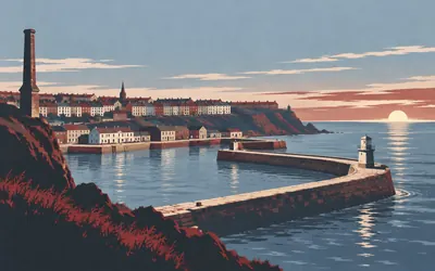
Whitehaven Harbour
A town built on purpose, on top of a mine
The back wheel goes in the water off the Old Quay, which Historic England dates to 1687, under a stone lighthouse nearly twelve metres tall.
- Historic England calls Saltom Pit the first undersea coal mine in Cumbria, worked between 1729 and 1848, and the oldest surviving undersea coal mine in north-west England.
- The council describes Whitehaven as one of the earliest and most complete post-medieval planned towns in England.
- Historic England records the attack on the harbour by the American vessel Ranger, commanded by John Paul Jones, in April 1778.
22 km (13 miles) · heritage
The Lamplugh Hall Gateway
Thus passes the glory of the world
A gateway with a datestone of 1595 and the name IOHN LAMPLVGH over the entrance on a twentieth-century facsimile panel, under a corbie-stepped parapet. On the back Historic England records a sundial, perhaps eighteenth-century, with a brass gnomon set in a carved sun's disc, inscribed Sic Transit Gloria Mundi. Thus passes the glory of the world. Somebody meant it.
29 km (18 miles) · heritage
Loweswater Pele
Half the moat was already there
Historic England counts about six thousand moated sites in England and calls this one unusual. Nobody dug a moat all the way round. Somebody took a low hillock already sticking out into the lake and cut ditches across its landward side, and the water did the rest. The record connects it to Ranulphe de Lindesaye, at Loweswater in the mid twelfth century.

37 km (23 miles) · nature
Whinlatter Pass
England's only true mountain forest
The road climbs out of Lorton into trees and does not stop climbing.
- Forestry England describes Whinlatter as England's only true mountain forest.
- Forestry England calls the views across Bassenthwaite Lake, Derwentwater and Keswick unrivalled.
- Forestry England describes Whinlatter as a hundred-year-old working forest and lists red squirrels, deer, badgers and foxes among its wildlife.
49 km (30 miles) · heritage
Keswick Moot Hall
A clock face or blind circle
Historic England's listing is precise about what it cannot tell you. The present building is 1813, on a site that carried one in 1571 and another in 1695. The tower has a half-moon window and, above it, what the listing calls a clock face or blind circle. Above that is a pagoda roof with a weathervane, on an island in the middle of the street.

52 km (32 miles) · heritage
Castlerigg Stone Circle
One of 45 known in England
Thirty-eight large stones in an oval on a shelf of high ground, with fells standing round the whole horizon.
- Historic England calls Castlerigg one of the finest examples of a large irregular stone circle in England.
- Of about 250 stone circles in England, Historic England records only 45 as large irregular circles.
- English Heritage reports Aubrey Burl's 1976 argument that Castlerigg is very early, and says the evidence supporting it is not strong.
64 km (40 miles) · heritage
St Kentigern's, Mungrisdale
Somebody signed the furniture
Historic England dates the church to 1756 on a medieval site, restored in 1925. Inside is a three-decker pulpit put together partly out of seventeenth-century box pews, one of them carrying a carved graffito that reads I.R.1679, and a pillar font under a seventeenth-century pyramidal wooden cover.
69 km (43 miles) · heritage
Troutbeck Roman Fort
A fort and three camps
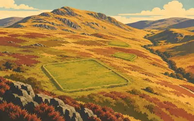
Four Roman earthworks inside a mile and a half of moor, and Historic England's records treat them as one problem.
- Historic England records the fort at about 120 metres by 110 internally, first garrisoned by around 500 auxiliary troops.
- It stands in a group with three Roman camps, and a section of the Roman road running to Voreda at Old Penrith.
- Historic England counts around 140 Roman camps identified in England, and records the largest camp here at about 430 metres by 370.
76 km (47 miles) · heritage
Greystoke Castle
Six hundred years of receipts
Historic England's listing reads like an invoice. Licensed to crenellate in 1353 for the Greystock family; damaged in the Civil War; part rebuilt in the late seventeenth century; refronted in 1710 for the Howards; altered in the mid eighteenth century and again in 1789; refaced by Anthony Salvin from 1839; and worked on by Salvin again after a fire in 1868.
78 km (49 miles) · heritage
Blencow Hall
Split from window to battlements
Historic England grades this fortified house I and dates it probably late fifteenth century with alterations of 1590. Then comes the sentence people come for: the left tower's front wall is rent from a ground-floor window all the way to the battlements, and the battlements are otherwise complete. Historic England gives no cause. Local story says a Civil War cannon. The register does not.
The Eden valley and the North Pennines
87–148 km · 9 places
87 km (54 miles) · heritage
The Giant's Grave
Four hogbacks between two crosses
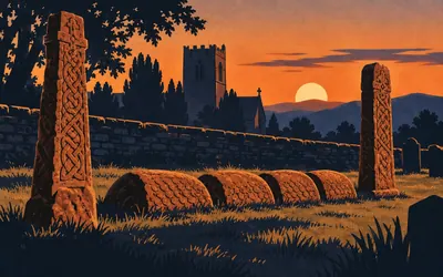
In St Andrew's churchyard, two tenth-century cross shafts stand at either end of a setting of four hogback stones, all of local red sandstone.
- Historic England calls the Giant's Grave a remarkable group of richly carved tenth-century monuments unparalleled in Cumbria.
- It is two Anglian cross shafts with four hogback tomb markers set between them, all of local red sandstone.
- Historic England records the link to Ewan, King of Cumberland, as local tradition, and gives six other names for him.

100 km (62 miles) · heritage
Long Meg and Her Daughters
Sixty-nine stones the ice brought
Sixty-nine stones, granite erratics dragged here by ice, set in an oval flattened along its northern side and enclosing about 109 metres by 94.
- Historic England records 69 stones, granitic glacial erratics in an oval about 109 metres by 94, and calls it the largest irregular stone circle in Cumbria.
- Long Meg herself is an outlying monolith of red sandstone 3.4 metres tall, carved with cup and ring marks and spirals.
- Aerial photographs have identified a cursus running about 600 metres west from the circle, invisible at ground level.
108 km (67 miles) · heritage
The Haresceugh Boundary Stone
Somebody walked the bounds in 1913
A small red sandstone post at a road junction, listed Grade II, with its whole story cut into its face: MANOR OF HARESCEUGH, 4 JUNE 1913, BOUNDARY PERAMBULATION, MANORIAL STONE. Somebody walked the manor bounds that summer and left this where the western edge was. The climb to Hartside starts a few miles further on.

115 km (72 miles) · viewpoint
Hartside Pass
ALSTON 5, PENRITH 14
There is no sign at the top, and no authority publishes a height for it, so this card gives you the milestones instead.
- Four milestones from the Penrith to Alston turnpike are listed along this road; the one at the summit reads ALSTON 5, PENRITH 14.
- UNESCO designated the North Pennines a Global Geopark in 2015.
- UNESCO records that the North Pennines holds 27 per cent of England's blanket bog.
127 km (79 miles) · engineering
Whitesike and Bentyfield
Picking, jigging, buddling
Historic England's record for these ore works spells the whole process out in the industry's own verbs: picking clean lumps from waste, breaking them down, sorting by size, jigging on a sieve in a tub of water, then buddling the fines away in a current. The dressing floors hold deep stratified deposits, some of them waterlogged, and the record notes that waterlogged ground is ideal for preserving wood and leather.
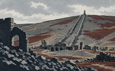
131 km (81 miles) · engineering
Nenthead Lead Mines
A flue a kilometre long
The North Pennines National Landscape says Nenthead is regarded as the most intact mining landscape within the North Pennines, and standing in it you can see why nothing has grown back over it.
- Historic England records Nenthead as one of the main mining areas of the London Lead Company by the mid-eighteenth century.
- The smeltmill flue runs 1.1 kilometres south-east to a collapsed chimney, and its spine wall stands up to 6.4 metres high.
- The North Pennines National Landscape says Nenthead is regarded as the most intact mining landscape within the North Pennines.
134 km (83 miles) · engineering
Coalcleugh Lead Rake
A vein, dug out from the top
A lead rake is what you get when men follow a vein along its outcrop and take it out from above: a long straight scar across a fell. Historic England dates this one to before the 1690s, records horse gins working three of its shafts by the mid eighteenth century, and gives the end as 1880 for lead and 1921 for zinc.
141 km (88 miles) · engineering
Allenheads Ore Works
Fourteen bays for raw ore
Bouse teams are tall stone containers for holding raw ore before it is washed, and Historic England calls the set here fine: fourteen apsidal bays separated by stepped walls. They belong to a wider complex that included the Fawside level, begun in 1776, and the Gin Hill shaft, dug by 1793. A stone arched tunnel and seventy metres of paved and walled channel carry the level's water to the river.

148 km (92 miles) · engineering
Rookhope Smeltmill
Chasing lead back out of the smoke
The valley floor at Rookhope holds a lead-smelting site abandoned in the late 1730s and, in Historic England's own words, little disturbed since.
- Historic England records the Rookhope smeltmill as abandoned in the late 1730s and little disturbed since.
- The register describes late eighteenth- and nineteenth-century smeltmills as often recovering lead from furnace fumes through systems of flues, condensers and chimneys.
- The Lintzgarth arch, about three metres thick, is what Historic England calls the only remains of the later smelting complex.
Weardale, the railway paths and the Tyne
158–225 km · 13 places
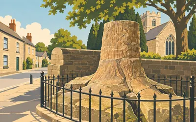
158 km (98 miles) · nature
The Stanhope Fossil Tree
A clubmoss thirty metres tall
Set against the churchyard wall in front of St Thomas's is the stump of a tree that stopped growing about 320 million years ago.
- The North Pennines National Landscape records that the fossil tree was found at Edmundbyers Cross in 1915 and reassembled in Stanhope churchyard in 1964.
- It is a Sigillaria, described as an early ancestor of the modern clubmosses, from a Carboniferous swamp forest.
- Historic England calls Stanhope's market cross the only one still surviving in its original position in County Durham.
161 km (100 miles) · engineering
Weatherhill Incline
Trains came up here on a rope
Four sandstone slabs stand along this stretch, each about a metre high with S&D/R cut into it in Roman capitals. Historic England dates them to about 1845 and says they mark the edges of a railway incline engineered by T. E. Harrison and Robert Stephenson for the Stanhope and Tyne Railroad Company in 1832. A standing engine hauled the wagons up by rope.
164 km (102 miles) · heritage
Edmundbyers Cross
One of three still where it was put
Historic England calls this one of only three wayside crosses still in its original position in County Durham, though what survives is a greatly weathered socket stone, sixty-four metres north of the road junction. The sandstone quarry that produced Stanhope's fossil tree was here too, which makes this crossroads a strange pairing: a medieval waymark and a Carboniferous forest, under one name.
168 km (105 miles) · heritage
Waskerley
A shed for six engines, and then nothing
Durham County Council's own account of Waskerley is short and final. A goods station, sidings, a shed for six engines, wagon repair shops, a church and a school stood here; the lead mines closed, the line closed in 1969, and Waskerley became a ghost village. A Stockton and Darlington boundary marker, probably of about 1844, still stands by the farm gate.

176 km (110 miles) · engineering
Hownes Gill Viaduct
A hundred and fifty feet of yellow brick
Twelve semicircular arches of yellow brick, fifty feet across each and a hundred and fifty feet up at the highest point, carrying what is now a cycle path over a gorge.
- Historic England records twelve semicircular arches, fifty feet across and a hundred and fifty feet high at the highest point.
- The listing dates the viaduct to 1858 and names Thomas Bouch as its engineer for the Stockton and Darlington Railway.
- Durham County Council puts it at forty-six metres above the tree canopy and calls it one of the most impressive railway structures in the North East.
184 km (115 miles) · heritage
Vindomora
Named by the church, not the register
Historic England schedules a Roman station here and publishes no description of it at all: the record is an old county number entry with a name, a grid reference and nothing else. What names the place is the church. The Grade II* listing for St Ebba's records a re-used Roman altar built into the fabric, and says the church stands on the site of the fort Vindomora.
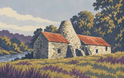
187 km (116 miles) · heritage
Derwentcote Steel Furnace
Iron baked in charcoal until it was steel
A stone cone in a field by the Derwent, and the two Historic England records for it reach for two different superlatives with two different scopes.
- Historic England's scheduling calls Derwentcote the earliest cementation steel furnace in the British Isles and the only intact and complete example.
- Its Grade I listing separately calls it the only complete surviving example in England of a cementation furnace.
- Historic England dates the furnace to around 1733 and records that it stayed in use until 1875.

193 km (120 miles) · heritage
The Monument to British Liberty
Liberty, paid for in coal
A column with a statue of Liberty on top of it, put up in a coal owner's park.
- Historic England's listing dates the Monument to British Liberty to 1750 to 1757, by Daniel Garrett and then James Paine.
- The listing gives the column's height as 140 feet; Historic England's register of parks and gardens gives about 50 metres for the same monument.
- The register calls the monument an overt expression of George Bowes's nationalist and Whig sympathies.
195 km (121 miles) · engineering
Winlaton Mill Ironworks
A factory before there were factories
Historic England calls Ambrose Crowley the leading supplier of ironwork to the Royal Navy, and records that he took over a corn and fulling mill here in 1691 and turned it into a large integrated ironworks: forges, a slitting mill, a cementation steel furnace, blade-grinding mills, an anvil shop. The register calls it an important early example of the factory system.
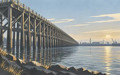
204 km (127 miles) · engineering
Dunston Staiths
A wooden pier for tipping coal
A timber pier a third of a mile long, standing out in the Tyne, built so coal could be tipped straight from railway wagons into ships.
- Historic England calls Dunston Staiths the last operating jetty staithes on the Tyne, over 1,700 feet of braced timber.
- Historic England dates the structure to 1890 for the North Eastern Railway; the Tyne and Wear Building Preservation Trust, which owns it, gives the opening as 1893.
- The trust records fires in 2003, 2010, 2019 and 2020.
215 km (133 miles) · heritage
Holy Cross, Wallsend
Possible reused Roman material
A ruined medieval chapel in a Wallsend graveyard, its register entry worth the detour for one clause. The chancel and nave form a tapering rectangle about sixteen metres long, its walls mostly low, but the south nave wall rises four metres around a semicircular Norman doorway the register considers to include re-used Roman material. First recorded in the late twelfth century, it was in use until 1797.
221 km (137 miles) · engineering
The Accumulator Tower
The Tyne's last hydraulic machinery
A sandstone hydraulic accumulator tower in Albert Edward Dock, listed Grade II* and dated 1882, built for the Tyne Improvement Commissioners by the engineers Ure and Messent. Historic England calls it the only surviving example on the Tyne of hydraulic machinery, first developed at Newcastle by William Armstrong in the 1840s. Four kilometres to go.
225 km (140 miles) · heritage
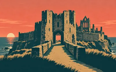
Tynemouth Priory and Castle
Fortified from the Iron Age to 1956
The route finishes on a headland fortified more or less without a break since the Iron Age.
- English Heritage records the headland fortified from Iron Age houses to gun emplacements manned until 1956.
- The priory was refounded in 1085 by Robert de Mowbray as a daughter house of St Albans Abbey, and King Osred II of Northumbria was buried in its church in 792.
- Historic England dates the Collingwood Monument to 1845, base and plinth by Dobson, with four guns from his ship the Royal Sovereign added in 1848.
Take on Coast to Coast (C2C) and collect these places as you reach them
Common questions
How do my rides count towards the North Sea?
Pair Strava or Apple Health once and everything it captures afterwards pushes you east from Whitehaven. At 150 km a week a cyclist crosses England in around a week and a half, while a walker at 30 km a week takes about eight weeks.
Do I have to be in northern England?
No. Nothing about this crossing depends on where you cross, so your commute and your weekend miles count towards it from anywhere. Riders of the real C2C dip a wheel in the Irish Sea at Whitehaven and finish on the North Sea at Sunderland; you cover the 225 km between them from home.
How far is the C2C?
The Route Rally route covers about 225 km, or roughly 140 miles, Whitehaven to Sunderland across northern England.
How long does it take to cycle?
At a steady 150 km a week you finish in around a week and a half. The real-world C2C is traditionally ridden over three to five days, but as a virtual challenge the pace is entirely yours, with the end date chosen at setup.
Can I run or walk the C2C?
Yes. Route Rally counts any discipline towards your virtual distance. Runners at 40 km a week finish in about six weeks, while walkers at 30 km a week complete it in around eight weeks.
Start your Coast to Coast (C2C) Conquest
Connect Strava or Apple Health once and every ride, run or walk you record syncs automatically, moving you along the route without anything else to log.