Virtual Mallorca Tramuntana Loop Challenge
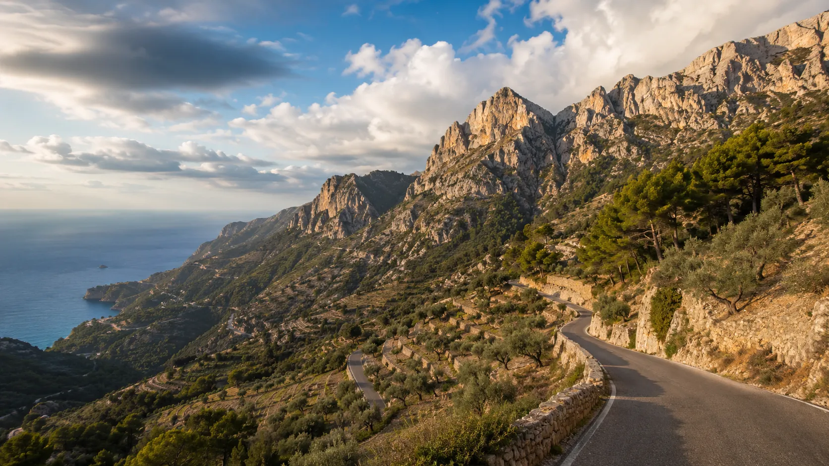
Take on one of Europe's great road cycling circuits from your own roads and turbo trainers. The Mallorca Tramuntana Loop covers roughly 181 km (about 112 miles) through the Serra de Tramuntana mountain range in the northwest of Mallorca, the UNESCO World Heritage landscape that draws professional cyclists and keen amateurs alike each spring. Route Rally turns every synced ride into progress around this demanding island circuit.
- Route: Mallorca Tramuntana Loop
- Distance: 180.9 km
- Elevation gain: 3101 m
- European mountain cycling circuit
- Best for: Medium rallies of your own for road cyclists and indoor riders, and focused training goals
Planning your challenge
A cyclist averaging 150 km/week finishes in a week or so; a runner at 40 km/week takes about five weeks, and a walker at 30 km/week completes it in around six weeks.
This is a Medium route by Route Rally distance bands, well suited to cyclists who want a recognised route goal with serious climbing.
Works especially well for road cyclists and indoor trainers who want a recognised European cycling challenge as a rally target.
Create your own rally for your own Tramuntana target, solo or with a cycling club or group.
Why this route
- The Mallorca Tramuntana Loop follows the mountain roads of the Serra de Tramuntana, covering about 181 km (112 miles) through the UNESCO World Heritage landscape in the northwest of the island.
- As a virtual challenge you cover the distance in your own time, with rides from your local roads and indoor trainers all counting towards the circuit finish.
- The Serra de Tramuntana is one of Europe's most popular cycling destinations, attracting professional teams and amateur cyclists throughout the spring season.
- The route's climbing profile is one of the most demanding of any Route Rally circuit, making it a motivating training goal for serious cyclists.
- Its medium length and circuit format make it a natural target for a focused four-to-eight week training block.
Highlights
- Start at Paguera on the Bay of Palma on the southwest coast of Mallorca
- Climb into the Serra de Tramuntana, a UNESCO World Heritage mountain range
- Pass the mountain village of Valldemossa, one of the island's most famous spots
- Follow the coastal mountain roads past Sa Calobra before looping back to the bay
Places along the route
Every place below is measured onto the route line, so the distance shown is where you actually reach it.
Places are researched from published sources. The distances are measured rather than estimated: we find the point on the route's own recorded line that lies nearest the place, and give the distance along the route to that point.
Peguera, Calvià and the crossing to the Raiguer
0–47 km · 4 places
0 km (0 miles) · landmark
Torre des Cap Andritxol
One of about two hundred
A watchtower stands out on the headland west of the start. Three authorities name it three different ways and all three land within about seven metres of the same rock. The state's own tower declarations count close to two hundred coastal defence elements surviving on Mallorca, and the Consell de Mallorca splits them: talaies only signalled, with fire or smoke; torres de defensa were armed.
9 km (5 miles) · heritage
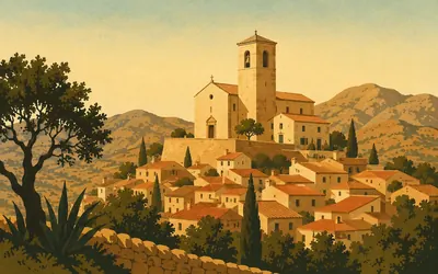
Sant Joan Baptista, Calvià
On the highest point, and a horse of fire
The road climbs off the coastal strip and Calvià sits above it.
- The Consell de Mallorca places the church on the highest point of the village, beside the rectory and a mirador.
- Calvià's heritage register holds forty-two protected entries and the parish church is not one of them.
- The Ajuntament records the Naveta Alemany as 22 metres long, one of the longest on Mallorca.
25 km (15 miles) · heritage
Els jardins de Son Berga Nou
A garden protected in its own category
The line runs through Establiments on the edge of Palma. The Consell de Mallorca's register lists the gardens of Son Berga Nou here as a jardí històric, a category of their own, declared in December 2000, and protects two large water systems, the síquies of Baster, threading the same ground underneath.
47 km (29 miles) · heritage
Convent de Nostra Senyora de la Soledat
Filed under a name nobody uses
Everybody calls this the Convent dels Mínims, which is exactly why it is hard to look up: the register files it as the Convent de Nostra Senyora de la Soledat, declared a monument in July 1990. A later act extended the protection to what is inside, including a fifteenth-century image of the Virgin brought from Genoa by Esteve Conrado.
The Raiguer and the climb to Lluc
55–72 km · 6 places
55 km (34 miles) · heritage
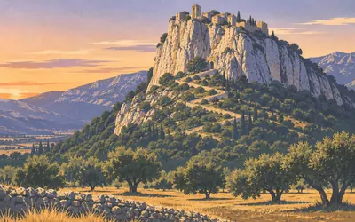
Castell d'Alaró
Practically impregnable, and still inhabited
A castle on a limestone crag, reached by an old bridle path that climbs the rock and enters under the arches of the keep.
- The Consell de Mallorca gives the castle's summit as 821 metres and calls it practically impregnable.
- The oratory of the Mare de Déu del Refugi at the top was built in 1622.
- Alaró was the first municipality on Mallorca with an electricity network, inaugurated on 15 August 1901.
62 km (38 miles) · heritage
Palau d'Aiamans, Lloseta
Fifteen thousand square metres beside the parish church
The seat of the Comtes d'Aiamans stands next to the parish church, about fifteen thousand square metres of it, with the palace gardens round it. The Ajuntament de Lloseta records that the March family bought it in 1927, that an interior reform followed in 1940, that the façade and the present gardens were rebuilt in that period under the architect Gabriel Alomar, and that it was sold again in 1975.
66 km (41 miles) · heritage
Sant Bartomeu, Inca
The town the great fair belongs to
The route skirts Inca rather than going into it. The Consell de Mallorca protects the church and convent of Sant Bartomeu here, declared in 2007. Every November the town holds the Dijous Bo, which the Ajuntament calls one of the most important and traditional fairs of Mallorca, and which it says is considered the great fair of the island.
68 km (42 miles) · heritage
Sant Llorenç de Selva
A Gothic front on a promontory
The Consell de Mallorca puts Sant Llorenç at the top of a promontory with a Gothic façade, holding a fifteenth-century Calvary retable by Gabriel Mòger II, and notes in the same breath that Selva is a place cyclists and walkers pass through. It was declared a monument of local historic and artistic interest in November 1978.
70 km (44 miles) · heritage
Caimari
A village that had nowhere to bury anyone
The last village before the climb to Lluc. Its old oratory of Sant Jaume was begun in 1732 and the church of the Immaculada was not raised until 1890. For a long time Caimari had no cemetery at all: the dead were kept in the Caseta dels Morts, on the Rota de s'Escolà, until they could be carried down to Selva.
72 km (45 miles) · heritage
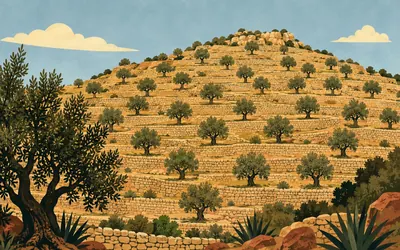
Les rotes de Caimari
Thirty-five hectares of wall, built in fifteen years
The climb to Lluc goes up through terraces, and these ones are protected twice over.
- UNESCO inscribed the Cultural Landscape of the Serra de Tramuntana in 2011, under criteria (ii), (iv) and (v).
- The Consell de Mallorca declared the rotes de Caimari a Bé d'Interès Cultural in 2009, as a site of ethnological interest.
- They cover 35.7 hectares in twenty-eight properties, between 180 and 475 metres above sea level, built out in dry stone between 1837 and 1852.
Lluc, the high reservoirs and Puig Major
80–94 km · 5 places

80 km (50 miles) · heritage
Santuari de Lluc
Remodelled on Gaudí's instructions
The Consell de Mallorca calls Lluc the spiritual centre of the island.
- The Consell de Mallorca calls the Santuari de Lluc the spiritual centre of the island.
- The basilica was remodelled in 1908 by J. Rubió and G. Reynés, following Antoni Gaudí's instructions.
- The sanctuary dates its choir school to the sixteenth century and calls it one of the oldest in Europe.
82 km (51 miles) · heritage
Les cases de neu de Massanella
Snow, kept in stone, carried down to Palma
Up on the Massanella massif the Consell de Mallorca protects a complex of snow houses as a lloc etnològic, declared in March 2004. It is one of only three dry-stone complexes the Consell names as protected in their own right, with the Barranc de Biniaraix path and the terraces at Caimari.
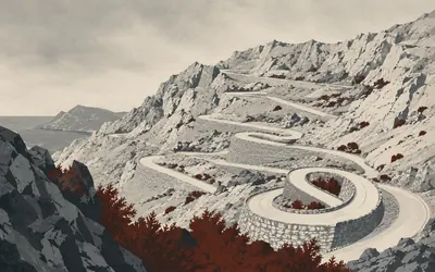
85 km (53 miles) · engineering
Coll de Cals Reis
Built for visitors, not for anywhere
The pass at the head of the road down to sa Calobra, and the road is the reason to stop.
- The Consell de Mallorca credits the road to Antoni Parietti Coll and says it was built for tourism rather than to connect existing settlements.
- It drops 800 metres over twelve kilometres of curves, and 31,000 cubic metres of rock and earth were moved to make it.
- The Nus de la Corbata bend turns through 270 degrees.
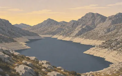
89 km (55 miles) · engineering
Gorg Blau and Cúber
Palma's water, arriving downhill
Two reservoirs in the highest valleys of the Serra, both built in 1972 by the Balearic government's account, and between them they carry just under a quarter of Palma's water supply.
- The Balearic government dates both the Gorg Blau and Cúber reservoirs to 1972.
- Cúber sits at the highest point of the supply system, so the water reaches Palma by gravity down almost 700 metres.
- Palma's water operator publishes Gorg Blau's capacity as 7.34 cubic hectometres on one page and 7.36 on another.
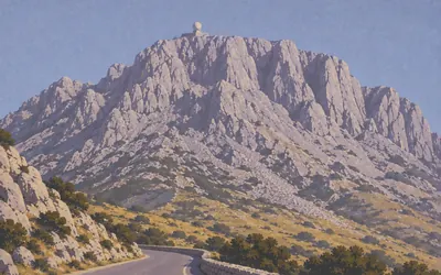
94 km (58 miles) · nature
Puig Major
The one summit you cannot walk to
The highest ground on Mallorca stands over the road here, and you cannot go up it.
- The Consell de Mallorca gives Puig Major as 1,445 metres.
- The Instituto Geográfico Nacional's geodetic marker on the mountain, at 1,414.926 metres, is explicitly not the summit.
- The summit was lowered by five metres to fit the radars, and its two domes were replaced by one in 2005.
The Sóller valley and the north-west coast
103–173 km · 12 places
103 km (64 miles) · viewpoint
Mirador de ses Barques
A named place with nothing published about it
The Balearic gazetteer carries a point here and a name, and that is the whole of what any authority publishes about the Mirador de ses Barques. Nobody describes it, dates it or explains the name. The road turns, the valley opens towards the Port de Sóller, and the register has nothing to add.
105 km (65 miles) · heritage
Fornalutx
One of the most beautiful, and they mean the ensemble
The town hall occupies Can Arbona, a sixteenth-century house that still has its tall square defence tower, and many of the roofs carry painted tiles, a tradition that marked the finishing of a house. The Consorci says the urban ensemble has been considered one of the most beautiful in Spain. In 1983 the village took the second national prize for beautified and well-kept towns.
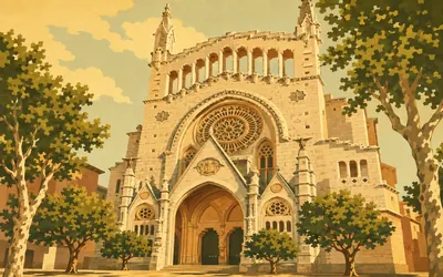
110 km (68 miles) · heritage
Sant Bartomeu, Sóller
A modernista front on a thirteenth-century church
The church was standing before 1236.
- The church's modernista façade was designed by Joan Rubió in 1904.
- The Sóller railway opened on 16 April 1912, the day the Titanic sank.
- The tram to the Port de Sóller, opened on 4 October 1913, was the first electric tramway on Mallorca.
119 km (74 miles) · heritage
Deià
Declared, in full, in 2001
The Consell de Mallorca declared the delimited urban areas of Deià a conjunt històric in February 2001, and the register carries nine separate sub-records for the municipality. The Consell describes a village made mythical by the cosmopolitan air that artists from everywhere brought to it, under the Teix, with five kilometres of steep coast.
123 km (76 miles) · heritage
Son Marroig
A marble temple looking at a hole in the sea
The Archduke Lluís Salvador bought this estate, with sa Foradada below it, from the Masroig family at the end of the nineteenth century. He restored the houses and their Renaissance tower, moved in, and filled the grounds with stone benches, miradors and a romantic garden with a small white marble temple at the centre of it.
125 km (78 miles) · heritage
Miramar
A school of oriental languages, 1276
In 1276 a school of oriental languages for missionaries was founded here, and two authorities disagree about who did the founding: the Ajuntament de Valldemossa says King Jaume II bought the place for Ramon Llull, while the Consell says Llull established it himself. The Archduke Lluís Salvador acquired Miramar in 1872.
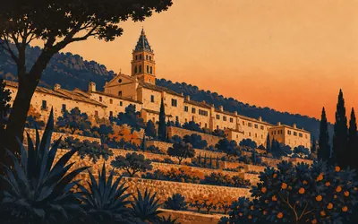
129 km (80 miles) · heritage
La Reial Cartoixa de Valldemossa
Almost without parallel in Europe, said the decree
A charterhouse in a valley that a Spanish state decree of 1971 called almost without parallel in Europe, for its historical, literary and musical value.
- The 1971 decree that protected the Cartoixa called its setting almost without parallel in Europe.
- Jaume II built the palace here in 1309 for his son Sanç; it was given to the Carthusians in 1399.
- The Ajuntament dates Chopin and George Sand's stay to December 1838 to February 1839; the Cartoixa's operator gives 95 days from November 1838.
137 km (85 miles) · heritage
Sa Granja d'Esporles
The first record of the name is 1274
Declared a Bé d'Interès Cultural in February 2025, the houses as a monument and the terraced gardens and orchards as a historic garden. The declaration is careful about the origins: it says historians read the documents differently and there is no consensus that the Cistercians founded a monastery here at all. The name granja is first recorded in 1274.
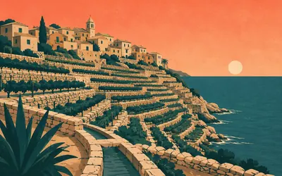
144 km (89 miles) · heritage
Banyalbufar
Construction beside the sea, and the water to prove it
The Ajuntament reads the whole village as the work of an Andalusi community: the name means construction beside the sea, and the terraces and the buried water-sharing system are the argument.
- The Ajuntament de Banyalbufar translates the village's name as construction beside the sea and reads its terraces and water system as Andalusi work.
- Malvasia de Banyalbufar is kept by the Balearic government's agriculture institute as a named local vine variety.
- The watchtower above the village was begun in 1579 and was put up for auction in 1875 at seventy pesetas.
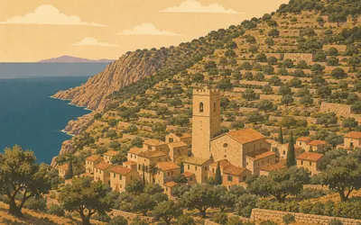
151 km (94 miles) · heritage
Estellencs
Three quarters, and a bell tower that was a defence tower
Declared a conjunt històric by a resolution of February 2007, on a technical report written in 2005.
- Estellencs was declared a conjunt històric by resolution of 9 February 2007.
- The declaration reads the village as three quarters: s'Arraval, sa Vileta and the centre.
- The first written reference is from 1234, when the Bishop of Barcelona granted the place to Bernat de Moguda on condition that he keep armed horses.
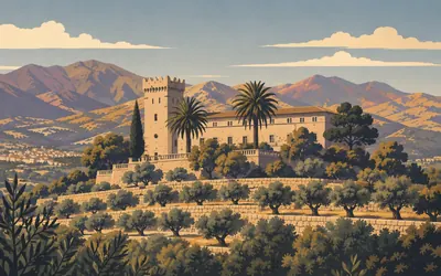
168 km (104 miles) · heritage
Castell de Son Mas, Andratx
A farmhouse the register files as a castle
Three bodies describe the same building three different ways.
- The heritage register files Son Mas under defensive architecture as a castle; the Consell de Mallorca calls it a possessió.
- The Ajuntament d'Andratx has had its offices in the building since 1998.
- Santa Maria d'Andratx was erected as a parish in 1248 and holds a painting of the Turkish landing of 2 August 1578.
173 km (107 miles) · nature
Finca Pública de Galatzó
A tenth of a municipality, in one estate
The Ajuntament de Calvià runs this estate as public land, and gives its area as 14,013,500 square metres: one of the largest holdings in the Balearic Islands, and about a tenth of the whole municipality. Two mountains stand inside it, the Puig de Galatzó at 1,025 metres and the Mola de s'Esclop at 925.
Take on Mallorca Tramuntana Loop and collect these places as you reach them
Common questions
How do my rides count towards the Tramuntana circuit?
Ride, sync, repeat. Every ride Strava or Apple Health hands over is credited to the loop and moves you on from Paguera. Turbo sessions count exactly as road miles do, so a winter block indoors closes the circuit just as well, and at 150 km a week that takes a week or so.
Do I have to ride in Mallorca?
No. The loop is a number to reach rather than an island to visit, so your local roads and indoor sessions all count. Route Rally works towards the distance rather than the climbing, so you get credit for the 181 km without having to find a Sa Calobra of your own.
Why do cyclists go to Mallorca?
The Serra de Tramuntana offers long mountain passes, warm spring weather and quiet roads in a compact island setting. Professional teams use it for pre-season training camps, and the combination of climbing and coastal roads makes it one of Europe's most enjoyable cycling destinations.
How long does it take to cycle?
At a steady 150 km a week you finish in a week or so. Push to 250 km a week and the circuit closes inside ten days. You name the finishing date at setup, so the pace stays yours.
Start your Mallorca Tramuntana Loop Conquest
Connect Strava or Apple Health once and every ride, run or walk you record syncs automatically, moving you along the route without anything else to log.