Virtual Ridgeway Challenge
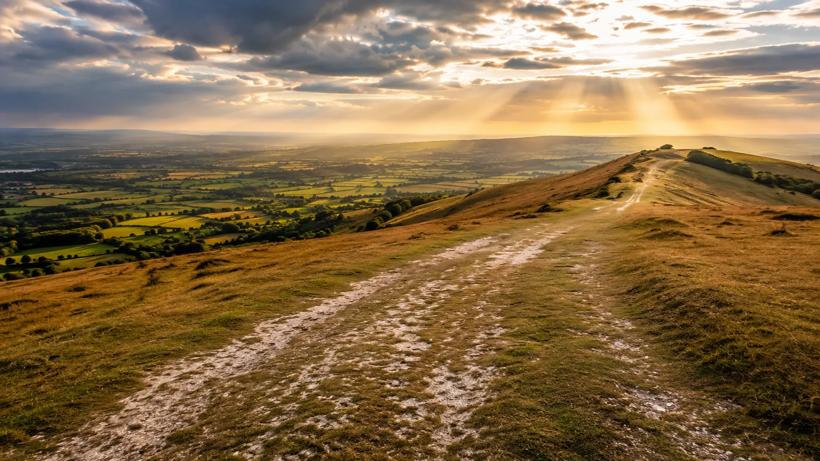
Walk or ride one of Britain's most ancient tracks from your own roads and trails. The Ridgeway runs roughly 164 km (about 102 miles) from Overton Hill near Avebury in Wiltshire to Ivinghoe Beacon in the Chilterns, following a route used for thousands of years by drovers, soldiers and traders. Route Rally turns every synced walk, run or ride into progress along this storied high-ground path.
Part of the National Trails series
- Route: The Ridgeway
- Distance: 163.7 km
- Elevation gain: 2421 m
- Ancient high-ground route
- Best for: Medium rallies of your own for walkers, runners and off-road cyclists, and seasonal goals
Planning your challenge
A cyclist averaging 150 km/week finishes in a week or so; a runner at 40 km/week takes about four weeks, and a walker at 30 km/week completes it in roughly five weeks.
This is a Medium route by Route Rally distance bands, achievable in a focused month and suitable for a first longer challenge.
Works well for those who want a route with genuine historical depth, and for walkers or cyclists looking for a focused seasonal goal.
Create your own rally for your own ancient-road target, solo or with a group sharing one leaderboard.
Why this route
- The Ridgeway is thought to be one of Britain's oldest roads, used continuously for at least 5,000 years along the chalk ridge from Wiltshire to the Chilterns.
- As a virtual challenge you cover about 164 km (102 miles) in your own time, with everyday walks, rides and runs all counting towards the finish.
- The route suits walkers and off-road cyclists: the western half follows a wide chalk track open to bikes, while the eastern Chilterns section is primarily a walking and running trail.
- Its medium length makes it a natural first longer challenge, finishing in weeks rather than months at a steady pace.
- The historical setting gives it a character unlike any road route, even when you are covering the distance from your local pavements and parks.
Highlights
- Start near Avebury and the Overton Hill stone circles on the Wiltshire chalk
- Follow the ancient ridge-top track west to east across open downland
- Pass Wayland's Smithy, White Horse Hill and the Uffington chalk figure
- Finish at Ivinghoe Beacon, high above the Chiltern Hills
Places along the route
Every place below is measured onto the route line, so the distance shown is where you actually reach it.
Places are researched from published sources. The distances are measured rather than estimated: we find the point on the route's own recorded line that lies nearest the place, and give the distance along the route to that point.
The Vale of Pewsey and the Avebury landscape
0–160 km · 31 places
0 km (0 miles) · landmark
Pewsey
Sixteen kilometres short of the trailhead
This route's line starts down in Pewsey and climbs north to meet the Ridgeway at Overton Hill, where National Trails says the trail itself begins. Historic England lists the church of St John the Baptist at Grade I and notes that its nave and south aisle are founded on large undressed sarsens: the same stone the monuments ahead are built from, used here as footings.
11 km (7 miles) · nature
Pewsey Downs
Twenty-eight kinds of butterfly, and two Neolithic hills
Natural England calls Pewsey Downs an extremely rich chalk grassland flora with an outstanding butterfly fauna, and counts twenty-eight resident breeding species, the marsh fritillary and the Duke of Burgundy among them. Adam's Grave, a long barrow seventy metres long, sits on the promontory above; Knap Hill's Neolithic enclosure is on the next one along.
13 km (8 miles) · heritage
The Wansdyke
Scheduled, and entirely undescribed
Historic England schedules this stretch of the Wansdyke and then publishes nothing about it: the record is an old county number with every field left blank. North Wessex Downs National Landscape fills the gap, giving it as a fifth or sixth century bank and ditch named after the Saxon god Woden, and most likely thrown up by the Britons against Saxons coming from the north.
16 km (10 miles) · heritage
East Kennett Long Barrow
Not the unexcavated one, whatever you have read
A flat-topped mound 106 metres long, 50 wide and eight metres high at one end, on private land with no access. It is often called the largest unexcavated long barrow in Britain, and Historic England's own scheduling says otherwise: it was partially dug twice, by the Rev. M Connor in the nineteenth century and later by Thurnham, and no details are known.
18 km (11 miles) · heritage
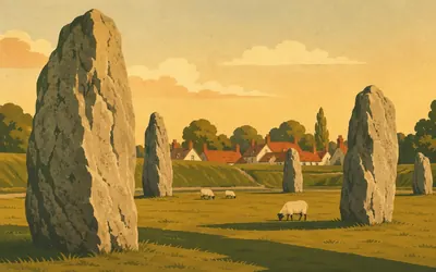
Avebury
A village inside a stone circle
The route passes two kilometres east of a stone circle with a village inside it.
- Historic England and English Heritage both call this 'the largest stone circle in Britain'; UNESCO and the National Trust say the world.
- The henge bank and ditch enclose roughly 11.5 ha, with the ditch cut 7 to 10 m into the chalk.
- Historic England records that an attempt to remove a stone in about 1300 killed a barber surgeon.
23 km (14 miles) · landmark
Hackpen Hill
Victorian beeches, some of them on barrows
The Ridgeway climbs over Hackpen Hill on its way to Barbury, and National Trails describes this stretch by its trees: small clumps of beech planted by the Victorians as landscape features and to give sheep some shelter. Some sit directly on top of Bronze Age round barrows, which nobody would do today, because of what roots do to a monument.
26 km (16 miles) · heritage
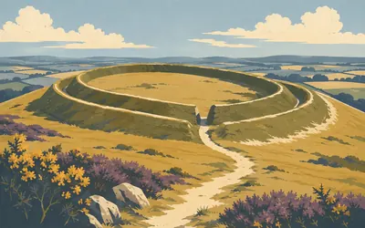
Barbury Castle
A smith's hoard, and a battle the record does not mention
Two rings of bank and ditch wrapped round the end of a chalk spur, enclosing about four and a half hectares, with entrances east and west on causeways the builders left when they dug.
- Historic England: the double ramparts enclose about 4.5 ha, with the inner ditch up to 24 m wide.
- An 1875 excavation found an Iron Age blacksmith's hoard, including chariot harness fittings and a wheel nave-hoop.
- Historic England records around fifty large multivallate hillforts nationally.
32 km (20 miles) · landmark
Ogbourne St George
Down Smeathe's Ridge into the valley of the Og
The trail comes down off Smeathe's Ridge, which National Trails rates for the best views on this section, into the valley of the River Og. The village church of St George is Grade II star, late twelfth to early thirteenth century, with a sundial and two mass dials over the porch arch and, as Historic England puts it, good gargoyles.
40 km (25 miles) · heritage
Liddington Castle
Refortified once more, in the Saxon period
A hillfort of about three hectares, its counterscarp bank standing six metres above the ditch. A small excavation in 1976 found the rampart built in at least four phases, the last a refortification in the Saxon period. North Wessex Downs records the tradition that King Arthur is said to have beaten the Saxons here; Historic England's record mentions no battle.

50 km (31 miles) · heritage
Wayland's Smithy
Fifteen years of burials, and a smith who works for a coin
Four tall sarsens stand across the south end of a long chalk mound, fifty metres off the Ridgeway.
- English Heritage dates the first monument to 3590-3555 BC and says it was used for no more than fifteen years.
- Fourteen people were buried in that first structure: eleven men, two women and a child.
- English Heritage says the name has been linked to the barrow since at least AD 955.
52 km (32 miles) · heritage
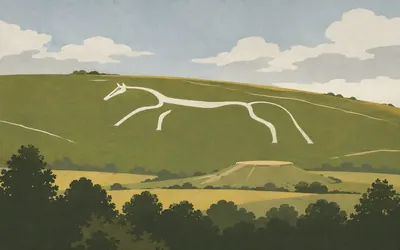
The Uffington White Horse
Not cut into the chalk, but packed into a trench
A long, flowing, barely-a-horse cut across the scarp, 111 metres from tail to ear.
- Every custodian gives the figure as 111 m from tail to ear.
- The National Trust found the horse was cut as a trench and packed with rammed chalk, not scoured into the hillside.
- A scouring festival was held on the hill every seven years from at least 1677.
61 km (38 miles) · heritage
Segsbury Camp
Letcombe Castle on the map, Segsbury in the scheduling
A single rampart standing three metres above the interior, with a ditch twenty metres wide outside it. Nineteenth-century digging showed the rampart was faced with sarsen, like Uffington's, and a burial cist in its south side suggests the Saxons came back to it. Historic England calls it one of a chain of hillforts strung along the old track.
66 km (41 miles) · landmark
The Lord Wantage Monument
A Crimean VC, and the start of the Red Cross
A stone cross 10.2 metres high, put up beside the Ridgeway in 1903 by Lady Wantage for her husband. Robert Loyd-Lindsay won the Victoria Cross in the Crimea and, when the Franco-Prussian War broke out in 1870, founded the society that became the British Red Cross. The cross itself was carved in Italy, modelled on the cross of St Zanobio in Florence.

69 km (43 miles) · heritage
Scutchamer Knob
A court, a boast, and a mound half its old height
A great mound of stacked turf in a ring of beeches beside the track, three metres high and thirty-four across, and much less than it used to be.
- A charter of AD 990-992 names the mound as the site of a 'gemote', probably a shire court.
- The Anglo-Saxon Chronicle records a Danish army halting here in 1006, after burning Wallingford.
- In 1844 William Hewett put the mound's former height at 6.4 m, against about 3 m today.
78 km (49 miles) · heritage
Lowbury Hill
A Roman rectangle nobody can name
A low ridge runs round the top of the hill, the perimeter of a Roman rectangular enclosure, with the small mound of an Anglo-Saxon round barrow beside it. National Trails lists the readings of it: upland farmstead, cattle enclosure, Roman camp, Romano-Celtic temple. A woman was buried in the enclosure wall around 550 to 650, with no grave goods at all.

85 km (53 miles) · nature
The Goring Gap
Where the ice pushed the Thames through the chalk
The Thames, and the reason the chalk ridge stops here.
- Natural England: ice sheets blocked the Thames from the Vale of St Albans, forcing it south to carve the Goring Gap.
- The Chilterns and the Berkshire Downs escarpments face each other across the river here.
- National Trails records the Thames Path crossing the Ridgeway at the Streatley and Goring bridge.

97 km (60 miles) · heritage
Grim's Ditch
Five kilometres of earthwork, and no agreed reason for it
For five kilometres the National Trail runs along the top of an earthwork, alternating between the bank and the ditch, and Historic England says so in exactly those words.
- Historic England: the Ridgeway 'follows the line of the monument for its full extent, alternating between passing over the ditch and the bank'.
- Historic England offers three readings of its original function and chooses none of them.
- A Saxon charter of AD 966 already records the ditch as a hollow-way route.
100 km (62 miles) · heritage
Holy Trinity, Nuffield
A font with a Latin verse cut round it
A twelfth-century church with a fourteenth-century north aisle, its chancel restored around 1845 by Benjamin Ferrey. Historic England transcribes the Latin inscription cut in Lombardic letters around the Romanesque font, and records a brass in the nave floor to Benert Engliss of about 1360.
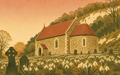
104 km (65 miles) · heritage
St Botolph's, Swyncombe
Flint, herringbone and a February carpet of snowdrops
National Trails calls the country round Swyncombe probably one of the remotest and loveliest parts of the Chilterns, and puts a small flint church in the middle of it.
- Historic England dates St Botolph's to the late eleventh century, its flint rubble laid in herringbone work.
- National Trails records the churchyard's February carpet of snowdrops and aconites.
- The church has an apsidal chancel and a blocked Norman north doorway with a hogback lintel.
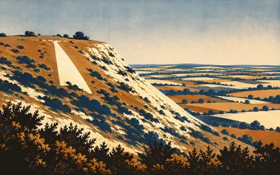
112 km (69 miles) · nature
Watlington Hill
A spire cut into a hillside because a church did not have one
Chalk grassland on the Chiltern scarp, with a white triangle cut into it that is not the ancient hill figure it looks like.
- Chilterns National Landscape: the White Mark was cut in 1764 by Edward Horne, to give his church an illusory spire.
- The mark is neither listed nor scheduled, and no authority publishes a position for it.
- Natural England picks out the nationally rare candytuft, centred on the western Chiltern scarp.
121 km (75 miles) · nature
Chinnor Hill
Juniper on a shrinking range
Natural England's citation for Chinnor Hill is mostly about juniper: a species that has contracted its British range and is uncommon in Oxfordshire, prominent here and dominant over parts of the grassland. The chalk turf also carries candytuft, which Natural England says is largely confined in Britain to Oxfordshire and Buckinghamshire.
130 km (81 miles) · landmark
Princes Risborough
Named for a prince nobody called the Black Prince
The Prince in the name was Edward, who held the manor in 1343. Chilterns National Landscape records that the split between Princes Risborough and Monks Risborough dates from then, and that nobody called him the Black Prince while he was alive. The Manor House, Grade II star and National Trust, stands inside his outer moat.
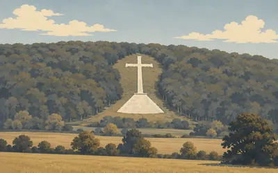
132 km (82 miles) · heritage
The Whiteleaf Cross
First recorded in 1742, and nobody knows what came before
A chalk cross standing on a broad triangular base, cut into a steep beech-wooded slope above the town and running about seventy-five metres up the hillside.
- Historic England: 'The origins of the figure are unknown and have caused much speculation.'
- The cross was first recorded in 1742, by Francis Wise.
- Its triangular base widened from 189 feet in 1742 to 400 feet by 1936.
134 km (83 miles) · heritage
Chequers
The trail crosses the drive
Historic England dates the mansion to 1565, built for William Hawtrey, Gothicised in the early nineteenth century and then put back to its Elizabethan appearance before the First World War. Sir Arthur Lee gave it to the nation in 1917 as a country residence for the Prime Minister, and Lloyd George moved in in 1921. National Trails notes that the Ridgeway crosses the main drive.
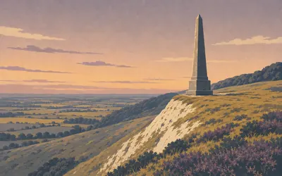
138 km (85 miles) · viewpoint
Coombe Hill
Struck by lightning, rebuilt the same year
A stone obelisk on the scarp edge, visible for miles, commemorating the Boer War of 1899 to 1902.
- Historic England: the monument was erected in 1904 and rebuilt in 1938 after a lightning strike.
- Natural England records the fringed gentian here at its only known locality in Britain.
- National Trails calls Coombe Hill, at 852 feet, one of the highest points in the Chiltern Hills.
140 km (87 miles) · landmark
Wendover
A clock tower built for a fire engine
The trail descends into Wendover past a clock tower of 1843 that Historic England says was originally designed to house the parish fire engine and now holds a tourist office. The Red Lion on the High Street is dated 1669. The Wendover Arm of the canal, opened in 1799 to feed water to the summit level, has been unnavigable since 1897.
150 km (93 miles) · heritage
Tring Park
Wren, Bridgeman, Gibbs, and then the Rothschilds
A late seventeenth-century house that Historic England attributes to Sir Christopher Wren, in a park laid out by Charles Bridgeman in the 1720s with buildings by James Gibbs, among them a summerhouse and a fifty-foot obelisk in the wood. The estate went to the Rothschilds in 1872 as a wedding present; the zoological museum opened to the public in 1892.
153 km (95 miles) · landmark
The Bridgewater Monument
Father of inland navigation, in capitals
A fluted Doric column of 1831 to 1832 by Sir Jeffry Wyatville, in Aberdeen granite, 108 feet high with a viewing gallery and a bronze vase on top. Its pedestal honours Francis, third Duke of Bridgewater, in the words cut there: father of inland navigation. A winding sandstone stair goes up inside it.
155 km (97 miles) · nature
Pitstone Hill
Grim's Ditch again, this time with nothing protecting it
Steep west-facing chalk downland which Natural England says carries several locally and nationally uncommon plants, the nationally scarce pasque flower and field fleawort among them, with twenty-six butterfly species recorded. Another length of Grim's Ditch crosses the hill, unprotected: the National Trust's own records list its designations as none.
158 km (98 miles) · viewpoint
Ivinghoe Beacon
Where the Ridgeway stops and this route keeps going
The Ridgeway's own end, though this route's line carries on a few kilometres past it.
- Historic England: the hillfort encloses about 2.2 ha, with its entrance at the east end of the ridge.
- Early Iron Age pottery and bronze suggest the fort was built in the early sixth century BC.
- Natural England records pasque flower, field fleawort and the endemic early gentian on the Ivinghoe Hills.
160 km (99 miles) · engineering
Pitstone Windmill
A date cut into a side girt in 1627
A post mill on a circular brick base, Grade II star, which Historic England's listing dates in four words: 1627 and 1749. The National Trust's records trace the 1627 to a date carved on a lower side girt, and call the mill one of the oldest surviving post mills in Britain. A freak storm in 1902 ended its working life.
Take on The Ridgeway and collect these places as you reach them
Common questions
How does my walking or riding count towards Ivinghoe Beacon?
There is nothing to fill in. Whatever your tracker logs moves you east from Overton Hill on its own. The real trail is open to bikes in the west and to walkers only in the Chilterns; the virtual one has no such split and counts any discipline towards the same 164 km.
Do I have to be on the ancient track itself?
No. The Ridgeway is a distance to cover here, so pavements, parks and towpaths anywhere move you along it. People used this ridge for thousands of years because it was the practical way to travel between places; covering its length from your own doorstep is arguably in keeping with that.
Can I cycle the Ridgeway?
Yes, though with an important note: the western half from Avebury to Goring is open to cyclists on the real trail, while the eastern Chilterns section is walking and running only. Route Rally counts any discipline towards your virtual distance regardless.
How long does it take?
At a steady 150 km a week on the bike you finish in a week or so. Runners covering 40 km a week take about four weeks, and walkers at 30 km a week complete it in roughly five weeks. The end date is one of the things you choose at creation.
Start your The Ridgeway Conquest
Connect Strava or Apple Health once and every ride, run or walk you record syncs automatically, moving you along the route without anything else to log.