Conquer the Virtual King Alfred's Way Challenge
Follow this historic southern England route virtually. Route Rally converts synced distance into visible progress around the King Alfred's Way loop.
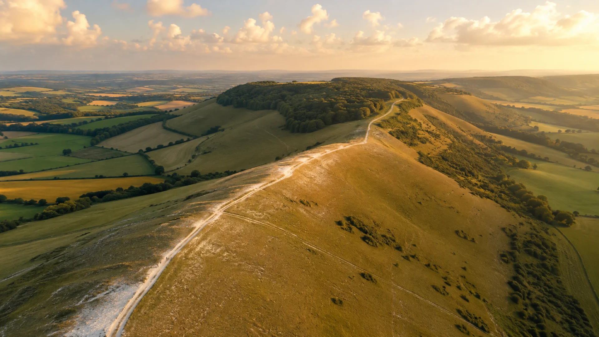
- Route: King Alfred’s Way
- Distance: 351 km
- Elevation gain: 4488 m
- Approachable historic loop
- Best for: First route rallies, shorter rallies of your own, and seasonal targets
Planning your challenge
A runner averaging 40 km/week could complete it in about 9 weeks; a cyclist at 150 km/week could finish in two to three weeks.
This is a Medium route by Route Rally distance bands, so it works when LEJOG feels too large but you still want a meaningful route goal.
Useful for a first rally, or a shorter route before committing to a longer one.
Create your own rally for your own challenge format, solo or with a club, workplace or group of friends.
Why this route
- King Alfred's Way is a compact historic loop through southern England.
- Compared with LEJOG, the shorter distance makes it easier to use as a first challenge or a focused monthly goal.
- The loop format gives the route a satisfying sense of completion for your own rally, solo or with a group.
Highlights
- Follow a loop inspired by historic southern England
- Use the distance as a manageable first virtual route target
- Build progress towards a complete loop rather than a one-way finish
Common questions
How does my riding count towards King Alfred's Way?
Your rides count themselves. Anything Strava or Apple Health records, whether a ride, a run or a walk, is added to the loop with no input from you. Because King Alfred's Way is a circuit, your progress is measured as the share of the loop you have closed: at 150 km a week on the bike it closes in two to three weeks.
Do I have to ride in southern England to take it on?
No. The loop is a length to cover, not a place you have to stand, so laps of a local park or a turbo session count exactly as much as tracks in southern England. Route Rally only asks how far you have gone; the historic loop supplies the shape of the goal and the satisfaction of closing it.
Is this a good first virtual challenge?
Yes, that's exactly what it's built for. The distance is short enough to finish in a month or two of regular activity, so you get a satisfying win without committing your whole year.
Start your King Alfred’s Way Conquest
Joining is free. Connect Strava or Apple Health once and every ride, run or walk you record syncs automatically, moving you along the route without anything else to log.