Conquer the Virtual Camino Primitivo Challenge: Walk the Original Way from Home
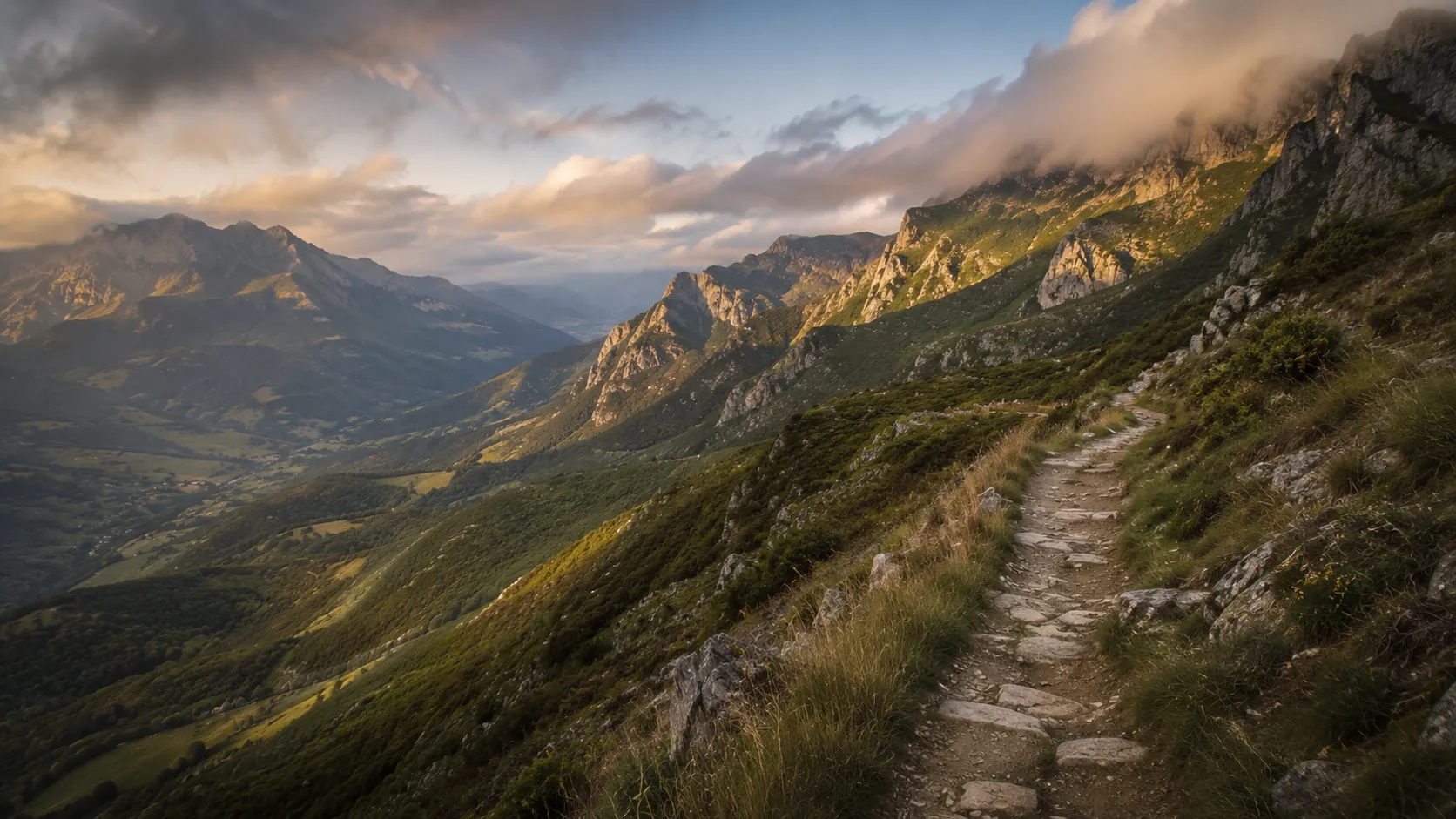
Walk the oldest of the Camino de Santiago routes from wherever you already move. The Camino Primitivo, or Original Way, runs about 341 km (roughly 212 miles) from Oviedo through the mountains of Asturias and Galicia before joining the French Way near Santiago de Compostela, and Route Rally turns every synced walk, run or daily step into progress along it. The most demanding of the Caminos, it rewards stronger walkers with wild, remote scenery.
Part of the Camino de Santiago series
- Route: Camino Primitivo
- Distance: 340.7 km
- Elevation gain: 7500 m
- Demanding mountain pilgrimage
- Best for: Stronger walkers and hikers, hill-walking goals, and multi-week rallies of your own
Planning your challenge
A walker averaging 30 km/week finishes in about eleven weeks; a hiker building hill mileage may treat it as a focused season goal.
This is a Medium route by Route Rally distance bands but with the most climbing of the Caminos, so it suits walkers who want a tougher challenge.
Works well for experienced walkers and hikers who want the original, more mountainous pilgrimage.
Create your own rally at your own pace, solo or with a group to share the climb.
Why this route
- The Camino Primitivo, or Original Way, is the oldest Camino, the route taken by the first pilgrims from the Asturian court.
- The Route Rally route runs about 341 km (212 miles) from Oviedo through the mountains of Asturias and Galicia before joining the French Way near Santiago.
- It is the most mountainous and demanding of the Caminos, which gives it a distinct identity for stronger walkers and hikers.
- As a virtual challenge you cover the distance in your own time, so hill walks, hikes and steps all count towards Santiago.
- It rounds out the Camino de Santiago series with a tougher, more remote option alongside the gentler routes.
Highlights
- Start in Oviedo, the historic capital of Asturias
- Climb through the green mountains of Asturias on the original pilgrim path
- Cross into Galicia and join the French Way for the final stretch
- Finish at the cathedral of Santiago de Compostela
Places along the route
Every place below is measured onto the route line, so the distance shown is where you actually reach it.
Places are researched from published sources. The distances are measured rather than estimated: we find the point on the route's own recorded line that lies nearest the place, and give the distance along the route to that point.
Oviedo and the Nalón
0–57 km · 13 places
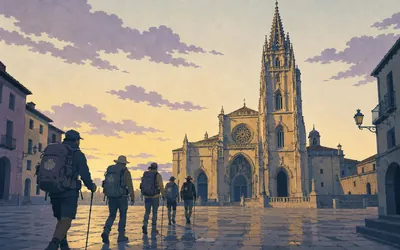
0 km (0 miles) · landmark
Catedral de San Salvador de Oviedo
Kilometre zero, and the older Camino
Every Camino has a starting point and this is the oldest one.
- The cathedral records the Camino Primitivo as the oldest of the routes, beginning here, with Alfonso II as the first pilgrim to Santiago.
- The Principado calls the ninth-century Foncalada spring the only example of a public civil building surviving from the early Middle Ages.
- Oviedo's cathedral, the Foncalada and San Julián de los Prados were all declared Bienes de Interés Cultural before 1932.
1 km (1 mile) · engineering
Acueducto de Los Pilares
The arches that watered Oviedo
Five stone arches left standing in a city park, all that survives of the aqueduct that carried Oviedo's water in from the west. It is a Bien de Interés Cultural, and unusually for the Asturian register its file carries no description at all, only the decree extending its protection in 2016. Eight hundred metres out of the city and already the first ruin.
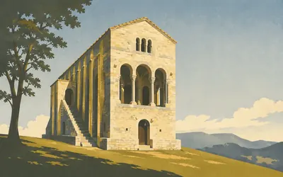
2 km (1 mile) · heritage
Santa María del Naranco
Nobody knows what it was for
Two kilometres out of Oviedo, up on the shoulder of Monte Naranco, stands a tall narrow stone building of about 842 to 850 that does not look like anything else in Europe: two storeys, an outside staircase, ribbed buttresses running to the roofline, and open loggias of three arches at each end.
- The Principado's own record says the building's purpose has never been established, and lists palace, church, royal pavilion and audience hall as possibilities.
- It calls the building the most significant construction of European pre-Romanesque art, built between 842 and 850.
- San Miguel de Lillo, built alongside it, survives as about a third of its original fabric.
11 km (7 miles) · heritage
El Escamplero
A pilgrim hospital, minus the hospital
Eleven kilometres out and the first of the road's shelters. The Ministerio de Cultura records that a pilgrims' hospital stood here and that what still stands of it is the fifteenth-century chapel of Santa Ana. A little way back the Camino crossed the medieval bridge at Gallegos, which the inventory also carries.
14 km (9 miles) · heritage
Palacio de Andallón
A tower that turned into a farmhouse
The Principado's inventory describes exactly the shape of Asturian country gentry: a late medieval defensive tower with rooms added onto it between the fifteenth century and the nineteenth, until what was left was a typical two-storey rural casona. The tower is still legible inside the house.
19 km (12 miles) · heritage
Termas romanas de Valduno
Roman baths beside the Nalón
Roman bathhouse remains on the flat ground by the river, declared a Bien de Interés Cultural only in 2021, which is why the Principado's own dossier series does not cover them. The Camino runs straight past. Whoever built here picked the same crossing of the Nalón that everyone since has used.
24 km (15 miles) · engineering
Puente de Peñaflor
One bridge, two inventory numbers
A long low bridge over the Nalón that the Ministerio de Cultura describes as Romanesque in origin. The concejo boundary runs down the middle of it, so the Principado's inventory carries it twice under two different numbers, once for each bank, at exactly the same coordinates.
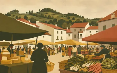
26 km (16 miles) · heritage
Grado
A market town inside a wall that is gone
Grado is where the Camino stops being a suburb of Oviedo and becomes a road through Asturias, and it is a market town first and everything else second: the Wednesday market has run here for centuries and still fills the streets.
- The Principado's record dates documentary references to Grado's wall to the fourteenth century and its destruction to 1810, during the Peninsular War.
- The town's perimeter was fixed soon after Alfonso X granted it the Fuero de Benavente.
- The old walled core still holds the Miranda Valdecarzana palace and its Capilla de los Dolores, both protected.
35 km (22 miles) · heritage
Palacio de Doriga
Twelve columns and a signature
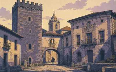
Half fortress, half house: a square fourteenth-century tower with a battlemented top and three centuries of building added round a courtyard. Twelve stone columns hold up the gallery, and one of them is signed. García de Doriga and his wife had these columns made, it says, in the year 1600.
38 km (24 miles) · heritage
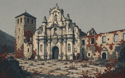
Monasterio de San Salvador de Cornellana
A royal foundation logged as progressive ruin
An infanta founded this.
- The foundation charter came from the infanta Cristina, daughter of Bermudo II; the house was refounded on 7 March 1122 and given to the monks of Cluny.
- The pilgrims' hospital opposite is documented in the fifteenth century and its steward was appointed by the monastery's abbots.
- The Principado's own record grades the monastery as progressive ruin and notes a restoration promised since 1999.
46 km (28 miles) · heritage
Capilla del Cristo y Santa Ana
Named in a charter of 912
A small late-Romanesque chapel on a rise between two hamlets, well away from either. It was the parish church until 1749, when the parish moved down to Villamar and left it here. The inventory traces it back further than the building: it appears in a donation by Fruela, son of Alfonso III, dated 24 October 912.
49 km (30 miles) · heritage
Salas
A town built round one man's tomb
Fernando de Valdés Salas was Archbishop of Seville, Inquisitor General of Spain and the founder of the University of Oviedo, and he came from here.
- The collegiate church was founded by Fernando de Valdés Salas, Inquisitor General and founder of the University of Oviedo, to hold his own tomb and his parents'.
- The Italian sculptor Pompeo Leoni carved the marble tomb between 1576 and 1582.
- A slab over the porch dates the completion of the building to 1549.
57 km (35 miles) · heritage
Necrópolis de La Espina
Neolithic mounds on the watershed
The Camino climbs to the ridge at La Espina and burial mounds start appearing beside it. The inventory classes them as Neolithic tumuli and says nothing else; its file is a scan with no text in it. People have been using this line along the crest for a very long time, which is the only claim the record will support.
Tineo, Allande and the gold country
70–138 km · 9 places
70 km (43 miles) · heritage
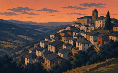
Tineo
A town founded to be walked through
Tineo hangs on a hillside and every street in it either climbs or falls.
- The Principado records that Alfonso IX founded the town and made it a compulsory stage on the pilgrimage route from Oviedo to Santiago.
- Tineo was so dominant from the twelfth to the fifteenth century that the region was called the Asturias of Tineo.
- Tineo's castle was demolished in 1912; the Franciscan monastery survives only as the parish church.
76 km (47 miles) · heritage
Monasterio de Santa María la Real de Obona
A cloister that was never finished
The Principado's file is careful about the beginning: an inscription attributes the foundation to Adegaster, son of King Silo, in the eighth century, but the first documentary mention is three hundred years later and it is about the Camino. The twelfth-century church survives with its three apses. Of the seventeenth-century cloister only the north range and parts of two others were ever built.
80 km (50 miles) · heritage
San Esteban de Relamiego
Enlarged, raised, and still twelfth century
The inventory calls this one of the oldest churches in the whole south-west of Asturias, going back to the twelfth or thirteenth century. The nave was extended westwards and its walls raised, and it was reworked again in 1856, but the record notes that the original twelfth-century arrangement can still be read underneath all of it.
96 km (60 miles) · heritage
Villa romana de Tamallanes
A Roman villa with no date
A Roman villa in the fields beside the Camino, inventoried by the Principado and dated, in the register's own word, as indeterminate. No century, no excavation history, no description: the file is a scan of a form. From here on, almost everything the record holds in these hills is Roman and to do with gold.
101 km (63 miles) · heritage
Explotaciones auríferas de la Sierra del Buño
The hills the Romans took apart
For the next forty kilometres the Camino crosses ground the Roman empire mined for gold, and the Principado's inventory is dense with it: workings on the Sierra del Buño, at Chabayos, at Río de Oro, all classed as imperial-period mining. What you see is a hillside with a piece missing. No authority will tell you how much came out.
104 km (64 miles) · heritage
Pola de Allande
The branch the road takes
A few kilometres back the Camino divided and this rally went left.
- The Ministerio de Cultura calls the Pola de Allande branch the traditional line and describes the Hospitales variant as fifteen hard kilometres with no villages or shelter.
- Turismo de Asturias says of the Hospitales ridge only that it is believed to have formed part of the original route.
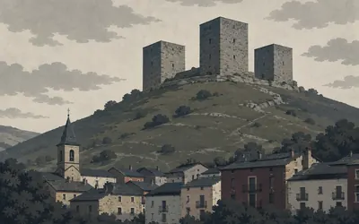
- The Principado's record for the Palacio de Cienfuegos de Peñalba says it reads as a military structure rather than a residence, and lists it as currently unused.
125 km (77 miles) · heritage
Petroglifos de Tiracouces
Carvings the register will not date
Cup marks and rings cut into outcrops beside the path, high on the moor. The Principado inventories them under the category other and gives the chronology as indeterminate, which is an honest answer and a rare one. Everything you will read about their age comes from somewhere that is not the register.
127 km (79 miles) · heritage
Necrópolis del Coral de Lago
Burial mounds above Berducedo
More tumuli, this time on the open ground between Lago and Berducedo, classed by the Principado as Neolithic. There is a pattern by now: the high crossing routes through these hills are lined with graves, and the Camino uses the same crossings because there are no others.
138 km (86 miles) · heritage
Casa de la Torre, San Emiliano
A slate roof like a dropped cloak
Built in the sixteenth century for González Cienfuegos, lord of Allande, out of the slate the hillside is made of: slate rubble walls, slate dressings round the doors and windows, and a slate roof that the Principado's file describes as falling over the different parts of the building like a cloak. Four coats of arms on the tower.
The Navia gorge and the border
144–160 km · 5 places
144 km (89 miles) · engineering
Embalse de Salime
A power station with a mural inside it
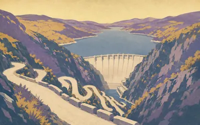
The Camino comes over a shoulder and the whole Navia valley is water: a reservoir held back by a concrete dam, with a green road switchbacking down to it and up the far side.
- The Salime hydroelectric station was conceived by the architect Joaquín Vaquero Palacios and his son Joaquín Vaquero Turcios.
- Its turbine-hall mural, in mixed media on cement and iron, depicts the phases of the dam's own construction.
- The operator says the mural is currently in the process of being declared a Bien de Interés Cultural.
147 km (91 miles) · heritage
Grandas de Salime
A village that collected itself
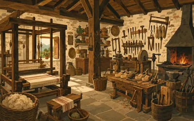
Up out of the gorge and into a small village with a very good museum in it.
- The Principado's register holds a single declared monument for the whole concejo of Grandas de Salime, and it is the Chao Samartín hillfort.
- The Museo Etnográfico de Grandas de Salime publishes its own year-round opening hours and is open through the winter.
- No entry for the village's collegiate church could be found in either the Asturian BIC register or the inventory.
153 km (95 miles) · heritage
Castro del Chao Samartín
Eight hundred BC, carbon-dated
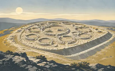
A low hill above a bend of the Cabalos, cut off on two sides by a ditch and a wall built on the spoil from it, and inside that a settlement people lived in for the best part of a thousand years.
- Radiometric dating places the first occupation of the Chao Samartín close to the start of the eighth century BC.
- The earliest defences of its inner acropolis included a timber palisade, whose post-holes and traces of destruction both survive.
- It was declared a Bien de Interés Cultural as an archaeological zone by decree in May 2014.
155 km (96 miles) · heritage
Túmulos de Pico de la Cancela
Neolithic mounds on the climb out
Climbing away from the Chao Samartín the path passes another group of burial mounds, inventoried as Neolithic and Chalcolithic. This is the fourth tumulus group the Camino has touched in a hundred kilometres, all of them on ridges, all of them where the walking is easiest.
160 km (100 miles) · viewpoint
Porta do Acebo
Out of Asturias, into Galicia
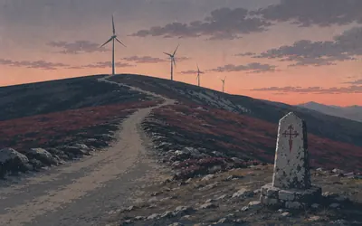
A bare saddle at the top of a long climb, wind turbines turning on the ridge above, and a sign.
- The pass carries the Asturias-Galicia border and the national gazetteer records it under its Galician name, Porta do Acebo.
- No heritage register on either side of the border holds anything at this pass.
- It stands almost exactly at kilometre 160 of the 340.7 km line, a little under halfway.
A Fonsagrada to Lugo
174–272 km · 13 places
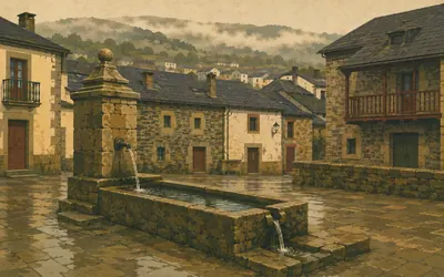
174 km (108 miles) · landmark
A Fonsagrada
Named after a miracle nobody agrees on
The first Galician town on the road, high up and cold, and it is named after water.
- The town's name means the sacred spring, and the Xunta's own oral-tradition archive records more than one incompatible account of whose miracle it was.
- One version brings the Virgin and her spring here from the older town of Burón; another credits Santiago passing through as a pilgrim.
- The Torre de Burón, a kilometre off the route, is the surviving trace of the town A Fonsagrada replaced.
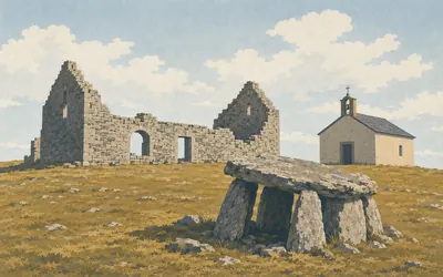
182 km (113 miles) · heritage
Hospital de Montouto
A dolmen, a ruin and a chapel on bare moor
There is nothing up here but grass, wind and three things standing close together, and they are four thousand years apart.
- Turismo de Galicia dates the Royal Hospital of Montouto's foundation to the fourteenth century, its rebuilding here to the late seventeenth, and its closure to the early twentieth.
- The chapel standing beside the ruins is described by the Xunta as a modern construction, not a medieval one.
- The Montouto dolmen next to them is part of a megalithic cemetery, and the site's protection is municipal rather than state-level.
185 km (115 miles) · heritage
Paradavella
A chapel, a parish, and no other detail
A scatter of slate houses along the ridge road with a chapel among them, protected on the Xunta's municipal catalogue. The catalogue gives its name, its parish and a coordinate, and stops. On this stretch of moorland that is the usual amount of information, and a good deal more than most places get.
202 km (125 miles) · heritage
O Cádavo
A field called the killing ground
Beside this village is a field that has long been called the Campo da Matanza. An old tradition holds that Alfonso II, the first pilgrim on this road, fought a Muslim army here early in the ninth century. No register records it, and the accounts do not agree on the year. The village keeps the story on its old town hall's shield.
211 km (131 miles) · heritage
Castroverde
One tower left, and a village cathedral
A single square tower on a mound above the village, all that is left of the castle the place is named for, declared a protected monument in 1994. A little way back the Camino passed Vilabade, whose fifteenth-century church has been a national monument since 1979 and which Turismo de Galicia says is so unexpectedly fine that it earned the nickname the cathedral of Castroverde.
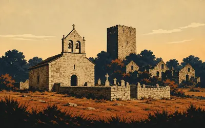
218 km (135 miles) · heritage
Soutomerille
A parish with a church, a graveyard and nobody
The Xunta's register protects four things at Soutomerille: the upper tower, the lower tower, the church of San Salvador and the cemetery.
- The Xunta's register carries the Torre de Arriba and the Torre de Abaixo at Soutomerille as two separate protected monuments, both declared in October 1994.
- The church of San Salvador and the village cemetery are protected separately again on the municipal catalogue.
- No authority publishes a population figure for the village, because there is not one to publish.
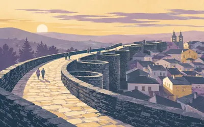
232 km (144 miles) · heritage
Muralla romana de Lugo
The only Roman circuit that still goes all the way round
You walk into Lugo through a hole in a Roman wall and then, if you have any sense, you go up on top of it and walk round the whole city.
- Spain's Ministerio de Cultura gives the circuit as 2,117 m enclosing 34.4 ha, with 71 of the original 85 towers surviving.
- The ministry calls it the only wall in the whole territory of the Roman empire that keeps its perimeter complete.
- It was inscribed as a World Heritage Site in 2000; the walls stand 8 to 10 m high and average 4.2 m thick.
232 km (144 miles) · heritage
Catedral de Santa María de Lugo
Romanesque under a baroque front
Inside the walls and up against them, a cathedral begun in the Romanesque and worked on for six hundred years, protected since 1931. The north doorway keeps its early carving under a later porch. What it is famous for, a papal privilege said to allow the Blessed Sacrament to be shown permanently, is not something any authority page would confirm in writing, so this card does not claim it.
246 km (153 miles) · heritage
Templo soterrado de Santa Olaia de Bóveda
A buried building nobody can name
Two kilometres off the road, under a later church, is a vaulted chamber with a pool in the floor and painted birds on the ceiling, protected since 1931. The Xunta's register calls it the buried temple of Santa Olaia and leaves it there. Roman bath, baptistery, something else: the arguments are a century old and the register has stayed out of them.
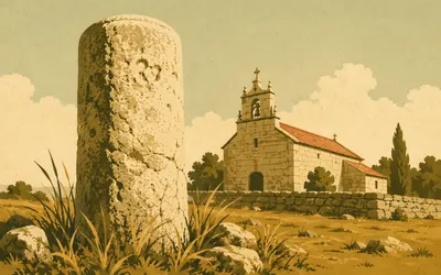
251 km (156 miles) · heritage
San Romao da Retorta
A Roman milestone in a churchyard wall
A granite cylinder standing by the church, about shoulder height, worn almost smooth.
- The stone is classed by Turismo de Galicia as a miliario, a Roman milestone, of archaeological interest on the Camino Primitivo.
- The authority's own entry carries no date, no inscription text and no measurements.
- It stands beside the parish church of San Romao, which the Xunta's municipal catalogue protects separately.
255 km (158 miles) · heritage
Casa da Torre, Vilamaior de Negral
A house named for a tower
The path runs within fifty metres of the door. A protected house called the Casa da Torre and, beside it, the parish church of San Lourenzo, both on the Xunta's municipal catalogue and both recorded with a name, a parish and a point. Whatever tower it was named after is not on the list.
264 km (164 miles) · heritage
Igrexa de Augas Santas
Holy waters, on the catalogue at least
A parish church dedicated to San Xurxo in a place called the holy waters, a hundred metres off the path. The Xunta's catalogue spells the parish in Castilian and the signposts spell it in Galician, which after a week in Galicia stops being confusing and starts being the normal state of affairs.
272 km (169 miles) · heritage
Igrexa de Santiago de Toques
Dedicated to the man at the far end
A small parish church dedicated to Santiago, standing where the path crosses the concello boundary into Toques. The Xunta's catalogue gives its name, its parish and a point, and no date at all. It is worth stopping at anyway, because it is dedicated to the man you are walking to see and there are only seventy kilometres left to do it in.
The Francés and the finish
281–341 km · 11 places
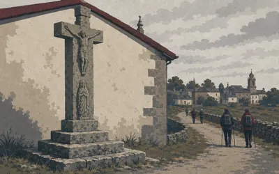
281 km (175 miles) · landmark
Cruceiro de Melide
Where the Oviedo road runs out
Melide is where it ends, in one sense.
- Melide is where the Camino Primitivo joins the Camino Francés; the Xunta calls the Primitivo the Camiño de Oviedo when it names the two.
- The town's tourism office describes the San Roque cruceiro as the one that for many is the oldest in Galicia, probably of the fourteenth century.
- Melide's museum has occupied the former pilgrims' hospital of Sancti Spiritus since 2001.
287 km (178 miles) · heritage
Santiago de Boente
A fountain, a church and a hill
A hamlet on a hill with a church of Santiago in it and a cross beside the road. Both are protected on the Xunta's municipal catalogue and neither is in the state register, which is the usual arrangement for the small churches along this last stretch. There is a fountain by the door. Everyone stops at it.
289 km (180 miles) · heritage
Santa María da Castañeda
Where the limestone was said to be burned
A parish church and a pazo, both on the Xunta's catalogue. Castañeda is remembered for something the register does not carry: the tradition that pilgrims coming from the east carried a lump of limestone from Triacastela to be burned in kilns here, for mortar for the cathedral. Nobody official will vouch for it. It is a good story about what a pilgrimage was for.
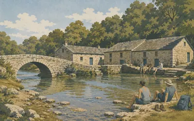
293 km (182 miles) · heritage
Ribadiso da Baixo
A pilgrim hospital, still taking pilgrims
The path drops off the hill, goes under trees and comes out at a stone bridge over the Iso with three low buildings on the far bank, right at the water.
- The former pilgrims' hospital at Ribadiso is in use as a pilgrim hostel today; the Xunta's record carries no date for it.
- The Xunta's municipal catalogue protects the bridge and the hospital buildings as separate items.
- Neither is carried in the state register of Bienes de Interés Cultural, which holds nothing at Ribadiso.
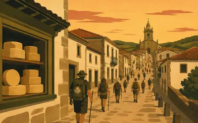
296 km (184 miles) · landmark
Arzúa
The last town, and it smells of cheese
One long street on a ridge, and by now there are pilgrims on it in numbers.
- Arzúa-Ulloa cheese has a protected designation of origin with its own regulating council, constituted in 1997, and the name was entered in the European register in 2010.
- The Xunta's municipal catalogue protects individual houses along Arzúa's main street as well as its churches.
- The Capela da Madalena at Arzúa belonged to an Augustinian community.
305 km (189 miles) · heritage
San Breixo de Ferreiros
Thirty metres off the path
The Camino passes within thirty metres of this church door, closer than it gets to anything else in Galicia. A parish church and its rectory, both on the Xunta's catalogue, in a hamlet whose name means the smiths. Eucalyptus on both sides of the track now, which is how you know you are close.
313 km (194 miles) · nature
Santa Irene
A chapel and an oak grove, both listed
The Xunta protects two things here and one of them is a wood. The chapel of Santa Irene is on the catalogue for its architecture and the carballeira, the stand of native oaks around it, is on it for its ethnographic interest, which is a Galician way of saying that a village oak grove is built heritage. After two days of eucalyptus plantation you will see the point.
328 km (204 miles) · landmark
Lavacolla
The stream you were supposed to wash in
A stream at the bottom of a dip, with the airport runway somewhere above it and Santiago twelve kilometres on. Pilgrims are said to have stopped here to wash before presenting themselves at the tomb, and the place name is generally taken to record it in blunter terms than that. No register mentions any of it. The Xunta protects some houses and a parish church.
333 km (207 miles) · viewpoint
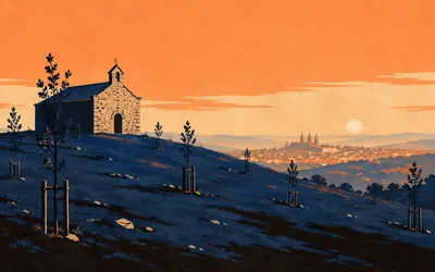
Monte do Gozo
The hill of joy, seven kilometres out
The last rise.
- Turismo de Galicia describes Monte do Gozo as a public space of more than 60 hectares with over 4,000 trees and 8,000 shrubs, laid out as an English-style park.
- The hill takes its name from the joy of pilgrims first sighting the cathedral towers from the top of it.
- The chapel of San Marcos on the summit is protected on the Xunta's municipal catalogue.
341 km (212 miles) · landmark
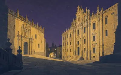
Praza da Inmaculada
You arrive at the back door, and that is correct
Three hundred and forty kilometres from Oviedo the street opens into a narrow sloping square with two enormous fronts facing each other across it, and the cathedral's is the smaller one.
- Turismo de Galicia names the four sides of the Praza da Inmaculada as San Martiño Pinario, the archbishop's palace, the arch down to the Obradoiro and the cathedral's Acibechería front.
- The eighteenth-century north front replaced a Romanesque doorway that stood at the centre of the medieval markets; it was begun by Ferro Caaveiro and Fernández Sarela and continued by Monteagudo.
- Acibechería is named for the workshops that worked acibeche, jet, which pilgrims bought here as badges.
Take on Camino Primitivo and collect these places as you reach them
Common questions
How do my hill walks count towards the Original Way?
Your tracker does the recording and Route Rally does the rest, moving you west from Oviedo as each walk, hike, run or ride lands. Distance is what it measures, not climbing, so a steep hill day counts the same as a flat one of the same length: at 30 km a week Santiago arrives in about eleven weeks.
Do I have to walk in the Asturian mountains?
No. The Primitivo is a distance to cover, so your local hills, or no hills at all, will get you to Santiago. The real route is the most mountainous of the Caminos and that reputation is half the reason people choose it, but the virtual version asks only for about 341 km, however level the ground under you.
How long is the virtual Camino Primitivo?
The Route Rally route covers about 341 km, or roughly 212 miles, Oviedo to Santiago de Compostela on the Original Way through the mountains.
Is the Camino Primitivo harder than the others?
In the real world it is the most mountainous Camino, with the most climbing. As a virtual challenge you are working towards the distance, but its identity as the tough, original route makes it a great goal for stronger walkers.
How long does it take to walk?
At 30 km a week it takes around eleven weeks, while 50 km a week brings Santiago inside seven weeks. The end date is yours to choose when the rally is created.
Start your Camino Primitivo Conquest
Joining is free. Connect Strava or Apple Health once and every ride, run or walk you record syncs automatically, moving you along the route without anything else to log.