Virtual Thames Path Challenge
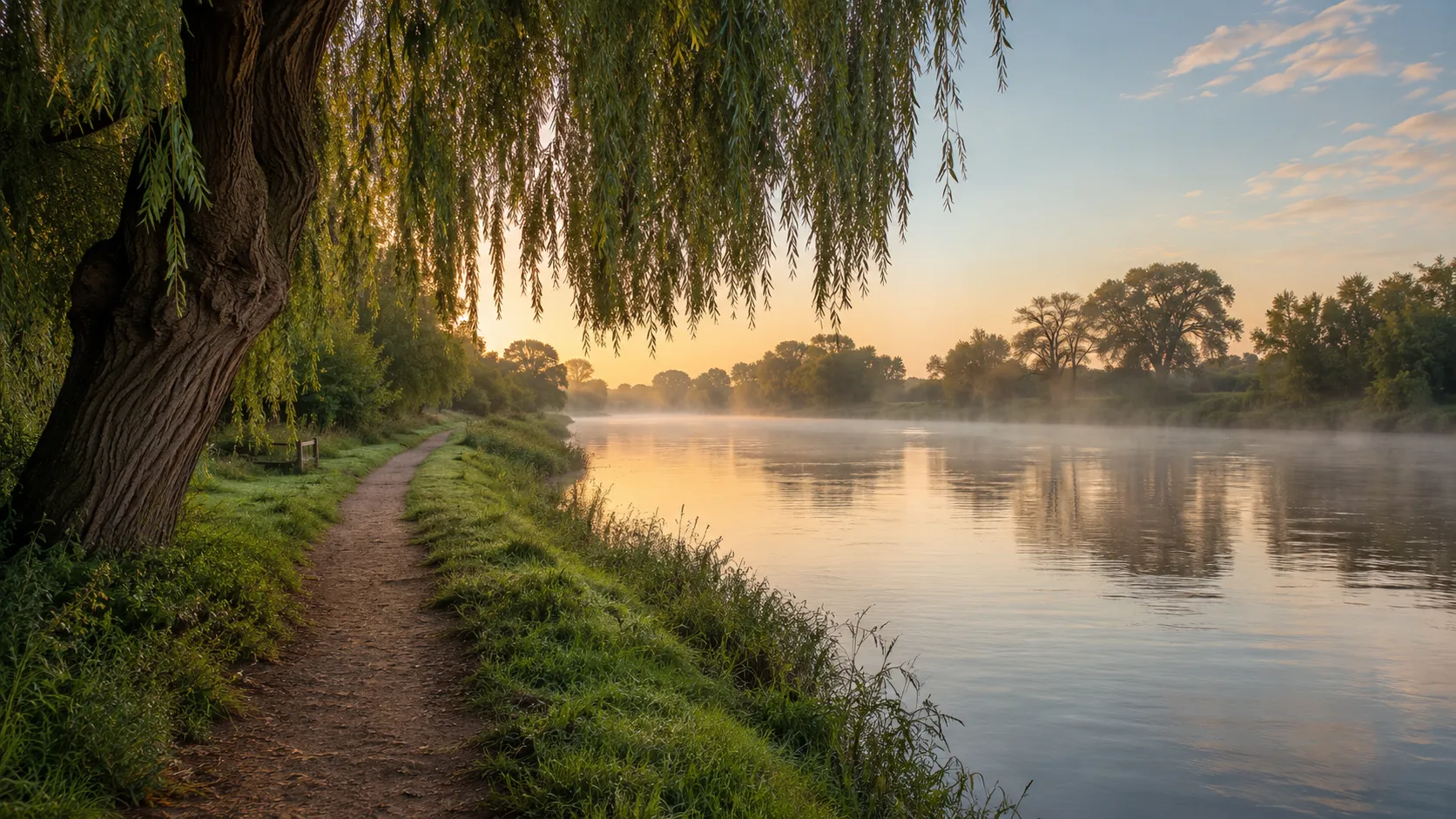
Follow England's most famous river from wherever you already walk or run. The Thames Path runs roughly 291 km (about 181 miles) from the river's source in the Cotswolds to the Thames Barrier on the eastern edge of London, passing through meadows, market towns, Windsor, Oxford and the centre of the capital. Route Rally turns every synced walk, run or ride into progress along this long and largely flat riverside trail.
Part of the National Trails series
- Route: Thames Path
- Distance: 291.2 km
- Elevation gain: 300 m
- Long riverside walking goal
- Best for: Longer rallies of your own for walkers and step-counters, and multi-month steady mileage goals
Planning your challenge
A walker averaging 30 km/week finishes in around ten weeks; a runner at 40 km/week takes about seven weeks, and a cyclist at 150 km/week completes it in under three weeks.
This is a Long route by Route Rally distance bands. The flat profile makes it ideal for walkers and step-counters who want a sustained goal rather than a quick sprint.
Particularly well suited to walkers and daily-movement goals, where consistent everyday steps build steadily towards a river finish in London.
Create your own rally for your own riverside target, solo or with a group sharing one leaderboard.
Why this route
- The Thames Path follows the River Thames about 291 km (181 miles) from the Cotswold source fields to the Thames Barrier in East London.
- As a virtual challenge you cover the distance in your own time, with daily walks, runs and rides from wherever you train all counting towards the London finish.
- The route is almost entirely flat, which makes it ideal for walkers and step-counters who want a sustained long-distance goal without significant climbing.
- Its length suits a multi-month target: a comfortable daily walking habit accumulates steadily towards one of England's most storied finishes.
- The route passes Oxford, Windsor Castle and central London, giving it a rich variety of named waypoints as your marker moves along the river.
Highlights
- Start at the Thames source near Kemble in the Cotswolds
- Follow the riverbank through Oxford, Windsor and the Thames Valley
- Pass through the heart of London along the South Bank and Embankment
- Finish at the Thames Barrier on the eastern edge of the city
Places along the route
Every place below is measured onto the route line, so the distance shown is where you actually reach it.
Places are researched from published sources. The distances are measured rather than estimated: we find the point on the route's own recorded line that lies nearest the place, and give the distance along the route to that point.
The Cotswold headwaters
0–63 km · 8 places
0 km (0 miles) · nature
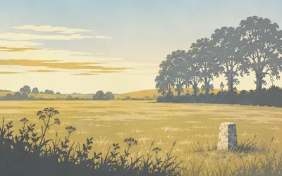
Thames Head
Mile zero, in a Cotswold field
A field.
- National Trails gives the Thames Path's start as the source of the Thames in the Cotswolds and the trail as 185 miles, 298 km.
- No national heritage or nature designation covers the source itself, and no authority publishes a coordinate for it.
- This rally's line measures 291.2 km, which is the geometry rather than the trail's own published length.
18 km (11 miles) · nature
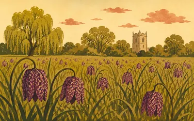
North Meadow, Cricklade
Half a million fritillaries, one hay meadow
For two weeks in April this field turns purple.
- Natural England calls North Meadow the largest British population of the snake's-head fritillary, with around 500,000 plants flowering each year.
- The citation estimates the meadow holds about 80% of the British population of wild fritillary.
- It is lammas land: grazed in common between 12 August and 12 February, and cut for hay no earlier than 1 July.
20 km (12 miles) · heritage
Cricklade Town Banks
A Saxon town wall nobody has written up
Cricklade is a Saxon burh and the bank that defended it is still there, scheduled twice over. Historic England calls records of this kind some of its oldest, and both of these are completely blank, so the only official description of the defences turns up sideways, in the listing for St Mary's church, which records that its north chapel stands on Anglo-Saxon work belonging to the town wall.
36 km (22 miles) · heritage
St John the Baptist, Inglesham
The church nobody scraped
Historic England lists this tiny church at Grade I and says why: it matters because of its unrestored interior. Box pews, wall paintings layered over each other, a late Saxon carving of the Madonna and child. When repairs came in 1888 they were done for the Society for the Protection of Ancient Buildings, with William Morris involved in the work, which in Victorian terms meant leaving almost everything alone.
43 km (27 miles) · heritage
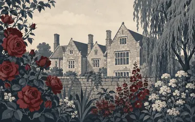
Kelmscott Manor
The house at the end of the river
A grey limestone farmhouse behind a wall, with mullioned windows and a garden that runs down towards the water.
- Historic England lists Kelmscott Manor at Grade I and registers its garden separately at Grade II.
- William Morris took the Manor on a joint lease in May 1871 and it remained his favourite family retreat until his death in 1896.
- The house passed to the Society of Antiquaries of London, which is its custodian today.
47 km (29 miles) · engineering
Radcot Bridge
Three pointed arches and a battle
Three stone arches, the outer two sharply pointed and ribbed underneath, standing on a stretch the river no longer uses. Historic England dates it to the fourteenth century, records a grant of pontage in 1312, and notes that the bridge was damaged in 1387 at the Battle of Radcot. Everyone will tell you it is the oldest bridge on the Thames. The register does not.
57 km (35 miles) · nature
Chimney Meadows
Curlew, snipe and redshank
Six unimproved hay meadows inside a bend of the river, and the birds are the point. Natural England records curlew, snipe and redshank nesting here and says all three are now uncommon breeders in Oxfordshire, because the drainage and improvement that took the rest of the Thames valley never reached these fields.
63 km (39 miles) · engineering
New Bridge
Six arches, two grades, one bridge
Historic England calls this the most complete medieval bridge in Oxfordshire: six pointed arches with cutwaters that step up into refuges where a walker could stand clear of a cart. The parish boundary runs down the centre of it, so one half is listed Grade I and the other Grade II*. Waller's men tried to force it in the Civil War and did not.
Oxford and the Vale
83–144 km · 8 places
83 km (51 miles) · nature
Port Meadow
Horses, floodwater and Oxford behind
A wide flat common with horses and cattle loose on it and the spires beyond. Under the grass, Historic England records ring ditches and barrows running from the Bronze Age into the Iron Age, first spotted from the air in 1933. At the north end stand the walls of Godstow, a nunnery the scheduling says was founded by Ediva, or Edith, probably in 1133.
88 km (54 miles) · landmark
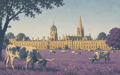
Christ Church Meadow
Cattle grazing under a cathedral
The path comes into Oxford along the water and the city arrives all at once: a wide flat meadow with longhorn cattle on it, and behind them the whole south front of Christ Church with the cathedral spire above.
- Historic England calls Tom Quad the largest quad in Oxford.
- Wolsey's builders destroyed the cathedral's west end in 1524-29 to make room for his college.
- Christ Church states that its college chapel being also a cathedral is unique.
90 km (56 miles) · heritage
St Mary the Virgin, Iffley
Norman carving above the lock
Built between 1175 and 1182 and barely altered since, with a west front of zigzag and beakhead that Historic England describes simply as notable Romanesque detail. In the churchyard stands a yew the listing calls one of the largest and oldest in England. Downstream of the lock, Iffley Meadows hold what Natural England records as the largest remaining fritillary population in the middle Thames.
101 km (63 miles) · heritage
Abingdon Abbey
A wine cellar, a chimney and a gate
The abbey church has vanished and its scheduling is blank, so what is left to look at is the working end of the place: the Checker, a thirteenth-century block whose undercroft Historic England calls the abbot's wine cellar, with a chimney the listing describes as having a rare top, three stepped lancets in a gable. Beside the river, almshouses built by the Fraternity of the Holy Cross in 1446.

115 km (71 miles) · viewpoint
Wittenham Clumps
Two hills with hats on
Two round chalk hills above the river with a crown of beeches on each, visible for twenty miles and unmistakable from every direction.
- Both scheduled monuments here, Sinodun Hill camp and the Dike Hills, are legacy records with no published description at all.
- Natural England calls Little Wittenham one of the largest known breeding populations of great crested newt in the UK.
- The Earth Trust records the Poem Tree, carved by the local poet Joseph Tubb in 1844; the tree died in the 1990s and collapsed in 2012.
123 km (76 miles) · heritage
Wallingford Castle
Sixteen weeks, then demolished
Begun in 1067 on the Conqueror's orders and finished as a motte and bailey by 1071. The Black Prince spent heavily on it; the Royalists held it through a sixteen-week siege in 1646; and on 17 November 1652 Cromwell's Council of State ordered it pulled down. What survives is grass mounds and one wall stub that Historic England says is traditionally thought to be part of the Queen's Tower.
137 km (85 miles) · nature
Hartslock
The orchid the citation will not name
A steep chalk bank above the Goring gap with ancient yew wood behind it, which Natural England calls one of the few examples in the Chilterns. Something rarer grows in the turf, and the citation refuses to say what: it records only a plant species listed in Schedule 8 of the Act. Protecting a thing by not naming it is a real tactic. This is what it looks like.
144 km (90 miles) · heritage
Mapledurham House
Elizabethan brick and a mill wheel
A tall red-brick house begun about 1585 by Sir Michael Blount and finished by his son in 1612, with a plaster ceiling of Roman heads inside and a Catholic chapel added in the 1780s. Beside it, a listed watermill on the bank. In the church next door an aisle was added around 1381 to commemorate the Bardolfs, who built it.
Reading to the Chilterns
152–202 km · 9 places
152 km (94 miles) · heritage
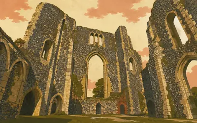
Reading Abbey
Where a king is buried, nobody knows quite where
Henry I founded this abbey in 1121, intended it as England's principal Cluniac house, and was buried in it near the high altar in January 1136.
- Historic England records Reading Abbey as one of the ten richest abbeys in the country by the mid-fourteenth century.
- The last abbot, Hugh Farrington, was hanged at the Abbey Gate at the dissolution in 1539.
- Reading Museum says Sumer is icumen in is believed to have been created at the abbey and was first written down there about 1240.
166 km (103 miles) · engineering
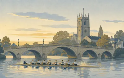
Henley Bridge
Five arches and a mile and a bit of straight water
Five stone arches of 1786, designed by William Hayward, who died four years before the first stone was laid, with river-god keystones carved by Anne Damer.
- Henley Royal Regatta records its first regatta in 1839, held annually since apart from the two World Wars and the COVID-19 pandemic.
- The bridge's architect, William Hayward, died in 1782, four years before work started.
- Historic England records the intact easternmost span of the twelfth-century bridge surviving beneath the present one.
176 km (109 miles) · heritage
Hurley Priory
A moat, fishponds and a cellar
A Benedictine priory founded by Geoffrey de Mandeville in memory of his first wife, Athelais, with its moat and fishponds still legible in the grass. After the dissolution John Lovelace built a mansion on it around 1550; that was pulled down in 1837 and Historic England says only a brick crypt remains. The priory church is still the parish church.

179 km (112 miles) · engineering
Marlow Bridge
A suspension bridge with a twin abroad
A white suspension bridge on stone towers, hung across the river between a church spire and a weir, and it is the most elegant thing on this stretch by a distance.
- William Tierney Clark built the bridge between 1831 and 1836; Historic England records him as a pupil of Telford and an assistant to Rennie.
- The bridge carries two separate Grade I listings, one for each parish, and the two entries contradict each other about Clark's other bridges.
- Bisham Abbey upstream was a Knights Templar preceptory from the reign of Stephen until the order's dissolution in 1307.
184 km (114 miles) · nature
Cock Marsh
Four barrows above a wet common
Boggy grazing at river level, a steep chalk slope behind, and four Bronze Age bowl barrows on top of it. Excavators in the 1870s found a later Saxon burial inserted into one of them. Natural England values the whole slope for the transition it shows, wet alluvial grass to chalk to clay in a few hundred metres, and records one protected plant it declines to name.
188 km (117 miles) · landmark
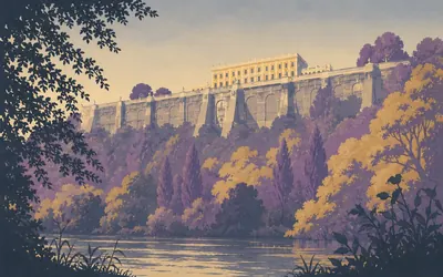
Cliveden
An Italian terrace over a hanging wood
The river runs under a wooded cliff for a couple of miles and then, high above it, a long Italianate front appears on top of an enormous stone terrace.
- Historic England dates the Borghese balustrade to 1618 and records Viscount Astor installing it at Cliveden in 1896.
- William Winde built the first house here about 1674-7; Charles Barry built the present one about 1850-1 on the same footprint.
- The Blenheim Pavilion in the grounds is by Giacomo Leoni, about 1735, and is listed Grade I in its own right.
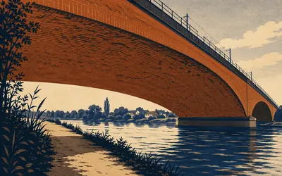
192 km (119 miles) · engineering
Maidenhead Railway Bridge
Two arches that were not supposed to stand
Two brick arches so wide and so shallow that the curve looks wrong, carrying the Great Western main line over the river.
- Historic England's listing says the two principal spans are believed still to be the longest and flattest brick arches ever built.
- The bridge is listed Grade I and still carries the Great Western main line.
- No authority publishes the echo the Sounding Arch is famous for, so this card does not claim it.
199 km (123 miles) · heritage
St Mary Magdalene, Boveney
A twelfth-century chapel in a field
A small twelfth-century chapel of chalk and flint rubble with a weatherboarded bell turret, standing in a field beside the towpath with no village left around it and no road to it. The Friends of Friendless Churches took it on in 1983 on a 999-year lease at a peppercorn rent, which is roughly how long it looks like lasting.
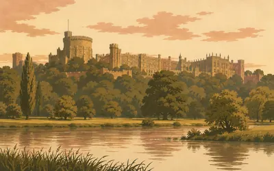
202 km (126 miles) · landmark
Windsor Castle
England's largest castle, on a chalk bluff
It appears from the water a long way off and then simply keeps getting bigger.
- Historic England's listing calls Windsor England's largest castle and a royal palace covering some 13 acres.
- The earliest masonry was commissioned by Henry II between 1165 and 1179; St George's Chapel dates from 1475 to 1511.
- Eton College's foundation charter is dated 11 October 1440 and provided for 25 poor scholars and 25 almsmen.
The Surrey reaches
212–268 km · 11 places
212 km (131 miles) · nature
Runnymede
The meadow named in the charter
Magna Carta ends by saying where it was given: in the meadow that is called Runnymede, between Windsor and Staines, on 15 June. That is as precise as the record ever gets, and Historic England's own wording for the association is traditionally. What is certain is the ground itself. Natural England calls Langham Pond and its meadows a habitat of a type and quality unknown elsewhere in southern England.
220 km (137 miles) · heritage
Chertsey Abbey
Founded 666, sacked 871, gone by 1537
Nothing stands. What survives is the shape of the place in the ground: an inner precinct Historic England measures at 245 metres by 290, moats up to five metres wide, fishponds, ridge and furrow. Erkenwald founded it in AD 666, Vikings burned it in 871, and it was dissolved in 1537. Downstream, James Paine's bridge of 1783, which the schedule calls the least altered of his Thames bridges.
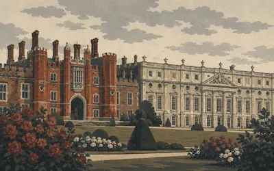
236 km (146 miles) · landmark
Hampton Court Palace
Two palaces bolted together
Wolsey started building here in 1514 and lost it to Henry VIII in 1528, which is the short version of a long lesson about ambition.
- Historic England records the palace's sash windows as among the earliest known.
- Giovanni da Majano's terracotta medallions are described as among the earliest manifestations of the Italian Renaissance in England.
- Hampton Court Park was opened to the public in 1893.
240 km (149 miles) · heritage
The Coronation Stone, Kingston
Two kings certainly, seven by legend
A block of sarsen inside Victorian railings, on a seven-sided plinth built in 1850 to allude to seven Saxon kings. Historic England's own listing takes that apart carefully: two coronations here are certain, Athelstan in 925 and Aethelred in 979, there is some evidence for Eadred in 946, the seven-kings story probably dates from the late eighteenth century, and whether this is even the stone is disputed.
245 km (152 miles) · heritage
Ham House
A Stuart interior nobody modernised
A dark red Jacobean block a field back from the towpath, with 1610 carved on the door and almost nothing changed inside since the Duchess of Lauderdale finished remodelling it in the 1670s. Historic England's listing calls the interior very fine, sumptuous and unspoilt. The garden was put back in 1975 to a seventeenth-century design, hedged compartments and gravel.
247 km (154 miles) · engineering
Richmond Bridge
The oldest one inside London
Five Portland stone arches of 1777 by James Paine and Kenton Couse, stepping up to a taller centre span. Historic England calls it the oldest bridge over the Thames within the boundaries of Greater London, which is a careful sentence: several older ones stand upstream of the boundary. It was widened in 1937 by taking the stonework down and rebuilding it further out.
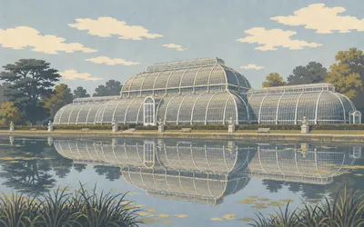
250 km (155 miles) · landmark
Royal Botanic Gardens, Kew
A glasshouse built like a ship
Inscribed as a World Heritage Site in 2003, and the citation is about landscape rather than plants: Bridgeman, Kent, Capability Brown and Chambers all worked here, and their designs, in Historic England's words, reflect the beginning of movements which were to have international influence.
- Kew was inscribed as a World Heritage Site in 2003; the core site covers 132 hectares and holds 44 listed buildings.
- Historic England calls the Palm House one of the boldest pieces of nineteenth-century functionalism in existence.
- Natural England records Syon Park across the river as the only known area of tall grass washland along the Thames in Greater London.
252 km (156 miles) · engineering
Kew Bridge Pumping Station
Cornish beam engines in west London
A tall Italianate standpipe tower and, behind it, engine houses of 1838, 1846 and 1869 built to lift London's water. Historic England lists all three at Grade I and names the machines inside: Boulton and Watt, Harvey of Hayle, Sandy Carne and Vivian of the Copperhouse Foundry. The museum here calls itself home to the world's largest collection of stationary steam engines, and still steams them.
257 km (159 miles) · landmark
Chiswick House
A villa scheduled as a monument
Unusually, the house is not only listed at Grade I but scheduled as an ancient monument, and the garden is registered at Grade I as well. So are the entrance piers, the flanking statues and the ten terms with female heads standing in a semicircle in front of it. It is a small Palladian villa surrounded by protected furniture, which is a good description of the taste that built it.
259 km (161 miles) · nature
Barn Elms Wetland
Four Victorian reservoirs, rewetted
Bitterns and lapwings four miles from Hyde Park Corner, on ground that was four disused Victorian reservoirs and was earmarked for houses. WWT describes it plainly as an entirely human-made wetland, saved in the 1990s at Peter Scott's instigation and turned into open water and reedbed. It was notified as a Site of Special Scientific Interest within a few years of opening.
268 km (167 miles) · landmark
Battersea Park
A war memorial and a bronze form
Laid out by James Pennethorne from 1845 and opened in 1854. Near the river stands Eric Kennington's memorial to the 24th Division, unveiled in 1924 for the men killed or listed as missing presumed dead, over ten thousand of them by Historic England's own count. By the boating lake is Barbara Hepworth's Single Form, made for Dag Hammarskjöld after his death in a plane crash in 1961.
Central London and the estuary
272–291 km · 8 places
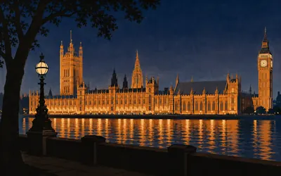
272 km (169 miles) · landmark
Westminster
One fire, and everything that survived it
The palace, the abbey and St Margaret's are inscribed together as one World Heritage Site, and the thread running through all three is what fire did and did not take.
- Westminster Hall was begun in 1097-99 and reroofed between 1394 and 1401 by Henry Yevele and Hugh Herland.
- English Heritage records that the Jewel Tower survived the 1834 fire because it stood slightly apart from the main palace.
- Westminster Abbey calls itself Britain's coronation church since 1066, and names Edward V and Edward VIII as the two kings never crowned.
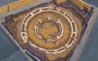
275 km (171 miles) · heritage
The Bankside Playhouses
Three theatres and a bear pit, all underground
This was the entertainment district, on the wrong bank, outside the City's reach.
- Historic England records the Globe as the third playhouse on Bankside, after the Rose of 1587 and the Swan of 1596.
- The Rose survives as a pair of concentric wall footings 3.5 metres apart, enclosing a polygon some 25 metres across.
- The Hope is described by its scheduling as the only known dual purpose bear baiting arena and playhouse.
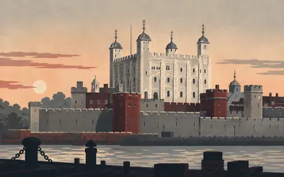
276 km (172 miles) · landmark
The Tower of London
A keep in Caen stone, put where it could be seen
The White Tower went up between about 1078 and 1100, Historic England says probably to designs by Gundulf, Bishop of Rochester, and it was built out of rag-stone rubble faced with limestone shipped from Caen in Normandy, which is the whole point: a Norman keep in Norman stone, planted at the edge of an English city that had just been taken.
- The White Tower was built about 1078-1100, Historic England says probably to designs by Gundulf, Bishop of Rochester.
- Its dressings are Caen stone from Normandy, later replaced in places with Portland stone.
- The scheduling calls the Royal Menagerie kept here the first zoo in England.
278 km (173 miles) · engineering
Brunel's Thames Tunnel
Eighteen years, and six men in one night
Marc Brunel's tunnelling shield went into the ground at Rotherhithe in 1825 and came out at Wapping in 1843. Historic England calls it the world's first bored tunnel crossing of a river. It flooded repeatedly. In the 1828 flood six men died and the museum names them: Ball, Long, Collins, Cook, Evans and Lincoln. The young Isambard was pulled out alive with severe internal injuries. Trains use it now.
285 km (177 miles) · engineering
Cutty Sark
Sydney to London in seventy-three days
Launched at Dumbarton in 1869 and built, as Royal Museums Greenwich puts it, exclusively for the China tea trade, which the Suez Canal killed within a decade. She made eight tea voyages and then went to the Australian wool run, where she was very fast indeed: seventy-three days Sydney to London under Richard Woodget in 1886. Fire went through all three decks in 2007. She reopened in 2012.
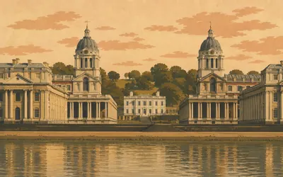
285 km (177 miles) · landmark
Maritime Greenwich
The one place they left the view alone
Two white colonnaded blocks with a gap straight down the middle, and in that gap, small and perfect, a low white house.
- Royal Museums Greenwich calls the Queen's House the first building in England created in the Palladian style; Inigo Jones began it in 1616 and it was finished in 1635.
- The Old Royal Naval College records the Painted Hall as designed by Sir James Thornhill and painted between 1707 and 1726, covering more than 3,700 square metres.
- Maritime Greenwich was inscribed as a World Heritage Site in 1997.
286 km (178 miles) · engineering
Enderby's Wharf
Where the transatlantic cable went aboard
A steel gantry on four tapered legs and a cable hauler on welded girders, both scheduled in 2025, on a bend of the river that used to make the world's telephone cables. Historic England records that most of TAT-1, the first transatlantic telephone cable, was made and loaded over this wharf in 1955 and 1956. The last to leave was the Australia to Papua New Guinea system, in 1975.
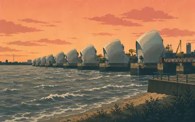
291 km (181 miles) · engineering
The Thames Barrier
Journey's end, 520 metres of steel
Ten silver shells in a line across the river, and the walk stops.
- The Environment Agency records the barrier as operational since 1982, with 10 steel gates spanning 520 metres.
- Each main gate weighs 3,300 tonnes and stands as high as a five-storey building when raised.
- The Agency recorded 221 flood-defence closures between 1982 and 17 November 2025.
Take on Thames Path and collect these places as you reach them
Common questions
How do my steps count towards the Thames Barrier?
Once your Strava or Apple Health feed is linked, everything on it edges you downstream from the Cotswold source. Daily steps are what make a flat riverside route work as a habit goal: at 30 km a week you pass Oxford and Windsor and reach the Barrier in about ten weeks.
Do I have to walk beside the Thames?
No. What the path really asks for is its length, wherever you happen to find it, so a lunchtime loop or a treadmill session moves you along the river just as a towpath walk does. The Thames supplies the line and the named places; your everyday walking supplies the 291 km.
Is this a good route for walkers?
Yes, it is one of the best on Route Rally for walkers. The path is largely flat and the long distance suits a steady daily-steps habit, where weeks of consistent movement build towards the capital.
How long does the Thames Path take to walk?
At 30 km a week you finish in around ten weeks. Lift that to 50 km a week and the Barrier arrives in about six. Set your own end date at creation and the weekly pace follows from it.
Start your Thames Path Conquest
Connect Strava or Apple Health once and every ride, run or walk you record syncs automatically, moving you along the route without anything else to log.