Conquer the Virtual Camino Inglés Challenge: Walk the English Way from Home
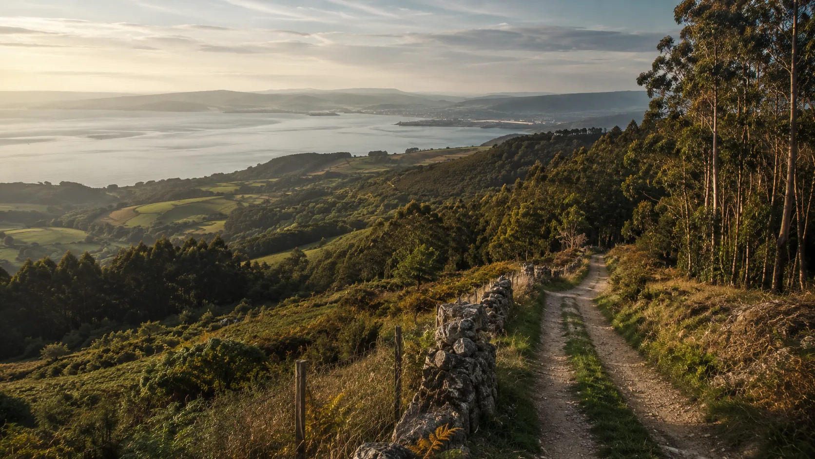
Walk the shortest of the classic Camino de Santiago routes from wherever you already move. The Camino Inglés, or English Way, runs about 120 km (roughly 75 miles) from the port of Ferrol inland through the Galician hills to Santiago de Compostela, and Route Rally turns every synced walk, run or daily step into progress along it. Short enough to finish in a few weeks, it is the ideal first Camino and a natural entry point to the wider pilgrimage.
Part of the Camino de Santiago series
- Route: Camino Inglés
- Distance: 120 km
- Elevation gain: 2000 m
- Short, approachable pilgrimage and steps goal
- Best for: First Camino challenges, walkers and step-counters, and shorter rallies of your own
Planning your challenge
A walker averaging 30 km/week finishes in about four weeks; a daily-steps habit completes it in a month or two.
This is a Short route by Route Rally distance bands, so it makes an ideal first finish before stepping up to a longer Camino.
Useful as an activation route for the walking and steps audience and as the gateway to the Camino series.
Create your own rally for a first personal pilgrimage, solo or with a group to walk it together.
Why this route
- The Camino Inglés, or English Way, is the short Camino historically walked by pilgrims who arrived in Galicia by sea from Britain and northern Europe.
- At about 120 km (75 miles) from Ferrol it is the most approachable of the Caminos, finishable in a few weeks of regular walking.
- As a virtual challenge you cover the distance in your own time, so daily steps, dog walks and weekend hikes all count towards Santiago.
- It is the natural first step into the Camino de Santiago series before taking on the longer French, Portuguese or Northern ways.
- The manageable distance makes it a great activation route and a popular charity or workplace step challenge.
Highlights
- Start at the historic naval port of Ferrol on the Galician coast
- Climb inland through the green hills and rías of Galicia
- Join the flow of pilgrims approaching the city from the north
- Finish at the cathedral of Santiago de Compostela
Places along the route
Every place below is measured onto the route line, so the distance shown is where you actually reach it.
Places are researched from published sources. The distances are measured rather than estimated: we find the point on the route's own recorded line that lies nearest the place, and give the distance along the route to that point.
The Ría de Ferrol
0–28 km · 6 places
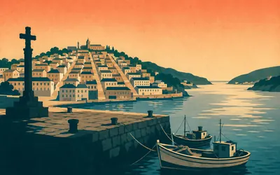
0 km (0 miles) · landmark
Curuxeiras, Ferrol
Where the pilgrims came ashore
The Camino Inglés starts on a quay, and that is the whole point of it.
- Medieval pilgrims from England and Ireland sailed to Galician ports and walked inland from there.
- English pilgrimage by sea ended after Henry VIII's break with Rome.
- Ferrol's Barrio da Magdalena is an eighteenth-century planned quarter built for the naval arsenal.
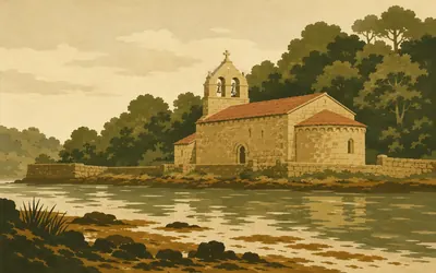
8 km (5 miles) · heritage
San Martiño de Xubia
A Cluniac house on a tidal river
At the head of the ría, where the Xubia runs into salt water, stands a granite church that Turismo de Galicia calls a fine example of Galician Romanesque.
- Turismo de Galicia describes San Martiño de Xubia as a Cluniac monastery complex.
- It was founded by the Counts of Traba and became a parish church after the 1836 dissolution.
- The Xunta's own pages spell the place Xubia, not the widely used Xuvia.
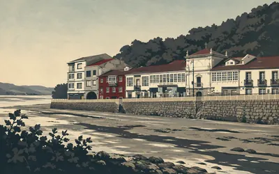
16 km (10 miles) · heritage
Sancti Spiritus, Neda
A hospital for people who had already crossed a sea
Neda sits at the head of the ría, where the tide goes out and leaves a great deal of mud.
- The Xunta's stage description names Neda's Sancti Spiritus pilgrims' hospital, standing since the fifteenth century.
- Pilgrims on this route arrived by sea, so its hospitals received people off ships rather than off the road.
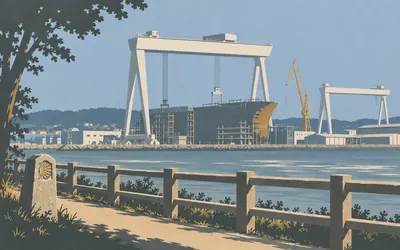
22 km (14 miles) · engineering
Fene
The Camino passes a shipyard town
For a stretch the pilgrim route runs through a shipyard town.
- The Xunta's own stage description names Fene's shipyard as a landmark on the Camino Inglés.
- The route passes Fene's town hall and climbs through woodland at Mundín.
24 km (15 miles) · engineering
Vilar do Colo
An industrial estate on the pilgrim road
The Xunta's own stage description sends the Camino Inglés round the edge of Vilar do Colo, which is a business park. Warehouses, roundabouts, lorries and a scallop-shell waymark on a lamp post. A road that has been walked for eight hundred years does not get to choose what gets built along it.
28 km (18 miles) · nature
Cabanas
Sand, pines and the bridge across
Cabanas faces Pontedeume across the mouth of the Eume, with a long beach and a pinewood behind it. The two towns are joined by the bridge that gives the other one its name. You walk the sand, then the bridge, and then you climb.
Pontedeume to Betanzos
30–51 km · 5 places
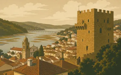
30 km (19 miles) · heritage
Pontedeume
The tower the bridge was named for
Pontedeume means the bridge over the Eume, and there has been one here since the fourteenth century, when Fernán Pérez de Andrade was granted the town and set about improving it.
- The Torre dos Andrade is what survives of Fernán Pérez de Andrade's fourteenth-century palace.
- The Andrade family emblem was a wild boar and a bear.
- The River Eume reaches the town out of the Fragas do Eume, a Xunta-protected natural park.
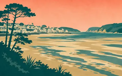
39 km (24 miles) · nature
Miño
Sand, then the hills
Miño is where the Camino Inglés meets open water again and, for a good many people walking it, where the first blister arrives.
- Miño stands on a shallow sand bay at the head of the Ría de Betanzos.
- The Xunta's stage leaves the town by the Rúa Real and the railway station.
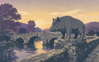
43 km (27 miles) · heritage
Ponte do Porco
The boar is not the old one
A low stone bridge crosses the Lambre close to where it reaches the Ría de Betanzos, and a stone boar stands by the old main-road bridge next to it.
- The bridge over the Lambre was built in the fourteenth century on the order of Fernán Pérez de Andrade.
- The stone boar beside it is a 1962 sculpture by Alfonso Sanmartín, not a medieval carving.
- It was moved to its present position in 1981.
49 km (30 miles) · heritage
San Martiño de Tiobre
Betanzos before Betanzos
A parish church on the hill above the Mandeo, named on the Xunta's own stage description, and by local account the site of the older Betanzos before the town moved down to the river. Whatever the truth of that, it is the last high ground before you drop into the valley.
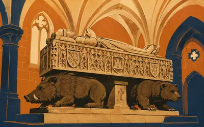
51 km (31 miles) · heritage
San Francisco de Betanzos
A knight asleep on a boar and a bear
Betanzos was the capital of one of the seven provinces of the old kingdom of Galicia and its centre is a protected historic ensemble of narrow granite streets with three Gothic churches within a few hundred metres of each other.
- Fernán Pérez de Andrade founded San Francisco and is buried in it.
- His tomb rests on carved figures of a wild boar and a bear, his family's emblems.
- Betanzos's old town is a protected historic ensemble.
The Galician interior
56–98 km · 11 places
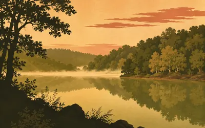
56 km (35 miles) · nature
Encoro de Cecebre
A protected wood the route never reaches
Nearly four kilometres west of the route, in a fold of the hills, the rivers Mero and Barcés are dammed into a long green reservoir.
- The Abegondo-Cecebre reservoir and its woods are a Natura 2000 site, ES1110004.
- The site covers about 530 hectares across four Galician councils.
- It has been a Zona de Especial Conservación since 2014.
62 km (39 miles) · heritage
Presedo
Halfway to nowhere in particular
Presedo is a scatter of houses, a church and a walled churchyard in the middle of Abegondo, and it is the sort of place this route is mostly made of. There is a fountain. There is usually a dog. On a wet day it is a welcome place to shelter.
65 km (40 miles) · heritage
Santa Baia de Leiro
A church, and a long way still to go
The parish church of Santa Baia de Leiro stands at the roadside in Abegondo, and Turismo de Galicia lists it among the things worth stopping for along here. From this point the route climbs steadily for ten kilometres with almost nothing on it, which is the hardest stretch of the whole Camino Inglés to enjoy.
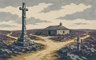
75 km (47 miles) · heritage
Hospital de Bruma
Where the two English Ways meet
Bruma is a few buildings on an upland crossroads and it is the most important place on this route that nobody has heard of.
- The Xunta publishes two Camino Inglés stages that both end at Hospital de Bruma, one from Ferrol and one from A Coruña.
- The place is named for a pilgrims' hospital that Mesía's council documents by a donation of 1175.
77 km (48 miles) · viewpoint
Cabeza de Lobo
Wolf's head, on the ridge
A hamlet on the ridge past Bruma whose name means the wolf's head, and which the Xunta names among the first hamlets past Bruma. There are no wolves. There is a great deal of sky, and a wind off the Atlantic that has met nothing on the way in.
80 km (50 miles) · nature
A Carballeira
The oak grove
A carballeira is an oak grove, and in Galicia it is also a place: the common ground where a parish holds its festa, under trees, usually beside a church. The Xunta names a place called A Carballeira here, on a stretch it says runs through native woodland.
85 km (53 miles) · heritage
San Paio de Buscás
The church at A Rúa
The Xunta's stage description puts it plainly: A Rúa, the site of the church of San Paio de Buscás. A granite parish church with a bell wall and a walled yard, of the kind this route passes every few kilometres, and the only building of any age for some way in either direction.
87 km (54 miles) · landmark
Ordes
The town the route goes round
The Camino does not go into Ordes. The line passes a couple of kilometres to the west and the Xunta's stage description names the outskirts rather than the centre, so the town stays a rumour off to your right for an hour. If you need a chemist, a bank or a bed, this is the turning. If you do not, you will never see it at all.
92 km (57 miles) · heritage
San Xiao de Poulo
A church up on the shoulder
The Xunta's stage description names the church of San Xiao de Poulo at Outeiro de Arriba, up on the shoulder of the hill. From here the route begins the long slow drop towards the Tambre, and for the first time since Betanzos it is going down more than it is going up.
96 km (60 miles) · heritage
Casanova
Granaries on stone legs
Casanova is one of a run of hamlets the Xunta names on this stage, each of them a handful of houses, a dog, and a hórreo standing on stone legs. Under Galician heritage law a hórreo built before 1901 is a protected cultural asset in its own right, with a twenty-metre buffer around it. You will pass dozens.
98 km (61 miles) · engineering
Ponte Pereira
The last bridge before the last town
A small bridge the Xunta names near the end of this stage, a couple of kilometres short of Sigüeiro. After a whole day of ridge and plantation the ground finally starts falling towards a river, and the sound of water is a genuine relief.
The Tambre and Santiago
100–120 km · 6 places
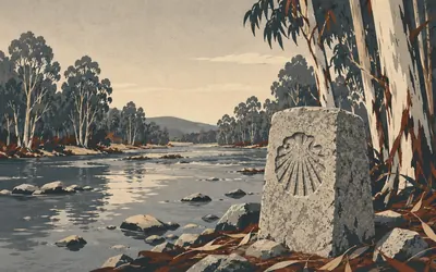
100 km (62 miles) · landmark
Sigüeiro
One river, then the city
The Tambre is the last real river before Santiago and Sigüeiro sits on it: a working Galician town with a bridge, a bar on every corner and no particular interest in pilgrims beyond feeding them.
- The Xunta's stage description marks the Sigüeiro bridge over the Tambre as the boundary of Santiago de Compostela.
- The route passes about a kilometre east of the town centre.
104 km (64 miles) · landmark
A Barciela
You are in Santiago now
The Xunta's own stage text marks the moment: cross the Sigüeiro bridge over the Tambre and you enter the municipality of Santiago de Compostela, at A Barciela. There are still sixteen kilometres to the cathedral and almost every one of them is suburb, but administratively you have arrived.
106 km (66 miles) · nature
Marantes
The city getting closer
The parish of Marantes, named on the Xunta's last stage, where the countryside starts to lose the argument. Fields, then a business unit, then fields, then a slip road. Santiago does not announce itself. It gradually stops being anywhere else.
115 km (71 miles) · engineering
Polígono do Tambre
The least holy stretch of any Camino
The Xunta's own stage description routes the Camino Inglés through the Polígono do Tambre, Santiago's industrial estate. Roundabouts, tyre depots and a scallop shell on a bollard. Every road into this city has a stretch like this and pretending otherwise helps nobody. Keep going. It ends.
118 km (73 miles) · viewpoint
Meixonfrío
The last inn
Meixonfrío is a neighbourhood on the Xunta's final stage, between the Tambre estate and As Cancelas, where an inn once refreshed pilgrims and travellers. The cathedral is two kilometres away, downhill, and it takes longer than you think.
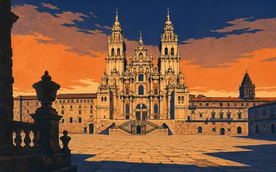
120 km (75 miles) · landmark
Catedral de Santiago
The end of every Camino
You come in through the old town, down a street of arcades, and out into the Praza do Obradoiro, and the cathedral fills the whole far side of it.
- The Obradoiro façade was designed by Fernando de Casas Novoa and built between 1738 and 1751.
- The cathedral records Master Mateo's Pórtico da Gloria lintels as set on 1 April 1188.
- The cathedral gives the botafumeiro as 53 kg, hanging from a height of 20 metres.
Take on Camino Inglés and collect these places as you reach them
Common questions
How do my steps count towards the English Way?
Route Rally reads your activities straight from Strava or Apple Health, so each walk, run or ride you record moves you inland from Ferrol on its own. On the shortest of the Caminos that adds up fast: about 30 km of walking a week reaches Santiago in roughly four weeks, and ordinary daily steps count towards it too.
Do I have to walk in Galicia?
No. Ferrol to Santiago is a distance to cover, so daily steps, the walk to work and a weekend hike anywhere all count towards it. Pilgrims on the English Way historically arrived in Galicia by sea from Britain and northern Europe and walked only the last stretch, so setting out from your own streets is broadly in keeping.
How long is the virtual Camino Inglés?
The Route Rally route covers about 120 km, or roughly 75 miles, Ferrol to Santiago de Compostela on the English Way. It is the shortest of the main Camino routes.
Is this a good first Camino?
Yes. The short distance makes it the ideal introduction to the Camino de Santiago, finishable in a few weeks of regular walking or steps before you take on a longer route.
How is it different from the Camino Francés?
The Francés is the full-length classic, roughly 764 km beginning in the French Pyrenees. The Inglés is a short Galician walk of about 120 km out of Ferrol, so it suits a quicker challenge or a first pilgrimage.
Start your Camino Inglés Conquest
Joining is free. Connect Strava or Apple Health once and every ride, run or walk you record syncs automatically, moving you along the route without anything else to log.