Conquer the Virtual Camino Portugués Challenge: Walk the Portuguese Way from Home
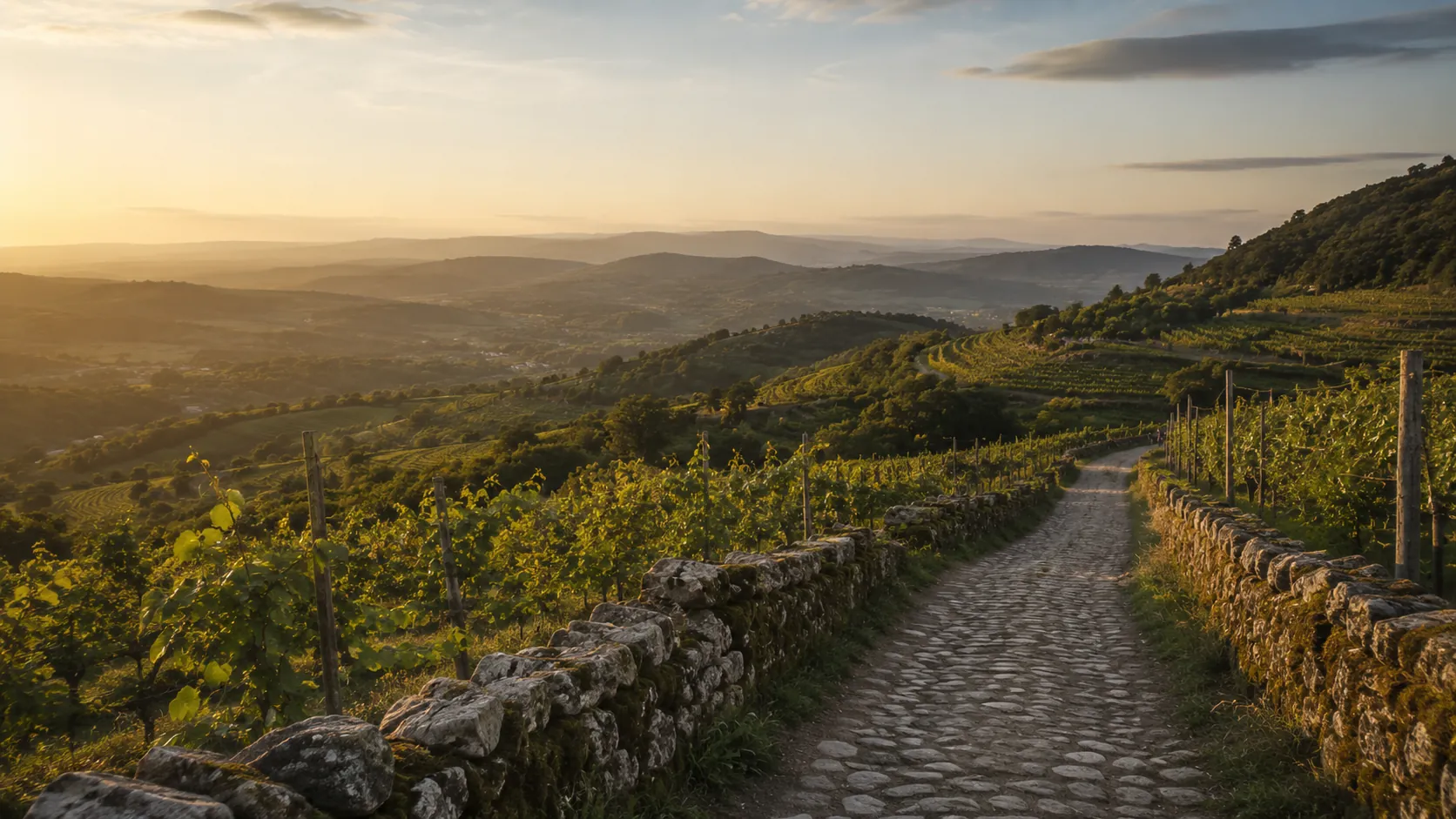
Walk the second most popular of the Camino de Santiago routes from wherever you already move. The Camino Portugués, or Portuguese Way, runs about 233 km (roughly 145 miles) north from Porto through the Minho and across the border into Galicia to Santiago de Compostela, and Route Rally turns every synced walk, run or daily step into progress along it. A favourite for its gentle terrain and river-and-coast scenery, it is an inviting medium-length pilgrimage.
Part of the Camino de Santiago series
- Route: Camino Portugués
- Distance: 233.3 km
- Elevation gain: 2500 m
- Popular medium-length walking pilgrimage
- Best for: Walkers and step-counters, multi-week goals, and medium rallies of your own
Planning your challenge
A walker averaging 30 km/week finishes in about eight weeks; a runner at 40 km/week completes it in around six weeks.
This is a Medium route by Route Rally distance bands, so it bridges the short Camino Inglés and the long Camino Francés.
Works well for walkers who want a meaningful pilgrimage without committing to the full French Way.
Create your own rally at your own pace, solo or with a group to share the route.
Why this route
- The Camino Portugués, or Portuguese Way, is the second most-walked Camino after the French Way.
- The Route Rally route runs about 233 km (145 miles) from Porto north through the Minho and into Galicia to Santiago de Compostela.
- It is known for gentler terrain than the mountain Caminos, which makes it an approachable medium-length pilgrimage for walkers and step-counters.
- As a virtual challenge you cover the distance in your own time, so everyday walks, steps and hikes all count towards Santiago.
- Its popularity and manageable length make it a strong centre point of the Camino de Santiago series.
Highlights
- Start in Porto, the riverside city famous for its port wine
- Walk north through the green Minho countryside of northern Portugal
- Cross the border into Galicia at the Minho river
- Finish at the cathedral of Santiago de Compostela
Places along the route
Every place below is measured onto the route line, so the distance shown is where you actually reach it.
Places are researched from published sources. The distances are measured rather than estimated: we find the point on the route's own recorded line that lies nearest the place, and give the distance along the route to that point.
Porto and the Minho
0–118 km · 20 places
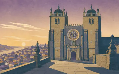
0 km (0 miles) · heritage
Sé do Porto
The Portuguese Way starts at a fortress
The Camino Portugués begins at a cathedral built like a castle.
- Portugal's register carries the historic centre of Porto, the Luís I bridge and the Serra do Pilar monastery as one national monument, inscribed on the World Heritage list in December 1996.
- The Diocese of Porto describes the cathedral as a fortress church with battlements, Romanesque and Gothic in structure, of the twelfth and thirteenth centuries.
- The diocese calls the pilgrim office beside the cathedral the starting point of the Caminos de Santiago in the city.
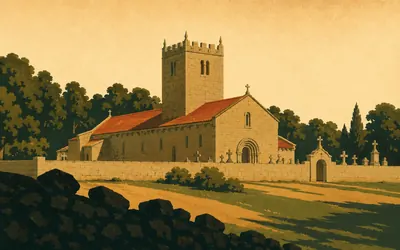
8 km (5 miles) · heritage
Mosteiro de Leça do Balio
A fighting order's house on a walkers' road
Eight kilometres out of Porto the suburbs give way to a squat granite church with a battlemented tower, and it was never only a church.
- Matosinhos council records that Queen Teresa gave the monastery to the military religious order of the Hospitaller Knights in the twelfth century.
- Portugal's classification names the bronze tomb slab inside the church as part of the national monument.
- The council records the abolition of the Baliado de Leça in 1834.
13 km (8 miles) · heritage
São Salvador de Moreira
A relic that has not moved since 1085
Maia council dates the former monastery here to the middle of the ninth century, and records a relic of the Holy Wood kept in it since 1085. A single nave, with a false transept turned into chapels. Portugal's register made it a monument of public interest in 2012.
24 km (15 miles) · heritage
Capela de São João, Vairão
Only the chapel is listed
Pilgrims stop the night at Vairão, in a monastery that carries no heritage designation of its own. Only the chapel is protected. Portugal's register lists the Capela de São João of the church of Vairão, a property of public interest since 1944, and Vila do Conde's own municipal list names that same chapel and nothing else.
30 km (19 miles) · heritage
Mosteiro de São Simão da Junqueira
First written down in 1084
Vila do Conde's tourism service dates the monastery's foundation to the eleventh century, by an archdeacon of Braga, and its oldest authentic mention to a deed of donation of 1084. Afonso Henriques granted it a charter in 1181. The church with its two bell towers went up in 1687, and a papal brief closed the convent in 1770.
33 km (20 miles) · heritage
São Cristóvão de Rio Mau
A national monument with no description
A small Romanesque church in the parish of Rio Mau e Arcos, made a national monument by the omnibus decree of June 1910, which names it and stops. Portugal's register has no description to give. A kilometre back down the road the same parish carries the bridge of São Miguel de Arcos, a property of public interest since 1982.
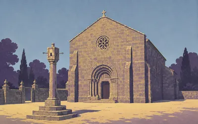
35 km (22 miles) · heritage
Igreja de São Pedro de Rates
A hundred years to build a village church
Póvoa de Varzim council calls this a notable example of the Romanesque style of their country: heavily built, of granite, with very few openings and a rose window set high in the front.
- Póvoa de Varzim council dates the present church's construction to the middle of the twelfth century, with the works finishing about a hundred years later.
- The council describes it as a notable example of the Romanesque style of Portugal, heavily built of granite with very few openings.
- The pillory outside the church has been a property of public interest since 1933.
46 km (29 miles) · heritage
Ruínas do Castelo de Faria
Four thousand years of somebody up here
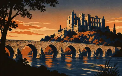
Barcelos council dates the first signs of occupation on this hilltop to four thousand years ago, a large community holding the whole crown of the hill to about twenty-two hundred, and a castle raised on the hillfort's ruins in the eleventh century. A siege story attaches to it, about a father cursing his son into holding out. The council files that under its own Legends of Barcelos.
51 km (32 miles) · heritage
Paço dos Condes de Barcelos
A roofless palace with a legend inside it
You cross the Cávado on a medieval bridge and climb straight into a roofless palace.
- Barcelos council describes the cross in its Archaeological Museum as alluding to the miracle of Saint James, the episode that gave rise to the legend of the cockerel, and keeps the story on its own Legends of Barcelos page.
- The palace has been a national monument since 1910, and the council's own title for it is the Paço dos Condes de Barcelos where the national register writes Paço dos Duques de Bragança.
- The bridge over the Cávado, the Solar dos Pinheiros and the parish church are each classified in their own right.
55 km (34 miles) · heritage
Santa Maria de Abade de Neiva
The council says appear, so we say appear
Barcelos council says the origins of this church appear to go back to the twelfth century and to Queen Mafalda, and it is careful with the word appear. The building standing now, church and tower together, it dates flatly to the sixteenth century. A national monument since 1927.
63 km (39 miles) · heritage
Torre de Aborim
Old, listed, unexplained
A tower standing in the fields at Aborim, a property of public interest since a decree of September 1978. That is the whole of what Portugal's register publishes about it, and the council has nothing to add. Some things on a long road are simply old and unexplained.
69 km (43 miles) · heritage
Castelo de Curutelo
Castle on one line, manor on the next
Portugal's register lists this twice over, as the Castelo de Curutelo and as the Paço de Curutelo, which tells you most of what there is to know about a building that was both. A property of public interest since a decree of September 1977. No description is published.
73 km (46 miles) · heritage
Castro do Cresto
Three hillforts, one parish, two decrees
Three Iron Age hillforts stand in this one parish, and Portugal's register protected them in two goes: Trás de Cidades and the Alto das Valadas by a decree of 1984, the Cresto by another in 1990. The road passes closest to the Cresto. No authority publishes a description of any of the three.
80 km (50 miles) · heritage
Marco miliário em Bertiandos
Fourteen stones, one decree, no description
For the next thirty kilometres the Camino keeps company with a Roman road. Portugal's register protects fourteen milestones of the road from Braga to Tui as a single national monument, under a decree of 1910 whose entire text about them is a district, three municipalities and a count. This is the stone at Bertiandos.
84 km (52 miles) · landmark
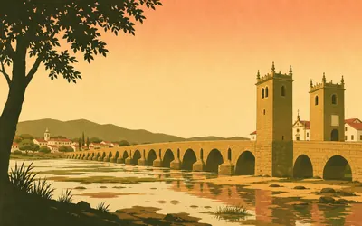
Ponte de Lima
The town is named after the bridge
The town is named after its bridge and says so: the bridge that gave its name to this noble land.
- Ponte de Lima council calls itself the oldest town in Portugal, resting the claim on a charter granted by Queen Teresa on 4 March 1125.
- The council describes the bridge as the only safe crossing of the Lima along its entire length until the late Middle Ages.
- Portugal's national register classifies the bridge as a national monument and publishes no construction date for it.
88 km (55 miles) · heritage
Paço de Calheiros
Classified, and nothing more than that
A manor on the hillside above the Lima valley, a property of public interest since a decree of September 1977. The house takes guests now, and its own account of itself could not be squared with any register, so this card claims nothing beyond the classification.
94 km (59 miles) · heritage
Santuário do Socorro
One listed building on the whole climb
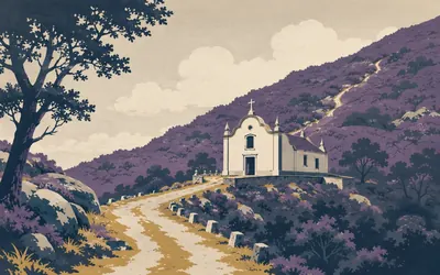
This is the hard part.
- Portugal's register holds one classified building in the whole parish of Labruja: the Santuário do Socorro, a property of public interest since a decree of September 1977.
- No heritage register, national or municipal, carries a record of the granite cross near the top of the Alto da Portela Grande.
101 km (63 miles) · heritage
São Pedro de Rubiães
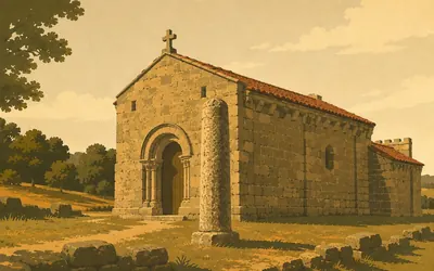
A Roman milestone at a church door
A Roman milestone stands at the door of a Romanesque church, and Portugal's register has given it a name: the Marco de Caracala.
- Portugal's register designates the milestone at the church door as the Marco de Caracala, naming the emperor Caracalla in its own official title.
- The church of São Pedro de Rubiães has been a national monument since a decree of 4 July 1922.
- The milestone belongs to a group of fourteen on the Roman road from Braga to Tui, classified together in 1910.
104 km (65 miles) · heritage
Povoado Fortificado de Cossourado
The decree that says why
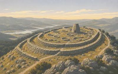
Portugal made this a national monument in June 2021, and unlike almost everything else on this road the decree that did it actually explains itself.
- The 2021 decree that made Cossourado a national monument describes an Iron Age settlement of about ten hectares, with three lines of walls and a tower of stone and earth.
- The decree calls Cossourado an exceptional site on the national and international scene.
- The settlement straddles two municipalities, Paredes de Coura and Vila Nova de Cerveira.
118 km (74 miles) · heritage
Fortificações de Valença
You walk into the town through the wall
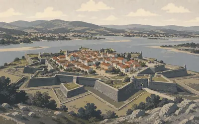
You enter Valença through a tunnel in a rampart and come out inside a town that is also a fortress.
- Valença council describes the fortress as one of the largest and best preserved military structures in Europe.
- Portugal's register classified the fortifications in March 1928 and publishes no construction date for them.
- Valença council recorded more than ninety-three thousand pilgrims crossing the international bridge to Tui in 2022.
Galicia
121–233 km · 16 places
121 km (75 miles) · heritage
Catedral de Tui
Three superlatives, three different scopes
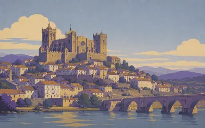
Tui calls this a cathedral fortress, and the council says its fortified look dominates the views of the city.
- Tui council calls the sculpture of the cathedral's north doorway the first example of Gothic sculpture on the Iberian Peninsula.
- Turismo de Galicia calls the cloister the largest surviving medieval cloister in Galicia and the chapter house the only Romanesque chapter house in Galicia.
- The cathedral was declared in 1931 and the historic ensemble of Tui in 1967.
130 km (81 miles) · nature
Gándaras de Budiño
Protected twice, described barely at all
A wetland the road skirts on the way into O Porriño, protected twice over and described almost not at all. Galicia's tourism authority lists it as a Natura 2000 site and cannot decide whether it covers 725 hectares or 727, its two language versions disagreeing with each other. The archaeological declaration of 1997 is real. Its text could not be obtained.
138 km (86 miles) · heritage
Capela dos Milagres
Listed, and left undescribed
A wayside chapel at Carracido, carried by Galicia's tourism authority and by the Xunta's own Camino site as a stop on the Portuguese Way. Neither publishes a sentence about it. It is a chapel of Our Lady of Miracles, on a road walked by people who would not mind one.
141 km (88 miles) · heritage
Pazo dos Marqueses de Mos
The road runs past the gates
Galicia's tourism authority records a pazo here, a Galician country house, classed as civil heritage and listed as conserved, on the Portuguese Way. It publishes no history and no date, so neither does this. The road runs straight past the gates.
151 km (94 miles) · engineering
Os viadutos de Redondela
Iron over the rooftops
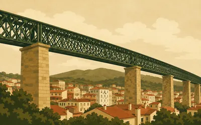
Two iron railway viaducts cross the town, and Galicia's tourism service calls Redondela the vila das pontes, the town of the bridges.
- Turismo de Galicia records the Madrid viaduct as opened in 1876, four hundred and eleven metres long and thirty-two metres high, out of use since 1971, restored and painted green in 2012.
- The Pontevedra viaduct opened in 1884, runs two hundred and fifty metres and still carries trains.
- Neither viaduct is on the Galician register of cultural assets; both are protected only by Redondela's own municipal plan.
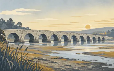
159 km (99 miles) · heritage
Ponte de Sampaio
Ten arches, eleven piers, two days in 1809
Ten arches and eleven piers, a hundred and forty-four metres of granite across the Verdugo.
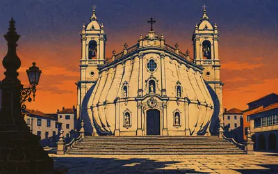
170 km (106 miles) · heritage
Santuario da Virxe Peregrina
A church built in the shape of a shell
The building is shaped like a scallop shell, and Galicia's tourism authority says so plainly: the ground plan is inspired by a vieira, the pilgrim's emblem, with a cross inscribed inside it.
- Turismo de Galicia states that the sanctuary's ground plan is inspired by a scallop shell, with a cross inscribed within it.
- Work began in 1778 to designs by Antonio de Souto with Bernardo José de Mier, and the high altarpiece was drawn in 1789 by Melchor de Prado.
- The image of A Peregrina above the door is nineteenth century, and she is the patron of the province of Pontevedra.
175 km (109 miles) · heritage
Igrexa de Santa María de Alba
A cross shape faked from the inside
Twelfth-century Romanesque, entirely rebuilt in the eighteenth, and the rebuilders did something neat: a rectangular plan that reads from outside as a Latin cross, the arms made by side chapels built within the walls. Thick granite ashlar, and the bell tower Galicia's tourism authority calls typical of rural churches here.
182 km (113 miles) · heritage
Igrexa de San Martiño de Agudelo
Quiet country, quiet record
A parish church at Faxil in the concello of Barro, on the Portuguese Way. Galicia's tourism authority lists it and describes it not at all, in either of its languages. Barro's other parishes return nothing from any register. This is quiet country and the record is quiet with it.
189 km (117 miles) · heritage
Igrexa de Santa María de Portas
Historiated capitals and carved eaves
Twelfth-century Romanesque with a great many later additions. Galicia's tourism authority picks out openings flanked by columns with historiated capitals and carved corbels along the eaves, Saint Peter and Saint Paul in stone either side of the way in, and a Baroque altarpiece of the eighteenth century. That description exists in Galician only.
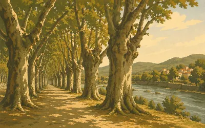
191 km (119 miles) · nature
A Carballeira de Caldas de Reis
Two hundred old oaks in ranks
An oak wood declared a monument.
- Turismo de Galicia describes more than two hundred centuries-old oaks set out in rows.
- The oak grove and the park garden beside it were declared a Paraxe Pintoresca in 1962.
208 km (129 miles) · engineering
Ponte Cesures
A builder some historians gave it
Galicia's tourism authority calls this a Roman bridge of several spans dating from the first century, and says that for nearly ten centuries the bridge gave the place its name. They add that some historians gave Caesar Augustus as its builder, and they leave it there, with the historians.
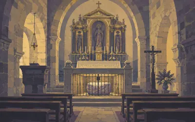
210 km (130 miles) · heritage
Santiago de Padrón
The stone the town is named after
Under the high altar of this church there is a Roman altar stone.
- Turismo de Galicia records a Roman altar stone, the Pedrón, beneath the high altar of the church at Padrón.
- The Xunta's own Camino site frames the arrival of the stone boat as ancient Christian tradition, and suggests the stone boat probably refers to the vessels that carried minerals out of Galicia.
- Turismo de Galicia dates Almanzor's destruction of the church at Iria Flavia to 997.
221 km (137 miles) · heritage
Cruz de Calo
One of about twelve thousand
Galicia's tourism authority counts about twelve thousand cruceiros across the region and calls this one of the most original and controversial examples of popular architecture in the area, clearly departing from the traditional type. The same authority notes that cruceiros are also said to protect travellers, and is careful to say said.
230 km (143 miles) · heritage
Castelo da Rocha Forte
Four words of description
Four kilometres short of Santiago, a castle. Galicia's register of cultural assets inscribed it in February 2022, and Galicia's tourism authority describes it in four words: castle, tower, fortress. Its own custodian site could not be reached. Whatever this place was, the record of it is thinner than the walls.
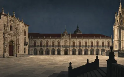
233 km (145 miles) · landmark
Praza do Obradoiro
The best thing here is behind the front
Two hundred and thirty-three kilometres from the Sé do Porto, the road stops in a square.
- Turismo de Galicia calls the Praza do Obradoiro the most monumental square in the city, and names the four buildings that enclose it.
- The cathedral records that Fernando de Casas demolished the old west front in 1738 and began the present Baroque one, leaving the Pórtico da Gloria, in the cathedral's own word, mutilated and boxed in behind it.
- The four buildings Turismo de Galicia names as enclosing the square are the cathedral's Obradoiro front, the doorway of the Pazo de San Xerome, the Pazo de Raxoi and the Hostal dos Reis Católicos.
Take on Camino Portugués and collect these places as you reach them
Common questions
How do my walks count towards Santiago from Porto?
Sync once with Strava or Apple Health and the counting looks after itself. Every walk, run or ride you record is added to your total and moves you north from Porto. Steps count as well as planned walks, which suits a route of this length: at 30 km a week you cross the Minho and reach Santiago in about eight weeks.
Do I have to walk in Portugal or Spain?
No. What stands between Porto and Santiago is 233 km, not a postcode, so local pavements and parks carry you along it. The real Portuguese Way is known for gentle terrain; yours may be hillier or flatter, and either way it is the distance that moves your marker.
How long is the virtual Camino Portugués?
The Route Rally route covers about 233 km, or roughly 145 miles, Porto to Santiago de Compostela on the popular Central route of the Portuguese Way.
How long does it take to walk?
At 30 km a week it takes around eight weeks, while a more committed 50 km a week brings Santiago inside five weeks. Pick the end date at setup and the pace follows from it.
How is it different from the Camino Francés?
The Camino Francés is the long classic route of about 764 km from the French Pyrenees. The Camino Portugués is a shorter route of about 233 km from Porto, so it suits a medium-length pilgrimage with gentler terrain.
Start your Camino Portugués Conquest
Joining is free. Connect Strava or Apple Health once and every ride, run or walk you record syncs automatically, moving you along the route without anything else to log.