Virtual Southern Upland Way Challenge
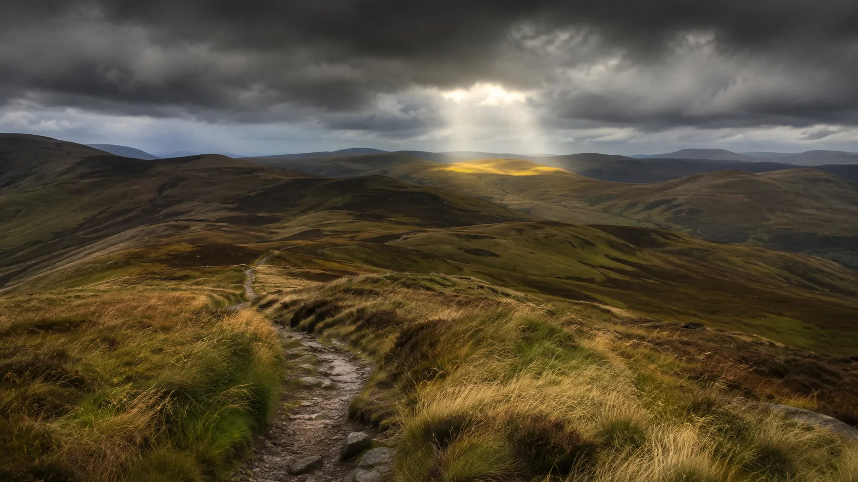
Take on Scotland's longest long-distance trail from wherever you already train. The Southern Upland Way runs roughly 335 km (about 208 miles) from Portpatrick on the Galloway coast in the southwest to Cockburnspath on the Berwickshire coast in the east, crossing the full width of southern Scotland through remote moorland, forest and border farmland. Route Rally turns every synced walk, run or ride into progress along this demanding coast-to-coast trail.
Part of the Scotland's Great Trails series
- Route: Southern Upland Way
- Distance: 334.6 km
- Elevation gain: 5900 m
- Long and remote coast-to-coast crossing
- Best for: Longer rallies of your own for serious walkers and runners, and multi-month endurance goals
Planning your challenge
A runner averaging 40 km/week finishes in around eight weeks; a walker at 30 km/week takes about eleven weeks, and a cyclist at 150 km/week completes it in just over two weeks.
This is a Long route by Route Rally distance bands, and Scotland's longest long-distance route. Best for committed walkers and runners who want a substantial multi-month goal.
Works well for serious walkers who want a remote and demanding coast-to-coast that takes them far from the well-trodden Highland routes.
Create your own rally for your own Southern Upland Way target, solo or with a club, workplace or group of friends.
Why this route
- The Southern Upland Way is Scotland's first official coast-to-coast route, covering about 335 km (208 miles) from Portpatrick to Cockburnspath.
- As a virtual challenge you cover the distance in your own time, with walks, runs and rides from anywhere pushing you steadily east across southern Scotland.
- The route passes through some of the most remote and least-visited landscapes in southern Scotland: the Galloway Forest Park, the Lowther Hills and the border moors around St Mary's Loch.
- Its length and remoteness make it the most demanding of Scotland's Great Trails, suited to committed walkers rather than casual day-trippers.
- At a consistent 30 km a week it takes around eleven weeks to complete, making it a serious long-term goal for those who want a trail that really tests their consistency.
Highlights
- Start at Portpatrick on the Galloway coast of southwest Scotland
- Cross the Galloway Forest Park, the largest forest park in the UK
- Follow the border moors through St Mary's Loch and the Ettrick Hills
- Finish at Cockburnspath on the Berwickshire coast of the North Sea
Places along the route
Every place below is measured onto the route line, so the distance shown is where you actually reach it.
Places are researched from published sources. The distances are measured rather than estimated: we find the point on the route's own recorded line that lies nearest the place, and give the distance along the route to that point.
Galloway: the Rhins and the Forest
0–120 km · 17 places
0 km (0 miles) · landmark
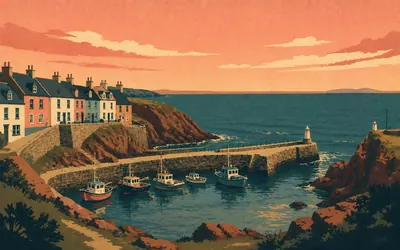
Portpatrick
Mile zero on the Irish Sea
A small harbour in a cleft of the Rhins, with Ireland twenty-one miles across the water and the whole breadth of southern Scotland behind you.
- Mail crossed from Portpatrick to Donaghadee from 1662, twice a week by 1677.
- Dumfries and Galloway Council calls the way Britain's first official coast to coast long distance path.
- The Southern Upland Way opened in 1984 and runs 344 km, or 214 miles.
10 km (6 miles) · heritage
The Castle of St John
A tower house that became a jail
An L-plan tower of about 1510, built for Ninian Adair of Kinhilt and later turned into the town jail: the register still describes the light cells and access passages put in during 1821. It stands in the middle of Stranraer with the town built up around it.
16 km (10 miles) · heritage
Castle Kennedy
A shell between two lochs
A roofless seventeenth-century house standing on the neck of land between the White Loch and the Black Loch, with formal gardens laid out around it and a Victorian mansion, Lochinch, at the far end. The ruin has been a ruin for a very long time and the gardens grew up around the fact.
29 km (18 miles) · heritage
New Luce
Where the two waters meet
A single street between the Main Water and the Cross Water of Luce. Scotland's Churches Trust records the Covenanter Alexander Peden as minister of this parish from 1660 to 1663. The church standing here now dates from 1821, and Historic Environment Scotland hedges even that: circa 1821, with one authority giving 1816.
32 km (20 miles) · heritage
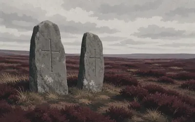
The Laggangairn Standing Stones
Two stones, and a cross cut into each
Two slabs of stone standing on open moor a long way from any road, each about two metres high and each carved with a cross.
- Historic Environment Scotland puts the stones at about 2000 BC and the crosses at the AD 600s to 800s.
- Tradition records up to fourteen stones here, with seven still standing in 1873.
- The neighbouring farm name, Kilgallioch, means the church of the standing stones.
52 km (32 miles) · heritage
The White Cairn
A tomb type named after this valley
A round cairn with a passage and a chamber inside it, dug into in 1949 and found already robbed. Its interest is that it is the type site: archaeologists call this whole south-western group of Neolithic tombs Bargrennan cairns, after the place you are standing in.
55 km (34 miles) · nature
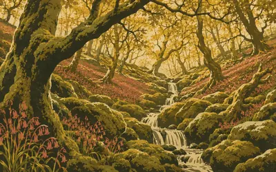
Wood of Cree
Oak and moss on the river
Down on the Cree, out of sight of the forestry road, there is a hanging oak wood full of ferns and mosses and running water.
- The RSPB calls Wood of Cree the largest ancient wood in southern Scotland.
- Ancient woodland means ground that has been continuously wooded, never cleared and replanted.
- Redstarts, pied flycatchers and wood warblers all nest in the oaks.

62 km (39 miles) · nature
Glen Trool
Three hundred square miles and no light
The way comes down off the moor into Galloway Forest Park, which Forestry and Land Scotland describes as over three hundred square miles of hill, loch and plantation.
- Forestry and Land Scotland describes Galloway Forest Park as over 300 square miles.
- The park was designated an International Dark Sky Park at Gold Tier in 2009.
- FLS calls it the UK's first Dark Sky Park on one of its own pages and one of the first in the world on another.
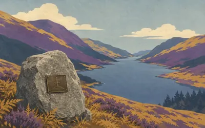
66 km (41 miles) · heritage
Bruce's Stone, Glen Trool
A granite boulder above the loch
A single boulder set on the shoulder above Loch Trool, looking down the length of the water.
- The stone commemorates the Battle of Glen Trool, fought in March 1307.
- Glen Trool was the opening action of the campaign Bruce closed at Bannockburn in 1314.
- Forestry and Land Scotland manages the glen as part of Galloway Forest Park.
74 km (46 miles) · nature
Loch Dee
Open water in the middle of the forest
A shallow loch lying in a bowl of granite and peat, inside the Merrick Kells Site of Special Scientific Interest. The water is famously clear and famously acid, and the loch has been measured and sampled for decades because of it.
81 km (50 miles) · engineering
Clatteringshaws Dam
A dam bent for the view
Built between 1932 and 1934 to make the loch you have been walking beside, and curved on purpose: the register records that Parliament attached conditions about landscape and amenity, and the shape is the answer to them. A tunnel takes the water south to Glenlee power station.
92 km (57 miles) · heritage
St John's Town of Dalry
A stone seat and a rising
A grey street above the Water of Ken with a carved stone seat at the top of it, which the national inventory hedges carefully as traditionally said to have been used by St John, or more likely one of his followers. In November 1666 a scuffle here between soldiers and local people set off the Pentland Rising.
99 km (61 miles) · engineering
Kendoon Power Station
1934, and a first for Scotland
A low concrete hall with THE GALLOWAY WATER POWER SCHEME, KENDOON POWER STATION, 1934 cut into it. Historic Environment Scotland calls it the first large-scale application of run-of-river hydroelectric technology in Scotland. It is one of six stations on the scheme and the whole chain still generates.
100 km (62 miles) · heritage
Polmaddy
A township in the trees
Low walls in a loop of the Polmaddy Burn, now inside a conifer plantation. Forestry and Land Scotland describes it as the two-hundred-year-old ruins of a traditional Galloway farming village, and leaves it at that: houses, a mill, a kiln, and the outlines of the rigs people worked.
115 km (71 miles) · landmark
The Striding Arch on Benbrack
Red sandstone on a green hill
An arch of dressed red sandstone standing by itself on the summit, one of four by Andy Goldsworthy for the Cairnhead Community Forest Trust, brought here after a showing at the Yorkshire Sculpture Park in 2007. Three stand on hilltops and one springs from the wall of a byre. The three on the tops are sited so that each can see the other two.
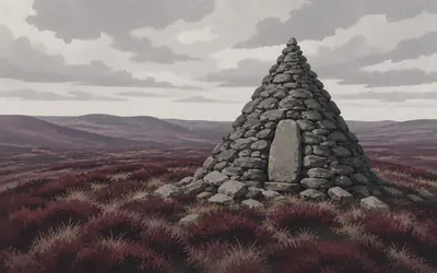
116 km (72 miles) · heritage
Allan's Cairn
A grave where three parishes meet
A cairn on open moor, miles from a road, at the point where three parish boundaries come together.
- The national inventory records the cairn as a Covenanters' monument.
- It stands at the meeting point of three parish boundaries.
- The Killing Times are the name given in south-west Scotland to the persecution of the 1680s.
120 km (75 miles) · landmark
The Chalk Memorial Bothy
A roof, high up, given in memory
A small stone shelter on the high ground above Polskeoch, open to anyone, put there and kept there in memory of two people who died suddenly. There is no lock and no charge. In weather, it is the only thing between here and the next glen.
Nithsdale, the Lowther edge and Annandale
142–187 km · 6 places
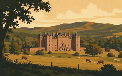
142 km (88 miles) · heritage
Drumlanrig Castle
Pink stone above the Nith
A vast square house of pink sandstone on a terrace above the river, built between 1679 and 1689 for the first Duke of Queensberry.
- Historic Environment Scotland dates the castle 1679-89 and names Robert Mylne as its probable designer.
- The Douglas family has owned this ground since 1388.
- Leonardo's Madonna of the Yarnwinder was stolen from the castle in 2003 and recovered in 2007.
143 km (89 miles) · heritage
The Nith Bridge Cross
Early medieval carving by the roadside
A red sandstone cross-shaft standing on its own at the bridge, about two metres high, with interlaced animals and plants running up it and the arms long gone. It is Northumbrian work, scheduled as a monument of national importance, and it has been standing beside this crossing for something over a thousand years.
151 km (94 miles) · heritage
Closeburn Castle
A tower with its iron gate still on
A plain rectangular tower house of the late fourteenth century, altered a good deal in the eighteenth and nineteenth. It still has its yett, the iron grille that hung behind the door, and the studded door itself. When the Kirkpatricks' newer mansion burned in 1748 they moved back into the tower.
160 km (100 miles) · nature
The Forest of Ae
A village built for the trees
Ae is a village that exists because of a forest: Forestry and Land Scotland records that the Forestry Commission built it in 1947 to house the people who worked the plantation. It is now also one of the 7stanes mountain-bike centres, so expect company on the fire roads.
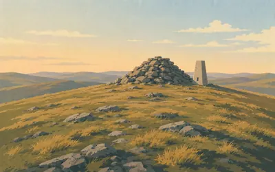
173 km (108 miles) · viewpoint
Queensberry
A bare dome above Annandale
A broad grassy dome at the southern end of the Lowther Hills, put at 697 metres by the walking guides though no authority publishes a height for it, with a cairn on top and very little else.
- No approved authority publishes a height for Queensberry; the 697 metres in circulation is the walking guides' figure.
- The summit is marked by a cairn and has no shelter of any kind.
- The trail's own custodian names Lowther Hill, not Queensberry, as the highest point on the Way.
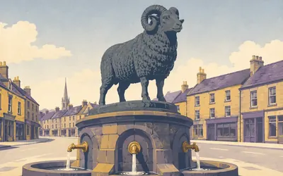
187 km (116 miles) · heritage
Moffat
A bronze ram with no ears
A wide High Street with a fountain in the middle of it, and on top of the fountain a bronze ram, given to the town by William Colvin of Craigielands in 1875 and modelled by William Brodie, who also made Greyfriars Bobby.
- The Colvin Fountain was given to Moffat in 1875 and its ram was modelled by William Brodie.
- Brodie also sculpted the Greyfriars Bobby statue in Edinburgh.
- Moffat's mineral well was found in the seventeenth century, about 1640, and made the town a spa.
Ettrick, Yarrow and Tweed
207–269 km · 13 places
207 km (129 miles) · viewpoint
Ettrick Head
A stile on the watershed
A gap between two hills with a fence across it and a stile in the fence. Behind you the burns run west to the Solway; ahead they run east to the Tweed and the North Sea. The county changes at the same step. From here the Ettrick begins, and so does the second half of the crossing.
208 km (129 miles) · landmark
Over Phawhope
The first roof in the Ettrick
A whitewashed bothy at the very head of the Ettrick valley, kept by the Mountain Bothies Association and left unlocked. It is the first building you come to after the watershed, and in a wet westerly it is a considerable relief.
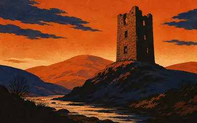
219 km (136 miles) · heritage
Tushielaw Tower
The man Bishop Leslie called a king of thieves
A ruined tower on a shelf above the Ettrick, built by Adam Scott, who in 1507 got a charter from James IV giving him the lands of Truschelaw and the right to raise a fortalice on them.
- James IV granted Adam Scott the lands of Truschelaw and the right to build a tower in 1507.
- Scott was convicted in 1530 of taking blackmail from his neighbours and beheaded.
- The national inventory attributes the nickname king of thieves to Bishop Leslie rather than stating it.
228 km (142 miles) · heritage
Dryhope Tower
Pulled down in 1592, up again by 1613
A square Border tower at the head of St Mary's Loch, ordered to be slighted in 1592 after its owner backed the wrong earl, and rebuilt within a generation: a panel on it may be read, the register says carefully, as carrying the date 1613. It was the home of Mary Scott, remembered in the ballads as the Flower of Yarrow.
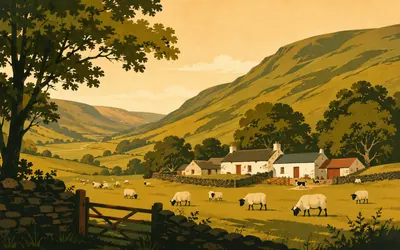
229 km (142 miles) · heritage
Altrieve
The Ettrick Shepherd's farm
The national record for this ground runs to a few lines.
- The national record classifies Altrieve as a farmhouse and a farm, in the parish of Yarrow.
- Its whole description is one line: sometime home of James Hogg, the Ettrick Shepherd.
- The archive holds an engraving inscribed Altrieve Cottage, the residence of the Ettrick Shepherd.
233 km (145 miles) · heritage
Blackhouse Tower
A ballad nobody can prove
A broken late-sixteenth-century tower on the Douglas Burn in a valley with almost nothing else in it. Walter Scott printed the ballad of the Douglas Tragedy in his Minstrelsy and set it here; the national inventory records only that the farm is said to have been the scene, and leaves it there.
243 km (151 miles) · heritage
Robert Smail's Printing Works
A jobbing printer, still setting type
A small-town printing works that ran as a business from 1866 to 1986 and was taken on by the National Trust for Scotland when it stopped. It still prints: the same presses, the same cases of metal type, and fifty-two guardbooks with almost every item the firm printed pasted into them.
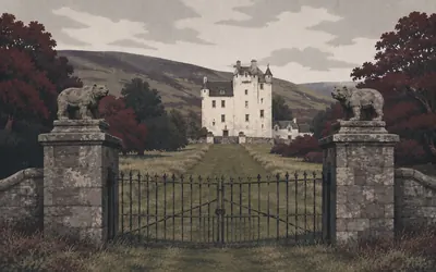
244 km (152 miles) · heritage
Traquair House
The gates that stay shut
A tall white house at the end of an avenue, which describes itself as Scotland's oldest inhabited house and says it has been lived in for over nine hundred years.
- Traquair describes itself as Scotland's oldest inhabited house, lived in for over 900 years.
- The house dates the closing of the Bear Gates to 1745; the listing record says the seventh Earl closed them in 1796.
- The eighteenth-century brewhouse under the chapel was restored to working order and still brews.
258 km (160 miles) · engineering
Yair Bridge
Three arches over the Tweed
A narrow three-arched bridge of the mid eighteenth century, with pedestrian refuges built out over each pier because the roadway was never wide enough for two carts. Historic Environment Scotland dates it no more precisely than that, and neither will we.
265 km (165 miles) · heritage
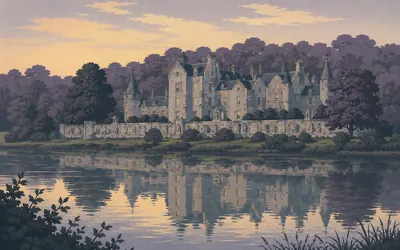
Abbotsford
The house the novels paid for
Walter Scott bought a farm on this bend of the Tweed and spent twenty years turning it into something else: turrets, a screen wall of carved stones rescued from ruins, a study lined with books, and a name borrowed from a ford the monks of Melrose had used.
- The Abbotsford Trust says the house was built on the proceeds of a phenomenally successful literary career.
- Scott called it his conundrum castle.
- Abbotsford opened to the public in 1833 and reopened after major restoration in July 2013.
267 km (166 miles) · heritage
The Galashiels Mercat Cross
Dated 1695, and silent on the story
A market cross of 1695, re-erected on its stepped base in 1887, with part of the original shaft now in the museum at Old Gala House. Galashiels tells a story about English raiders ambushed while eating wild plums, and puts it on the burgh arms. The listing record says nothing about any of that. It describes a cross.
268 km (166 miles) · engineering
Tweedbank
The end of a line that came back
The Waverley Line from Edinburgh to Carlisle closed in 1969 and the Borders were left without a railway for forty-six years. On 6 September 2015 trains came back as far as here, thirty miles of new railway on the old alignment, and the platform is a five-minute walk from the way.
269 km (167 miles) · heritage
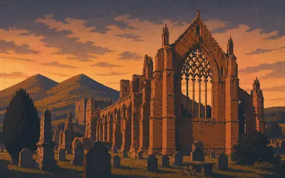
Melrose Abbey
Red sandstone, and a heart
David I brought Cistercian monks here in 1136 and they built in the local red sandstone, which carves beautifully and weathers to the colour of a fox.
- Melrose Abbey was founded by David I in 1136 for the Cistercian order.
- Richard II's army burned it in 1385 and the rebuilding took most of a century.
- One roof gargoyle on the nave is a pig playing the bagpipes.
The Lammermuirs and the Berwickshire coast
283–335 km · 11 places
283 km (176 miles) · heritage
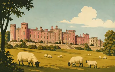
Thirlestane Castle
Three centuries in one elevation
A long pink castle above Lauder that shows its whole history on its face.
- The castle's core was built 1587-90 for Sir John Maitland, Chancellor of Scotland.
- Sir William Bruce and Robert Mylne added the pavilion wings in 1673 for the Duke of Lauderdale.
- William Burn's Scots Baronial remodelling of 1841-45 cost £25,000.
300 km (186 miles) · heritage
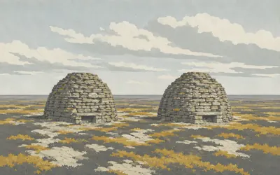
The Twin Law Cairns
Two heaps of stone, and a story about brothers
Two great cairns on a bare Lammermuir ridge, each about a metre and a half high and twenty-odd metres across, each topped by a drystone beacon three metres high.
- The national inventory records the cairns as 20 m and 24 m across, each about 1.5 m high.
- Each cairn has a passage stair inside it up to a drystone beacon three metres high.
- The record says the cairns were damaged by the military, and by Polish troops, during the Second World War, and later rebuilt.
305 km (189 miles) · engineering
Watch Water Reservoir
An earth dam in the Lammermuirs
Open water in the valley of the Watch Water, held back by an earthen dam, and the national record adds only that it was built after the Ordnance Survey revision of 1907 to 1908. After a long day on the heather it is the first flat blue thing you have seen, and the track along its edge is the easiest walking of the stage.
310 km (193 miles) · landmark
Longformacus
The last village before the coast
A handful of houses on both sides of the Dye Water, on the south side of the Lammermuirs, with nothing much either side of it for a long way. No register holds the village and no approved authority publishes a height for it, so the card gives none. For walkers it is the point at which the moor finally lets go and the route starts running downhill towards the sea.
314 km (195 miles) · nature
Ellemford
Where the Whiteadder comes out of the hills
The Whiteadder collects the Lammermuir burns and runs east through a wooded valley to join the Tweed. Downstream of here the river cuts through Carboniferous rock and is protected for what the exposures contain; up here it is simply a clear brown river with a bridge over it.
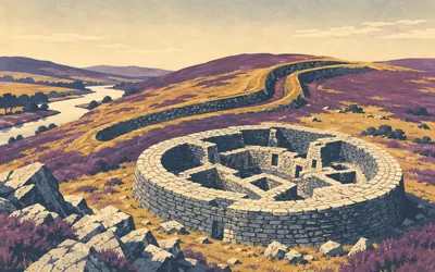
320 km (199 miles) · heritage
Edin's Hall Broch
A northern building in the wrong county
Brochs are a northern thing: tall drystone towers, thousands of years old, found in Caithness and Sutherland and the isles.
- Historic Environment Scotland calls it one of the very few Iron Age brochs in lowland Scotland.
- The designation record gives the broch a diameter of about 27 m with walls about 5 m thick.
- The site has been a scheduled monument since 18 August 1882.
322 km (200 miles) · heritage
Abbey St Bathans
A nunnery inside a parish church
A hamlet on the Whiteadder named for a priory of Cistercian nuns said to have been founded here around 1200. The priory is gone, but its late-fourteenth-century walls were not demolished so much as absorbed: the national record puts parts of them in the east and north walls of the parish church.
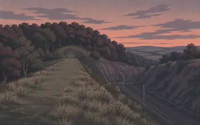
328 km (204 miles) · heritage
Penmanshiel
A tunnel that was never reopened
At about half past three in the morning on 17 March 1979, engineers were lowering the track through the railway tunnel under this hill when the roof came down.
- The collapse happened at about 3.30 a.m. on 17 March 1979 during work to lower the track.
- About 25 yards of tunnel came down and two contractors' employees were killed.
- The tunnel was never brought back into use and the main line now runs on a new alignment.
331 km (206 miles) · engineering
Pease Bridge
Four arches over a wooded gorge
A four-arched bridge of 1786 carrying the old road across the Pease Burn about forty metres above it. The dean below is a steep wooded cleft running down to the sea, which is why the bridge had to be as tall as it is and why an army coming up this coast always had trouble here.
334 km (207 miles) · heritage
Dunglass Collegiate Church
A stone roof that never came off
A small cross-shaped church of the 1440s, dedicated to St Mary, which Historic Environment Scotland describes as standing remarkably complete. It owes that to its roof: heavy stone slabs rather than timber and slate, which is why it survived the Reformation, two centuries as a farm building and everything since.
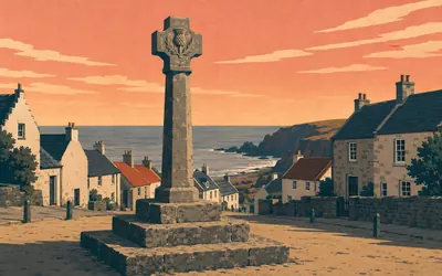
335 km (208 miles) · landmark
Cockburnspath
The North Sea, and the end of it
A market cross with a thistle carved on each face of its head, standing on a three-tier stepped base in the middle of a village a mile from the sea.
- The mercat cross is Category A listed and separately a scheduled ancient monument.
- Its cross-head carries a thistle in relief on each side, and the listing gives no erection date.
- Cockburnspath is the eastern end of the Southern Upland Way, which opened in 1984.
Take on Southern Upland Way and collect these places as you reach them
Common questions
How does my walking count on Scotland's longest trail?
Your tracker feeds the total directly, moving you east from Portpatrick with every walk, run or ride it captures. On a route this long the consistency does the work: 30 km a week reaches Cockburnspath in around eleven weeks, and 50 km a week in about seven.
Do I have to be in southern Scotland?
No. The coast-to-coast is measured in kilometres, not in map references, so pavements, parks and treadmills all count. The real route's difficulty is its remoteness, with long empty sections and very few services; the virtual one keeps the length, and at 335 km that is demanding enough on its own.
How long does the Southern Upland Way take?
At 30 km a week it takes around eleven weeks, roughly three months. Build to 50 km a week and you finish in about seven weeks. The end date you choose at setup sets the weekly rhythm.
Is this harder than the West Highland Way?
The Southern Upland Way is longer and significantly more remote. It does not have the same volume of walkers, services or infrastructure as the West Highland Way, and long sections cross empty moorland with few landmarks. That makes it more demanding for those doing the real route, but as a virtual challenge the difficulty is simply the consistency required to cover the distance.
Start your Southern Upland Way Conquest
Connect Strava or Apple Health once and every ride, run or walk you record syncs automatically, moving you along the route without anything else to log.