Virtual West Highland Way Challenge
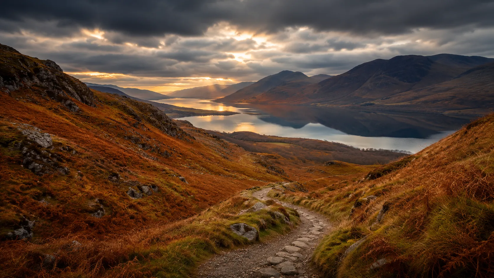
Walk Scotland's most iconic long-distance trail from wherever you already train. The West Highland Way runs roughly 153 km (about 95 miles) from Milngavie on the northern edge of Glasgow north through Loch Lomond, Rannoch Moor and Glencoe to Fort William at the foot of Ben Nevis. Route Rally turns every synced walk, run or ride into progress along this celebrated Highland route.
Part of the Scotland's Great Trails series
- Route: West Highland Way
- Distance: 153 km
- Elevation gain: 4262 m
- Classic Highland trail
- Best for: Medium rallies of your own for walkers and runners, and focused one-to-two month Highland goals
Planning your challenge
A runner averaging 40 km/week finishes in about four weeks; a walker at 30 km/week takes around five weeks, and a cyclist at 150 km/week completes it in just over a week.
This is a Medium route by Route Rally distance bands, achievable in a focused month and a strong choice as a first Scottish trail.
Works well for walkers and runners who want a route with a well-deserved reputation and a clear Highland narrative.
Create your own rally for your own West Highland Way target, solo or with a club, workplace or group of friends.
Why this route
- The West Highland Way is Scotland's most popular long-distance route, covering about 153 km (95 miles) from the outskirts of Glasgow to the foot of Ben Nevis.
- As a virtual challenge you cover the distance in your own time, with daily walks, runs and rides from wherever you train pushing you north towards Fort William.
- The route passes through some of Scotland's most dramatic landscapes: the east shore of Loch Lomond, the empty expanse of Rannoch Moor and the historic pass of Glencoe.
- Its medium length makes it a realistic four-to-eight week goal at a steady pace, while still feeling substantial.
- It is widely regarded as the best introduction to long-distance walking in Scotland, with clear waymarking, regular accommodation on the real route and a legendary finish beneath Scotland's highest mountain.
Highlights
- Start at Milngavie, just north of Glasgow, the traditional start of the Way
- Follow Loch Lomond's eastern shore through the Trossachs and highland boundary
- Cross the vast expanse of Rannoch Moor, one of Europe's last true wildernesses
- Finish at Fort William beneath Ben Nevis, Scotland's highest mountain
Places along the route
Every place below is measured onto the route line, so the distance shown is where you actually reach it.
Places are researched from published sources. The distances are measured rather than estimated: we find the point on the route's own recorded line that lies nearest the place, and give the distance along the route to that point.
Milngavie to Drymen
0–20 km · 6 places
0 km (0 miles) · landmark
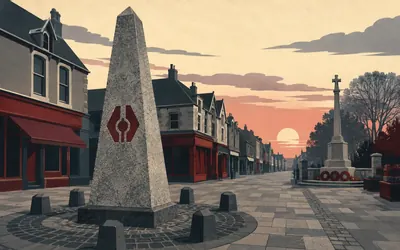
The Milngavie Obelisk
Mile zero, on a suburban high street
The Way starts on a pedestrianised high street north of Glasgow, at a granite obelisk beside the war memorial.
- The trail's custodian calls the West Highland Way Scotland's first official long-distance route.
- It was officially opened on 6 October 1980; the route approved in 1974 was ninety-five miles long.
- The custodian gives the modern route as 96 miles, or 154 km.
3 km (2 miles) · heritage
Mugdock Castle
Two towers and a wall, in a country park
Scheduled since October 1969, Mugdock is the remains of a courtyard castle whose original fourteenth-century design, in Historic Environment Scotland's own words, leaves two towers on the west side and part of a gatehouse on the south, joined by a high curtain wall. The site was occupied almost continuously into the twentieth century.
8 km (5 miles) · heritage
The Dumgoyach Stones
Five stones in a line, three still standing
Historic Environment Scotland classifies these as a Neolithic stone row and describes five standing stones arranged in a straight line running north-west to south-east. Three are earthfast; the other two are recumbent. They were scheduled in April 1966 and sit in a field the trail runs along the edge of.
11 km (7 miles) · landmark
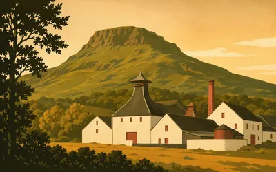
Glengoyne and Dumgoyne
A distillery under the stump of a volcano
The Way runs the line of an old railway with the Campsie Fells standing up on the right, a run of blunt green hills ending in the plug of Dumgoyne.
- Historic Environment Scotland's record gives Glengoyne as founded in 1833.
- The British Geological Survey describes Dumgoyne as a Lower Carboniferous volcanic vent.
- The vents run in a line about 27 km long, from Fintry to Dumbarton.
16 km (10 miles) · heritage
Gartness
The lost house of the man who invented logarithms
Nothing remains of Gartness Castle, which Historic Environment Scotland records flatly as once the house of John Napier, the inventor of logarithms. A reused window lintel in the mill nearby, and a stone dated 1574 in a store-house gable, probably came from it. That he did the mathematics here is tradition rather than record.
20 km (13 miles) · landmark
Drymen
The last shop before the hills
Drymen's square is the Way's last proper village before Conic Hill, and the trail custodian attaches a rule to leaving it: from here on, camping and firelighting byelaws are in force between 1 March and 30 September. North of the square the route enters Garadhban Forest, some 441 hectares of it inside the national park.
Loch Lomond
30–68 km · 7 places

30 km (19 miles) · viewpoint
Conic Hill
The line where Scotland changes
Conic Hill is a short, steep, unmistakable climb, and the reason to make it is what you can see from the top.
- The National Park Authority traces the Highland Boundary Fault through the islands of Inchcailloch, Torrinch, Creinch and Inchmurrin.
- The National Park Authority gives Conic Hill as 361 m high; Historic Environment Scotland gives 358 m.
- The British Geological Survey describes the fault zone as separating the Highlands from the Midland Valley.
39 km (24 miles) · nature
Sallochy
Oakwood, and a farmstead in the trees
Forestry and Land Scotland's trails here run through oakwoods it describes as over two hundred years old. A few hundred metres in stand the walls of Wester Sallochy, recorded by Historic Environment Scotland as a farmstead: two large buildings standing to gable height in places, one with a fireplace in each gable end and infilled cruck-slots in the other.
43 km (27 miles) · landmark
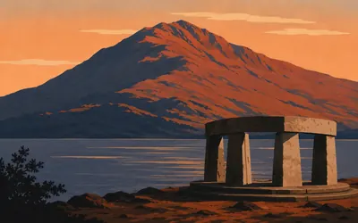
Ben Lomond
A mountain that stands as a memorial
At Rowardennan the road ends and a path leaves the lochside for the summit of Ben Lomond, three thousand one hundred and ninety-three feet above the water.
- The National Trust for Scotland records the landscape around Ben Lomond as designated a war memorial in 1995.
- With Forestry and Land Scotland's adjoining ground the memorial landscape is around 4,000 hectares.
- The Trust gives Ben Lomond as 3,193 ft, or 974 m, and calls it the most southerly Munro.
49 km (31 miles) · heritage
Rowchoish Bothy
A byre with a door that is never locked
Historic Environment Scotland describes this bothy as a former byre of a nineteenth-century shepherd's farmstead, in woodland at the foot of Ben Lomond's north-eastern slopes. The Mountain Bothies Association records that the Scottish Rights of Way Society renovated it in 1965 and dedicated it to William Ferris, and that the MBA took it on in 1977.

54 km (34 miles) · nature
Inversnaid
Rainforest, and a barracks built for one man
The east shore of Loch Lomond stops being a walk here and turns into a scramble over roots and boulders, under a wood the RSPB describes as an internationally important example of rare Atlantic oak woodland, a habitat so rich that it is also called temperate rainforest.
- The RSPB calls the wood here an internationally important example of rare Atlantic oak woodland, or temperate rainforest.
- The reserve is over 800 hectares and rises to the 770 m summit of Beinn a' Choin.
- Historic Environment Scotland dates the Inversnaid Garrison to 1718 to 1719.
65 km (40 miles) · heritage
The Drovers Inn
An inn already marked on a map of 1776
Historic Environment Scotland lists the Drovers Inn as dating from the eighteenth century, noted as an inn on a map of 1776, and likely a droving inn on the old boundary between Perthshire and Dunbartonshire. It probably housed troops while Caulfeild built the military road from Tarbet to Crianlarich between 1748 and 1753.
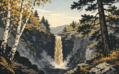
68 km (42 miles) · nature
The Falls of Falloch
Thirty feet, and a poet's line cut into steel
Glen Falloch takes the Way up out of the loch head, and the river drops into a pool beside the path.
- The National Park Authority gives the Falls of Falloch as thirty feet high.
- The Woven Sound viewpoint shelter was designed by John Kennedy.
- A Dorothy Wordsworth diary entry is etched into the shelter's steel.
Strathfillan to Rannoch Moor
74–152 km · 17 places
74 km (46 miles) · landmark
Crianlarich
Halfway, and a junction of everything
The Way skirts Crianlarich on the hillside rather than entering it, and the trail custodian calls this the halfway point. Two military roads met in the village in the 1750s. The upper station opened on 7 August 1894 and is now the junction of the lines to Oban and Fort William.
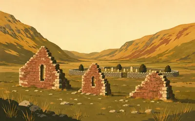
79 km (49 miles) · heritage
St Fillan's Priory
A king's priory, and the path straight through it
Three fragments of wall stand in a field beside the trail at Kirkton, with a graveyard behind them.
- Historic Environment Scotland records the priory as founded in 1317 or 1318 and dissolved in 1607.
- The site began as a non-parochial chapel of the late thirteenth century.
- The scheduling excludes the top 0.3 m of the West Highland Way track so the path can be maintained.
81 km (51 miles) · heritage
Dal Righ
A defeat with no contemporary witness
Historic Environment Scotland records this as the site of a battle between King Robert I and MacDougall of Lorn in 1306, while noting in the same breath that there are no contemporary authorities for it. The National Park Authority passes on the legend that the king threw his sword into a small lochan here to get away more quickly.
84 km (52 miles) · engineering
The Tyndrum Lead Mines
Shafts, adits and a tub-way down to the village
Historic Environment Scotland's scheduling calls these the remains of one of the largest lead mines in Scotland, worked from at least the later eighteenth century until the site was abandoned in the early twentieth. The protected ground runs 830 m by 400 m and takes in shafts, adits, dressing floors, reservoirs, stables and a tub-way running down to the village.
90 km (56 miles) · engineering
The Auch Viaduct
Nine spans on the horseshoe curve
The national record gives this viaduct as opened on 11 August 1894 and still in use, a lattice girder structure 576 feet long in nine spans of sixty feet, its girders hoisted into place with cantilever lifting tackle. The trail custodian calls it the Kinglass Viaduct. The railway swings right round the head of the glen to gain height.
95 km (59 miles) · engineering
Bridge of Orchy
A hump-backed arch on a soldiers' road
Historic Environment Scotland's listing describes a single segmental arch, hump-backed, random rubble, on the old road to Ballachulish and Fort William, and dates it 1742 with a question mark after it. The national record instead puts it in or shortly before 1751 and names Major Caulfeild as the engineer. Two authorities, one bridge, a decade apart.
99 km (62 miles) · heritage
Inveroran
A last bridge before the moor
Drochaid Tolaghan, listed by Historic Environment Scotland as an eighteenth-century segmental arch of random rubble on the old road to Ballachulish and Fort William, carries the Way over the burn at Inveroran. Beyond it the old road climbs onto Rannoch Moor and stays there.

107 km (66 miles) · nature
Rannoch Moor
Bog, lochans and a soldiers' road across the middle
For hours there is nothing but moor.
- NatureScot calls Rannoch Moor one of the most extensive and undisturbed blanket bog and fen complexes in Britain.
- NatureScot says it is the only place in Britain where the Rannoch-rush is found.
- Historic Environment Scotland dates the military road here to about 1752 to 1753 and attributes it to Major William Caulfeild.
112 km (70 miles) · landmark
Blackrock Cottage
A white cottage where two roads met
Historic Environment Scotland's listing describes a whitewashed rubble cottage with battered walls and a corrugated iron roof, standing where the old military road met a trackway, of uncertain date and possibly eighteenth century. It appears on the 1870 map as Tigh Craige-duibhe, and the Ladies' Scottish Climbing Club has rented it since 1947.
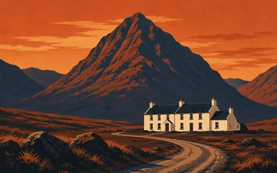
114 km (71 miles) · heritage
The King's House
A king's house at the head of the glen
A white building stands alone where the moor ends and Glen Coe begins, with the pyramid of Buachaille Etive Mor filling the sky behind it.
- Historic Environment Scotland records the King's House as built about 1750 for troops and travellers.
- Historic Environment Scotland keeps 'kingshouse' as a site classification for the military roads' staging inns.
- The building was dropped from the statutory list of buildings in 1985.
121 km (75 miles) · viewpoint
The Devil's Staircase
The high point, at five hundred and fifty metres
The trail custodian calls this the highest point of the West Highland Way, at 550 m, marked by a cairn. The zigzags climb an eighteenth-century military road, and the national record holds a 1776 survey milestone standing on them. Where the name came from, no authority will say. Two carved oak pillars were raised at the top in 2023.
123 km (76 miles) · engineering
The Blackwater Dam
Built by hand, three miles off the path
Three and a half kilometres east of the trail stands the dam that made Kinlochleven work. Historic Environment Scotland's category A listing gives P W and C S Meik as its engineers, dates it 1904 to 1909, and calls it the longest mass concrete gravity dam in Europe. The same listing notes that it is prominently sited and reads best from the West Highland Way.
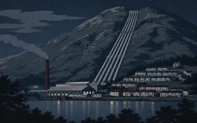
128 km (80 miles) · engineering
Kinlochleven
A village built to feed a smelter
The Way drops off the hill into a village that exists because of falling water and a demand for aluminium.
- Historic Environment Scotland calls the scheme of international significance on its completion in 1909.
- Its generating capacity remained unsurpassed until the Lochaber scheme over twenty years later.
- The smelter ceased producing aluminium in 2000; the powerhouse remains in use.
135 km (84 miles) · heritage
Tigh-na-sleubhaich
A roofless house in an empty pass
The Lairig Mor, which the trail custodian translates as the great pass, runs for miles between steep hills with almost nothing in it. Halfway along stand the walls of Tigh-na-sleubhaich, recorded in a 1998 survey as a post-medieval settlement with an enclosure and cultivation rigs beside it. People farmed here.
146 km (91 miles) · heritage
Dun Deardail
A fort whose walls were melted
Forestry and Land Scotland dates this fort to around 500 BC and records that it was destroyed in a fire hot enough to melt the rubble core of its rampart, so that the stone fractured, ran, and cooled into blocks of conglomerate. Historic Environment Scotland's scheduling notes that the wall still contains numerous fragments of vitrified rock.

147 km (91 miles) · nature
Ben Nevis
The highest ground in Britain, seen from underneath
For the last hours the Way runs beneath Ben Nevis without ever going up it.
- Ordnance Survey resurveyed Ben Nevis in 2016, measured 1,344.527 m, and changed the published height from 1,344 m to 1,345 m.
- The John Muir Trust took on guardianship of the Ben Nevis estate in July 2000.
- NatureScot calls Ben Nevis and its neighbours the only three peaks over 1,200 m outside the Cairngorms.
152 km (95 miles) · heritage
The Old Fort, Fort William
The fort that gave the town its name
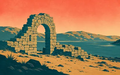
The Way comes into town past a low stub of rampart by the water, which is what the railway left of the fort the place is named after.
- Historic Environment Scotland calls it the only fort in the Highlands garrisoned from the mid-seventeenth century into the nineteenth.
- The fort was built in the 1650s under General Monck and refortified in the late 1680s.
- Nineteenth-century railway works removed about two thirds of the fort.
Take on West Highland Way and collect these places as you reach them
Common questions
How does my walking count towards Fort William?
Hook up Strava or Apple Health and each walk, run or ride you log pushes you north from Milngavie of its own accord. A walker at 30 km a week reaches Fort William in around five weeks; 50 km a week brings it down to about three. There is no upload step and no mileage to type in.
Do I have to be in Scotland?
No. The Way lends you its length and nothing else, so pavements, parks and treadmills anywhere count towards it. You will not cross Rannoch Moor or come down through Glencoe, but you will have covered the same 153 km that separates Milngavie from the foot of Ben Nevis.
How long does the West Highland Way take to walk?
At 30 km a week you finish in around five weeks. Build to 50 km a week and you reach Fort William in about three weeks. You fix the finish date at creation, so the pace is yours to hold.
Is this a good first Scottish trail?
Yes, it is Scotland's most accessible long-distance route. The distance is manageable in a month at a steady pace, the waymarking on the real trail is excellent, and the Highland scenery makes the virtual version feel rewarding even from your local streets.
Start your West Highland Way Conquest
Connect Strava or Apple Health once and every ride, run or walk you record syncs automatically, moving you along the route without anything else to log.