Virtual Pennine Way Challenge
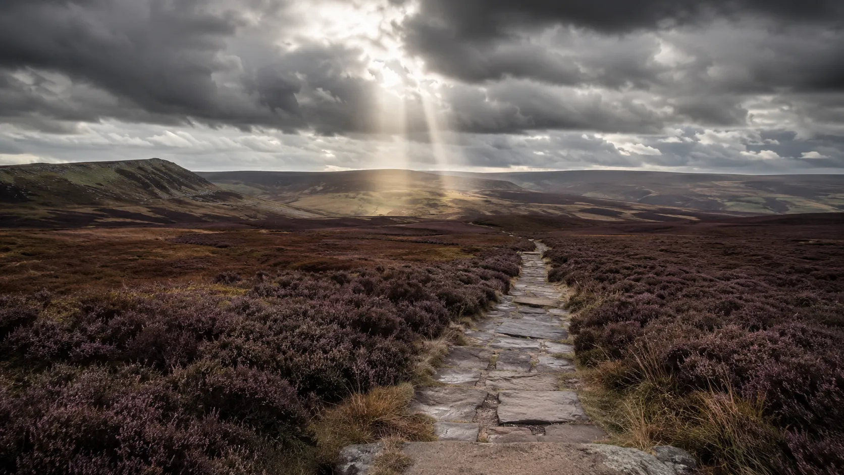
Take on Britain's oldest and toughest long-distance trail from wherever you already train. The Pennine Way runs roughly 397 km (about 247 miles) from Edale in the Peak District north along the spine of the Pennines through the Yorkshire Dales, Cross Fell and the North Pennines to Kirk Yetholm just inside the Scottish border. Route Rally turns every synced walk, run or ride into progress along this demanding, storied trail.
Part of the National Trails series
- Route: Pennine Way
- Distance: 396.7 km
- Elevation gain: 8200 m
- Britain's toughest long-distance trail
- Best for: Longer rallies of your own for serious walkers and runners, and multi-month endurance goals
Planning your challenge
A runner averaging 40 km/week finishes in around ten weeks; a walker at 30 km/week takes roughly thirteen weeks, and a cyclist at 150 km/week completes it in about three weeks.
This is a Long route by Route Rally distance bands, and the longest and most demanding of the English national trails. Best for committed walkers and runners who want a serious multi-month goal.
Works well for serious walkers and runners who want the benchmark long-distance challenge in England and do not mind a goal that takes months to complete.
Create your own rally for your own Pennine Way target, solo or with a club, workplace or group of friends sharing one leaderboard.
Why this route
- The Pennine Way is Britain's oldest designated long-distance trail, opened in 1965 and running about 397 km (247 miles) along the backbone of England from the Peak District to the Scottish border.
- As a virtual challenge you cover the distance in your own time, with walks, runs and rides from anywhere pushing you north along the Pennine spine.
- It is widely regarded as England's hardest national trail, with sustained high moorland, long stretches of bog and few easy miles, which makes the virtual version a serious goal.
- The distance suits a multi-month target: at a consistent 40 km a week running, you reach Kirk Yetholm in about ten weeks.
- Finishing the Pennine Way, even virtually, carries genuine weight as an endurance achievement in the long-distance walking world.
Highlights
- Start at Edale in the Peak District, the traditional southern gateway to the trail
- Cross Bleaklow, Kinder Scout and the high moors of the south Pennines
- Pass through the Yorkshire Dales and along the summit of Cross Fell, the highest point in the Pennines
- Finish at Kirk Yetholm in the Scottish Borders, just over the border from Northumberland
Places along the route
Every place below is measured onto the route line, so the distance shown is where you actually reach it.
Places are researched from published sources. The distances are measured rather than estimated: we find the point on the route's own recorded line that lies nearest the place, and give the distance along the route to that point.
The Dark Peak
0–25 km · 5 places
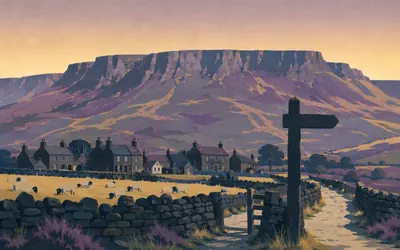
0 km (0 miles) · landmark
Edale
Kilometre zero of England's first National Trail
A field, a church, a pub and the beginning of the whole idea.
- National Trails calls the Pennine Way England's first National Trail; it opened on 24 April 1965.
- Tom Stephenson proposed it in 1935, asking for something akin to the Appalachian Trail.
- The custodian gives 268 miles officially but says an end-to-end walk is nearer 253.
5 km (3 miles) · heritage
Edale Cross
A boundary stone for a royal forest
A squat gritstone cross in a walled enclosure on the pass over to Hayfield, standing where it has always stood. Historic England's scheduling calls it a finely dressed wayside cross in its original location on an ancient route across open moorland, and rates its second job as highly as its first: it marked the edge of a royal forest, and where a forest ended so did the forest law.

7 km (4 miles) · nature
Kinder Scout
The plateau people went to prison for
A high peat plateau with no summit to speak of, groughs like trenches and, in the wrong weather, no visible horizon at all.
- The Peak District National Park Authority gives Kinder Scout as the Peak District's highest point, at 636 metres.
- Natural England's national nature reserve here covers 1,086.752 hectares.
- Six men were arrested after the 1932 mass trespass and five were imprisoned.
14 km (9 miles) · heritage
The Bleaklow Bomber
A memorial you have to walk to
On Bleaklow's open peat lie the remains of an American Superfortress, down in November 1948 on a routine flight between British bases. The Peak District National Park Authority calls it a place of memorial where several airmen lost their lives, and asks that nothing be moved or taken. It does not give a number. Neither will we. Military aircraft crash sites in the United Kingdom are protected by law.
25 km (16 miles) · heritage
The fortlet above Longdendale
One of about fifty in Britain
A rectangle of low banks on the moor edge, easy to walk past. Historic England calls it a particularly rare and well preserved example of its type in Derbyshire, and puts the type itself in perspective: about fifty Roman fortlets are known in the whole of Britain, and half of those are in Scotland. Not a fort with a garrison, a small post watching a road.
The South Pennine moors
44–86 km · 7 places
44 km (27 miles) · heritage
Castleshaw
Two forts, one platform
Down in the valley below the Standedge ridge, two Roman forts occupy the same shelf of ground: a larger one, then a smaller one built inside its footprint when fewer men were needed. They sat on the road between Chester and York. From up here you see the whole plan at once, which is the only way anyone ever sees a fort plan properly.

53 km (33 miles) · heritage
Blackstone Edge
A paved road, and two records that say nothing
A broad band of stone paving climbs the moor here with a worn groove running down the middle of it, and it is one of the more argued-over surfaces in England.
- The same stretch of road carries two scheduled-monument records with the same grid reference.
- Both are legacy old-county-number entries with no description text at all.
- Historic England therefore publishes no dating for the paving.

63 km (39 miles) · landmark
Stoodley Pike
A peace monument, twice built
A black stone obelisk forty metres high on a bare edge above the Calder valley, visible for twenty miles and impossible to mistake for anything else.
- The first monument went up in 1814-15 to mark the surrender of Paris, and later collapsed.
- The present tower is John Green's 1856 design, paid for by public subscription.
- Historic England's listing for it is a legacy entry with no reasons-for-designation text.
66 km (41 miles) · engineering
The old bridge, Hebden Bridge
The bridge the town is named after
A narrow packhorse bridge of about 1510 over the Hebden Water, with plaques on it recording repairs in 1600, 1602 and 1657. The parapet went up in 1890 because people kept falling off. It is listed and separately scheduled, and the scheduling record, like several on this route, has no description in it at all.
73 km (45 miles) · heritage
Reaps Cross
Broken, and still where it was put
A snapped shaft of gritstone standing alone on Heptonstall Moor at a meeting of old rights of way. Historic England calls it a rare example of an in situ wayside cross that retains all its original components, and notes that whole it would have been a visible and impressive landmark. Broken, on this moor, in this weather, it still is.
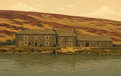
83 km (51 miles) · heritage
Ponden Hall
The house with the library, not the house on the hill
A seventeenth-century house above the reservoir, and the one Brontë building on this moor that the national list actually says something about.
- Historic England dates Ponden Hall to 1634, built for the Heatons, with an 1801 addition.
- The listing says Emily Bronte often visited and used the library here.
- It hedges the fiction twice: it is thought the house might be Thrushcross Grange.
86 km (53 miles) · heritage
The Hanging Stone
In a document in the fourteenth century
A worn stone on the watershed, marking where one church's land stopped and another's began. Historic England calls it a rare survival in Lancashire of an in situ medieval ecclesiastical property boundary marker, and notes that it turns up in a fourteenth-century document. Somebody wrote this stone down seven hundred years ago and it is still standing where they said it was.
The Craven lowland
99–152 km · 12 places
99 km (62 miles) · heritage
Burwen Castle
Cut in half by a railway
Not a castle. Two Roman forts on one site at Elslack, built one after the other, with the Skipton line driven straight through the middle of them in the nineteenth century. Historic England notes drily that much survives undisturbed anyway, and that having two forts on one platform shows how the design of a rare monument type changed over time.
107 km (67 miles) · heritage
Kirk Sink
Wooden water pipes with iron collars
A Roman villa in a field at Gargrave, the most westerly of the Vale of York group. Two things are unusual enough for the register to say so: round timber-and-turf houses, one still in use into the villa period, the old way living next door to the new, and a water supply of wooden pipes with iron collars, which Historic England says has at present been recognised nowhere else.
113 km (70 miles) · heritage
Airton Meeting House
Worship without a break since the 1690s
A plain low building beside the green with a stone bench outside it, funded by William and Alice Ellis around the turn of the eighteenth century and possibly built into an older cruck barn. Historic England's reason for listing it is not the architecture: it has been in continuing use for worship since at least the 1690s. Three hundred years of people sitting in silence in the same room.
115 km (72 miles) · heritage
St Michael the Archangel, Kirkby Malham
Four roofs and three bells
A late fifteenth-century church of squared millstone grit, listed at the top grade, restored hard in 1879. The listing catalogues its roofs one by one, lead over the aisles, slate over the nave, stone slate over the hearse house, and ends by naming the three bells in the tower and their dates: 1601, 1617 and 1785.
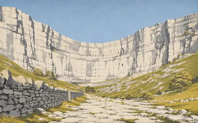
118 km (74 miles) · nature
Malham Cove
Seventy metres of white limestone, and no waterfall
The path comes round a corner and there it is: a curved white wall seventy metres high across the whole head of the valley, which the Yorkshire Dales National Park Authority says has amazed visitors for centuries and which is hard to argue with.
- The Yorkshire Dales National Park Authority gives the cliff as 70 metres (230 ft) high.
- A waterfall once came over the top; the stream now runs underground.
- Peregrines have nested on the face since 1993, and the viewpoint is announced to run again in 2026.
121 km (75 miles) · heritage
The cross base at Water Sinks
The cross is gone; the base still points the way
A socketed block of limestone beside the track where the Malham Tarn outflow disappears into the ground. The cross that stood in it is long lost. Historic England's point is that the base is not: it is one of a group along Mastiles Lane that between them still mark a monastic route across this moor, and a route you can still follow is worth more than a cross you cannot.
122 km (76 miles) · heritage
Mastiles Lane
A Roman camp with a monk's cross inside it
A green walled lane across the limestone, used by Fountains' monks to move sheep between granges. Where it crosses the moor is a Roman marching camp, and inside the camp a medieval cross base: a thousand years of traffic on one patch of grass. Historic England suggests the camp may belong to the campaigns of Cerialis or of Agricola at the end of the first century, and does not choose.
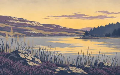
123 km (76 miles) · nature
Malham Tarn
A lake on limestone, which should not work
Limestone does not hold water, which is the whole trouble with this landscape and the reason the streams keep vanishing.
- Natural England's national nature reserve at Malham Tarn covers 147 hectares.
- The Park Authority says the tarn is said to be the highest limestone lake in Britain, at 380 metres.
- Natural England's own description of the reserve makes no such claim.
130 km (80 miles) · engineering
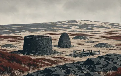
Fountains Fell colliery
A coal mine at six hundred metres
Near the top of a fell that has nothing on it, the ground is pocked with shaft mouths and there is a squat stone drum, roofless, that was a coke oven.
- The colliery was founded around 1807 by Lord Ribblesdale to fuel zinc processing at Malham.
- Historic England calls the coke oven one of the earliest surviving beehive examples.
- It adds that most beehive ovens date from after 1840.
131 km (81 miles) · viewpoint
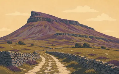
Pen-y-ghent
The smallest of the three, and the one you climb
It looks like a crouching animal from the south and it is the only one of the Yorkshire Three Peaks the Pennine Way actually goes over.
- The Yorkshire Dales National Park Authority gives Pen-y-ghent as 694 m (2,277 ft).
- It is the smallest of the Yorkshire Three Peaks and the only one on the Pennine Way.
- A scheduled round barrow on the fell is known as the Giant's Grave.
140 km (87 miles) · heritage
St Oswald's, Horton in Ribblesdale
A twelfth-century nave and a zig-zag font
The church at the foot of Pen-y-ghent, where the Three Peaks walkers start and finish and where the Pennine Way comes down off the fell. Grade I listed for a twelfth-century nave inside a mostly fifteenth-century building, and for a Romanesque font the listing describes with satisfying precision: zig-zag moulding to the bowl, on a square base with splayed sides.
152 km (94 miles) · heritage
The cairn above Cam Pasture
Somebody buried up here on purpose
A low heap of stones on the high green road, scheduled and easily missed. Whoever was under it was put where the track ran and where the view goes for thirty miles, which was not an accident. The Way follows the same line they did.
Wensleydale and Swaledale
160–186 km · 5 places
160 km (100 miles) · engineering
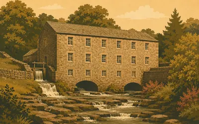
Gayle Mill
Cotton, then wool, then timber, then the village lights
A plain three-storey rubble mill of about 1784 over Gayle Beck, which has spent two and a half centuries refusing to become redundant.
- Built around 1784 as a cotton mill, then re-equipped for wool, then converted to sawing.
- Its two Williamson of Kendal water turbines still work.
- The turbines supplied Gayle's electric light from 1919 to 1948.

163 km (101 miles) · nature
Hardraw Force
Reached through a pub
A single unbroken fall of water over an overhanging lip into a wooded amphitheatre, and the way in is past the Green Dragon Inn, on ground its operator runs separately from the pub.
- The Park Authority calls Hardraw Force the highest single drop waterfall in England.
- The waterfall's own operator calls it the largest, at a reputed 100 feet.
- Access is past the inn at four pounds a head, through a turnstile when the centre is unmanned.
179 km (111 miles) · engineering
Beldi Hill
One of the best preserved in the Dales
Above Keld the hillside is scarred with hushes, spoil and the shells of a lead dressing floor. Historic England calls the ore works one of the best preserved in the Yorkshire Dales, with unusual structures, and is blunt on the date: it is not known exactly when the complex was developed, sources suggest the mine was driven in 1843, and it is certainly shown on the 1857 Ordnance Survey map.
183 km (114 miles) · engineering
West Stonesdale mine
A hydraulic engine in a stone shed
A roofless engine house on a bare hillside above the Stonesdale road, put up around 1850 to work the west end of the Blakethwaite vein. What was in it was unusual enough for the register to say so: the only known hydraulic engine in this part of the Yorkshire Dales, water doing the work that steam did elsewhere, because water was what there was.
186 km (116 miles) · landmark
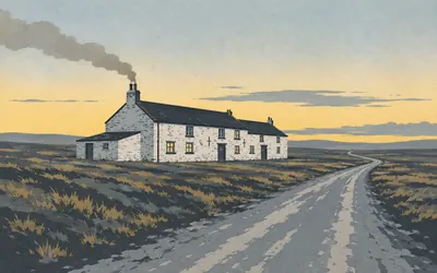
The Tan Hill Inn
Said to be the highest pub in Britain
There is nothing else.
- The listing gives 1,732 feet and says the inn is said to be Britain's highest public house.
- The inn's own site states the same claim without the hedge.
- It is an early-to-mid eighteenth-century building of squared rubble.
Stainmore, Baldersdale and Teesdale
196–225 km · 7 places
196 km (122 miles) · heritage
The tower above Stainmore
One of a chain, probably
A Roman tower stood on this spur above the Stainmore pass, right beside the road it watched. Historic England is careful about what it was for: one of a group of towers thought to have been used for signalling across Stainmore. Thought to have been. The pass is the lowest crossing of the northern Pennines and everything has come through it, which is why somebody always wants to see who.
197 km (122 miles) · heritage
The cairnfield on Ravock
Six scheduled monuments on one bare moor
Bowes Moor looks like nothing at all and is covered in Bronze Age field clearance. Within two kilometres of the path here the national list carries six separate scheduled entries on Ravock alone: cairnfields, single cairns, carved rocks, a Roman aqueduct. Somebody cleared these stones off this ground to grow something on it, three thousand years ago, at four hundred metres, in this wind.
211 km (131 miles) · engineering
Middleton Bridge
Listed twice, dated twice, four metres apart
A single segmental arch over the Tees, with blind roundels in the spandrels. It carries two entries on the national list, four metres apart, because it straddles two parishes and was listed under each. The descriptions were written independently and do not agree: one dates it circa 1800 with a repair in 1984, the other circa 1814 with alterations around 1980. Same bridge, two official dates.
214 km (133 miles) · heritage
The shielings on Crossthwaite Scars
Eight summer huts and a path between them
A shieling is a hut you live in for the summer while your animals eat the high grass, and then you go home. Eight of them are scheduled together on this scar, with the track that joined them. It is the plainest possible evidence of a way of working the Pennines that lasted centuries and then simply stopped.

217 km (135 miles) · engineering
The Wynch Bridge
A miners' footbridge over Low Force
A narrow chained footbridge swinging over the Tees just above Low Force, built about 1820 for the Duke of Cleveland.
- The present bridge dates from about 1820, built for the Duke of Cleveland.
- Its predecessor, erected before 1757, was said by the listing to have been the earliest in Europe.
- Both were built so that Holwick lead miners could reach the Middleton mines.

219 km (136 miles) · nature
High Force
The Whin Sill, in one drop
The whole Tees goes over a wall of hard black dolerite in one piece and lands twenty-one metres down in a plunge pool you can feel through your boots.
- Raby Estates gives the drop as 21 metres and calls it one of the largest waterfalls in England.
- Natural England's reserve description makes no size claim about it at all.
- The lip is dolerite of the Whin Sill, harder than the rock beneath it.

225 km (140 miles) · nature
Widdybank Fell
Arctic flowers that never left
The path runs the flat floodplain of the Tees under Cronkley Scar across ground that looks like poor grazing and is one of the strangest botanical sites in Britain.
- The JNCC calls Moor House-Upper Teesdale one of the most important arctic-alpine refugia in the UK.
- Historic England says around 100 burnt mounds have been identified in England.
- It hedges their purpose: cooking with heated stones is the most likely use.
Cross Fell and the South Tyne
259–289 km · 9 places
259 km (161 miles) · viewpoint
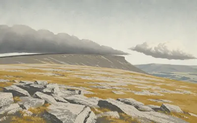
Cross Fell
The only named wind in the country blows here
National Trails calls this the highest point on the Pennine Way and adds that it was once known as Fiend's Fell, which tells you how it was regarded before it was renamed.
- National Trails calls Cross Fell the highest point on the Pennine Way.
- The Met Office says the Helm Wind is the only named wind in the UK.
- Historic England's scheduling for the Cashwell workings notes they lie adjacent to the Pennine Way.
268 km (166 miles) · engineering
Fletcheras Rake
Two hundred and fifty one out of ten thousand
A rake is the trench left where men followed a lead vein along its outcrop and took the shallow ore. Historic England puts it in context: about ten thousand lead-industry sites are thought to survive in England, spanning nearly three thousand years, and two hundred and fifty one, about two and a half per cent, are nationally important. This is one of the two hundred and fifty one.
273 km (169 miles) · heritage
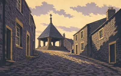
Alston
A cobbled hill, and an argument with Buxton
A steep cobbled market street with a stepped cross at the top of it, first put up in 1764 by a local boy who became Lord Mayor of London, knocked down twice in living memory and re-erected both times.
- The market cross was first erected in 1764 by Sir William Stephenson, Lord Mayor of London.
- It was knocked down and re-erected in 1970 and again in 1981.
- Alston Moor Parish Council minuted in 2017 that the town took the highest-market-town title back from Buxton.
273 km (169 miles) · engineering
High Mill, Alston
The only Smeaton water mill left
A corn mill of 1767 by John Smeaton, the engineer of the Eddystone lighthouse, extended by 1775 and later raised. Historic England says it is considered to be the only surviving water mill Smeaton designed, and reserves its warmest language for the machinery: an almost complete cast-iron and timber wheel of 1817, genuine pitchback design, a fine example of extreme interest.
277 km (172 miles) · heritage
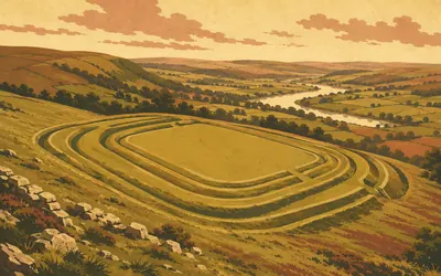
Epiacum
A fort with an unreasonable number of ditches
Also called Whitley Castle, though there is no castle.
- Historic England's own scheduling text names the fort Epiacum.
- The monument includes the fort and part of its civilian settlement, the vicus.
- It has been a scheduled monument since 30 November 1925.
277 km (172 miles) · heritage
The cross at Kirkhaugh
Ten metres south of the church door
The national list is at its most literal here. The listed thing is a cross, and the official name of the listed thing is its position: ten metres south of the parish church door. Kirkhaugh's church has a needle spire visible a long way down the South Tyne, and the cross has presumably been standing beside it for as long as anyone has bothered to measure the distance.
285 km (177 miles) · heritage
The Maiden Way
A Roman road under your boots
Over Hartleyburn Common the Pennine Way walks on the Maiden Way, the Roman road from the Eden valley up to the Wall. Historic England calls this section well preserved and says what it was for: a key component of the military conquest and subsequent occupation of northern England. Two thousand years of people getting from here to there by the same line, because it is the only sensible one.
287 km (178 miles) · engineering
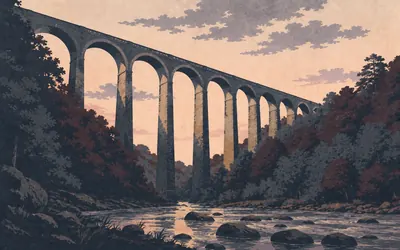
Lambley Viaduct
Thirty-three metres of nothing underneath
Nine tall arches carrying a dead railway over the South Tyne, thirty-three metres above the water, built in 1852 for the Alston branch of the Newcastle and Carlisle.
- The viaduct dates from 1852 and carried the Alston branch of the Newcastle and Carlisle Railway.
- The listing gives its height as over 33 m above the river and calls it spectacular.
- Historic England hedges the engineer: probably Sir George Barclay-Bruce.
289 km (180 miles) · heritage
Featherstone Castle
A tower, a hall and a Georgian afterthought
A grey pile in a bend of the South Tyne, Grade I listed, built in three goes. The register hedges the oldest part, possibly an early thirteenth-century hall house in the west range, then gets specific about the tower: early fourteenth century, three stages, L-plan, loops, corner bartizans and a slightly taller look-out turret. Most of it is Thomas Wallace's remodelling of the 1810s and 20s, built to match.
Hadrian's Wall, briefly
303–307 km · 2 places
303 km (189 miles) · heritage
Great Chesters
Aesica, and a brooch shaped like a hare
A fort the Romans called Aesica, 129 metres by 109 across its ramparts, above the Caw Burn. It is quieter than its neighbours, but the west tower of its south gate gave up a hoard of jewellery: an enamelled brooch shaped as a hare, and a gilded bronze brooch Historic England calls a masterpiece of Celtic art. Somebody hid their good things there and never came back.
307 km (191 miles) · viewpoint
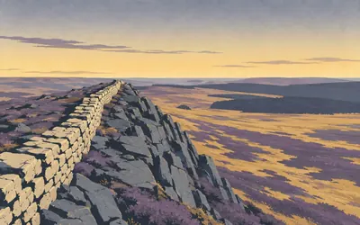
Winshields Crags
The highest the Wall ever gets
For twelve kilometres the Pennine Way and Hadrian's Wall are the same walk, and this is the top of it.
- English Heritage gives Winshields as the Wall's highest point, at 345 metres.
- Hadrian's Wall is a World Heritage Site.
- The Pennine Way leaves the Wall northward at Rapishaw Gap.
The North Tyne and Redesdale
322–397 km · 11 places
322 km (200 miles) · heritage
Horneystead bastle
A farmhouse built to be attacked
A bastle is a farmhouse with metre-thick walls, animals downstairs, family upstairs and no way between the floors but a ladder you could pull up. People built them along this border for two hundred years because raiding was not an event, it was the weather. Historic England notes the commanding defensive position above the Warks Burn, which is a polite way of saying they could see them coming.
325 km (202 miles) · heritage
The farmstead above the Warks Burn
A palisade first, then a wall
Two settlements on one patch of ground, and the order matters: a palisaded enclosure first, then a Romano-British farmstead over the top of it. The first people here fenced themselves in with timber; the ones who came after used stone. The register records both in a single line and leaves you to work out the gap between them.

331 km (206 miles) · heritage
St Cuthbert's, Bellingham
A church roofed in stone slabs on a stone vault
From outside it is a low grey church in a border village.
- The listing describes a stone barrel vault over the nave with fifteen transverse ribs.
- It calls the roof remarkable, with alternating single and double thicknesses of stone slab.
- The chancel is roofed in Lakeland slate instead.
331 km (206 miles) · engineering
Hareshaw Ironworks
Five hundred men and boys, then nothing
Overgrown ramps and furnace footings in a wooded burn behind Bellingham. Batson, Campion and Company opened the works in 1839, making pig iron from local coal, ore and limestone, coking the coal first and blowing the furnace cold. By the 1841 census about 150 foundry workers were living in the village; at its height the company employed about 500 men and boys.
352 km (219 miles) · heritage
The Three Kings
Four stones called three
A four-poster: four standing stones set at the corners of a square, on a terrace above the Rede with the view open east, south and north. One of the four has fallen, which is presumably why the name counts three. Digging inside the setting found a Bronze Age round cairn, so the stones were put round a grave rather than the other way about.
362 km (225 miles) · heritage
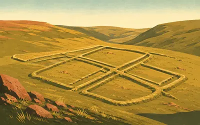
Chew Green
Seven monuments in one field, at four hundred metres
The official name of this scheduled monument is a list: a Roman fort, two Roman fortlets, two Roman camps, a section of Roman road, and a medieval settlement and chapel.
- One scheduling covers a fort, two fortlets, two camps, a Roman road and a medieval settlement and chapel.
- Dere Street runs immediately past it.
- Historic England calls the Roman military complex very well preserved.
373 km (232 miles) · heritage
The cairn on the border
Nine metres across, in two countries
A low round cairn of stone and earth on the western shoulder of Windy Gyle, nine metres across and a metre high, which Historic England records as straddling the England-Scotland border. Whoever piled it up was not thinking about that. The line arrived later and went straight over the top of them.
373 km (232 miles) · heritage
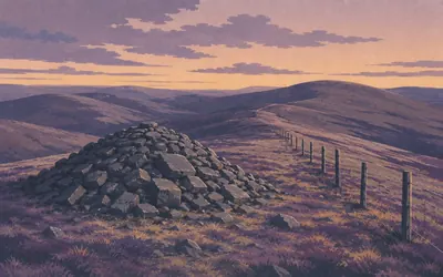
Russell's Cairn
A Bronze Age grave with a Tudor name
A big cairn on the summit ridge of Windy Gyle, right on the border, prehistoric and visible for miles.
- The cairn is prehistoric and sits on the England-Scotland border on Windy Gyle.
- Historic England says it is traditionally connected with Lord Russell.
- The register hedges the killing twice: traditionally connected, and it is said.
387 km (241 miles) · heritage
The College valley shielings
Five scheduled monuments on one hillside
In the College valley the national list carries five scheduled entries within a kilometre of the path: a Bronze Age cairnfield, a prehistoric enclosure, a Romano-British settlement and medieval shielings. The Northumberland National Park Authority's rangers and volunteers built two shelters on the ridge behind you with the mountain rescue team, materials flown out by the RAF. The Cheviot, at 815 metres, is the park's highest point.
393 km (244 miles) · heritage
Tuppie's Grave
A name nobody can account for
Two round cairns on the last hill before the border comes down to the road, scheduled as lying south west of a place the register calls Tuppie's Grave. Who Tuppie was, or whether there was a Tuppie, no authority says. The name has outlasted the explanation, which is the usual order of things up here.
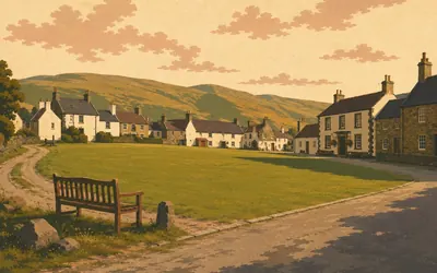
397 km (247 miles) · landmark
Kirk Yetholm
Two hundred and sixty-eight miles, and a half pint
A triangular green, a few houses, a hotel and the end of it.
- The Border Hotel offers finishers a free half pint; National Trails' own pages do not mention it.
- Historic Environment Scotland records the Gypsy Palace as a whitewashed cottage on the village green.
- No listing or scheduling exists for either palace site, though six other Kirk Yetholm buildings are listed.
Take on Pennine Way and collect these places as you reach them
Common questions
How does my walking count towards Kirk Yetholm?
Whatever Strava or Apple Health records is credited without you asking, moving you north along the Pennine spine from Edale. Route Rally counts distance, not bog: at 30 km a week Kirk Yetholm arrives in roughly thirteen weeks, and at 50 km a week in about eight.
Do I have to walk on the Pennines?
No. England's hardest national trail becomes a distance to cover here, so pavements, parks and treadmills all count towards it. What the virtual version keeps is the scale: 397 km is a long way however flat and dry your own routes are, and finishing still takes months of steady weeks.
How long does the Pennine Way take to walk?
At 30 km a week it takes roughly thirteen weeks, or about three months. Build to 50 km a week and you can finish it in around eight weeks. You choose how long the rally runs for when you create it.
Is the Pennine Way the hardest national trail?
It is widely regarded as the hardest in England, combining its length with sustained high moorland, navigation challenges and stretches of bog that slow real-world walkers considerably. As a virtual challenge the difficulty is the time and consistency required to cover the distance.
Start your Pennine Way Conquest
Connect Strava or Apple Health once and every ride, run or walk you record syncs automatically, moving you along the route without anything else to log.