Virtual Pembrokeshire Coast Path Challenge
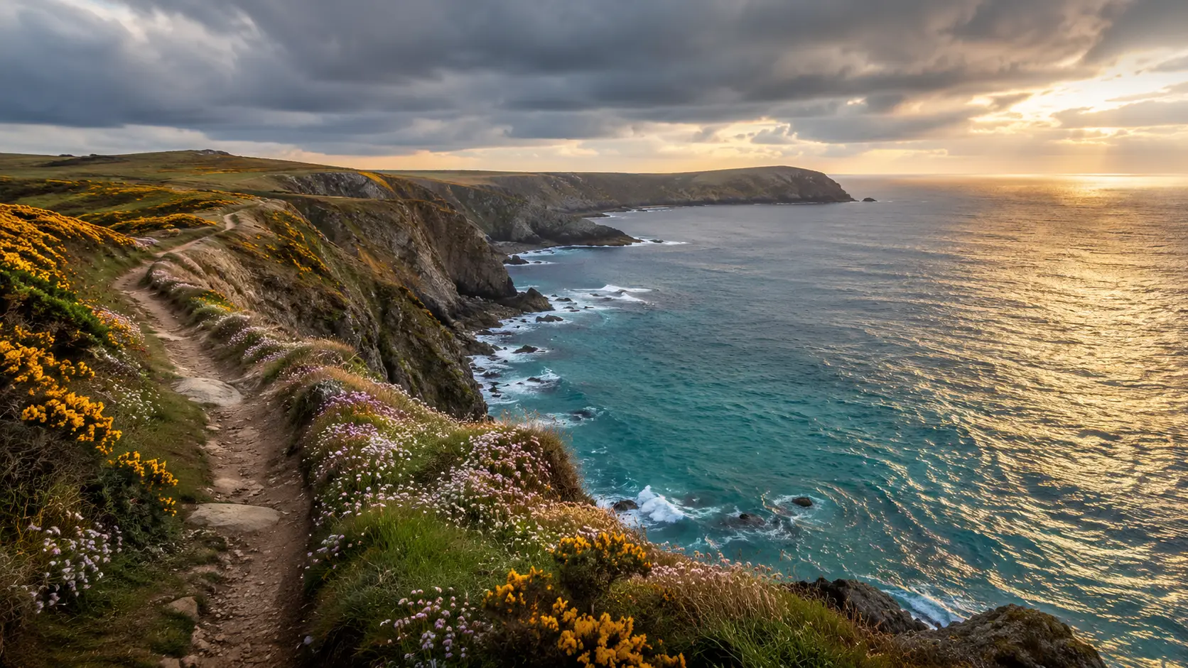
Walk one of Britain's most dramatic coastal routes from your own trails and roads. The Pembrokeshire Coast Path runs roughly 284 km (about 177 miles) around the clifftops and headlands of the Pembrokeshire coast national park in Wales, taking in wild sea views, secluded coves and the ancient landscape of the far west. Route Rally turns every synced walk or run into progress along this rugged, rewarding trail.
Part of the National Trails series
- Route: Pembrokeshire Coast Path
- Distance: 284.4 km
- Elevation gain: 8206 m
- Wild clifftop coastal challenge
- Best for: Longer rallies of your own for walkers and runners, and coastal route goals
Planning your challenge
A walker averaging 30 km/week finishes in around nine to ten weeks; a runner at 40 km/week takes about seven weeks, and a cyclist at 150 km/week completes it in around two weeks.
This is a Long route by Route Rally distance bands, and the most demanding coastal route in Wales, best when you want a challenge that keeps going for a couple of months.
Works well for walkers and runners who want a dramatic coastal route with real variety and a challenge that spans multiple weeks.
Create your own rally for your own Welsh coastal target, solo or with a group sharing one leaderboard.
Why this route
- The Pembrokeshire Coast Path follows the clifftops of Wales's only coastal national park for about 284 km (177 miles), from Amroth in the south to Cardigan Bay in the north.
- As a virtual challenge you cover the distance in your own time, with walks and runs from anywhere pushing you further around the wild Pembrokeshire headlands.
- The route is known for its dramatic cliff scenery, secluded beaches and strong Atlantic winds, all of which make it one of the toughest coastal paths in Britain.
- Its length suits a multi-month goal: a consistent daily walking habit accumulates steadily towards the remote bays and headlands of the far west.
- It is primarily a walking and running route, and the terrain means those weekly distances add up more slowly than on flatter trails.
Highlights
- Start at Amroth on Carmarthen Bay at the southern end of the national park
- Follow dramatic cliff edges around St Govan's Head and the Stackpole headlands
- Pass the cathedral city of St Davids, the smallest in Britain, on the western tip of Wales
- Finish at St Dogmaels near Cardigan on the north coast of the park
Places along the route
Every place below is measured onto the route line, so the distance shown is where you actually reach it.
Places are researched from published sources. The distances are measured rather than estimated: we find the point on the route's own recorded line that lies nearest the place, and give the distance along the route to that point.
Amroth to Manorbier
0–23 km · 6 places
0 km (0 miles) · landmark
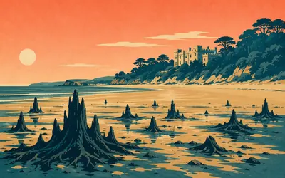
Amroth
Where it starts, or ends
Amroth is where it starts, or where it ends if you are walking the other way, and the National Park Authority puts it exactly like that.
- National Trails records the Pembrokeshire Coast Path as opened in 1970 and the first National Trail in Wales.
- Cadw lists Amroth Castle at Grade I, recording a feudal residence here from the early Middle Ages, extensively rebuilt in the early eighteenth century.
- The National Park Authority records that at extremely low tides the stumps and trunks of an ancient submerged forest are occasionally exposed at Amroth.
4 km (3 miles) · engineering
The Saundersfoot tramway tunnels
The coast path on a coal line
Coal came down to Saundersfoot on a horse-drawn dramway, and the Park Authority records that the path follows the line of the disused colliery railway. Ore was dug from patches in the sea cliffs between here and Amroth and worked at the Kilgetty ironworks up Pleasant Valley. The monuments record carries the tunnel at Coppet Hall and a foundry at Wiseman's Bridge.
11 km (7 miles) · heritage
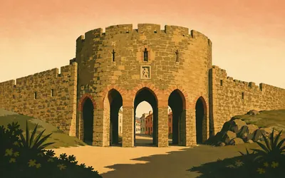
Tenby Town Walls
Four defences, four centuries, one small town
Cadw calls these one of the most important surviving medieval city walls in Britain, and Britain is their scope, not ours.
- Cadw describes Tenby's town walls as one of the most important surviving medieval city walls in Britain.
- The circuit once had three gateways and twelve towers, and Cadw records that only the Five Arches survives of the gates.
- Cadw dates Fort St Catherine to 1868 to 1870, built on the site of a medieval chapel, and calls it the only fortification built outside the Haven.
15 km (9 miles) · heritage
Caldey Priory
A cell of the abbey where this path ends
An island of monks, two and a half kilometres out. Cadw records that Robert Fitzmartin was granted Caldey in 1113 and his mother Geva founded the priory as a cell of the Tironian abbey at St Dogmaels, which is where this path finishes. Sold to Anglican Benedictines in 1906, and to a Cistercian order in 1928, and the Park Authority says it is still a working monastic community.
18 km (11 miles) · heritage
The Old Palace, Lydstep
Called a palace, and nothing of the kind
A medieval house with a job. Cadw records an undefended first-floor hall of limestone masonry, about twenty metres by seven, which also served as the court of the manor of Manorbier and Penally. It is called the Old Palace and it was never anything of the sort.

23 km (14 miles) · heritage
King's Quoit
Two authorities, several thousand years apart
A capstone three and a half metres long, two and a half wide and half a metre thick, propped on two small uprights and on the slope of the hill itself.
- Cadw gives the capstone as three and a half metres long, two and a half wide and half a metre thick, supported by two small uprights and the sloping ground.
- Cadw dates King's Quoit to the Neolithic, about 4400 to 2900 BC, while the National Park Authority's own page calls it Mesolithic.
- Cadw records Manorbier Castle as first mentioned in 1146 as the birthplace of Gerald de Barri, Giraldus Cambrensis, and believes it was never seriously besieged.
Stackpole and Castlemartin
33–53 km · 5 places
33 km (20 miles) · heritage
Stackpole Court
The park outlived the house
Cadw's register of parks and gardens carries this at Grade I for a designed landscape developed from the early eighteenth century onwards, and says that at its height Stackpole would have rivalled some of the best estates in Britain. The house itself has gone: Cadw records it demolished in the 1960s. You walk through the park it left behind.

36 km (23 miles) · nature
Stackpole
The lily ponds were dug
The lily ponds are not natural.
- Cadw's register records the Bosherston lily ponds as some eighty acres of water created by the Campbell family between about 1780 and about 1840.
- Natural Resources Wales describes Broadhaven and Barafundle Bay as two of Pembrokeshire's finest beaches, both inside the reserve.
- The reserve was first declared in 1981 and extended in 1995.
40 km (25 miles) · heritage
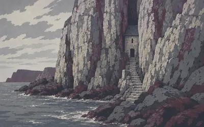
St Govan's Chapel
A chapel in a crack, inside a firing range
A chapel wedged into a fissure in the cliff, on a ledge, reached down a flight of steps from the top.
- Cadw records the chapel as built across a gap in the cliffs at the cleft where Saint Gobhan, abbot of Dairinis, who died in 586, was believed to have hidden from pirates.
- The chapel was scheduled as an ancient monument on 2 July 1958.
- Access is controlled by the Castlemartin firing range, and the National Park Authority publishes a telephone number to check whether the path is open.
44 km (28 miles) · heritage
Flimston Bay Camp
The fort is listed, the arch is not
An Iron Age promontory fort above the Elegug Stacks. The Park Authority explains the name: elegug is Welsh for guillemot, and the stacks are two detached pillars of limestone. Just along is the Green Bridge, which the Authority describes as a natural arch carved by the waves. Neither the stacks nor the arch carries a heritage record. The fort does.
53 km (33 miles) · heritage
The seaweed hut, Freshwater West
The last of twenty
A small stone hut on the dunes, listed by Cadw, and the last of twenty. Cadw records that gathering red laver at Freshwater West became an organised trade in 1879, run by speculators from Swansea and worked by women from Angle. By the early twentieth century twenty huts stood here, drying and storing the weed before it went to Pembroke and Swansea. The trade died out about 1940.
The Milford Haven waterway
61–147 km · 10 places
61 km (38 miles) · heritage
West Angle Bay promontory fort
The last of the open coast
The Welsh monuments record puts an Iron Age promontory fort and an early medieval chapel site within a hundred metres of each other above West Angle Bay, and publishes nothing about either beyond a name and a period. This is the last of the open coast. From here the path turns inland along the Milford Haven waterway.
63 km (39 miles) · heritage
Chapel Bay Fort
Dismantled and sold in 1932
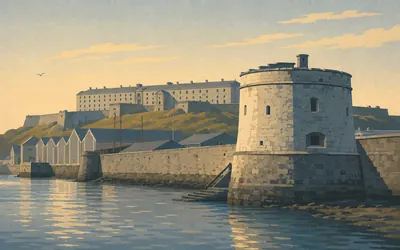
The first of the Haven's forts. Cadw records a late nineteenth-century fort on the cliff edge, with a deep revetted ditch on three sides, remodelled in the 1900s for heavier guns, in service until the end of the First World War, then dismantled and sold in 1932. Thorn Island sits offshore with another one on it.
72 km (44 miles) · heritage
Fort Popton
Faint praise from a heritage agency
Cadw dates Fort Popton to the late 1850s and 1860s, built to strengthen the defences of Milford Haven, and is unusually frank about it: the barrack block, they say, is less distinguished than South Hook and Hubberston, but the gun emplacements are the best preserved and most varied. Faint praise from a heritage agency is still praise.
88 km (55 miles) · engineering
Pembroke Royal Dockyard
Every royal yacht but one
The town is here because the yard was.
- The National Park Authority records that over two hundred and sixty warships and every royal yacht except Britannia were built at Pembroke Dockyard, which employed three thousand men before closing in 1926.
- Cadw calls the Defensible Barracks of 1841 to 1846 probably the last example of a square bastion trace fortification built in Europe.
- Cadw describes the former dockyard chapel as thought to be the only Georgian classical church to survive in south Wales.
93 km (58 miles) · engineering
Brunel Quay, Neyland
The railway that stopped at the water
The Park Authority records that Brunel chose this site as the terminus of the South Wales Railway, with a ferry running to Ireland, and that in 1906 the ferry terminal moved along the coast to Fishguard. The Welsh monuments record still calls the waterfront Brunel Quay. The trains and the ships have both gone.
103 km (64 miles) · heritage
Milford Haven
Said to have been
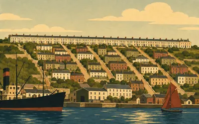
A town laid out on a grid, on purpose, in the 1790s. Cadw's listings tell the story in fragments: a hotel of 1795 to 1800 built for Charles Greville as part of the first phase of the new town; a house associated with Jean-Louis Barrallier, the French shipbuilder who set up the naval dockyard here and acted as Greville's agent in laying out the streets and assigning the leases; an 1801 house built for Benjamin Rotch, a North American Quaker who owned whaling ships.
- Cadw records the Lord Nelson Hotel as built between 1795 and 1800 for Charles Greville, as part of the first phase of the new town.
- Cadw associates Jean-Louis Barrallier, the French shipbuilder who set up the naval dockyard, with laying out the town and assigning its leases.
- Cadw writes that one building is said to have been the bakery set up for the Nantucket whaling fleet by Timothy Folger, one of the leaders of the North American whalers invited to Milford in 1792.
121 km (75 miles) · heritage
Monk Haven
Cadw says nobody knows, twice
A tall battlemented wall runs right across the back of the beach, and Cadw's own listing says its date and purpose are unknown. They include it as a picturesque screen wall. Above it stands a folly which Cadw says was probably a look-out, purpose and history obscure. Two structures, one small valley, and the heritage agency admitting twice that nobody knows why.
138 km (86 miles) · heritage
Gateholm Island
A hundred and ten huts on a tidal rock
A half-tidal islet with a settlement on top of it. Cadw records around a hundred and ten rectangular hut structures across a summit roughly five hundred metres by a hundred, laid out in rows with yards or paddocks between them, probably Iron Age to Romano-British. Half-tidal means you reach it at low water and not otherwise.

140 km (87 miles) · nature
Skomer Island
Three superlatives that do not agree
Three and a half kilometres offshore, and the reason the path swings out to Martin's Haven.
- Natural Resources Wales describes Skomer as one of the most important seabird breeding sites in southern Britain.
- The Wildlife Trust of South and West Wales publishes three different scopes for the Manx shearwater colony across its own pages: largest in the world on Skomer alone, largest in the world for Skomer and Skokholm combined, and around half the world's population.
- Natural Resources Wales says the Marine Conservation Zone around Skomer is the only stretch of water in Wales with that protection.
147 km (92 miles) · heritage
Church of Saint Bridget, St Brides
A very rare survival, unscoped
A medieval parish church first mentioned in 1291, restored in 1869 by Charles Buckeridge of Oxford for fourteen hundred pounds. Cadw picks out two bays of a fine late medieval screen against the east wall of the nave, blind tracery in every panel, and calls it a very rare survival. Cadw attaches no geography to that, and neither does this.
St Brides Bay to St Davids
164–196 km · 7 places
164 km (102 miles) · engineering
Trefrane Cliff Colliery
Galleries out under the sea
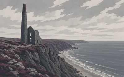
An engine-house chimney on a sea cliff, and Cadw's reason for listing it runs to one line: the last building left of the most westerly coalfield in Wales.
- Cadw's reason for listing the chimney is that it is the last building left of the most westerly coalfield in Wales.
- Cadw records six main collieries in the Nolton and Newgale coalfield in the later nineteenth century, of which Trefrane Cliff was the last to close, in 1905.
- The National Park Authority records that some of Trefrane's galleries ran out under the sea, and that coal was mined at Newgale as early as the fifteenth century.
167 km (104 miles) · heritage
The Newgale tank traps
Concrete in the shingle
Concrete blocks in the shingle, recorded by the Welsh monuments record as anti-invasion defences. The Park Authority says the shingle ridge itself was made by rising sea levels at the end of the ice age, that a drowned forest shows at the north end at low tide, and that a storm in 1896 washed the original Duke of Edinburgh Inn clean off the seaward side of the road.
174 km (108 miles) · heritage
The Gribin, Solva
A knife-edge between two flooded valleys
A knife-edged ridge with an Iron Age fort on top, dividing two flooded valleys. The Park Authority explains both: glacial meltwater cut the Solva and Gwadn valleys, then the ice went and the sea came up and filled them. By 1900 some thirty ships were registered in the harbour below, with nine warehouses and lime kilns burning stone brought in by sea.
182 km (113 miles) · heritage
St Davids Cathedral
Down in its own valley, leaning
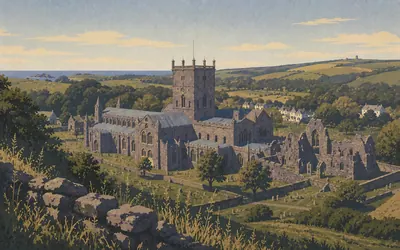
The path runs the cliff at St Non's and the cathedral is a kilometre inland, down in its own valley, out of sight until you are almost on top of it.
- The cathedral records the present building as begun between 1180 and 1182, and says the floor slopes noticeably, the arcades lean off the vertical and the two ends differ in height by about four metres.
- The cathedral describes its carved pendant ceiling as the only cathedral ceiling of its kind in Britain.
- Cadw records that a twelfth-century pope decreed two journeys to St Davids equal to one journey to Rome.
188 km (117 miles) · nature
Ramsey Island
A sound that runs like a river
An island across a fierce sound. The Park Authority says the force of the tide in Ramsey Sound and the Bitches rapids comes from the Irish Sea meeting St George's Channel. Natural Resources Wales declared the reserve in 1996 and records it as owned and managed by the RSPB, who describe cliffs up to a hundred and twenty metres and grey seals pupping on every beach in autumn.
190 km (118 miles) · heritage
St Justinian's Chapel
Buried with white quartz
A small medieval chapel above the cove, and a lifeboat station below it. Cadw records burials found under the chapel floor, one of them in a rough cist of slabs, laid with white quartz pebbles. The lifeboat institution's own site could not be reached, so nothing at all is claimed here about the station.
196 km (122 miles) · heritage
St David's Head
A fort, three tombs and nothing else
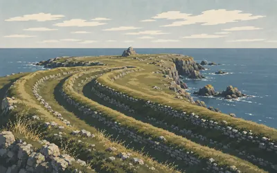
The headland is cut off from the rest of Wales by a triple rampart and ditch of stone thrown across the neck of the promontory.
- Cadw records the promontory cut off from the mainland by a triple rampart and ditch of stone across its neck.
- Cadw gives the capstone of Coetan Arthur as 3.65 metres by 2.03, slipped off its uprights and resting on one of them.
- No approved authority publishes a translation of the fort's Welsh name, Clawdd y Milwyr.
The north coast
205–284 km · 12 places
205 km (128 miles) · engineering
The Blue Lagoon, Abereiddy
Not a lagoon
Not a lagoon. The Park Authority calls it one of the best examples in Pembrokeshire of a sea quarry, formed when the sea floods old workings, and records that slate was quarried here through the nineteenth century until the quarry was abandoned in 1901. Flooding in the thirties eventually drove the people out as well.
208 km (129 miles) · engineering
Porthgain
Brick hoppers over a tiny harbour
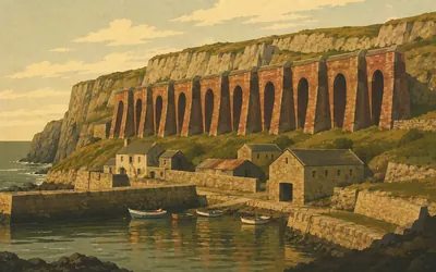
A row of brick hoppers stands over a harbour barely big enough for them, and they are the entire reason the harbour is there.
- The National Park Authority describes Porthgain's stone as diorite, a hard igneous rock quarried for building and for surfacing roads.
- The stone works closed in 1932, and the Authority says it is now responsible for conserving the harbour and its industrial remains.
- Much of the slate quarried at Abereiddy was shipped out through Porthgain.
215 km (134 miles) · heritage
Carreg Samson
Cadw calls it particularly impressive
Six large pointed uprights, three of them carrying a capstone four and three quarter metres long. Cadw calls its appearance particularly impressive, which for a scheduling record counts as enthusiasm. It stands above a narrow creek running down to Abercastle. Neither Cadw nor the monuments record explains the name.
221 km (137 miles) · heritage
Melin Tregwynt
Still weaving
A woollen mill in a wooded valley a kilometre off the coast, and still working. The mill's own account dates the building to the eighteenth century, originally part of the Tregwynt estate and originally a corn mill, later a fulling mill, and says it has been in continuous operation since at least 1841.
226 km (141 miles) · heritage
Garn Fawr
Eleven hut circles on a crag
A hillfort on a craggy outcrop at the west end of Pen Caer, which Cadw says it dominates, holding at least eleven probable hut circles inside its main enclosure. Below is Pwll Deri, a cove the Park Authority describes as hemmed in by impressively steep cliffs, with a memorial stone to the poet Dewi Emrys, who died in 1952 and wrote a poem about this coast.

230 km (143 miles) · engineering
Strumble Head Lighthouse
Built on an islet, crossed by a footbridge
The lighthouse is not on the mainland.
- Trinity House built Strumble Head lighthouse in 1908 to mark a dangerous stretch of coast for vessels between Ireland and Wales.
- Trinity House records that some sixty vessels are known to have been lost along that coast in the nineteenth century alone.
- The lighthouse stands on the islet of Ynysmeicl, reached by a footbridge, and was converted to unmanned automatic operation in 1980.
235 km (146 miles) · heritage
Carreg Wastad Point
The last invasion of Britain
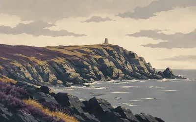
On this headland, the Park Authority says, the last invasion of Britain took place, in 1797.
- The National Park Authority records the last invasion of Britain as landing at Carreg Wastad Point in 1797, about fifteen hundred men led by an American, Colonel Tate.
- The Authority frames the story of the local women mistaken for redcoats as something the force is said to have lost heart over.
- No Welsh heritage authority publishes a date, a dedicator or an inscription for the memorial stone on the point.
243 km (151 miles) · heritage
The Royal Oak, Fishguard
Three rounds and a bluff
Cadw calls this the reputed location of the signing of the surrender that ended the French invasion of 22 to 24 February 1797, and quotes the notice above the door. Cadw also records why the ships went to Carreg Wastad instead of here: the fort had no ammunition and hardly any gunpowder, so blanks were fired to save its three rounds, and the bluff worked.
255 km (158 miles) · heritage
Cwm-yr-Eglwys
One wall left standing
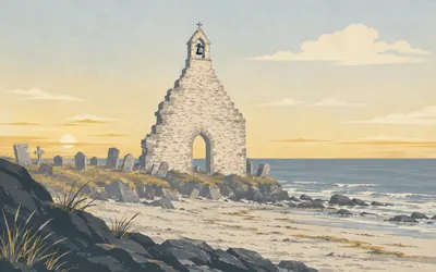
What stands at the top of the beach is one wall.
261 km (162 miles) · heritage
Newport Castle
A gatehouse turned into a house
Cadw records a castle founded here by William Fitzmartin, whose father conquered Cemais, and first mentioned in 1215 when Llywelyn ap Iorwerth took it. In 1859 the ruined gatehouse was turned into a house by R K Penson, the same architect who built the replacement church at Cwm-yr-Eglwys. In the town below is a Neolithic tomb Cadw calls one of the best preserved in the Nevern valley.
273 km (170 miles) · engineering
Ceibwr lime kilns
The Cauldron is in no register
A ruined lime kiln at the mouth of a stream, in what the Park Authority says was once the port serving Moylgrove and the farmland behind it. A little back along the cliff is Pwll y Wrach, the Witches' Cauldron, which the Authority describes as a collapsed cave cut where the sea picked out soft shales along a fault. It appears in no heritage register at all.
284 km (177 miles) · heritage
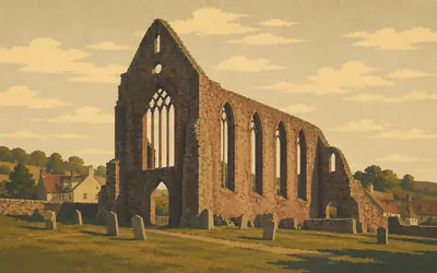
St Dogmaels Abbey
Where Caldey came from
The path ends at an abbey, and the abbey has a founding-date problem.
- Cadw's scheduling record dates the abbey's foundation to 1115 by Robert fitz Martin as a Tironensian priory, while Cadw's own visitor page says 1120.
- Cadw records thirteen monks brought from France, and the priory raised to an abbey within five years.
- Caldey Priory, near the start of the path, was founded as a cell of the Tironensian abbey at St Dogmaels.
Take on Pembrokeshire Coast Path and collect these places as you reach them
Common questions
How do my walks and runs count towards the northern end?
Whatever lands in your Strava or Apple Health feed is counted for you, carrying you round the coast from Amroth. Ascent is not part of the sum, so a flat park loop counts the same as a clifftop climb of the same length: at 30 km a week the far end arrives in nine to ten weeks.
Do I have to walk on the Welsh coast?
No. Only the kilometres matter, not the coastline they were covered on, so inland trails, pavements and treadmills all count. The real path is one of the toughest in Britain because of its relentless climbing and Atlantic winds; the virtual one asks for the 284 km, which is challenge enough for most people.
Is the Pembrokeshire Coast Path suitable for cycling?
The real path is walking and running only and very hilly, but Route Rally counts cycling distance towards your virtual target just as it counts walking and running. You are building virtual metres along the route, not literally riding the cliff path.
How long does it take to walk?
At 30 km a week you finish in around nine to ten weeks. Build to 50 km a week and you reach the far end in about six weeks. You pick the deadline as you create the rally.
Start your Pembrokeshire Coast Path Conquest
Connect Strava or Apple Health once and every ride, run or walk you record syncs automatically, moving you along the route without anything else to log.