Virtual Offa's Dyke Path Challenge
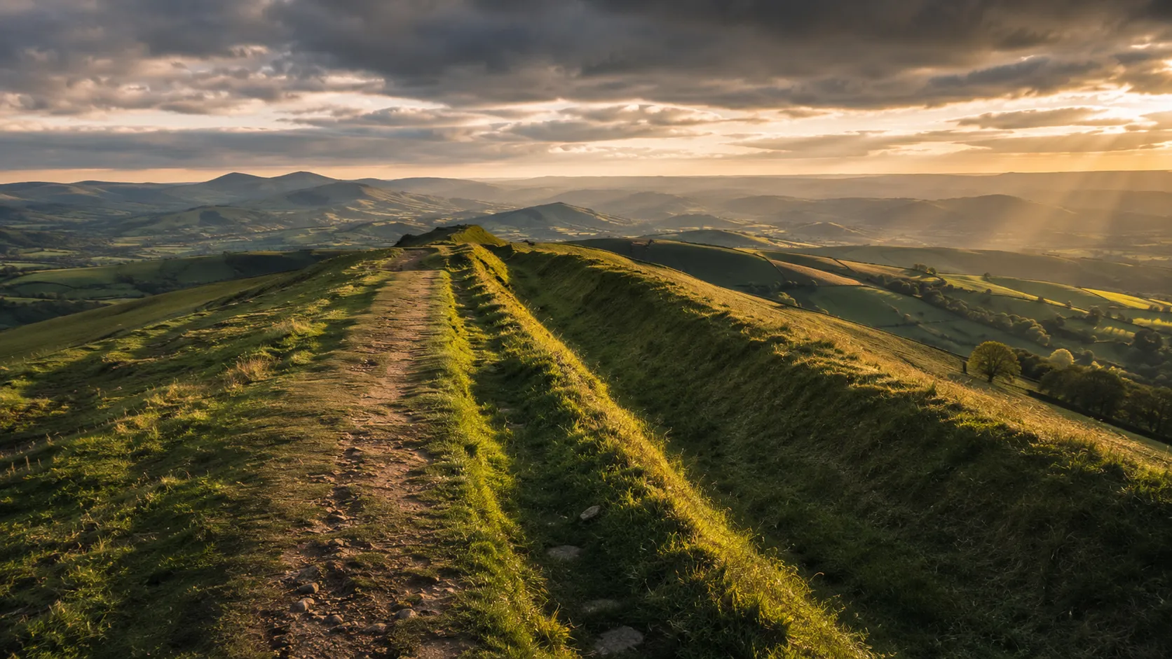
Follow the ancient border between England and Wales from your own trails and roads. Offa's Dyke Path runs roughly 289 km (about 179 miles) from Prestatyn on the North Wales coast to Chepstow on the Severn estuary, tracing the line of the great earthwork built by King Offa of Mercia in the 8th century. Route Rally turns every synced walk, run or ride into progress along this historic border trail.
Part of the National Trails series
- Route: Offa's Dyke Path
- Distance: 288.7 km
- Elevation gain: 9036 m
- Historic border crossing challenge
- Best for: Longer rallies of your own for walkers and runners, and multi-month border trail goals
Planning your challenge
A runner averaging 40 km/week finishes in around seven weeks; a walker at 30 km/week takes about ten weeks, and a cyclist at 150 km/week completes it in roughly two weeks.
This is a Long route by Route Rally distance bands, best for committed walkers and runners who want a journey with genuine historical depth.
Works well for those who want a demanding long route with a clear story: the ancient boundary between two nations.
Create your own rally for your own border trail target, solo or with a club, workplace or group of friends.
Why this route
- Offa's Dyke Path follows the England-Wales border for about 289 km (179 miles) from Prestatyn on the North Wales coast to Chepstow at the mouth of the Wye.
- As a virtual challenge you cover the distance in your own time, with walks, runs and rides from anywhere counting towards the river estuary finish.
- The route traces the line of the 8th-century earthwork built by Offa, King of Mercia, as a boundary marker between his kingdom and the Welsh kingdoms to the west.
- The terrain varies from gentle pastoral valleys to the high ridges of the Black Mountains and the Clwydian Hills, giving the route real variety across its length.
- Its length suits a multi-month walking goal, where consistent daily or weekly movement builds steadily towards the Severn estuary.
Highlights
- Start at Prestatyn on the North Wales coast at the northern end of the trail
- Cross the Clwydian Range, the Dee Valley and the hills of Shropshire
- Follow the Black Mountains ridge high above the Wye Valley
- Finish at Chepstow Castle on the Severn estuary at the Welsh border
Places along the route
Every place below is measured onto the route line, so the distance shown is where you actually reach it.
Places are researched from published sources. The distances are measured rather than estimated: we find the point on the route's own recorded line that lies nearest the place, and give the distance along the route to that point.
Prestatyn and the Clwydian Range
1–47 km · 9 places
1 km (1 mile) · heritage
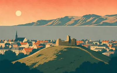
Prestatyn Castle
The sea behind you, the border ahead
The trail begins on the Irish Sea.
- National Trails records the Offa's Dyke Path as opened in the summer of 1971, running between Prestatyn and Sedbury Cliffs near Chepstow.
- Cadw says approximately 80 km of the earthwork coincides with the National Trail named after it.
- Cadw records Prestatyn Castle as a ditched motte about 20 metres across and 0.9 metres high, with walls and a causeway dated by excavation in 1913 to the eleventh century.
5 km (3 miles) · engineering
Clive Engine House
A hundred-inch beam engine, and nothing left inside
A tall limestone shell with tapered walls above the old lead workings at Meliden. Cadw dates it to 1860 to 1862 and says it was built to house a beam engine of a hundred inches, with a lined stone shaft in front of it and weatherboarding above the bob wall. Not one internal fitting survives.
8 km (5 miles) · heritage
Moel Hiraddug
Half a hillfort, quarried away
A limestone ridge a kilometre and a quarter long with a hillfort on it, and Cadw records that the north end, gateway included, has been destroyed by large-scale quarrying. Making a road to a mine on the summit in 1872 turned up late Iron Age metalwork with shield fittings among it. Excavation ran ahead of the quarry from 1954 to 1980.
16 km (10 miles) · heritage
Ffynnon Beuno and Cae Gwyn caves
Upper Palaeolithic flint, and no date attached
Two caves in a limestone outcrop above a stream, dug in the 1880s. Cadw records upper Palaeolithic flint and animal bone from both, Ffynnon Beuno in 1885 and Cae Gwyn between 1883 and 1887, and gives Ffynnon Beuno as ten metres deep and two wide behind a small platform. It attaches no dates to the finds and names no excavator.
19 km (12 miles) · heritage
Moel y Gaer, Bodfari
The first of two hills with this name
A multivallate hillfort on a hilltop above the Wheeler Valley, with two probable entrances, one north and one south-east, and a scheduled area Cadw gives as roughly 355 metres by 230. There is another Moel-y-Gaer fifteen kilometres further down this route. The name means the bare hill of the fort, and the Clwydians have several.
25 km (15 miles) · heritage
Pen-y-Cloddiau
Twenty-one hectares of hilltop, walled
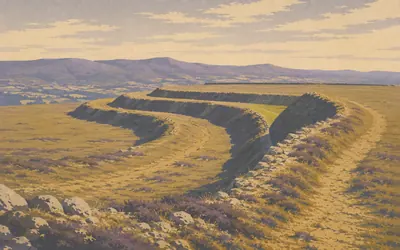
The path walks straight through the middle of it, and you can go a long way across the interior before the far rampart appears.
- Cadw calls Pen-y-Cloddiau one of the largest prehistoric monuments in the U.K, covering approximately 21 hectares.
- The number of ramparts changes with the slope: three on the east, north-east and north, two on the north-west, one elsewhere.
- Liverpool University excavated here between 2012 and 2018, which Cadw says added to what is known about the ramparts and roundhouses.
32 km (20 miles) · landmark
Moel Famau
An Egyptian pyramid that lasted fifty years
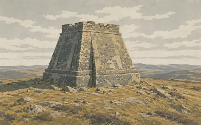
The highest point in the Clwydian Hills, and Cadw's own phrase for it, carries the stump of a monument that should not look the way it does.
- Cadw describes Moel Famau as the highest point in the Clwydian Hills.
- The monument was built 1810 to 1812 to Thomas Harrison's Egyptian Revival design, after his earlier Gothic design for the same site.
- Cadw records a partial collapse in 1851 and severe storm damage in 1862, since when only the base survives; it was consolidated in 1970.
36 km (22 miles) · heritage
Moel Fenlli
Ten hectares over two passes
The third great Clwydian hillfort in twelve kilometres, sitting where the ridge overlooks the passes through the hills both north and south. Cadw gives it up to three ramparts around about ten hectares, with numerous hut platforms inside and the main entrance on the west. It offers no comparison with the others, so neither does this card.
47 km (29 miles) · heritage
Rhos-Ddigre Caves
Nineteenth-century digging, and Cadw is not sure
Four caves in limestone outcrops among scrub and pasture on the Llandegla side. Nineteenth-century excavations, Cadw says, appear to have discovered human remains, animal bones, charcoal and a flint flake. Appear to is the authority's own wording and it is doing real work: no date, no excavator, and a register that will not underwrite the finds.
Eglwyseg, the Dee and the first of the Dyke
60–95 km · 8 places
60 km (37 miles) · heritage
Creigiau Eglwyseg
Six scheduled monuments in four kilometres
Limestone terraces stacked above the path under World's End, and the moor on top of them is thick with Bronze Age monuments. This scheduling alone holds two round barrows and two earth circles, which Cadw dates probably to the Bronze Age. Five more scheduled cairns, barrows and a stone circle lie within four kilometres of it along the same escarpment.
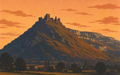
62 km (38 miles) · heritage
Castell Dinas Brân
A Welsh castle in the corner of a hillfort
A steep isolated hill where the Dee valley meets the Horseshoe Pass, with a fort on it and then a castle inside the fort.
- Cadw dates the hillfort as later prehistoric, probably Iron Age, and the stone castle to the 1260s, built by the lords of Powys Fadog.
- The castle stands in the north-west corner of the much older hillfort, not on a site of its own.
- Cadw describes the apsidal tower on the south side as typically Welsh.
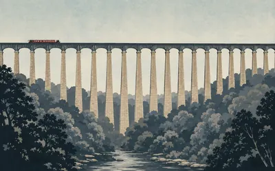
67 km (42 miles) · engineering
Pontcysyllte Aqueduct
The third one ever built, and the one that mattered
Nineteen spans, three hundred and seven metres long, thirty-eight metres above the River Dee, and no parapet on the towpath side.
- Cadw gives the aqueduct as 19 spans, 307 metres long, crossing the Dee at a height of 38 metres.
- Cadw says that when Pontcysyllte was completed in 1805 it was the third iron canal aqueduct built in the world, and by far the most influential.
- Cadw records that credit for the design went largely to Telford, who almost completely excised Jessop from his own autobiography, and that current interpretations hold Jessop ultimately responsible.
70 km (43 miles) · heritage
Offa's Dyke at Plas-Offa
Seventy kilometres in, the dyke finally appears
Seventy kilometres in, and this is the first scheduled length of the earthwork the trail is named after. Cadw calls the Dyke a boundary earthwork, believed to be Early Medieval, traditionally thought to have been built by King Offa in the later eighth century, and notes that recent excavation near Chirk suggests some sections may incorporate earlier earthworks.
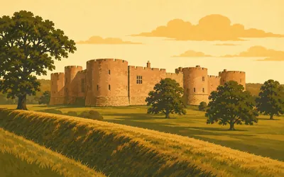
74 km (46 miles) · heritage
Chirk Castle
Four hundred and ninety metres of dyke in the park
A drum-towered castle still roofed and lived in, which almost none of the Edwardian castles are.
- Cadw says the castle was probably begun soon after 1295 for Roger Mortimer, and that the royal mason Master James of St George was probably the originator of the plan.
- Cadw schedules approximately 490 metres of Offa's Dyke running through the castle park, reaching about two metres in height.
- The castle was bought for the nation in 1978.
79 km (49 miles) · heritage
Selattyn Tower
A Victorian folly inside a Bronze Age cairn
A small square tower built in 1847 and set inside a Bronze Age ring cairn. Historic England says it commemorates the death of Prince Gwen, a sixth-century prince who, according to legend, was killed in a battle between the British and the Saxons near the brook below. Building it turned up twelve urns of burnt bone. The Home Guard used it as an observation post.
86 km (54 miles) · heritage
Offa's Dyke above Trefonen
Two agencies, one earthwork, a hundred kilometres apart
This is England now, and the register changes with the border. Historic England calls Offa's Dyke the longest linear earthwork in Britain at approximately 220 km; Cadw, on the other side of the line, says roughly 120 km. Same earthwork, two national agencies, a hundred kilometres of disagreement. This scheduled piece is 520 metres of it, and Historic England gives the Dyke's bank generally as up to 3.5 metres high.
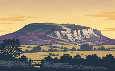
95 km (59 miles) · heritage
Llanymynech Hill
One hillfort, two national registers
A limestone plateau with the England and Wales border drawn across it, and both countries schedule their half separately.
- Cadw calls Llanymynech the largest hillfort in Wales, enclosing around 70 hectares.
- Cadw's own record states that the north-east ramparts and a probable entrance are scheduled separately in England; Historic England's matching record publishes no description at all.
- Cadw records that a single large rampart on the western slope was adapted to form a stretch of Offa's Dyke.
The Severn, Montgomery and the Shropshire dyke
113–151 km · 5 places
113 km (70 miles) · heritage
Strata Marcella Abbey
The largest in Wales, and nothing above ground
A field by the Severn. Cadw records a Cistercian abbey founded here in 1170 by Owain Cyfeiliog, Prince of Powys, as a daughter house of Whitland, and says that by the early thirteenth century it had become the largest Cistercian abbey in Wales. Its church ran two hundred and seventy-three feet. Excavated in 1890; the finds are in the Powysland Museum at Welshpool.
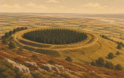
120 km (74 miles) · heritage
Beacon Ring
A complete circuit, and a wood planted inside it
The last hill before the Severn plain, and the path goes round the rampart of a univallate hillfort Cadw dates probably to the Iron Age.
- Cadw gives the interior of Beacon Ring as about 190 metres by 125, within a complete circuit of rampart with one entrance on the south-south-west.
- Cadw dates the hillfort probably to the Iron Age, between about 800 BC and the Roman conquest of Wales in AD 74.
- Cadw's own record name for the monument is Beacon Ring Camp, with Caer Digoll given alongside it.
130 km (81 miles) · heritage
Montgomery Castle
A mile off the line, and worth the mile
The path keeps to the Dyke and leaves the town alone, so this one is a detour. Cadw says Henry III began the castle in 1223 on an entirely new site on the ridge above the Severn valley, to replace the earth and timber fortification at Hen Domen nearby. Parliament had it levelled in 1649 and the ruins were pillaged for stone afterwards.
141 km (88 miles) · heritage
St John the Baptist, Churchtown
A stone that may have measured a bag of wheat
A church alone in a hollow with no village round it, rebuilt in 1887 on an older site and listed at Grade II* for its fifteenth-century roof. Historic England says the stone from which the parish is said to derive its name is kept inside, and that it has been suggested it was the measure for a bag of wheat: twenty pounds, plus four and a half for the bag.
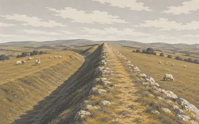
151 km (94 miles) · heritage
The Dyke on Llanfair Hill
It survives well, and nobody will call it the highest
For most of a day the trail is the earthwork: you walk on the bank with the ditch below you on the Welsh side, and the ground on either hand is open.
- Historic England records this section as running some 1.8 kilometres along the western side of Llanfair Hill.
- No authority checked in this pass publishes a claim that Llanfair Hill is the highest point Offa's Dyke reaches, and Historic England's entry gives no altitude.
- Historic England notes public access along the southern half of the section as a recreational and educational resource.
Knighton, Radnorshire and the Herefordshire gap
159–197 km · 5 places
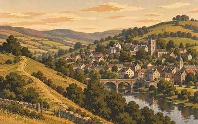
159 km (99 miles) · landmark
Knighton
The town on the dyke
The Welsh name for Knighton is Tref-y-clawdd, the town on the dyke, and it is named after the earthwork itself.
- Knighton's Welsh name, Tref-y-clawdd, means the town on the dyke.
- Cadw records three scheduled sections of the Dyke defining the western edge of the medieval borough, and says it is possible the earthwork was adapted as the town's defences.
- A commemorative stone at the north end of the section marks the opening of the Offa's Dyke National Trail in 1971.
175 km (109 miles) · heritage
Burfa Camp
Where the dyke goes round rather than over
A long fort on Burfa Bank, about seven hundred metres by two, holding some 5.9 hectares, with the bank rising to three and a half metres on the north. Round the western slope below it the Dyke shrinks to a shelf two or three metres wide, which Cadw says is slight and difficult to discern on the ground.
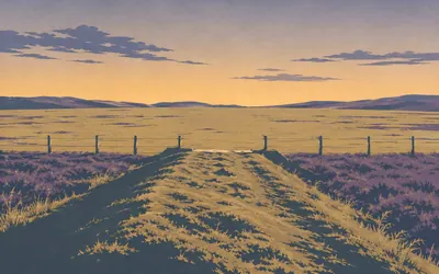
178 km (111 miles) · heritage
Rushock Hill
Where the path leaves the dyke
The Dyke runs along the spine of what Historic England calls an extremely prominent and plateau-like ridge, above the Hindwell Brook, and here the path leaves it.
- Historic England says a break of 23 km in Herefordshire may represent an area where the Dyke was not built, perhaps because political alliances made it unnecessary.
- This record gives the Dyke as some 149 miles with at least 81 miles surviving, while Historic England's own standard paragraph says approximately 220 kilometres.
- Historic England gives the Dyke's bank, along its length, as more than two metres high on average, with a Wales-facing ditch and an overall width of around 18 metres.
182 km (113 miles) · heritage
Kington
A double-broach spire and an arboretum
The church stands apart from the town it serves, dated by Historic England to about 1300 and much altered, with a Decorated south chapel of about 1320 and a double-broach spire rebuilt in 1794. Just west, Hergest Croft, which the register records as in the late twentieth century said to be one of the finest collections of exotic trees and shrubs in private hands.
197 km (123 miles) · heritage
Pen Twyn Settlement
Named a camp, described as a defended settlement
An oval enclosure of about 1.4 hectares, double-ramparted on the west and defined by a scarp up to 2.4 metres high on the north and east. Historic England is careful with the label: this is a defended settlement, a smaller class than a hillfort, and the authority suggests such places may have held perhaps no more than a single family group.
Hay, the Black Mountains and the Monnow
205–261 km · 8 places
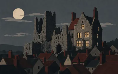
205 km (128 miles) · heritage
Hay Castle
Burnt in 1216, burnt in 1263, burnt in 1934, burnt in 1977
A castle with a very bad record on fire.
- Cadw records the castle as burnt by King John in 1216, rebuilt by Henry III in 1233 and burnt again by Prince Edward in 1263.
- Major fires took the east half of the building in 1934 and the west half in 1977.
- Cadw's own record still describes restoration as in progress at its 1987 inspection; the Hay Castle Trust now runs the building as a visitor attraction.
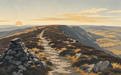
220 km (136 miles) · nature
The Hatterrall Ridge
The last upland before the south coast
Seventeen kilometres of open ridge with the border along the top of it, England falling away east and the Vale of Ewyas west.
- Natural England calls this the most south-easterly area of upland habitat in southern Britain.
- The citation records open mixed scrub climbing to 610 metres here, about the highest it is recorded in Wales.
- The Welsh side of the ridge lies within the national park its own authority now styles Bannau Brycheiniog.
222 km (138 miles) · heritage
Llanthony Priory
Four hundred metres below the path, and hedged all the way
An Augustinian priory down in the Vale of Ewyas, and the trail stays on the ridge above it. Cadw attributes the foundation to a knight of Hugh de Lacy who established a hermitage, apparently on the site of an earlier chapel built by St David. The church, its listing adds, is said to have been built by William de Lacy and consecrated in 1108.
235 km (146 miles) · heritage
St Cadoc's, Llangattock Lingoed
A dedication is not a date
The path goes through the churchyard. Cadw says the dedication to the Welsh saint Cadoc suggests pre-Norman origins but the masonry is largely undatable, which is a register declining to guess. Inside are a medieval rood beam, seventeenth-century box pews and monuments of the seventeenth and eighteenth centuries. The churchyard cross has lost its shaft.
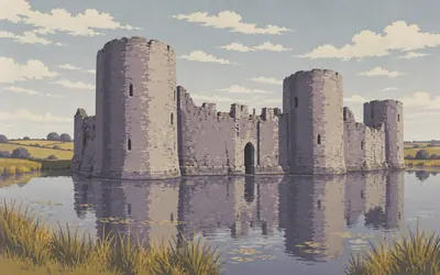
240 km (149 miles) · heritage
White Castle
Never attacked, and nobody says why it is white
Round towers standing in a moat that still holds water, in the middle of quiet farmland with nothing else near it.
- Cadw says the sole purpose of White Castle throughout its life was military, and that as a deterrent it succeeded admirably because it was never attacked.
- Cadw groups it with Grosmont and Skenfrith as one of the Three Castles.
- Neither Cadw's scheduling nor its Grade I listing explains why the castle is called White.
251 km (156 miles) · heritage
Grace Dieu Abbey
The last one begun in Wales, and nothing stands
Cadw calls this the site of the last Cistercian abbey begun in Wales, founded by John of Monmouth in 1226. There is nothing to see. No standing remains survive, and what is known of the plan comes from buried walls, drainage ditches and tracks picked out from the air. Twenty-six kilometres on, this route passes the first Cistercian house in Wales as well.
258 km (160 miles) · heritage
Monmouth Castle
Probably, says one Cadw record; definitely, says the other
Cadw's scheduling calls the keep famous as the probable birthplace of the future Henry V on 16 September 1387. Cadw's Grade I listing for the same castle says he was born here in 1387, with no hedge at all. One agency, one building, two levels of confidence. Beside it stands Great Castle House, built from stone recovered when the round tower came down.
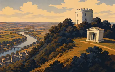
261 km (162 miles) · heritage
The Kymin
A dining club, and a monument to sixteen admirals
A round white banqueting house on a hill above Monmouth, put up in 1794 by the Kymin Club, gentlemen of the town who met on Tuesdays, in Cadw's quotation of their own words, dining together in a social and friendly manner.
- Cadw dates the Roundhouse to 1794, built by the Kymin Club as a picnic house for members of Monmouth society.
- The Naval Temple was erected in 1800 as a tribute to the British Navy and sixteen admirals of the Seven Years War, the American Revolutionary War and the wars against revolutionary France.
- Cadw's own listing records that three of the admirals commemorated are known to have supported the slave trade.
The lower Wye
264–288 km · 6 places
264 km (164 miles) · engineering
Redbrook incline overbridge
A tramroad bridge over a main road
A stone arch carrying nothing over a road that is still busy. Cadw records it as part of the Monmouth tramroad, which opened in 1812 and ran from Howler's Slade at Coleford down to Monmouth, and says this bridge stood on the branch serving the tinplate works at Redbrook.
270 km (168 miles) · engineering
Bigsweir Bridge
One bridge, two registers, one designer
A single cast-iron span across the Wye, built between 1826 and 1829 for the Wye Valley turnpike. Historic England lists it and names nobody. Cadw lists the same bridge and names Charles Hollis of London, adding that it is very much in the manner of Thomas Telford. The ironwork, Historic England says, was cast at Merthyr Tydfil.
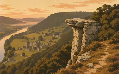
279 km (173 miles) · viewpoint
The Devil's Pulpit
A pillar of rock, possibly left by quarrymen
A pillar of rock on the lip of the wood, high above the river, looking out over Tintern Abbey.
- Historic England's own record describes the Dyke immediately east of the pillar as a viewing point over Tintern Abbey and the River Wye.
- Historic England says the rock pillar is thought to have been left following nineteenth-century quarrying.
- Cadw calls Tintern Abbey, in the meadow below, only the second Cistercian foundation in Britain and the first in Wales.
283 km (176 miles) · heritage
Lancaut promontory fort
An Iron Age rampart pressed into service
The Wye loops almost back on itself here and an Iron Age fort cuts off the neck of the peninsula. Historic England records the earthworks as Iron Age in origin but re-used to form part of Offa's Dyke in the early medieval period. Promontory forts, it adds, are rare nationally, with fewer than a hundred recorded examples.
286 km (178 miles) · engineering
Chepstow Bridge
Half in Wales, half in England, listed twice
Five cast-iron arches on stone breakwaters, the county names cast into the ironwork. Historic England's own words are that the bridge is half in Wales and half in England, and both registers list it at Grade I, England in 1954 and Wales in 1975. England credits John Raistrick; Wales credits John Urpeth Raistrick, adapting a design by John Rennie.

288 km (179 miles) · landmark
Sedbury Cliffs
Where the path ends, and the register says the dyke does
The last of the Dyke grows as it goes.
- Historic England records this final section growing from a bank about 10 metres wide and 2 metres high on its southern face to one up to 17 metres wide and 5 metres high on the same face.
- Historic England says the Butt element of nearby Buttington is thought to mean end, suggesting an early terminal for the Dyke at that point.
- National Trails records the path as linking Sedbury Cliffs near Chepstow with Prestatyn on the Irish Sea, opened in the summer of 1971.
Take on Offa's Dyke Path and collect these places as you reach them
Common questions
How does my walking count towards Chepstow?
The counting is automatic once your Strava or Apple Health account is linked, and every activity on it moves you south along the border from Prestatyn. A runner at 40 km a week reaches the Severn estuary in around seven weeks, and a walker at 30 km a week in about ten.
Do I have to walk on the England-Wales border?
No. The border sets the distance and leaves the ground entirely to you, so your local roads and hills all move you along it. Offa marked a boundary between two kingdoms; the modern path that traces it runs about 289 km, and covering that length is the whole of the virtual challenge.
What is Offa's Dyke?
Offa's Dyke is an 8th-century earthwork running roughly along the England-Wales border, built on the orders of Offa, King of Mercia. Stretches of the original bank and ditch are still clearly visible along the trail, making it one of the longest surviving early medieval monuments in Britain.
How long does it take to walk?
At 30 km a week it takes roughly ten weeks. Build to 50 km a week and you reach Chepstow in about six weeks. The rally's end date is yours to name at setup.
Start your Offa's Dyke Path Conquest
Connect Strava or Apple Health once and every ride, run or walk you record syncs automatically, moving you along the route without anything else to log.