Virtual North Downs Way Challenge
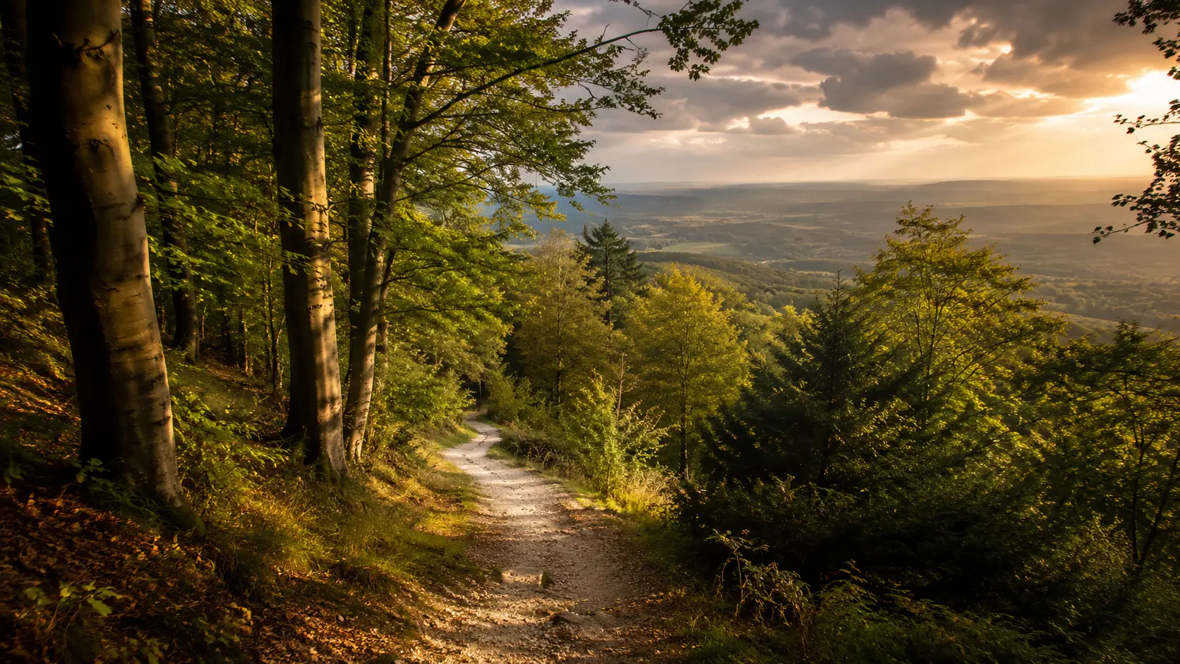
Walk or run the chalk ridge of Surrey and Kent from your own roads and paths. The North Downs Way runs roughly 203 km (about 126 miles) from Farnham in Surrey east to the Kent coast, crossing the North Downs ridge. The National Trail forks after Boughton Lees; the line here follows the Folkestone leg to Dover, not the Canterbury loop. Route Rally turns every synced walk, run or ride into progress along this long and varied southern England trail.
Part of the National Trails series
- Route: North Downs Way
- Distance: 202.6 km
- Elevation gain: 5662 m
- Long chalk ridge and Kent coast route
- Best for: Longer rallies of your own for walkers and runners, and steady multi-week goals
Planning your challenge
A walker averaging 30 km/week finishes in around seven weeks; a runner at 40 km/week takes about five weeks, and a cyclist at 150 km/week completes it in a week and a half.
This is a Medium route by Route Rally distance bands, well suited to a steady multi-week target that keeps walkers and runners progressing.
Works well for walkers and runners in or around London who want a long route with the Folkestone leg's Dover finish.
Create your own rally for your own North Downs target, solo or with a group sharing one leaderboard.
Why this route
- The North Downs Way follows the chalk ridge from Farnham in Surrey east to the Kent coast, covering about 203 km (126 miles) through Surrey and Kent.
- As a virtual challenge you cover the distance in your own time, with walks, runs and rides from wherever you train all counting towards the coastal finish.
- The route passes through Surrey's wooded hills and the open agricultural Kent landscape, ending near the famous White Cliffs of Dover.
- It shares some of its path with the old Pilgrims' Way to Canterbury, giving it a long historical association with journeys to the coast.
- Its length suits a steady multi-week goal: consistent everyday movement covers the distance towards the sea.
Highlights
- Start at Farnham in Surrey, at the western end of the chalk ridge
- Cross the North Downs through Box Hill, one of Surrey's most popular viewpoints
- Follow the ridge east through the Kent Downs Area of Outstanding Natural Beauty
- Finish near Dover and the White Cliffs on the English Channel coast
Places along the route
Every place below is measured onto the route line, so the distance shown is where you actually reach it.
Places are researched from published sources. The distances are measured rather than estimated: we find the point on the route's own recorded line that lies nearest the place, and give the distance along the route to that point.
Farnham and the Surrey greensand
0–32 km · 8 places
0 km (0 miles) · heritage
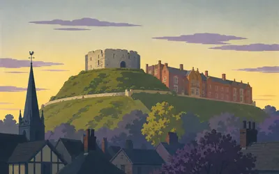
Farnham Castle
A tower with chalk piled up its sides
The trail starts in the town and the castle is the thing above it.
- Historic England dates Farnham Castle to 1138, built on the orders of Henry of Blois, Bishop of Winchester.
- Its stone tower was built from ground level and then partially buried, which Historic England calls a late stage in the development of the motte and bailey castle.
- The pub in Bridge Square, Farnham, is listed as the birthplace of William Cobbett.
2 km (1 mile) · heritage
Moor Park
Where a heart is said to be buried
Sir William Temple's late seventeenth-century garden, and Historic England records that Charles Darwin came here often and worked on what its entry calls The Origin of the Species. A sundial said to mark the grave of Temple's heart has disappeared. A mile off, the authority dates Waverley Abbey to 1128 and calls it the first Cistercian house established in Britain.
8 km (5 miles) · heritage
Hillbury
A hillfort that may later have penned stock
A bank and a ditch on a greensand spur on Puttenham Common. Historic England calls it a slight univallate hillfort and says the type is rare, with around a hundred and fifty examples recorded nationally. A later phase inside it has been dated to the medieval period, when the authority says the enclosure may have been used for stock.
13 km (8 miles) · heritage
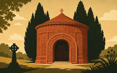
Watts Memorial Chapel
A village built its own chapel
A round red chapel for a village cemetery, clad outside in clay tiles and dense with symbols inside.
- Historic England dates the chapel to between 1896 and 1898 with the interior decorated in 1901; the Watts Gallery Trust says between 1895 and 1904, opened in 1898.
- The Watts Gallery Trust records that over seventy people from the local community helped Mary Seton Watts build it, and that it is still a working chapel.
- Historic England lists the chapel at Grade I and describes its plan as a Greek cross within a circle.
17 km (11 miles) · heritage
St Catherine's Chapel
Reputed a pilgrims' chapel, and maybe not
A roofless sandstone shell on a knoll above the Wey. Historic England says Richard de Wauncey, Rector of St Nicholas, put it up on the site of an earlier chapel, and that it was traditionally reputed to be a pilgrim's chapel on the route to Canterbury, but may equally have served the local community. Its two records give 45.5 feet by 20.5, and 15.5 by 8 metres.

21 km (13 miles) · heritage
St Martha's Hill
Earth circles that are probably tree rings
The hill is the landmark: a sand ridge with a church on top and the whole Weald laid out south of it.
- Historic England titles the record earth circles but calls the same features ring banks throughout its own description, and says they are likely to be plantation rings.
- The Chilworth gunpowder mills were established by the East India Company in 1626, and Historic England records the works in almost continuous use until 1920.
- Historic England says the soft sandy soil and dense bracken keep the earthworks faint on the ground.
23 km (15 miles) · viewpoint
Newlands Corner
The register records the mound, not the view
A prehistoric bowl barrow on the lip of the escarpment, nineteen metres across and just over a metre high, with a hollow in the top that Historic England reads as antiquarian digging. The view south from beside it is the reason most people stop, and its Historic England entry does not mention it. The barrow is one of over ten thousand recorded nationally.
32 km (20 miles) · nature
Hackhurst and White Downs
The only juniper left of any size
Chalk grassland, and a thicket that Natural England says is the only sizeable population of juniper remaining on the North Downs, with thirteen invertebrates dependent on it. Among them the citation names a spider known from only two other places in Britain. Part of the down is a local nature reserve, managed, the citation says, by Surrey County Council and in part by the National Trust.
Box Hill and the Victorian invasion scare
38–69 km · 6 places
38 km (23 miles) · heritage
West Humble Chapel
A chapel of ease on land called Capellond
Flint and sandstone walls in a valley at Westhumble, roofless, the west gable still standing. Historic England says it is likely to have been built in the late twelfth or thirteenth century by the Canons of Merton, as a chapel of ease for their tenants, and that the land was known as Capellond in 1538. Excavation found burials, two cooking pots and two jugs.
40 km (25 miles) · heritage
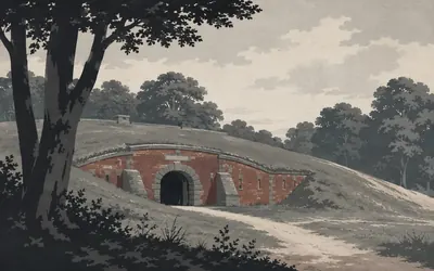
Box Hill Fort
One of fifteen forts for an invasion nobody made
Somebody in 1888 decided London needed a defended line, and much of it ran along the North Downs.
- Historic England records fifteen London mobilisation centres, built in the 1890s under the London Defence Positions scheme drawn up in 1888.
- Seven of the fifteen lie within 800 metres of this route: Henley, Box Hill, Betchworth, Reigate, Alderstead, Fosterdown and Woldingham.
- Historic England says that by 1905 confidence in the Royal Navy had returned and the centres were abandoned and gradually sold off.
43 km (27 miles) · engineering
Brockham Lime Works
A kiln patent that travelled the world
Two batteries of lime kilns built into the slope below the quarries, which Historic England says survive in remarkably good condition and represent a unique survival of two nineteenth-century types: the flare kiln and the Brockham-patent kiln. The patent, the authority says, was internationally known and influenced the development of lime kilns worldwide. Round the hill, the Betchworth kilns worked for the Dorking Greystone Lime Company from 1865 to 1959.
51 km (32 miles) · heritage
Reigate Fort
The one nobody ever tidied up
The fourth of the seven mobilisation centres on this trail, and Historic England calls two parts of it unusual: a large brick tool store built inside the compound, and a flint revetted parapet. Two earthworks at the west end are believed to be a firing platform and a traverse against enfilade fire. The fort, the authority says, has remained largely free of alteration or renovation and survives comparatively well.

60 km (38 miles) · heritage
War Coppice Camp
The only known Surrey hillfort on the North Downs
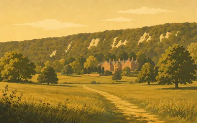
A large enclosure in beech woods above Caterham, and Historic England says it is the only known Iron Age hillfort in Surrey to be situated on the North Downs.
- Historic England calls War Coppice the only known Iron Age hillfort in Surrey sited on the North Downs.
- Historic England records that the monument was originally thought to be Roman or Neolithic until excavation in 1950 showed it to be Iron Age.
- The hillfort encloses approximately eight hectares.
69 km (43 miles) · heritage
Titsey Place
A park the trail goes straight through
The trail runs through a registered park here, as it also does at Gatton.
- Historic England records the Titsey estate as acquired by Sir John Gresham, one time Lord Mayor of London, in 1534.
- A Roman villa lies inside the registered park boundary, and Historic England says excavation indicated it was destroyed by fire.
- Historic England's entry dates its own note on public access to the year 2000, so opening arrangements should be checked before a visit.
Otford, the Medway and the Kent scarp
88–134 km · 6 places
88 km (55 miles) · heritage
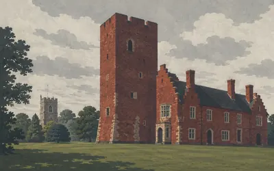
Otford Palace
A corner of an archbishop's palace
One brick tower and a run of lodgings, standing in a recreation ground.
- Historic England says the early sixteenth-century palace is thought to have covered about 134 metres by 67 metres.
- Excavation recovered six papal lead bulls from a medieval sewer on the site, one of Pope Lucius III and five of Pope Urban III.
- Historic England describes the nearby reservoir as traditionally associated with St Thomas a Becket and part of the palace's water supply.
90 km (56 miles) · heritage
The Pilgrim's Way milestone
Four directions, date not known
A scheduled milestone beside the lane, with a direction cut on each face. Historic England reads the north face as the way to Dartford, the west as to Bromley twelve miles, the east as to Malling ten. The south is now illegible but formerly read the way to Sevenoaks. As for when it was cut, the authority says plainly that the original date of the stone is not known.
103 km (64 miles) · heritage
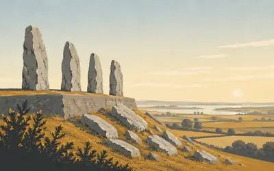
Coldrum Long Barrow
At least twenty-four people, four stones
Four sarsen stones standing along the east end of a low rectangular platform, with more of them tipped down the slope below.
- Historic England records the bones of at least twenty-four people found in the chamber when it was excavated in 1922.
- Historic England groups Coldrum with the burial mounds it calls the Medway Megaliths, while noting it is an atypical example.
- Trottiscliffe's parish church keeps a pulpit made in 1775 by Henry Keene for Westminster Abbey, where it stood until 1824.
117 km (73 miles) · heritage
Fort Borstal
Scheduled, and undescribed
A scheduled fort in Medway, and Historic England publishes nothing whatever about it. The record is an unmodernised old county number scheduling: summary, reasons and history all read not currently available for this entry. So this card says what the register says, which is the name and where it is. A kilometre on, a bell barrow, a type the authority calls rare nationally with fewer than 250 known.
124 km (77 miles) · heritage
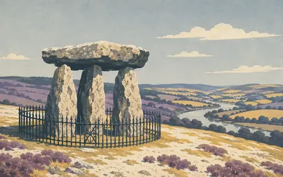
Kit's Coty House
Enquired into since 1570, its name unexplained
Three uprights and a capstone in a railed enclosure above the Medway, and a run of stones for the next kilometre and a half.
- Historic England says Kit's Coty has been the subject of enquiry since 1570 and that no satisfactory explanation for the name has yet been found.
- No investigator has reported bones from the monument; Historic England rests the burial interpretation on its similarity to other examples.
- Little Kit's Coty House, also known as The Countless Stones, was seriously damaged in 1690 before any reliable record was made.
134 km (83 miles) · heritage
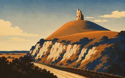
Thurnham Castle
A shell keep over the old road
A castle on the very edge of the scarp, above the old road.
- Historic England sites Thurnham Castle on a spur of the North Downs above the Pilgrim's Way.
- Historic England records a gatehouse and the remains of a stone shell keep among the surviving features.
- A crop-mark site half a kilometre on is recorded as possibly Corbier Hall, thought to have been built in the late fourteenth century.
The Great Stour, Wye and the run to Dover
147–203 km · 11 places
147 km (91 miles) · heritage
The Lenham mortuary and lock-up
A mortuary first, a cell second
Everybody calls it the lock-up, as does Historic England's list entry, but its summary puts the mortuary first: an early eighteenth-century mortuary attached to a workhouse that has since been demolished, later used as the village lock-up, and now in use as a store. Lock-ups, it adds, were also known as round houses, blind houses and clinks. Across the square stands a tithe barn dated probably late fourteenth century.
153 km (95 miles) · heritage
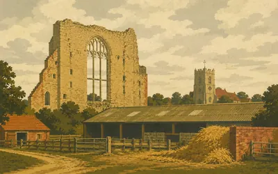
Charing Palace
Let out to farm and never taken back
The second archbishop's palace on this trail, and the one that turned into a farmyard.
- Historic England traces the manor at Charing to AD 788, when Kenulph gave the land to Christchurch priory at Canterbury.
- Historic England records that after Henry VIII acquired the palace by exchange with Cranmer in 1545, no monarch ever used it and it was let out to farm.
- Historic England says only some 150 bishops' palaces have been identified nationally.
160 km (99 miles) · heritage
St Mary's, Eastwell
The register never says why
A largely roofless church beside a lake in a park. Historic England says the west end still stands to roof height while elsewhere the footings stand up to a metre and a half, and that a large amount of medieval fabric survives despite the partial demolition. What the register never says, anywhere in the entry, is when the church came down or why.
165 km (102 miles) · heritage
Wye College and St Gregory's
The tower fell and took the transepts
Cardinal Archbishop John Kempe founded a college here in the fifteenth century and remodelled the church. Historic England says the chancel is arranged as if a college chapel, and indeed was used as one by the school or college opposite. In 1686 the tower came down, taking the transepts and the east end with it, which is why the chancel is at least sixty feet shorter than it was.
168 km (104 miles) · nature
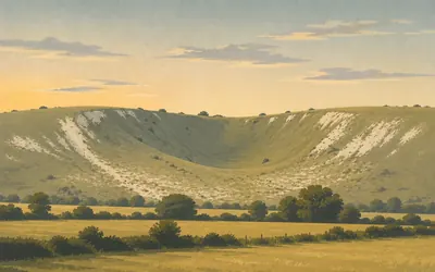
The Devil's Kneading Trough
Cut by meltwater and then left alone
A chalk coombe bitten out of the escarpment, so steep and so clean-sided it looks manufactured.
- Natural England calls the Devil's Kneading Trough one of the most important periglacial sites in Britain for its forms, erosional history and deposits.
- The citation records at least 86 nationally rare or scarce species, including the black-veined moth at one of its very few locations in Britain.
- The lady orchid grows here, and Natural England records the species as restricted in Britain to Kent.
182 km (113 miles) · heritage
Tolsford Hill practice trenches
Where men learned to go over the top
Three groups of practice trenches cut into the down. Historic England records that from 1915 the Canadian Training Division was stationed at nearby Shorncliffe, a staging post for the Western Front, and that the Canadian battalions who dug these trenches practised going over the top in them. The authority calls the monument a poignant memorial to the men who trained here before fighting in Europe.
189 km (118 miles) · heritage
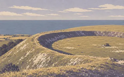
Castle Hill ringwork
Called Caesar's Camp, and nothing Roman about it
Everybody local calls this Caesar's Camp.
- Historic England calls this the largest and most complete ringwork in the south east of England.
- The name Caesar's Camp appears nowhere in Historic England's record, which describes the site as medieval and identifies nothing Roman.
- General Pitt-Rivers part-excavated the ringwork in 1878 and found a well over 29 metres deep inside it.
193 km (120 miles) · heritage
East Wear Bay Roman villa
Exposed by cliff erosion in 1923
A Roman villa on a cliff top. Historic England says the masonry is among the best preserved at any Roman villa site in Britain and the mosaic unique in this country, and records that several rooms of the bath house have gone over the edge. Tiles stamped by the Classis Britannica led to a suggestion, the authority's own hedge, that a fleet officer may have lived here.

195 km (121 miles) · nature
Folkestone Warren
Twelve major landslips since 1765
A whole hillside that keeps sliding into the sea, and has been doing it for as long as anyone has kept count.
- Natural England records twelve major landslips at Folkestone Warren since 1765.
- The main Folkestone to Dover railway crosses the Warren and has been displaced by the moving ground, notably in 1915.
- Natural England says the fiery clearwing moth is known only from Folkestone Warren in Britain.
201 km (125 miles) · heritage
Dover Western Heights
Napoleonic ditches round a Roman lighthouse
Ditches deep enough to lose a bus in. Historic England calls the fortifications here the largest, most elaborate and impressive surviving example of early nineteenth century fortification in England. Among them are older things: the foundations of one of a pair of Roman lighthouses that flanked the port of Dubris, and a twelfth-century chapel whose unusual form, the authority says, has led to suggestions that the Knights Templars built it.
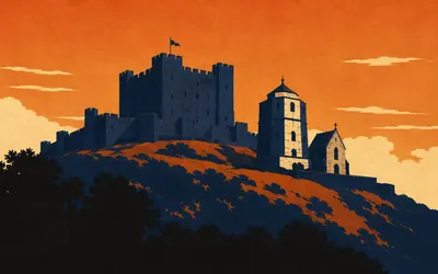
203 km (126 miles) · heritage
Dover Castle
One agency, one lighthouse, two dates
The trail finishes under a castle showing, in Historic England's words, a unique sequence of uninterrupted military occupation from the Napoleonic era to the late twentieth century.
- Historic England calls Dover Castle one of the most elaborate and heavily defended fortresses in Europe, and Henry II's keep the last and technically most ambitious of its kind in England.
- Historic England's listing dates the Roman lighthouse to AD 46 under the Emperor Claudius; its scheduling for the castle dates the same tower only to around the first century AD.
- In 1940 Vice Admiral Ramsay planned and directed Operation Dynamo from the Napoleonic tunnels beneath the castle.
Take on North Downs Way and collect these places as you reach them
Common questions
How does my walking or running count towards Dover?
The sync does the bookkeeping. Anything that reaches Strava or Apple Health is credited to your total and moves you east from Farnham. A walker at 30 km a week reaches the Kent coast in about seven weeks; 50 km a week brings it inside five.
Do I have to be in Surrey or Kent?
No. The ridge sets a target, not a location, so your local roads and weekend walks all move you towards the White Cliffs. Pilgrims once joined part of this line to Canterbury from wherever they had set out; covering it from your own doorstep follows much the same logic.
How long does it take to walk the North Downs Way?
At 30 km a week you finish in around seven weeks. Build to 50 km a week and you reach the Kent coast in about four. The end date is chosen by you at setup.
How does the North Downs Way compare to the South Downs Way?
They are similar in length, both follow chalk ridges, and both finish near the coast. The North Downs Way is generally considered more varied, running through woodland as well as open downland, and takes you further from London into Kent.
Start your North Downs Way Conquest
Connect Strava or Apple Health once and every ride, run or walk you record syncs automatically, moving you along the route without anything else to log.