Conquer the Virtual LEJOG Challenge: Complete Land's End to John O'Groats
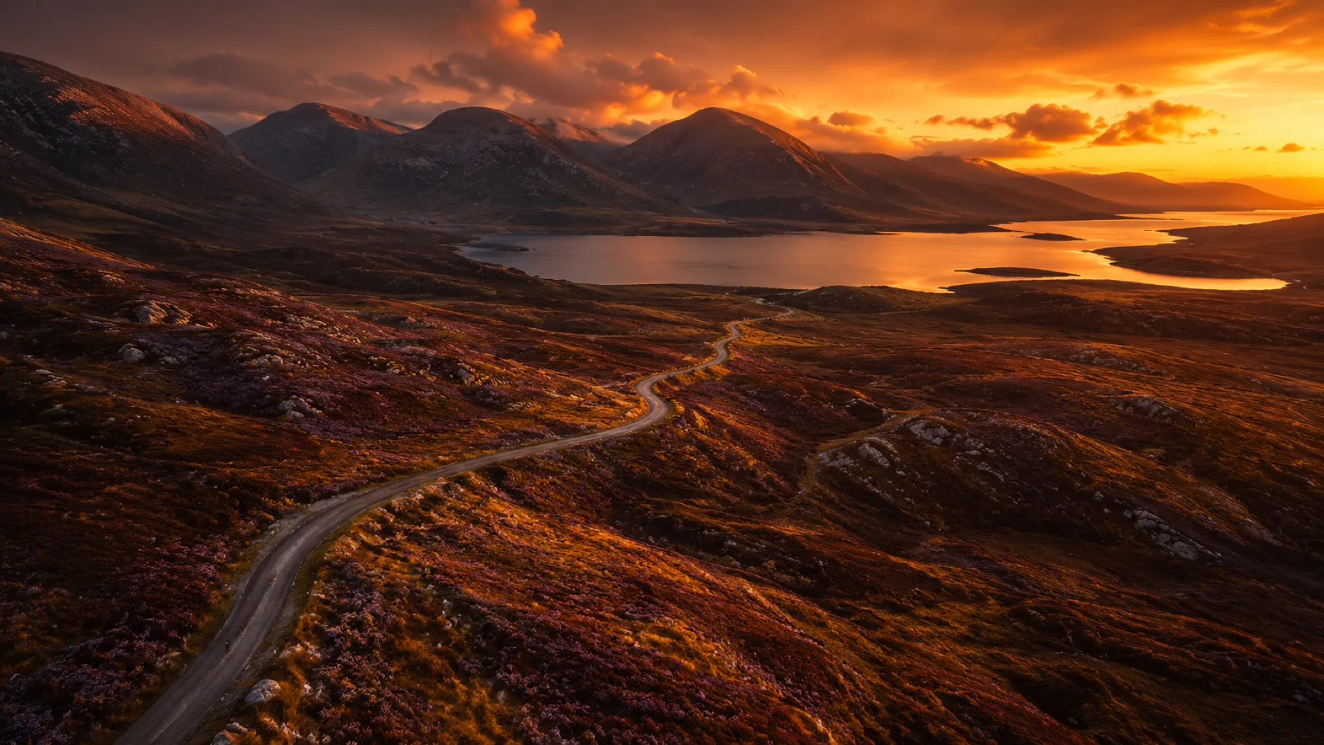
Take on one of the UK's classic end-to-end journeys from wherever you train. Land's End to John O'Groats runs roughly 1,390 km (about 864 miles) from the tip of Cornwall to the far north of Scotland, and Route Rally turns every synced cycle, run or walk into progress along it. You do not have to ride it in one go or even live near the route: log your miles at home and watch your marker move north, day by day, until you reach John O'Groats.
Part of the Great British Routes series
- Route: Lands End to John O'Groats
- Distance: 1390.3 km
- Elevation gain: 13996 m
- Long end-to-end endurance goal
- Best for: Longer rallies of your own for individuals, clubs and teams, and steady mileage targets
Planning your challenge
A cyclist averaging 150 km/week finishes in about 10 weeks; runners at 40 km/week take roughly eight months, and walkers often treat it as a year-long target.
This is a Long route by Route Rally distance bands, so it is best when you want a challenge that keeps people coming back for months.
Works well when participants can progress at their own pace while sharing one route-based leaderboard.
Create your own rally when you want your own route target, solo or with a group sharing one leaderboard.
Why this route
- Land's End to John O'Groats, often shortened to LEJOG, is the classic UK end-to-end, stretching about 1,390 km (864 miles) from Cornwall to the far north of Scotland.
- As a virtual challenge you cover the distance in your own time, so there is no need to travel the route in one trip or take weeks off to ride it end to end.
- It suits cyclists, runners and walkers alike: ride it over a couple of months, run it across a year, or walk it as a long-term goal.
- At a steady 150 km a week on the bike you would finish in roughly ten weeks, while runners covering 40 km a week reach John O'Groats in well under a year.
- The scale makes it especially useful for multi-month consistency goals and longer rallies of your own.
Highlights
- Start at Land's End on the Cornish coast, the traditional southern start point
- Build distance the length of Britain, through England and into the Scottish Highlands
- Finish at John O'Groats, one of the UK's most recognisable end points
- Take it on solo, or share the route with a club, workplace team or group of friends
Places along the route
Every place below is measured onto the route line, so the distance shown is where you actually reach it.
Places are researched from published sources. The distances are measured rather than estimated: we find the point on the route's own recorded line that lies nearest the place, and give the distance along the route to that point.
Cornwall
0–152 km · 8 places

0 km (0 miles) · landmark
Land's End
Mile zero, Cornwall
Granite cliffs, an Atlantic horizon and a signpost that has launched more end-to-end attempts than anywhere else in Britain.
- Land's End is the most westerly point of mainland England.
- The operator letters the signpost for each visitor's own town, so the mileage on it is theirs rather than a fixed figure.
- The Isles of Scilly lie about 28 miles out to sea, and are visible on a clear day.
1 km (1 mile) · heritage
The Minack Theatre
A stage cut into the cliff
An open-air theatre carved out of the granite above Porthcurno, largely by one woman and her gardener working through the winters. The sea is the backdrop, and on a rough night the actors compete with it.
28 km (17 miles) · nature
Hayle Estuary
Mudflats and wintering birds
Tidal mud, sandbanks and a great deal of noise. Winters here are mild enough for birds to feed when other sites are frozen, so waders and wildfowl pile in while the rest of the country is locked up.
44 km (27 miles) · heritage
Wheal Peevor
Engine houses on the skyline
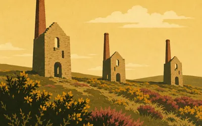
Three roofless engine houses standing in gorse and heather, close enough to the road that you can see the window openings as you pass.
- The Cornwall and West Devon Mining Landscape became a World Heritage Site in 2006.
- Wheal Peevor's three engine houses each did a different job: pumping, winding and stamping.
102 km (63 miles) · nature
Bodmin Moor
Granite, weather and not much else
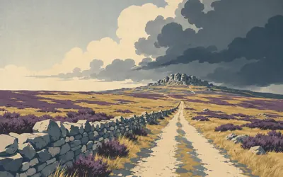
The road lifts out of the fields and suddenly there is nothing on either side but rough grass, granite and sky.
- Brown Willy, at 420 metres, is the highest point in Cornwall.
- The moor is granite, part of the same mass that surfaces at Land's End and Dartmoor.
107 km (66 miles) · heritage
Jamaica Inn
A coaching inn on the moor
A long, low, grey inn in the middle of Bodmin Moor, built for coach horses and travellers who could go no further. Daphne du Maurier stayed here and turned it into a smugglers' novel in 1936, and the name has belonged to the book ever since.
123 km (77 miles) · heritage
Launceston Castle
The gate of Cornwall
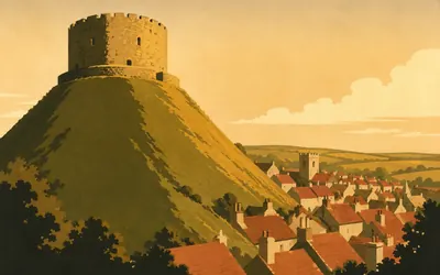
A round stone keep on top of a very steep artificial mound, put there by the Normans to hold the road into Cornwall.
- By the thirteenth century the town below the castle was surrounded by a wall.
- The keep sits on a motte raised soon after the Norman Conquest.
152 km (95 miles) · heritage
Okehampton Castle
Norman ruins on the edge of Dartmoor
A motte-and-bailey castle begun soon after the Conquest, its jagged keep standing over the West Okement river where the road first meets Dartmoor.
Somerset and the Severn
200–466 km · 13 places
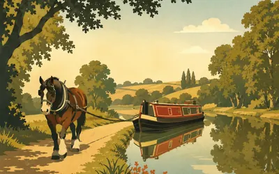
200 km (124 miles) · engineering
The Grand Western Canal
The canal that never reached the Channel
Eleven miles of still green water on a single level, with no locks at all.
- The surviving stretch has no locks: eleven miles on one level.
- The extension to Taunton opened in 1838 and the railway company closed it in 1867.
220 km (137 miles) · landmark
Wellington Monument
A three-sided spike on the Blackdowns
A tall triangular obelisk on the ridge, put up to thank the Duke of Wellington for Waterloo and then left half-finished for decades while the money ran out. It has been repaired more times than it has been completed.
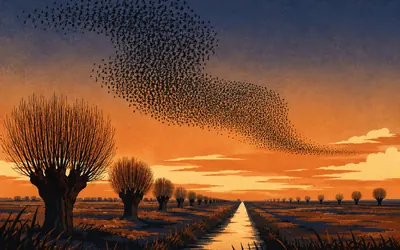
252 km (157 miles) · nature
The Somerset Levels
Land below the high tide
Dead flat, laced with ditches, and in places lower than the tide outside the sea wall.
- Parts of the Levels lie below the level of the high tide outside the sea defences.
- Neolithic timber trackways preserved in the peat here are among the oldest known in northern Europe.
264 km (164 miles) · heritage
Brent Knoll
An island in a drained sea
A single steep hill standing out of the flat, ringed by the ramparts of an Iron Age fort. When the Levels around it were open marsh this really was an island, and whoever held the top could see anyone coming for miles.
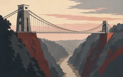
300 km (186 miles) · engineering
Clifton Suspension Bridge
Brunel's first, finished last
Two stone towers on the lips of the Avon Gorge with a road slung between them, seventy-odd metres above the mud.
- Brunel won the design competition at twenty-four; the bridge opened in 1864, five years after he died.
- Its chains were reused from another Brunel bridge, the Hungerford footbridge in London.
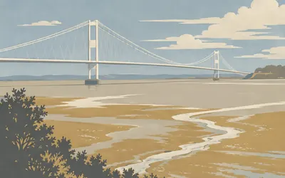
322 km (200 miles) · engineering
The Severn Bridge
England into Wales, 1966
The first road crossing of the Severn estuary, slung above one of the largest tidal ranges on Earth.
- It opened in 1966 and now carries the M48.
- Its aerodynamic deck and inclined hangers made it the first bridge in the world built with both.
- It replaced the Aust ferry; the other way across was the long road round by Gloucester.
335 km (208 miles) · heritage
Tintern Abbey
Roofless in the Wye Valley
A Cistercian abbey founded in 1131, left open to the sky since the Dissolution. Its empty windows made it one of the first places in Britain people travelled to simply because it was beautiful.
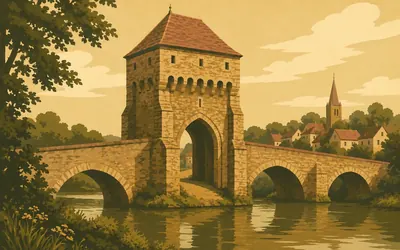
350 km (217 miles) · heritage
Monnow Bridge
A gatehouse in the middle of the river
A squat stone tower sitting on the middle of a bridge, with an arch through it just wide enough for a cart.
- It is the only medieval fortified river bridge in Britain with its gate tower still on the bridge.
- The bridge carried road traffic until 2004, more than seven centuries after it was built.
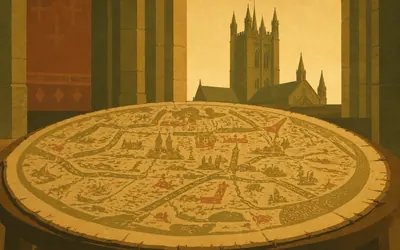
378 km (235 miles) · heritage
Hereford Cathedral
Where the world is a circle
Pink sandstone beside the Wye, and inside it a sheet of calfskin about the size of a door.
- The Mappa Mundi dates from about 1300 and puts Jerusalem at the centre of the world.
- The chained library, fitted out in 1611, still has its books secured to the shelves by their chains.
399 km (248 miles) · heritage
Leominster Priory
Half a monastery, still in use
A Benedictine priory church that is now the parish church, its Norman priory nave standing beside a thirteenth-century parish nave. The result is a church built in phases side by side, with Norman arches along the north.
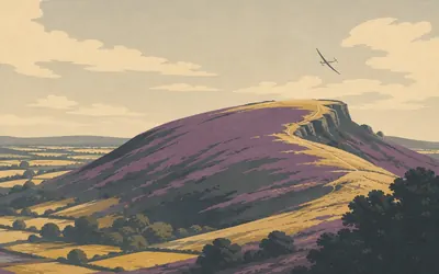
439 km (273 miles) · nature
The Long Mynd
Heather, and a road older than roads
A long whaleback of heather moorland lifting straight out of the Shropshire fields, with steep wooded valleys cut into its eastern side.
- The Portway along the ridge has carried traders for around five thousand years.
- The Long Mynd's rocks are Precambrian, among the oldest in Shropshire.
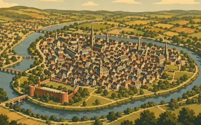
460 km (286 miles) · heritage
Shrewsbury
A town inside a river
The Severn makes a loop here that the old town sits inside, with a castle planted across the neck.
- The old town sits inside a loop of the Severn.
- Charles Darwin was born in Shrewsbury, and the town library was once its grammar school.
466 km (289 miles) · heritage
Battlefield
21 July 1403
A church standing alone in a field with a name that gives the game away. Henry IV met Harry Hotspur here in the first major battle where English archers fought each other on home soil, and the church was built afterwards so somebody would pray for the dead.
Cheshire and Lancashire
512–635 km · 6 places
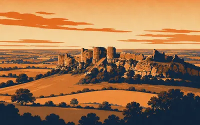
512 km (318 miles) · heritage
Beeston Castle
A rock in the middle of the plain
The Cheshire Plain runs flat to the horizon in every direction and then, without any warning, there is a sandstone crag with a castle on it.
- The inner bailey well is over 100 metres deep, one of the deepest castle wells in England.
- An Iron Age hillfort occupied the same crag long before the medieval castle.
538 km (334 miles) · engineering
The Manchester Ship Canal
Thirty-six miles to make a seaport
A canal wide enough for ocean-going ships, dug across Cheshire so that Manchester could stop paying Liverpool's dock charges. It opened in 1894 and turned a city forty miles inland into Britain's third busiest port.
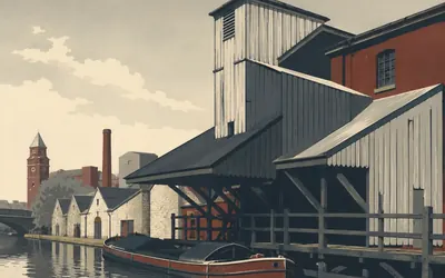
563 km (350 miles) · heritage
Wigan Pier
The most famous joke in Lancashire
There is no seaside pier.
- The pier was a coal tippler on the canal, dropping coal into the barges below.
- Orwell's The Road to Wigan Pier was published in 1937.
607 km (377 miles) · heritage
Garstang
The first Fairtrade Town
A small market town on the Lancaster Canal that in 2000 declared itself the world's first Fairtrade Town. Nobody had done it before, several thousand towns have done it since, and it started with a public meeting here.
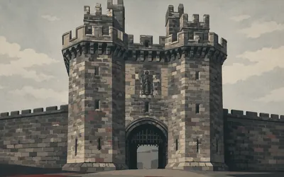
625 km (388 miles) · heritage
Lancaster Castle
A working prison until 2011
Most castles on this route stopped being used somewhere around the seventeenth century.
- The Pendle witch trials were heard here in 1612.
- It served as HM Prison Lancaster until 2011, and the Crown Court still sits in it.
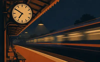
635 km (394 miles) · heritage
Carnforth Station
The clock from Brief Encounter
An ordinary Lancashire junction station that happens to be one of the most recognisable places in British cinema.
- The Ministry of War Transport judged Carnforth far enough from the capital to be safe from enemy attack.
- Filming ran overnight, when little or no traffic was booked, so trains would not disturb the shoot.
- The platform clock is the original from the film, restored and put back in 2026.
Cumbria and the border
670–903 km · 10 places
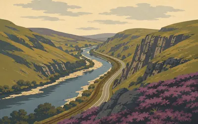
670 km (416 miles) · nature
The Lune Gorge
Everything squeezed through one gap
The Lakeland fells come down from the west, the Howgills come down from the east, and between them there is one narrow valley.
- The gorge carries the river, the West Coast Main Line and the M6 through one gap.
- The Howgill Fells are smooth, grassy Silurian domes, older than most of the Dales' rocks.
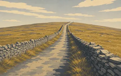
687 km (427 miles) · nature
Shap Fell
The old road north
Open fell, dry-stone walls and a climb that goes on long after you expect it to stop.
- Highways England records vehicles queueing in winter to get past the snow on the A6 at Shap.
- The M6 between Lancaster and Penrith opened in October 1970 and took the traffic north.
689 km (428 miles) · heritage
Shap Abbey
Hidden in a fold of the fell
A tower standing on its own in a hollow by the River Lowther, invisible until you are almost on top of it. White canons of the Premonstratensian order founded it in the late twelfth century, and the last abbot handed it over to Henry VIII in January 1540.
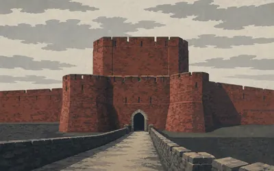
737 km (458 miles) · heritage
Carlisle Castle
The most besieged place in the British Isles
A blunt red sandstone block at the heart of a place besieged ten times, more often than anywhere else in the British Isles, for the simple reason that Carlisle sits on the western end of the border and whoever held it held the road.
- Carlisle has been besieged ten times, more than any other place in the British Isles.
- Mary, Queen of Scots was imprisoned here in 1568.
- The castle changed hands twice during the 1745 Jacobite rising.
752 km (468 miles) · heritage
Gretna Green
First village in Scotland
The border crossing every end-to-end rider counts down to. For about a century it was also where eloping English couples stopped, because the law changed the moment they crossed it.
777 km (483 miles) · heritage
Lockerbie Garden of Remembrance
21 December 1988
A quiet walled garden at Dryfesdale, above the town, given over to the memory of the people who died that night. The Air Accidents Investigation Branch, which investigated the crash, records two hundred and seventy lives lost, in the air and on the ground. Riders pass through a small Scottish market town and mostly would not know. The garden is why this entry is here.
859 km (534 miles) · heritage
West Linton
A village that carved itself
A drove-road village under the Pentlands with a long tradition of stone carving. In 1666 the mason James Gifford put a statue of his wife on the village well; a cast of her still watches the traffic.
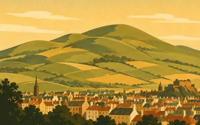
867 km (539 miles) · nature
The Pentland Hills
A range on a city's doorstep
A run of rounded green hills coming right up to the southern edge of Edinburgh, close enough that people walk out of the suburbs and onto open moorland in twenty minutes.
- The Pentlands were designated a Regional Park in 1984, confirmed in 1986.
- Robert Louis Stevenson summered at Swanston below them and used them in poems to the end of his writing life.
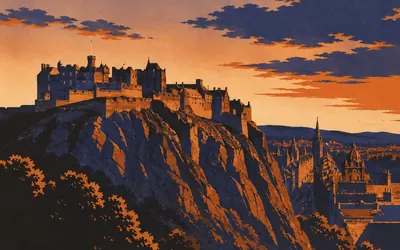
886 km (551 miles) · heritage
Edinburgh Castle
A fortress on a dead volcano
The rock came first.
- The castle rock is the plug of a volcano active early in the Carboniferous, over 300 million years ago.
- St Margaret's Chapel, about 1130, is the oldest surviving building in Edinburgh.
- The Scottish crown jewels were locked in a chest and forgotten for over a century before being rediscovered in 1818.
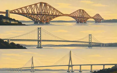
903 km (561 miles) · engineering
The Forth Bridges
Three centuries of crossing, side by side
Cantilevered red steel from 1890, a suspension bridge from 1964 and a cable-stayed crossing from 2017, all in one view.
- The 1890 Forth Bridge became a UNESCO World Heritage Site in 2015.
- The Queensferry Crossing, the newest of the three, opened in 2017.
- "Painting the Forth Bridge" became a phrase for a never-ending task.
Fife and Perthshire
935–1,021 km · 6 places
935 km (581 miles) · nature
Glen Farg
A wooded slot in the Ochils
The Ochil Hills part just enough to let a burn, a road and once a railway through, all of them stacked in a narrow wooded gorge. The railway closed to passengers in 1970 and its tunnels are still in the hillside, going nowhere.
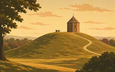
956 km (594 miles) · heritage
Scone Palace
The mound where kings were made
The palace is Georgian gothic and rather grand, but the thing that matters here is a low grassy mound beside it with a chapel on top.
- Kings of Scots were inaugurated on Moot Hill, seated on the Stone of Destiny.
- Edward I removed the Stone to Westminster in 1296; it was returned to Scotland in 1996.
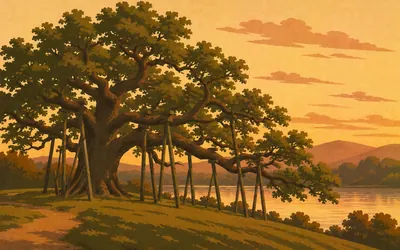
981 km (609 miles) · nature
The Birnam Oak
The last of Birnam Wood
An enormous, half-hollow, propped-up oak on the bank of the Tay, with branches so heavy they rest on crutches.
- The tree is held by tradition to be a survivor of Shakespeare's Birnam Wood.
- Beatrix Potter spent childhood summers a few miles up the Tay at Dalguise, and later stayed at Birnam, studying local fungi.
984 km (612 miles) · nature
The Hermitage
A folly over a waterfall
A small stone pavilion built in 1758 on a ledge directly above a waterfall, purely so that eighteenth-century visitors could be pleasurably terrified by the noise. The Douglas firs in the gorge around it are among the tallest trees in Britain.
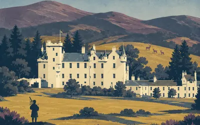
1,016 km (631 miles) · heritage
Blair Castle
The last private army in Europe
A startling white castle in a green park at the mouth of the Highlands, with red deer on the hill behind and a private army on the payroll.
- The Atholl Highlanders are the only remaining private army in Europe.
- Blair Castle was besieged in 1746, one of the very last castle sieges fought on British soil.
1,021 km (634 miles) · nature
The Falls of Bruar
A poem that planted a wood
Robert Burns walked up this gorge in 1787, decided the bare rock needed trees, and wrote a poem in the voice of the river asking the Duke of Atholl to plant some. The Duke planted the gorge from 1796, said to be the poem's doing, and the wood you walk through now is a later replanting.
The Highlands
1,071–1,238 km · 9 places
1,071 km (665 miles) · heritage
Highland Folk Museum
The first open-air museum in mainland Britain
A mile-long strip of rebuilt Highland buildings, from an eighteenth-century turf-roof township to a 1930s schoolroom, with peat fires actually burning in them. Isabel Grant started it in 1936 because nobody else was collecting ordinary Highland life.
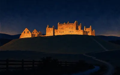
1,077 km (669 miles) · heritage
Ruthven Barracks
Burned by the men who reached it
A roofless stone barrack block on a perfectly conical green mound, floodlit at night and visible for miles across the flat floor of Strathspey.
- It was built between 1719 and 1721, after the failed 1715 Jacobite rising.
- Jacobite survivors of Culloden gathered here in 1746, then burned it and dispersed.
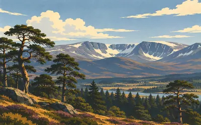
1,100 km (684 miles) · nature
The Cairngorms
Britain's arctic
From the road at Aviemore the Cairngorms look like a long grey wall with snow on it for most of the year, and that is roughly what they are.
- The Cairngorms National Park is the largest national park in the United Kingdom.
- The plateau holds Britain's largest expanse of arctic-alpine habitat.
- A free-ranging reindeer herd, reintroduced in the 1950s, lives on the hills above Aviemore.
1,123 km (697 miles) · viewpoint
Slochd Summit
1,328 feet, and then downhill
The second and last summit on the road north, marked by a stone and a lay-by. From here the ground falls away towards Inverness and the Moray Firth, and the hard climbing of the Highlands is behind you.
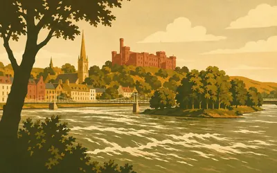
1,154 km (717 miles) · heritage
Inverness
The capital of the Highlands
A fast, clear, surprisingly wide river running through the middle of a small city, with a red sandstone castle above it and a chain of wooded islands linked by footbridges downstream.
- Inverness is known as the capital of the Highlands.
- Telford's Caledonian Canal, opened in 1822, reaches the sea here after crossing the Great Glen.
1,158 km (719 miles) · engineering
Kessock Bridge
Dolphins underneath
A cable-stayed bridge opened in 1982, carrying the road onto the Black Isle and cutting a long detour round the head of the firth. The narrows open onto the Moray Firth, one of the most important areas for Scotland's east coast bottlenose dolphins.
1,189 km (739 miles) · engineering
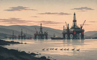
The Cromarty Firth
Oil rigs parked in a sea loch
You come round a bend expecting hills and water, and instead there are oil platforms standing in the firth like a small steel city that has waded out from shore.
- The firth is deep and sheltered enough to take offshore rigs for repair and lay-up.
- The Nigg yard at the mouth of the firth first built offshore structures in 1972.
1,205 km (749 miles) · viewpoint
The Struie Viewpoint
The top of the old road
The old road over the hill climbs steadily to a lay-by at the top, and then falls away for miles in front of you. A good part of what you are about to ride is in sight from here at once, which is either encouraging or not. Nobody who looks after this road publishes a word about the view, so nothing here is named on their say-so.
1,238 km (769 miles) · nature
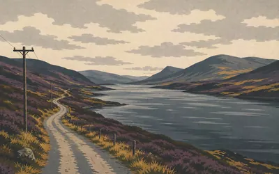
Lairg
The last crossroads
A village at the foot of a long dark loch, and the point where the cross-county roads of central Sutherland meet before going their separate empty ways.
- Lairg is where central Sutherland's cross-county roads meet the railway.
- Thousands of lambs are sold at Lairg in a single day each August.
Sutherland and the north coast
1,260–1,390 km · 8 places
1,260 km (783 miles) · heritage
The Crask Inn
One building, thirteen miles of nothing
A white inn on an empty moor with no village attached and no other building in sight. It has been sheltering drovers, shepherds and now cyclists for two centuries, and since 2017 it has belonged to the Scottish Episcopal Church, which added a chapel.
1,281 km (796 miles) · heritage
Strathnaver
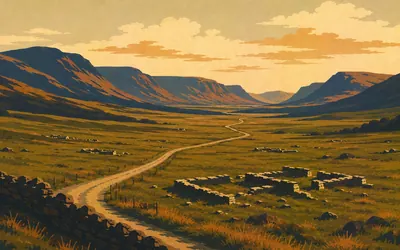
A valley emptied of people
A wide green river valley running some twenty miles to the sea, with a single-track road down one side and almost nobody living in it.
- The townships of Strathnaver were cleared between 1814 and 1819.
- The stone footings of cleared villages can still be walked round on the Strathnaver Trail.
1,292 km (803 miles) · heritage
Rosal
A township you can still walk round
The excavated remains of a Strathnaver township, cleared of its people and left. The outlines of the houses, the kilns and the field walls are all still legible in the grass, and a path takes you round what was somebody's front door.
1,336 km (830 miles) · viewpoint
Melvich Bay
Sutherland hands over to Caithness
The road comes over a rise and there is a crescent of pale sand with the Halladale running into it and Orkney low on the water beyond. This is roughly where the hills of Sutherland give up and the flat farmland of Caithness begins.
1,343 km (834 miles) · engineering
Dounreay
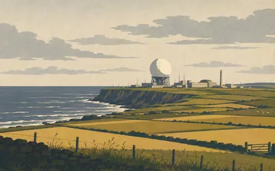
A steel golf ball on the Atlantic
Twelve miles of flat Caithness farmland and then, on the cliff edge, an enormous white steel sphere that looks as though it landed rather than got built.
- The sphere is the containment shell of the Dounreay Fast Reactor, first operational in 1959.
- The whole site is now being decommissioned, and the sphere is scheduled to be removed.
1,359 km (844 miles) · landmark
Thurso
The most northerly town in Britain
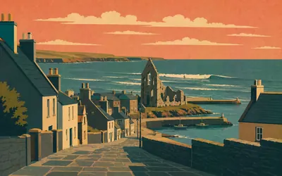
Grey flagstone streets laid out on a grid, a river running through the middle and the Pentland Firth at the end of it.
- Thurso is the most northerly town on the British mainland.
- Orkneyinga Saga calls it Thor's river, but the Gaelic name suggests bull river.
- Thurso is a world-class surf spot, with some of the best waves in Europe.
1,384 km (860 miles) · heritage
The Castle of Mey
A ruin somebody decided to save
The Queen Mother saw this castle in 1952, shortly after she was widowed, found it roofless and about to be abandoned, and bought it. She spent the next fifty years coming back every August. It is the most northerly inhabited castle on the British mainland.
1,390 km (864 miles) · landmark
John o' Groats
The far end
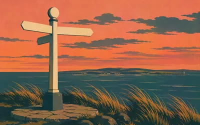
The other signpost.
- It is named after Jan de Groot, said to have run a ferry to Orkney in the fifteenth century.
- It is not the most northerly point of mainland Britain: Dunnet Head, to the west, is.
Take on Lands End to John O'Groats and collect these places as you reach them
Common questions
How does my cycling or running count towards LEJOG?
Connect Strava or Apple Health once and every ride, run or walk you record is added to your total, moving your marker north from Land's End. A 40 km Sunday ride is 40 km of LEJOG, whether you rode it in Cornwall or on a turbo trainer in a garage. There is nothing to upload afterwards and no distance to enter by hand.
Do I have to live near the Land's End to John O'Groats route?
No, and almost nobody taking on the virtual LEJOG does. The route sets the distance; you choose the ground. Your commute, your Saturday 5k and your weekend miles all carry you further up the country, and the only thing Land's End and John O'Groats decide is how far you still have to go.
How far is Land's End to John O'Groats?
The Route Rally route covers about 1,390 km, or roughly 864 miles, running from Land's End in Cornwall to John O'Groats in the far north of Scotland. Real-world cycling routes vary, with most falling between 870 and 1,000 miles depending on the roads you take.
How long does it take to cycle LEJOG?
At a steady 150 km a week it works out at around nine to ten weeks. Push to 250 km a week and you could finish in under six weeks, while a more relaxed 100 km a week stretches it to about three months. The end date is yours to set when you create the rally, so the pace is too.
Can I run Land's End to John O'Groats virtually?
Yes. The running variant uses the same route as a long-term target. Runners often treat LEJOG as a year-long project: cover 40 km a week and you reach John O'Groats in roughly eight months, while 70 km a week brings it inside half a year. Every run you sync counts towards the total.
How long does LEJOG take to walk?
Walkers usually take it on as an annual goal. At 30 km a week you would arrive in just under a year, and daily walks, steps and hikes all add up, so it suits anyone building a steady, low-impact habit.
How should I train for a virtual LEJOG?
Build distance gradually rather than chasing big one-off efforts. Pick a weekly target you can repeat, add a little each fortnight, and let consistency do the work. Because progress is cumulative, the steady weeks matter far more than the occasional long one.
How much climbing does the route involve?
Followed end to end, the LEJOG route gains close to 14,000 m of elevation, which is part of what makes the full journey so demanding. In a virtual rally you are working towards the distance rather than that exact climb, but it shows just how much ground the route covers.
Can a team or club take it on together?
Definitely. Set up a rally for your club, workplace or group of friends and everyone's synced activities move along the same route. It is a popular way to keep a team motivated over a longer challenge.
Start your Lands End to John O'Groats Conquest
Joining is free. Connect Strava or Apple Health once and every ride, run or walk you record syncs automatically, moving you along the route without anything else to log.
Start your Lands End to John O'Groats Conquest, free to join