Virtual John Muir Way Challenge
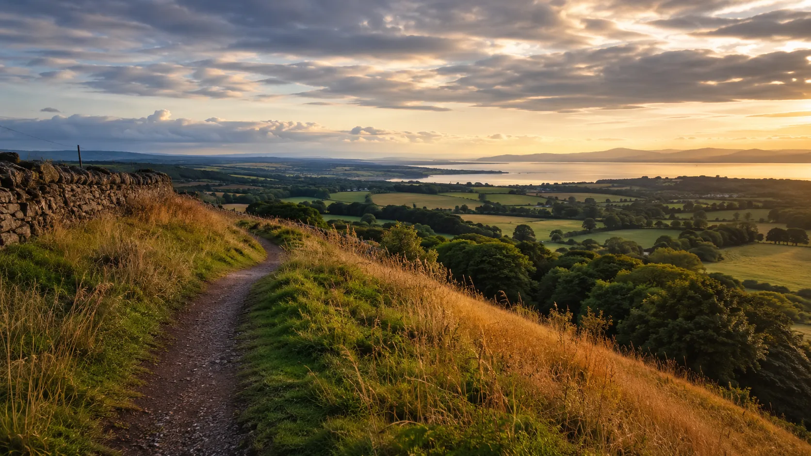
Walk coast to coast across the heart of Scotland from your own roads and trails. The John Muir Way runs roughly 208 km (about 130 miles) from Helensburgh on the Firth of Clyde in the west to Dunbar on the East Lothian coast, birthplace of the conservationist John Muir. The route crosses the Central Belt through Loch Lomond's southern shores, the Falkirk Wheel and the Firth of Forth. Route Rally turns every synced walk, run or ride into progress along it.
Part of the Scotland's Great Trails series
- Route: John Muir Way
- Distance: 208.4 km
- Elevation gain: 2271 m
- Coast-to-coast Scotland crossing
- Best for: Medium rallies of your own for walkers and runners, and coast-to-coast journey goals
Planning your challenge
A runner averaging 40 km/week finishes in about five weeks; a walker at 30 km/week takes around seven weeks, and a cyclist at 150 km/week completes it in around a week and a half.
This is a Medium route by Route Rally distance bands, fitting a focused two-month target for walkers and a shorter goal for cyclists.
Works well for walkers who want a gentle coast-to-coast crossing of Scotland without the high-mountain terrain of the West Highland Way.
Create your own rally for your own John Muir Way target, solo or with a group sharing one leaderboard.
Why this route
- The John Muir Way covers about 208 km (130 miles) from the Clyde coast at Helensburgh east to Dunbar on the North Sea, crossing Scotland through its most populated and historically rich central corridor.
- As a virtual challenge you cover the distance in your own time, with walks, runs and rides from anywhere pushing you east across Scotland.
- The route is named after John Muir, the Scottish-American naturalist and father of the American national park movement, who was born in Dunbar in 1838.
- It is one of the more accessible of Scotland's long-distance routes, following lowland and lochside terrain rather than high mountain paths.
- Its medium length suits a focused six-to-eight week walking goal, while cyclists can complete it in a week and a half of steady riding.
Highlights
- Start at Helensburgh on the Firth of Clyde, by Mackintosh's Hill House
- Follow the southern shore of Loch Lomond from Balloch Castle and on through the Campsie Fells
- Pass the Antonine Wall forts at Bar Hill and Rough Castle, and the Falkirk Wheel
- Build distance by Linlithgow Palace and Blackness Castle to South Queensferry and Holyrood Park
- Finish past Dirleton Castle and North Berwick Law at John Muir's birthplace in Dunbar
Places along the route
Every place below is measured onto the route line, so the distance shown is where you actually reach it.
Places are researched from published sources. The distances are measured rather than estimated: we find the point on the route's own recorded line that lies nearest the place, and give the distance along the route to that point.
The Clyde, Loch Lomond and the Campsies
0–44 km · 7 places
0 km (0 miles) · landmark
Helensburgh
The end he sailed from
The trail's western end, on the Clyde. The John Muir Trust, which took on the route's administration in 2023, gives it as 134 miles coast to coast and says Helensburgh is the western terminus because this is where John Muir left Scotland for the United States. He was eleven. The other end of the trail is the house he was born in.
2 km (1 mile) · heritage
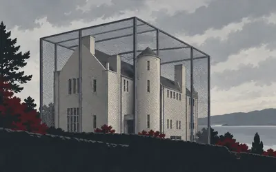
The Hill House
A Mackintosh house inside a cage
Charles Rennie Mackintosh designed this house inside and out, and Historic Environment Scotland's listing is careful to say the interior was conceived in its entirety by Mackintosh and by Margaret Macdonald Mackintosh together.
- Historic Environment Scotland lists the Hill House at Category A and dates Mackintosh's design to 1902 to 1904, for the publisher Walter Blackie.
- The listing credits the interior to Charles Rennie Mackintosh and Margaret Macdonald Mackintosh together.
- Historic Environment Scotland's own account says the cement harl achieved the intended look but has proved more than problematic, and that the house is over-saturated.
7 km (4 miles) · heritage
Bannachra Castle
An arrow through a stair window
Historic Environment Scotland's record for this tower house contains one sentence you do not forget. The Colquhouns built it after 1512; in 1592 the MacGregors took it and killed Sir Humphrey Colquhoun with an arrow fired through a stair window. It was never repaired. What is left measures fourteen metres by seven, with gun loops under some of the windows.
16 km (10 miles) · landmark
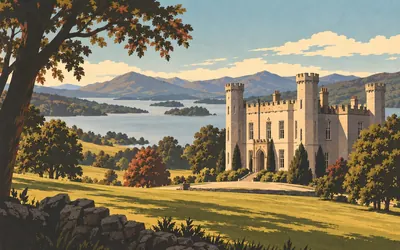
Balloch Castle
The loch that made a national park
The trail reaches Loch Lomond here, and the castle above the shore is younger than it looks.
- Historic Environment Scotland dates the present castle to 1808 and 1809 and names Robert Lugar as its architect.
- The Lennox family's original stronghold survives as a scheduled mound and moat in the south-west of the park.
- Loch Lomond and The Trossachs National Park became fully operational on 19 July 2002.
28 km (17 miles) · heritage
Drumquhassle Roman Fort
A fort that only exists in photographs
There is nothing to see. Historic Environment Scotland records a fort of about 130 metres by 110 surviving only as cropmarks on aerial photographs, and a small excavation in 1980 that found a single period of occupation followed by the deliberate slighting of its own defences. It is thought to belong to the short-lived Flavian push under Agricola, two generations before the frontier this trail meets later.
30 km (18 miles) · nature
The Endrick Water
Lampreys that never went to sea
NatureScot calls this the largest river flowing into Loch Lomond and notifies it for its lampreys. The river lamprey here does something recorded nowhere else in the UK: instead of going to sea as an adult it stays in fresh water and feeds in the loch. The citation also describes an unmodified lowland river with tortuous meanders, oxbows and abandoned channels.
44 km (27 miles) · nature
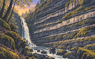
Ballagan Glen
The place a rock was named after
A steep wooded cleft in the south face of the Campsie Fells, with a waterfall at the top of it called the Spout of Ballagan.
- NatureScot's citation calls Ballagan Glen the type locality for the Ballagan Beds.
- The citation describes it as a classic section for rocks of the Carboniferous Cementstone Group.
- The glen is notified twice over: for its Lower Carboniferous stratigraphy and for its upland mixed ash woodland.
The Antonine Wall and the Falkirk canals
56–79 km · 7 places
56 km (35 miles) · engineering
The Luggie Water Aqueduct
Canal over road over river
Three things cross here, stacked. John Smeaton's aqueduct carries the Forth and Clyde Canal over a road, and the road in turn is carried over the Luggie Water on a low two-arched bridge below it. Historic Environment Scotland dates the eastern section of the canal to 1768 to 1775 and lists the whole arrangement at Category A. It is all grey ashlar.
62 km (39 miles) · heritage
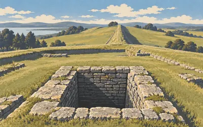
Bar Hill Fort
What came out of the well
The Antonine Wall was not a wall of stone.
- Historic Environment Scotland records that Bar Hill fort does not stand on the Antonine Wall but up to twenty-five metres behind it.
- The fort's well and waterlogged pits preserved leather shoes, tent fragments, a wooden bucket, winding gear and a wagon wheel.
- Historic Environment Scotland describes the Antonine Wall as a turf rampart three to four metres high, occupied for about twenty years before it was abandoned in the AD 160s.
65 km (40 miles) · heritage
Croy Hill
A ditch cut through basalt
The ditch here is cut through solid rock, and Historic Environment Scotland calls it exceptionally well preserved for exactly that reason: basalt keeps its edges where turf does not. Croy Hill carried a fort, a fortlet, a temporary camp and two raised platforms thought to be signalling posts. HES counts sixteen known forts along the whole wall.
67 km (42 miles) · heritage
The Battle of Kilsyth
Fifteenth of August, 1645
Historic Environment Scotland's inventory calls Kilsyth the largest battle fought within Scotland during the Civil Wars. In 1645 Montrose's Royalists destroyed the last Covenanter army in the country, and the inventory records that the Covenanters reportedly lost more than half of their number. Local tradition has kept its own account in the field names: Slaughter Howe, Bullet Knowes, Baggage Know.
74 km (46 miles) · heritage
Seabegs Wood
The road behind the rampart
Three hundred and fifty metres of the wall survive in this wood, and Historic Environment Scotland calls the stretch exceptionally well preserved: a ditch over twelve metres wide and two deep, a rampart still over a metre high. Better still is the road behind it. HES says the Military Way is best seen here, a seven-metre cambered mound with its surface showing.
77 km (48 miles) · heritage
Rough Castle
Ten rows of sharpened stakes
Historic Environment Scotland calls this the best-preserved of all the Antonine Wall forts, but the thing to look for lies in front of it. Ten rows of shallow oval pits are cut north of the ditch. They held sharpened stakes under brushwood, and the Romans called them lilia, after lilies, a name HES traces to Caesar describing the same trap in Gaul.

79 km (49 miles) · engineering
The Falkirk Wheel
Eleven locks, replaced by one turn
Two canals meet here at different heights, and for most of a century there was no way between them at all.
- Scottish Canals calls the Falkirk Wheel the world's one and only rotating boat lift.
- It replaced a flight of eleven locks and forty-four gates that stepped the Union Canal down more than a hundred feet.
- Scottish Canals gives the electricity used by one rotation as 1.5 kilowatt hours.
The Union Canal, the Forth shore and Edinburgh
94–151 km · 10 places
94 km (59 miles) · engineering
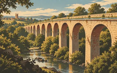
The Avon Aqueduct
Twelve arches and a cast-iron trough
Twelve arches, eight hundred and ten feet of them, carrying a canal eighty-six feet above the river Avon.
- Historic Environment Scotland records twelve arches, 810 feet long and 86 feet high.
- The listing names Hugh Baird as engineer and says the aqueduct was built on the united advice of Baird and Telford.
- The Union Canal is a contour canal, cut to hold a single level between Falkirk and Edinburgh.
100 km (62 miles) · heritage
Linlithgow Palace
The royal nursery
Historic Environment Scotland calls this the largest non-defensive royal residence in medieval Scotland, built between 1424 and 1624. It served as the royal nursery: James V was born here in 1512 and Mary Queen of Scots in 1542. In the courtyard stands the three-tiered fountain James V added in 1538. NatureScot calls the loch below it the largest natural freshwater loch in the Lothians.
102 km (64 miles) · heritage
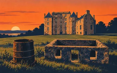
Kinneil House
Head, or end, of the wall
The name means head, or end, of the wall, and Historic Environment Scotland notes that Bede wrote it down in 731, which makes it one of the earliest places in Scotland to be named in writing.
- Historic Environment Scotland says Kinneil means head, or end, of the wall, and that Bede named the place in 731.
- James Watt worked in the cottage behind the house from 1769 to 1773 on the separate condenser he first patented in 1769.
- Historic Environment Scotland calls the cottage the only surviving building in Scotland directly associated with Watt's steam-engine experiments.
109 km (68 miles) · heritage
Carriden Roman Fort
The wall's eastern end, entirely underground
Nothing stands here. Historic Environment Scotland records a fort of about 1.4 hectares surviving entirely as buried remains, found as cropmarks in 1945. An altar turned up nearby in 1956 whose dedication names the villagers of a place called Velaunia, which is as close as this frontier ever gets to telling you what it called itself.
114 km (71 miles) · heritage
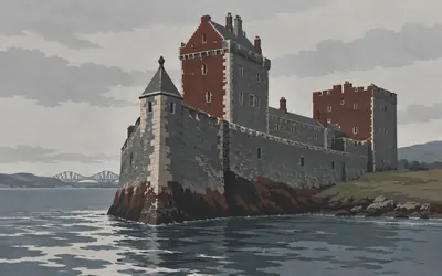
Blackness Castle
The ship that never sailed
Historic Environment Scotland says Blackness is often called the ship that never sailed, and from the water the reason is obvious: a pointed stem tower at the prow, a tall main-mast tower amidships, a solid stern tower beached on the grass.
- Historic Environment Scotland records that Blackness is often called the ship that never sailed, with a stem tower, a main-mast tower and a stern tower.
- James V converted it into a state prison and artillery fortification, work completed in 1542.
- It served as the central munitions depot for Scotland from 1870 to 1912.
118 km (73 miles) · heritage
Abercorn Kirk
Birds inside spiral vines
A late eleventh-century church, much altered, with a built-up round-headed Norman doorway on the south of the nave and a Hopetoun aisle by Sir William Bruce added in 1707. The session house holds a scheduled collection of carved stones: two hog-backed grave covers, cross shafts and cross slabs, one shaft carved with birds sitting inside spiral vines.
123 km (77 miles) · heritage
South Queensferry
Older than the bridges over it
Historic Environment Scotland dates the Carmelite priory church here to about 1450, on a friary founded in 1330, and the Black Castle on the High Street to 1626. The Black Castle's listing carries a grim aside: the owner's sister-in-law, Janet Lowrie, was condemned to death as a witch and was probably burnt at Ferry Muir, where many were.
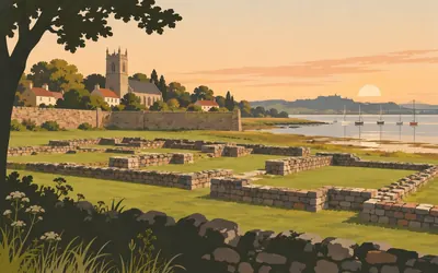
131 km (81 miles) · heritage
Cramond Roman Fort
Five acres at the mouth of the Almond
The mouth of the Almond, and under the grass a Roman fort of just under five acres.
- Historic Environment Scotland dates the fort's construction to around AD 140 and records reoccupation under Severus in the early third century.
- The fort encloses just under five acres, with a civilian settlement outside it showing evidence of leather working.
- First-century coins suggest Agricolan-period activity, but Historic Environment Scotland records that excavation has not proved an Agricolan origin.
133 km (82 miles) · engineering
Cramond Old Bridge
Every repair is cut into the wall
Three shallow pointed arches over the Almond, on a bridge rebuilt more often than most roads. Historic Environment Scotland dates the original to the late fifteenth or early sixteenth century, records that it was ruinous and unpassable by 1607, and lists repairs in 1617, 1687, 1761, 1776 and 1854. Every one of those dates is inscribed on the bridge itself.
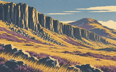
151 km (94 miles) · nature
Holyrood Park
Where geology stopped being an argument
A volcano in the middle of a capital city, and NatureScot's citation does not undersell it: one of the most studied ancient volcanoes in the world, with every part of a typical strato-volcano on show and the sequence of eruptions traceable with a continuity unique in Britain.
- NatureScot calls Arthur's Seat one of the most studied ancient volcanoes in the world.
- Its citation says the sequence of eruptions can be traced with a continuity unique in Britain, and calls Salisbury Crags one of the earliest, if not the earliest, sill to be recognised.
- Historic Environment Scotland schedules four prehistoric forts in the park and calls its cultivation terraces the best in the Lothians.
The East Lothian coast
157–208 km · 11 places
157 km (97 miles) · heritage
Newhailes
A garden that survives as earthworks
Historic Environment Scotland's inventory calls Newhailes a rare survival of an early to mid-eighteenth-century rococo landscape garden, laid out for the Dalrymple family in the 1720s to 1740s while the natural style was still forming in Scotland. Much of it survives as relict earthworks rather than planting, which the inventory rates of high archaeological interest.
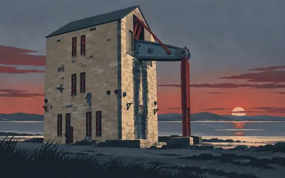
163 km (101 miles) · engineering
Prestongrange Beam Engine
A Cornish engine on the Forth
A Cornish beam engine on a Scottish shore.
- Historic Environment Scotland records the beam engine as built by Harvey and Company in Cornwall and erected here in 1874.
- It pumped water out of the pit in three stages at 2,955 litres a minute until the colliery closed in 1963.
- The listing names the only other surviving beam engine in Scotland, at Devon Colliery in Clackmannan.
165 km (102 miles) · heritage
Preston Tower
Two floors that do not belong
A fifteenth-century tower with two extra floors dropped on top of it in the early seventeenth, and Historic Environment Scotland notes how badly they match: light Renaissance detailing above, sheer mass below. Cromwell's troops burnt it in 1650, it was repaired, and it burnt again by accident in 1663. Nobody has lived in it since. The doocot still holds almost a thousand nesting boxes.
169 km (105 miles) · heritage
Seton Collegiate Church
The nave was never built
Historic Environment Scotland records that the 1st Lord Seton founded the college of priests in 1470 and began the choir, though the Pope died before granting permission; his son secured it in 1492. English troops burnt the timberwork and stole the bells and organ in the 1540s, and Lady Janet built the present transepts and tower out of the repair. The nave never came.
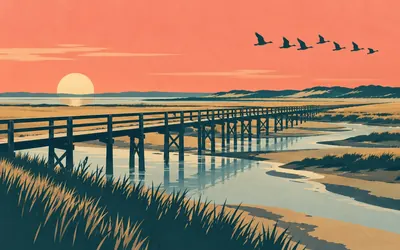
177 km (110 miles) · nature
Aberlady Bay
The first one anybody made
East Lothian Council's own account carries the claim worth keeping: Aberlady Bay was the first Local Nature Reserve designated in the UK, established in 1952.
- East Lothian Council records Aberlady Bay as the first Local Nature Reserve designated in the UK, established in 1952.
- The council puts the autumn roost at up to thirty thousand pink-footed geese arriving from Iceland.
- The bay lies inside NatureScot's Firth of Forth site, notified for wintering birds including pink-footed goose, knot, dunlin and bar-tailed godwit.
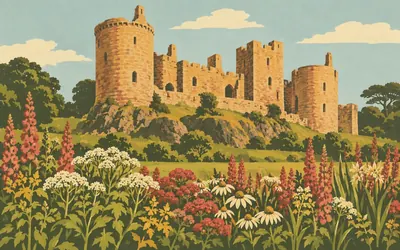
184 km (114 miles) · heritage
Dirleton Castle
A ruin kept as an ornament
Historic Environment Scotland calls Dirleton one of Scotland's oldest surviving strongholds and says the cluster of towers from the 1200s is among the oldest castle architecture left in the country.
- Historic Environment Scotland calls Dirleton one of Scotland's oldest surviving strongholds, its 13th-century towers among the oldest castle architecture in Scotland.
- Historic Environment Scotland describes the gardens as home to the world's longest herbaceous border.
- Edward I's forces captured the castle in 1298 and Cromwell's siege of 1650 ended its military use.
189 km (118 miles) · nature
North Berwick Law
Notified for the grass, not the shape
A volcanic plug standing alone out of flat farmland. NatureScot notifies it not for the shape but for the grass: unimproved, mineral-rich, a rare and declining habitat in East Lothian, holding purple milk-vetch, which the citation notes is not normally found inland. Historic Environment Scotland schedules a fort and hut circles on the summit and publishes no description of them at all.
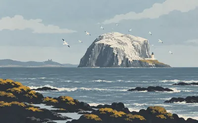
191 km (119 miles) · nature
The Bass Rock
White for a reason
A volcanic plug two kilometres offshore, and white from the mainland all summer.
- NatureScot's citation calls the Bass Rock the largest single-rock northern gannet colony in the world.
- The Scottish Seabird Centre counted over 75,000 occupied sites in 2014 and 52,459 in 2025, about thirty per cent below the level before the 2022 avian influenza outbreak.
- The Northern Lighthouse Board's light first shone from the rock on 1 November 1902 and was automated in 1988.
195 km (121 miles) · heritage
Whitekirk
Further restoration after suffragette fire
Historic Environment Scotland's listing contains the phrase "further restoration after suffragette fire", which is the whole of 1914 in five words. Before that the church was a pilgrimage centre: HES schedules the remains of early fifteenth-century pilgrims' houses beside it, built for the traffic to a healing well, and records that Aeneas Silvius Piccolomini came here before he became Pope Pius II.
205 km (127 miles) · nature
John Muir Country Park
Named for him, forty years too late
East Lothian Council designated this on 12 October 1976 to commemorate John Muir, who was born a few miles east of it. The park covers 713.5 hectares and thirteen kilometres of coastline from Peffer Sands to Dunbar Castle: sand, saltmarsh, the mouth of the Tyne and a long run of dune. He never saw it. He left before there was anything to see.
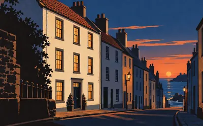
208 km (130 miles) · heritage
John Muir's Birthplace
Where the whole thing started
The trail ends at a three-storey tenement on the High Street, and Historic Environment Scotland's listing gets to the point in four words: birthplace of naturalist John Muir.
- Historic Environment Scotland's listing records the building as the birthplace of the naturalist John Muir, 1838 to 1914.
- John Muir's Birthplace Trust gives his birth date as 21 April 1838 and records that the family left Dunbar in 1849.
- Muir and his friends started the Sierra Club in 1892, two years after Yosemite became a national park.
Take on John Muir Way and collect these places as you reach them
Common questions
How does my walking count towards Dunbar?
Link your account once and every walk, run or ride after that is credited for you, moving you east across Scotland from Helensburgh. A runner at 40 km a week reaches the East Lothian coast in about five weeks, and a walker at 30 km a week in around seven.
Do I have to be in Scotland's Central Belt?
No. Where you walk is your business; how far you walk is the challenge, so your local paths and pavements count towards it. John Muir left Dunbar as a boy and spent his life walking landscapes on the other side of the world; taking his route on from wherever you live is not a bad way to mark that.
Who was John Muir?
John Muir was a Scottish-American naturalist and writer born in Dunbar in 1838. He emigrated to the United States and became the leading figure in the early American conservation movement, playing a key role in establishing Yosemite as a national park and inspiring the US national parks system.
How does this compare to the West Highland Way?
The John Muir Way is longer and follows a very different landscape. The West Highland Way goes through dramatic Highland terrain, while the John Muir Way crosses the Central Belt and Lowlands for a gentler, more varied journey.
Start your John Muir Way Conquest
Connect Strava or Apple Health once and every ride, run or walk you record syncs automatically, moving you along the route without anything else to log.