Conquer the Virtual Hadrian's Wall Challenge: Walk the Roman Frontier Coast to Coast
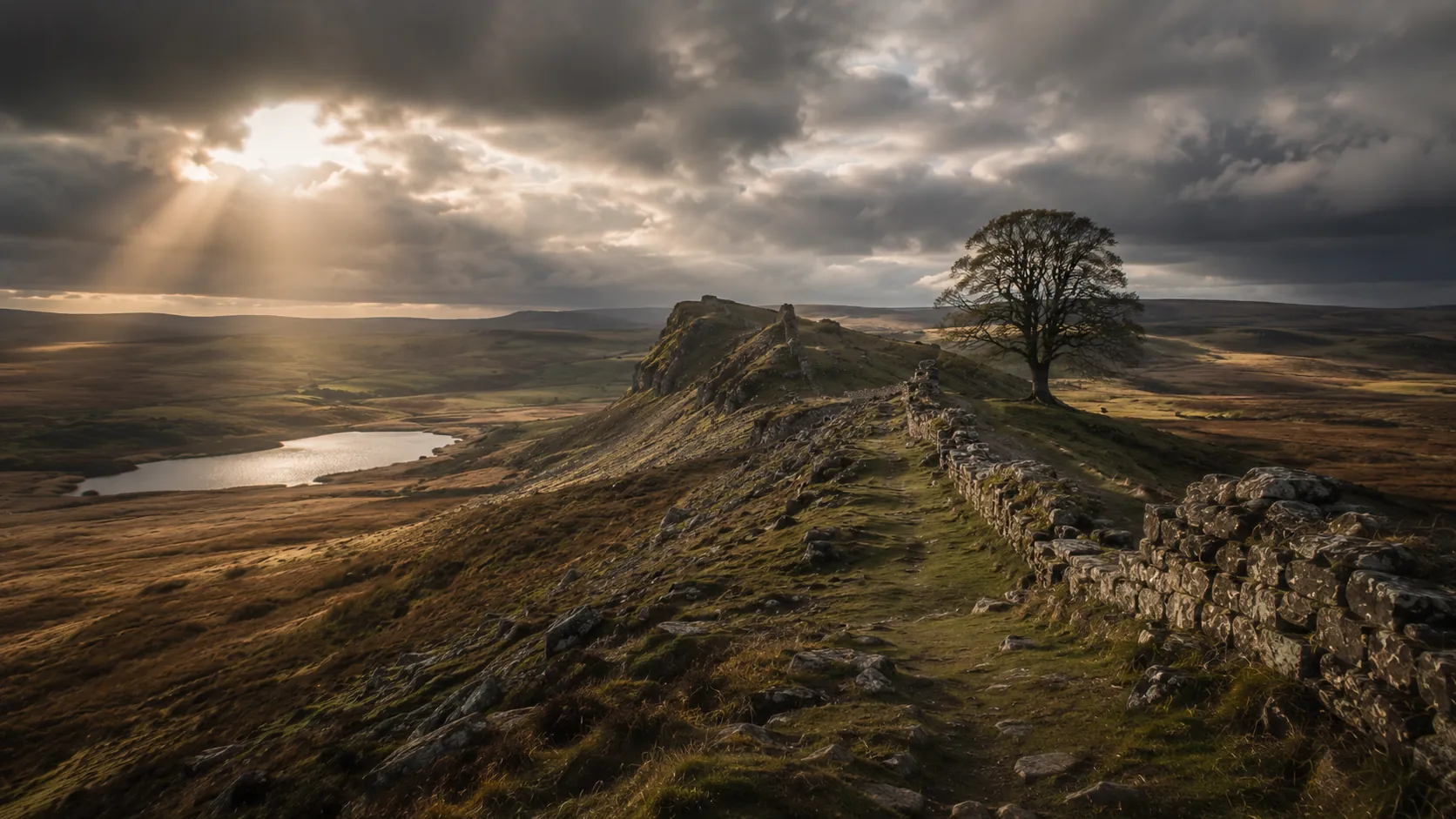
Follow the line of the Roman frontier across the narrow neck of England, virtually. Hadrian's Wall Path runs about 138 km (roughly 86 miles) from Wallsend on the North Sea to Bowness-on-Solway on the Solway Firth, and Route Rally turns every synced walk, run or daily step into progress along it. Short enough to finish in a few weeks of regular activity, it makes an ideal first virtual challenge with eighteen centuries of history behind it.
Part of the Great British Routes series
- Route: Hadrian's Wall Path
- Distance: 137.8 km
- Elevation gain: 2400 m
- Approachable coast-to-coast walking goal
- Best for: First virtual challenges, walkers and step-counters, and shorter rallies of your own
Planning your challenge
A walker averaging 30 km/week finishes in about four to five weeks; a runner at 40 km/week completes it in under a month.
This is a Short route by Route Rally distance bands, so it works well as a first win or a focused monthly goal before committing to a longer route.
Useful for a first rally, a step-count challenge, or a short shared route with a clear coast-to-coast finish.
Create your own rally for your own challenge format, solo or with a club, workplace or group of friends.
Why this route
- Hadrian's Wall Path follows the line of the Roman frontier built across northern England eighteen centuries ago, from coast to coast.
- At about 138 km (86 miles) it is short enough to finish in a few weeks, which makes it an ideal first virtual challenge or a focused monthly goal.
- The route runs coast to coast from Wallsend near Newcastle to Bowness-on-Solway in Cumbria, a complete crossing of the country at its narrowest.
- Hadrian's Wall is a World Heritage Site and a globally recognised name, so the history gives the challenge a strong identity for walkers and step-counters.
- The manageable distance and the Roman-frontier story make it a popular activation route and a great charity or workplace step challenge.
Highlights
- Start at Wallsend on the North Sea coast near Newcastle
- Build distance along the line of the Roman frontier across northern England
- Pass the central crags country where the most famous stretches of wall survive
- Finish at Bowness-on-Solway on the Solway Firth, a full coast-to-coast crossing
Places along the route
Every place below is measured onto the route line, so the distance shown is where you actually reach it.
Places are researched from published sources. The distances are measured rather than estimated: we find the point on the route's own recorded line that lies nearest the place, and give the distance along the route to that point.
Tyneside
0–30 km · 7 places
0 km (0 miles) · heritage
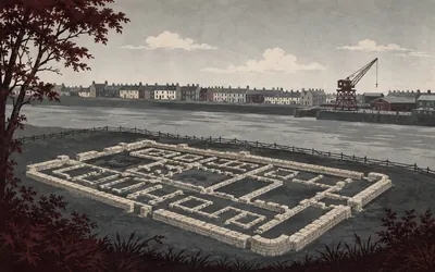
Segedunum
Where the Wall came down to the river
Hadrian's Wall begins in a housing estate.
- Segedunum guarded the eastern end of Hadrian's Wall, where it ran down to the River Tyne.
- Its museum calls it the most excavated site on Hadrian's Wall.
- A thirty-five metre viewing tower lets you read the whole fort plan from above.

8 km (5 miles) · landmark
The Newcastle Quayside
A Roman bridge under a Victorian one
The trail spends its first hours on tarmac beside the Tyne and then turns into the middle of Newcastle, where the bridges stack up one behind another across the gorge.
- Historic England records the Swing Bridge as built in 1868 to 1876 on the site of the Roman and medieval bridges.
- Historic England records the Roman fort here as Pons Aelius, a name taken from its river crossing.
- Historic England records the Tyne Bridge, opened October 1928, as then the largest single-span steel arch bridge in Britain.
12 km (8 miles) · heritage
Benwell Roman Temple
A god known from nowhere else
Two scraps of Roman Benwell survive between houses a kilometre up the bank. One is a temple to Antenociticus, a god attested here and nowhere else in the empire. The other is a stone causeway over the Vallum, which English Heritage calls the only permanent crossing of that earthwork to be seen anywhere on the line of the Wall.
19 km (12 miles) · heritage
Newburn Ford
A ford that lost a war
The Tyne is shallow here, and in the summer of 1640 a Scottish army forced the crossing and beat off the English defending it. Historic England registers the ground as a battlefield: the only battle of the Second Bishops' War, and the one that let the Scots occupy Newcastle.
25 km (15 miles) · heritage
Heddon-on-the-Wall
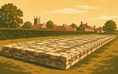
The Wall at its full width
Behind a hedge at the edge of the village lies two hundred and twenty metres of Roman masonry, and English Heritage calls it the longest visible stretch of the broad Wall to have survived.
- English Heritage calls this the longest visible stretch of the broad Wall to have survived.
- The broad specification was about ten Roman feet, roughly three metres, across.
- The gauge was later cut to between six and eight Roman feet.
28 km (17 miles) · heritage
Rudchester
Vindovala, under grass
A fort called Vindovala stood astride the Wall here, with a civilian settlement outside its gates, and Historic England schedules the lot along with the length of Wall and ditch running away on either side. What you can see is a platform in a field. Most of the frontier's forts look exactly like this.
30 km (19 miles) · engineering
The Military Road
A road built out of a wall
For the next thirty kilometres the trail runs beside a dead straight road, and for long stretches that road is sitting on the Wall. It was built through the 1750s, after General Wade's forces struggled to move between Newcastle and Carlisle in the 1745 rising. Wade himself died in 1748, before a stone of it was laid. The Wall went into the foundations, and it is still under there.
The Military Road to the North Tyne
40–57 km · 5 places
40 km (25 miles) · heritage
Halton Chesters
Onnum, cut through by a road
The Military Road goes straight through the fort the Romans called Onnum, which sat astride the Wall. Its remains lie buried on both sides of the tarmac, under grass, and modern traffic crosses the fort without slowing down for it.
47 km (29 miles) · heritage
Planetrees Roman Wall
Where the builders changed their minds
A short length of Wall in which the plan visibly changes. English Heritage measures the eastern fifteen metres at the broad gauge and the western twenty at one metre eighty, and you can stand at the join. Somewhere behind that join is a decision, taken by somebody, to build the rest of the frontier cheaper.
51 km (32 miles) · heritage
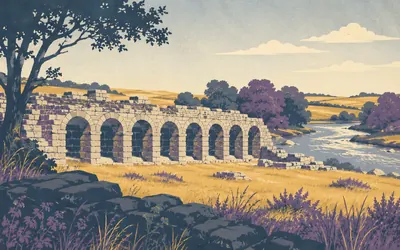
Chesters Roman Fort
Where the Wall crossed the North Tyne
Chesters is a cavalry fort, Cilurnum, built about AD 124 where the Wall crossed the North Tyne, and it is the one place on the frontier that gives you a proper sense of Roman comfort.
- Chesters was a cavalry fort the Romans called Cilurnum, built around AD 124.
- English Heritage gives its garrison as some five hundred cavalrymen.
- Its bath house stands on the bank of the North Tyne below the fort.
55 km (34 miles) · engineering
Limestone Corner
Where the diggers gave up
This is as far north as the Wall goes, and here the work plainly stopped. The ditch is cut down through solid bedrock, and Historic England records that east of the corner the rock-cut ditch was left unfinished. The name misleads as well: the outcrop by the Roman camp here is dolerite.
57 km (35 miles) · heritage
The Temple of Mithras
A cave cult on an open moor
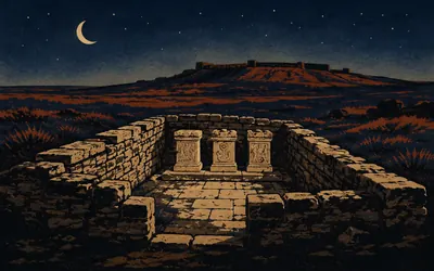
Below the fort at Brocolitia, in a wet hollow that floods most winters, is a rectangle of low walls about six metres by eight with three stone altars standing at one end.
- English Heritage dates the temple's first phase to around AD 200.
- The temple measures about 5.6 by 7.9 metres.
- Coventina's Well produced around 16,000 coins when it was excavated in 1876.
The crags
61–76 km · 6 places
61 km (38 miles) · viewpoint
Sewingshields Crags
The crags begin
The trail climbs onto the Whin Sill here and stays up on it for most of the next fifteen kilometres, the Wall riding a north-facing cliff with nothing much beyond it. Legend puts King Arthur asleep in a cave somewhere under these rocks. No authority repeats that, and up here nobody is especially keen to argue.
65 km (40 miles) · heritage
Housesteads Roman Fort
The whole fort, on the edge of everything
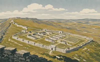
Housesteads sits on a ridge with the ground falling away north into empty country, and English Heritage calls it Britain's most complete Roman fort: walls, gates, granaries up on their raised pillars, the commander's house, the hospital, all of it legible from the gateway.
- English Heritage calls Housesteads Britain's most complete Roman fort.
- Its garrison was an 800-strong infantry regiment, the cohors I Tungrorum.
- English Heritage rates the fort's latrines one of the most remarkable survivals of Roman Britain.
67 km (42 miles) · heritage
Vindolanda
Letters from the edge of the world
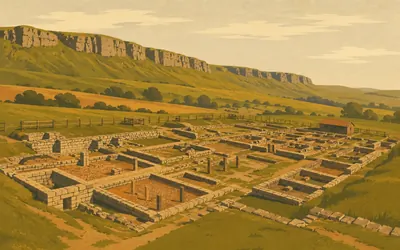
A mile down off the crags, in the valley, is a fort that stood before the Wall and outlasted it.
- Vindolanda guarded the Stanegate road and was built before Hadrian's Wall.
- British Museum curators ranked its writing tablets first among the Museum's top ten British treasures.
- One is an invitation to a birthday party, among the earliest known writing in Latin by a woman.
68 km (42 miles) · nature
Sycamore Gap
The gap is still there
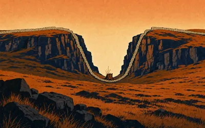
For more than a century a single sycamore stood in a deep dip in the crags, the Wall running down one side of the hollow and up the other.
72 km (45 miles) · engineering
Cawfields
The quarry that ate the Wall
Milecastle 42 stands complete in outline on a steep slope above Hole Gap, and just beyond it the ground stops. English Heritage says plainly that a large stretch of the Wall was destroyed by the working of Cawfields Quarry from 1902. What is left is a flooded hole where the frontier used to run.
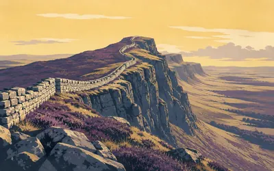
76 km (47 miles) · nature
Walltown Crags
The Wall on a switchback
This is the stretch that sells the whole monument.
- English Heritage measures almost 400 metres of surviving Wall here, up to 2.2 metres high.
- The Wall follows the crest of the Great Whin Sill, a band of hard volcanic rock.
- Greenhead Quarry truncated the stretch at both ends before it closed in 1976.
The Irthing and the turf
80–103 km · 6 places
80 km (50 miles) · heritage
Thirlwall Castle
Built out of the Wall
A ruined tower house over a burn, raised in the fourteenth century against Border raiding and built largely of dressed Roman stone lifted from the Wall a few hundred metres away. Northumberland National Park has held the lease since 1999. The frontier was a quarry for a thousand years, and this is what it was quarried for.
83 km (52 miles) · heritage
Poltross Burn Milecastle
A staircase that measures a wall
Milecastle 48 keeps a flight of Roman steps in its north-east corner, and because a stair can be measured it gives a real clue to how high the milecastle wall stood. English Heritage reads the wall-walk at about 3.66 metres, and with a parapet on top, about 5.34 metres overall.
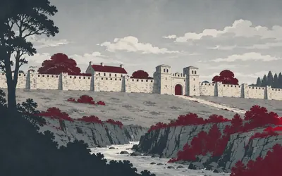
86 km (53 miles) · heritage
Birdoswald Roman Fort
The fort that would not stop
Banna stands above the gorge of the River Irthing, and English Heritage calls it the perfect place to see the longest continuous stretch of Wall still standing.
- English Heritage calls Birdoswald the best place to see the longest continuous stretch of Wall.
- Its Roman name, Banna, is attested by an altar naming the venatores Bannienses.
- Timber halls were built over the fort's ruined granary and occupation continued without a break.
89 km (56 miles) · heritage
Pike Hill Signal Tower
Older than the Wall it stands in
A stump of signal tower set at about forty-five degrees to the Wall, because the tower was there first. English Heritage calls it one of the few visible parts of the Roman frontier that predate Hadrian's Wall. When the Wall came through, nobody straightened it out. They built up to it and carried on.
93 km (58 miles) · heritage
Lanercost Priory
A church made out of a frontier
Two kilometres south of the Wall line stands an Augustinian priory founded in 1169, and English Heritage says outright that part of the appeal of the site was the Wall next door, an excellent source of building stone. Roman blocks are in the walls, some still carrying their inscriptions. Edward I rested here in the winter of 1306 to 1307, not long before he died.
103 km (64 miles) · heritage
The Turf Wall
The Wall that was made of grass
West of the River Irthing the frontier was not built in stone at first. It was cut and stacked out of turf, and rebuilt in stone only later. What runs through these fields now is the buried stone rebuild, a low scarp under the grass rather than a ruin, with possible traces of the turf beside it.
Carlisle and the Solway
108–138 km · 6 places
108 km (67 miles) · nature
Crosby-on-Eden
Red sandstone country, and no Wall to see
There is nothing to see along here, and that is worth noticing. The Wall north of the village survives only as a buried line under the fields. What is left to see is a faint ditch, a line on a map, and the River Eden keeping you company.
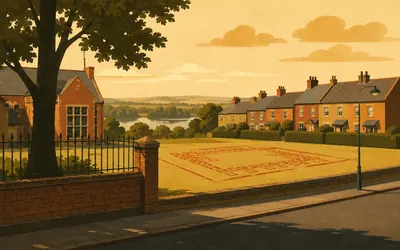
114 km (71 miles) · heritage
Stanwix
The biggest fort is under a school
On the ridge above the Eden, in a Carlisle suburb of houses and hedges, is the largest fort on the whole Wall.
- Historic England's listing calls Stanwix the largest fort on Hadrian's Wall, at 3.96 hectares once enlarged.
- Its garrison, the ala Petriana, is recorded as the only thousand-strong cavalry unit in Roman Britain.
- A granary found under Stanwix Primary School is marked out in red concrete on the playground.
125 km (77 miles) · heritage
Burgh by Sands
Where a king died on the marsh
Edward I died in his camp at Burgh by Sands on 7 July 1307. A monument of 1685 out on the marsh carries a Latin inscription to his memory, and Historic England lists it Grade II star. The church behind you has a fortified tower: this stayed raiding country long after the Romans left.
131 km (81 miles) · heritage
Drumburgh Castle
Licensed in the year a king died
Robert le Brun was granted a licence to crenellate here on 24 August 1307, seven weeks after Edward I died a few miles back up the road. What stands now carries the alterations of 1518, with Lord Dacre's arms over the door, and walls of red sandstone from the nearby Roman Wall. It is somebody's home. You walk straight past the front.
135 km (84 miles) · engineering
Port Carlisle
A canal, then a railway, then nothing
This was built as a canal port so that seagoing ships could reach Carlisle. The canal opened in the 1820s and was closed and drained about thirty years later, whereupon a railway was laid along part of its bed. That closed too. What is left is a harbour with no water in it and one street facing the Solway.
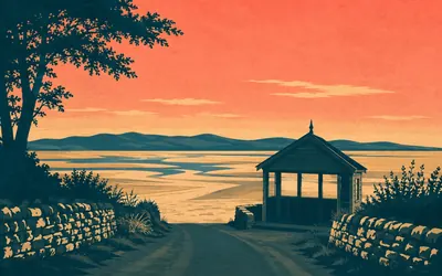
138 km (86 miles) · landmark
Bowness-on-Solway
The far end
The Wall stops at a village ending on a low clay knoll, with the Solway spread out in front of it and Scotland close enough across the water to look like the next field.
- The Wall's western end was a fort the Romans called Maia, now buried under the village.
- Historic England schedules the fort together with the civil settlement outside it.
- The trail officially finishes on The Banks promenade, looking out over the Solway Firth.
Take on Hadrian's Wall Path and collect these places as you reach them
Common questions
How do my walks and steps count towards the wall?
Every activity you record in Strava or Apple Health is added automatically, moving you west along the line of the Roman frontier. On a route of about 138 km the arithmetic stays friendly: 30 km of walking a week reaches Bowness-on-Solway in four to five weeks, and ordinary daily steps count towards that just as a planned hike does.
Do I have to be in northern England to take it on?
No. Wallsend to Bowness-on-Solway is a width of country to cover, not a place you have to stand, so pavements, parks and treadmills anywhere will get you across it. The Romans picked the narrowest neck of England; your job is simply to cover the same span, wherever you happen to be doing your walking.
How long is the virtual Hadrian's Wall challenge?
The Route Rally route covers about 138 km, or roughly 86 miles, coast to coast from Wallsend near Newcastle to Bowness-on-Solway in Cumbria, following the line of Hadrian's Wall Path.
Is this a good first virtual challenge?
Yes. The distance is short enough to finish in a few weeks of regular walking, running or steps, so you get a satisfying coast-to-coast win without committing your whole year.
Can I take it on with daily steps and walks?
Absolutely. Hadrian's Wall is a walking trail, so daily steps, dog walks and weekend hikes all count. At 30 km a week you reach the far coast in about four to five weeks.
Is it a good charity or workplace challenge?
Yes. The short distance and the well-known Roman-history theme make it a popular shared goal. Create a rally and every walk and step the group syncs moves along the wall together.
Start your Hadrian's Wall Path Conquest
Joining is free. Connect Strava or Apple Health once and every ride, run or walk you record syncs automatically, moving you along the route without anything else to log.