Virtual Great Glen Way Challenge
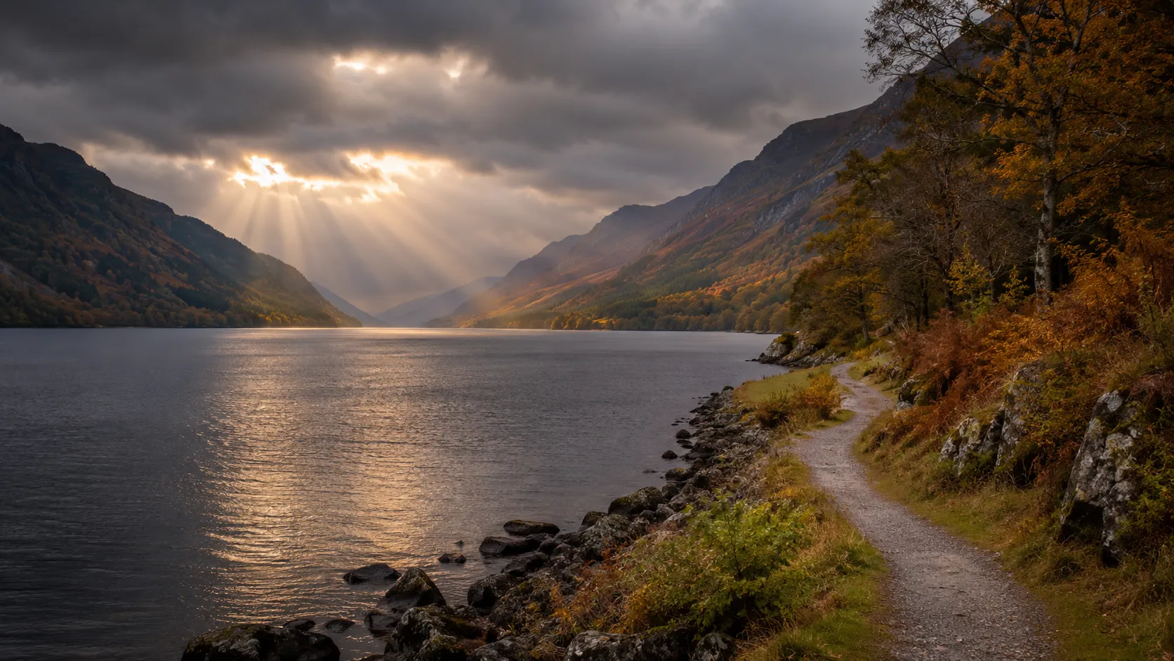
Follow one of Scotland's great geological features from your own roads and trails. The Great Glen Way runs roughly 116 km (about 72 miles) from Fort William at the foot of Ben Nevis northeast along the Great Glen fault to Inverness on the Moray Firth, passing the full length of Loch Ness. Route Rally turns every synced walk, run or ride into progress along this scenic Highland corridor.
Part of the Scotland's Great Trails series
- Route: Great Glen Way
- Distance: 116.4 km
- Free
- Elevation gain: 2608 m
- Scenic Highland loch corridor
- Best for: Shorter rallies of your own for walkers and cyclists, and focused three-to-six week Highland goals
Planning your challenge
A runner averaging 40 km/week finishes in about three weeks; a walker at 30 km/week takes around four weeks, and a cyclist at 150 km/week completes it in under a week.
This is a Short-to-medium route by Route Rally distance bands, the shortest of the Scottish Great Trails and a good first entry into this set.
Works well as a first Scottish trail, a quick Highland goal, or the natural complement to the West Highland Way if you want to link Fort William to Inverness.
Create your own rally for your own Great Glen target, solo or with a group sharing one leaderboard.
Why this route
- The Great Glen Way follows the Great Glen fault from Fort William to Inverness for about 116 km (72 miles), passing the full length of Loch Ness.
- As a virtual challenge you cover the distance in your own time, with daily walks, runs and rides from anywhere pushing you northeast along the lochside.
- It is the shortest of Scotland's Great Trails, which makes it an ideal introduction to the set and a manageable month-long goal.
- The route follows a clear geological line through the Highlands, linking two of Scotland's most important towns via one of its most famous lochs.
- Cyclists can follow much of the route on the Great Glen cycle path, and the relatively gentle terrain makes it accessible across all disciplines.
Highlights
- Start at Fort William at the foot of Ben Nevis, the natural end-point of the West Highland Way
- Follow Loch Lochy and the Caledonian Canal northeast towards Loch Ness
- Travel the full length of Loch Ness along the southern shore
- Finish at Inverness, the capital of the Scottish Highlands
Places along the route
Every place below is measured onto the route line, so the distance shown is where you actually reach it.
Places are researched from published sources. The distances are measured rather than estimated: we find the point on the route's own recorded line that lies nearest the place, and give the distance along the route to that point.
Corpach to Loch Lochy
0–31 km · 9 places
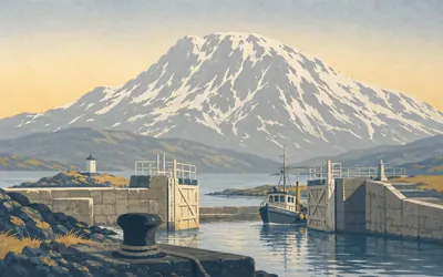
0 km (0 miles) · engineering
Corpach Sea Lock
Where the canal meets the sea
The Caledonian Canal begins here, at a sea lock on Loch Linnhe with Ben Nevis filling the sky behind it.
- The Caledonian Canal opened in 1822, surveyed by Thomas Telford with William Jessop.
- Of its sixty miles, thirty-eight are natural loch and only twenty-two are cut.
- It has twenty-nine locks between Corpach and Inverness.
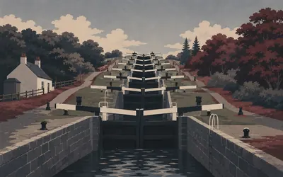
2 km (1 mile) · engineering
Neptune's Staircase
Eight locks, one hill
Two kilometres in and the canal has to climb.
- Neptune's Staircase is eight locks in one flight, raising the canal by 19 metres.
- Scottish Canals calls it the longest staircase lock in Scotland.
- A boat takes around ninety minutes to work through it.
6 km (4 miles) · engineering
Moy Swing Bridge
Two halves, opened by hand
A cast-iron swing bridge in two halves, still worked by hand; until recently the keeper had to row across the canal to open the far half. Scottish Canals describe it as the only known cast-iron swing bridge in existence in the United Kingdom. It has been a scheduled monument since 1974.
8 km (5 miles) · engineering
Gairlochy
Where the canal stops being a canal
The cut ends here and Loch Lochy begins. To make room, Telford's engineers re-cut the River Lochy into a new course so the canal could take its old bed. The next stage of the waterway is not engineering at all. It is just a loch.
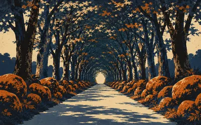
15 km (9 miles) · nature
The Dark Mile
A mile the sun does not reach
The road narrows and the light goes out.
- The Dark Mile is a beech avenue whose canopy closes overhead for most of its length.
- Achnacarry's own history links the planting with Donald Cameron of Lochiel and 1745.
- The Cia-aig burn falls into a pool known as the Witch's Cauldron at its western end.
16 km (10 miles) · heritage
Achnacarry
Where the commandos were made
Achnacarry is the seat of Cameron of Lochiel, and from 1942 it trained commandos, as the Commando Depot and, from 1943, the Commando Basic Training Centre. Men came here to be taken apart and put back together in the hills you are riding through. The memorial to them stands four kilometres away at Spean Bridge, unveiled in 1952.
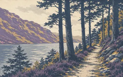
22 km (14 miles) · nature
Loch Lochy
Miles of borrowed canal
For this stage the canal is a loch, and the route is a forest track along its steep north-western shore.
- The canal uses Loch Lochy itself rather than a cut, so there is no towpath along it.
- The loch lies along the Great Glen Fault, which crosses Scotland from coast to coast.
27 km (17 miles) · nature
Glas Dhoire
A place to stop on the water
A clearing on Loch Lochy's shore with a shelter and room to camp, named on Scottish Canals' Great Glen Canoe Trail map. It exists because the north-west side of this loch has nothing else on it for a very long way, and somebody sensible noticed.
31 km (19 miles) · heritage
Kilfinnan Burial Ground
Three stones and a lost church
A small burial ground at the top of Loch Lochy, listed since 1971. Historic Environment Scotland reads it as probably a medieval church site and records three tombstones among the rest, dated 1679, 1699 and 1832. The mausoleum here is traditionally the Glengarry MacDonells'.
Loch Oich and Fort Augustus
34–52 km · 7 places
34 km (21 miles) · engineering
Laggan Locks
The top of the whole canal
From here the canal stops climbing. Loch Oich, just ahead, is the summit level of the whole waterway: everything behind you was uphill and everything in front of you is down. Boats coming the other way have been working up to this point since Inverness. It is a quiet place to have reached a top.
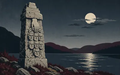
36 km (22 miles) · heritage
The Well of the Seven Heads
A monument nobody softened
On the far shore of Loch Oich stands a stone monument carrying seven carved heads beneath a hand holding a dagger.
- The monument was erected in 1812 by Alasdair Ranaldson MacDonell of Glengarry.
- Its inscription is carved in four languages: Latin, English, French and Gaelic.
- It commemorates the Keppoch murders of 1663 and the executions at Inverlair in 1665.
38 km (24 miles) · heritage
Invergarry Castle
Burned by Cumberland, never rebuilt
A late seventeenth-century ruin on a rock above Loch Oich, the seat of the MacDonells of Glengarry. The Duke of Cumberland's men burned it in 1746 after Culloden and nobody put it back. It is a scheduled monument, and the shell is fenced off, which is what happens to a building left standing on principle.
42 km (26 miles) · engineering
Aberchalder Swing Bridge
The bridge that is not the scheduled one
The canal is crossed here by a road swing bridge, and beside it stand the abutments of an older accommodation bridge. Only the old abutments fall inside the scheduled monument; the working road bridge is explicitly excluded from it, which is the sort of distinction heritage law lives on.
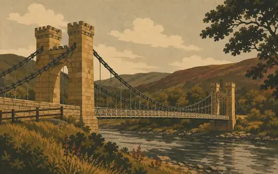
44 km (27 miles) · engineering
The Bridge of Oich
Chains that get thinner as they go
James Dredge patented an idea and built this to prove it.
- The Bridge of Oich was built in 1854 to James Dredge's patented taper principle.
- Its chains shed a bar at every hanger, tapering from thick at the towers to thin at mid-span.
- It is a Category A listed building, bypassed in 1932 and reopened to people on foot in 1997.
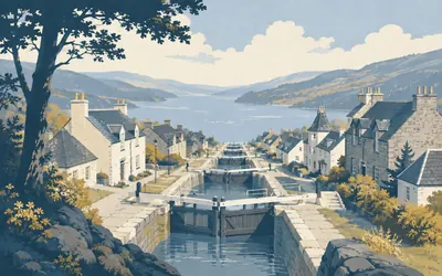
50 km (31 miles) · engineering
The Fort Augustus Locks
Down the middle of the village
The canal comes into Fort Augustus and drops straight through the middle of it, a flight of locks stepping down between shops and pavements with people leaning on the railings watching boats descend.
- The canal descends through the village in a flight of locks and enters Loch Ness below.
- General Wade enlarged the fort here from 1729, on the site of the earlier Kilwhimen Barracks.
- Fort Augustus Abbey was a Benedictine house and school from 1876; the monks left in 1998.
52 km (32 miles) · heritage
Cherry Island
The only island in Loch Ness
Loch Ness has exactly one island and people built it. Cherry Island is a crannog, an artificial islet raised in the shallows, and Historic Environment Scotland gives it as fifty to sixty metres across before the canal raised the loch and drowned most of it. What you can see is the top.
Loch Ness
55–87 km · 7 places
55 km (34 miles) · nature
Allt na Crìche
Steep steps, waterfalls and the loch below
Forestry and Land Scotland's waymarked circuit leaves the way here and climbs hard beside the burn, past waterfalls, to a view out over Loch Ness. The woods are mixed birch and pine and hold red squirrels, pine marten and red deer. Its lower section is the track you are already on.
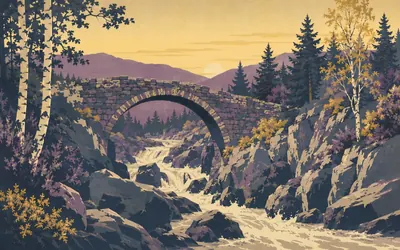
60 km (37 miles) · heritage
The old bridge at Invermoriston
Older than the road that used it
A stone arch stands abandoned over the gorge of the River Moriston, water tearing through the boulders beneath it, birch and pine leaning in from both banks.
- Historic Environment Scotland dates the old bridge at Invermoriston to the mid eighteenth century.
- It is Category B listed and no longer carries traffic.
- It predates Thomas Telford's Highland road programme, which used the existing crossing.
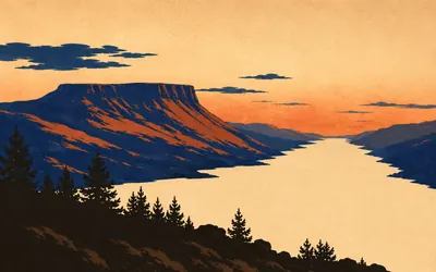
71 km (44 miles) · viewpoint
Meall Fuar-mhonaidh
The hill that shows you the fault
Loch Ness is not a lake shape.
- Meall Fuar-mhonaidh is 699 metres, a major landmark above Loch Ness's western shore.
- The Great Glen is a fault running clean across Scotland, which is why the loch is straight.
73 km (45 miles) · nature
Alltsigh
Down to the water, briefly
One of the few places on this stretch where the way comes down off the hillside towards Loch Ness. A burn drops down the slope, there is a hostel, and the loch is suddenly enormous and very close. Then the track climbs again.
79 km (49 miles) · viewpoint
Grotaig
The high line above Urquhart Bay
The way runs along the hillside here, a couple of hundred metres above the loch, with Urquhart Bay opening below and the far shore close enough to pick out individual fields. It is a long, open view of Loch Ness, and it goes on for kilometres.
85 km (53 miles) · nature
Drumnadrochit
A wood that floods on purpose
The wet ground where the rivers Enrick and Coiltie reach Loch Ness is Urquhart Bay Wood, and NatureScot rates it one of very few intact floodplain woodlands left in the UK, a habitat rare throughout Europe. Locally it is just The Cover. It floods, which is the point of it.
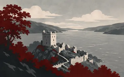
87 km (54 miles) · heritage
Urquhart Castle
Blown up so nobody else could have it
Urquhart is a ruin because somebody decided it should be.
- The gatehouse was deliberately blown up in 1692 to deny the castle to Jacobite forces.
- The five-storey Grant Tower is sixteenth century and partly collapsed in a storm in 1715.
- Historic Environment Scotland records activity on the rock long before the 1228 grant.
Over the hill to Inverness
93–116 km · 7 places
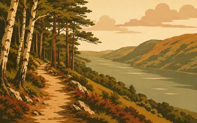
93 km (58 miles) · nature
Abriachan Forest
A forest the village bought
In 1998 the people of Abriachan bought their forest.
- Abriachan's community bought the forest in 1998 and has managed it ever since.
- The Great Glen Way calls it the UK's first community woodland bought from the Forestry Commission.
- The Great Glen Way's highest point, 434 metres, is on its high route through this forest.
99 km (61 miles) · nature
Loch Laide
A small loch on the tops
A small upland loch on the moor above Abriachan, in a landscape of peat, birch scrub and old crofting ground. After a hundred kilometres of one enormous loch a long way below you, a small one at eye level is a strange and welcome change of scale.
101 km (63 miles) · landmark
Bona Lighthouse
A lighthouse a long way from the sea
Where Loch Ness narrows into Loch Dochfour there is a small white lighthouse. Telford built the house around 1815 as part of the canal works, and the light was only added about thirty years later. Scottish Canals says it was once the smallest manned inland lighthouse in Britain, which is a very particular record to hold.
106 km (66 miles) · engineering
Dochgarroch Lock
The gate that holds the loch
Dochgarroch is the lock that holds Loch Ness back. Everything above it, all thirty-odd kilometres of loch, is held back here, with Telford's Ness Weir nearby setting the level. It is a scheduled monument and Scottish Canals still work it, which is a strange combination and entirely normal on this waterway.
112 km (70 miles) · heritage
Craig Phadrig
A fort that was set on fire
A vitrified hillfort in the woods above Inverness: the ramparts burned so fiercely that the stone itself melted and ran. Historic Environment Scotland dates the walls to around the third century BC, with Pictish occupation between roughly 400 and 600 AD. Tradition puts King Bridei here, and Saint Columba visiting him. Neither custodian of the site says so.
114 km (71 miles) · nature
The Ness Islands
Footbridges to nowhere in particular
Wooded islands in the middle of the River Ness, joined to both banks and to each other by footbridges, two of them suspension spans in Victorian style, all of it a few minutes from the centre of Inverness. The river runs fast around them. It is the last quiet thing on the route.
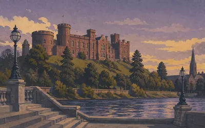
116 km (72 miles) · landmark
Inverness Castle
The end of the glen
The red sandstone building on the mound above the river is not the castle that mattered.
- The earlier castle was destroyed by Jacobite forces in 1746.
- William Burn's courthouse was built from 1833 to 1836; Thomas Brown II's gaol followed in 1846 to 1848.
- It reopened as the Inverness Castle Experience in February 2026 after a £47 million rebuild.
Take on Great Glen Way and collect these places as you reach them
Common questions
How does my activity count along the Great Glen?
There is no logging step at all. Your Strava or Apple Health activities arrive on their own and move you northeast from Fort William. A runner at 40 km a week reaches Inverness in about three weeks, and a cyclist at 150 km a week in under a week.
Do I have to be near Loch Ness?
No. Only the length of the glen is asked of you, so your local roads and towpaths carry you the whole way along it. The real corridor runs dead straight along a geological fault; your own version can wander as much as it likes, provided it adds up to 116 km.
Can I do this after the West Highland Way?
Yes. Many walkers link the two trails: the West Highland Way ends at Fort William, and the Great Glen Way starts there, effectively letting you walk from the outskirts of Glasgow to Inverness in one unbroken journey. As virtual challenges they are separate routes with separate leaderboards.
How long does it take?
At 30 km a week you finish in about four weeks. Runners at 40 km a week complete it in around three weeks, and cyclists at 150 km a week in under a week. How long the rally runs is settled by you at setup.
Start your Great Glen Way Conquest
Joining is free. Connect Strava or Apple Health once and every ride, run or walk you record syncs automatically, moving you along the route without anything else to log.