Virtual Cotswold Way Challenge
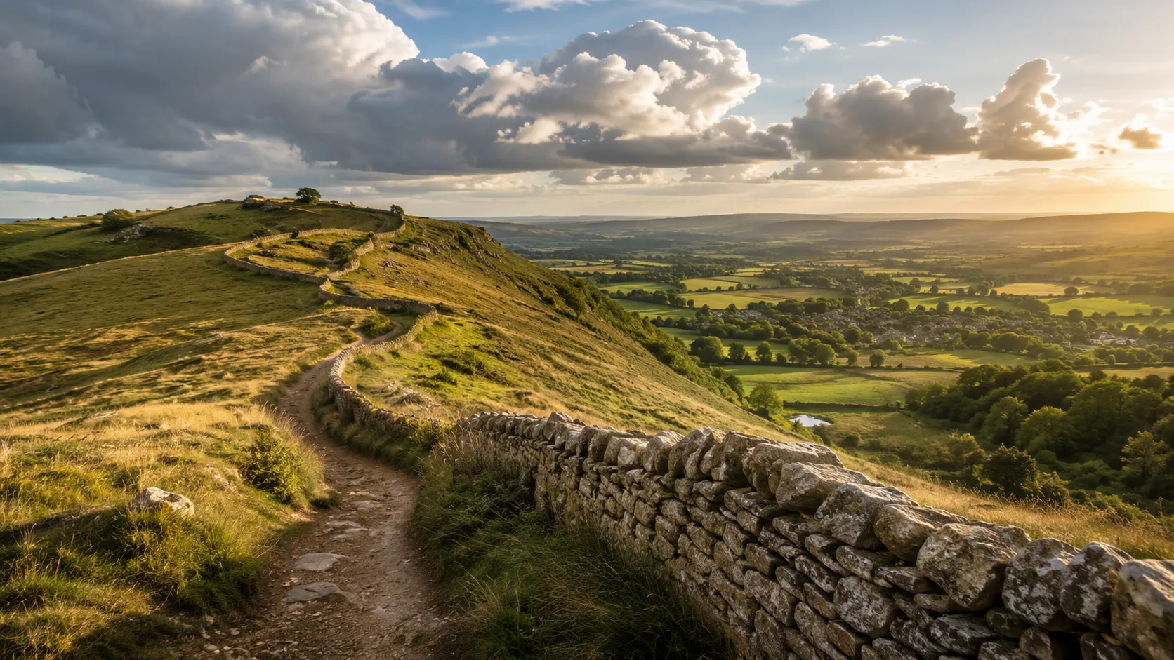
Walk one of England's most beautiful long-distance routes from wherever you already move. The Cotswold Way runs roughly 155 km (about 96 miles) from the market town of Chipping Campden in Gloucestershire south to the Georgian city of Bath in Somerset, winding along the limestone escarpment of the Cotswolds through honey-coloured villages and open hillside views. Route Rally turns every synced walk, run or ride into progress along it.
Part of the National Trails series
- Route: Cotswold Way
- Distance: 154.9 km
- Elevation gain: 4247 m
- Gentle limestone escarpment walk
- Best for: Medium rallies of your own for walkers and runners, and steady four-to-eight week goals
Planning your challenge
A runner averaging 40 km/week finishes in about four weeks; a walker at 30 km/week takes around five weeks, and a cyclist at 150 km/week completes it in about a week.
This is a Medium route by Route Rally distance bands, ideal for a first longer challenge or a focused seasonal goal.
Particularly well suited to walkers and runners who want a scenic, manageable route that finishes in weeks rather than months.
Create your own rally for your own Cotswolds target, solo or with a group sharing one leaderboard.
Why this route
- The Cotswold Way follows the limestone escarpment from Chipping Campden to Bath, about 155 km (96 miles) through one of England's most picturesque regions.
- As a virtual challenge you cover the distance in your own time, so daily walks, weekend runs and steady bike miles all count towards the finish.
- Its length sits in a sweet spot: long enough to feel like a proper journey, short enough to finish in a month at a comfortable pace.
- The route leans naturally towards walking and running, though cyclists can use the distance as a brisk target.
- The combination of gentle hills, open views and a famous city finish gives it real appeal as a first or second route challenge.
Highlights
- Start at Chipping Campden, a classic Cotswolds market town in Gloucestershire
- Follow the limestone escarpment south through rolling hills and hilltop viewpoints
- Pass Cleeve Hill, the highest point in the Cotswolds, and Broadway Tower
- Finish in Bath, a UNESCO World Heritage city in Somerset
Places along the route
Every place below is measured onto the route line, so the distance shown is where you actually reach it.
Places are researched from published sources. The distances are measured rather than estimated: we find the point on the route's own recorded line that lies nearest the place, and give the distance along the route to that point.
The northern escarpment
0–155 km · 31 places

0 km (0 miles) · heritage
Chipping Campden Market Hall
Four hundred years of shelter for butter and poultry
The Cotswold Way begins in a wool town whose High Street is one long curve of honey-coloured stone, and the thing you set off past is an open arcaded hall standing in the middle of it.
- Historic England's Grade I listing dates the Market Hall to 1627, built for Sir Baptist Hicks.
- It was built to shelter traders selling dairy produce and poultry.
- National Trails gives the Cotswold Way as 102 miles, or 164 km, from Chipping Campden to Bath.
5 km (3 miles) · landmark
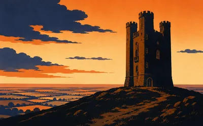
Broadway Tower
A folly with a printing press inside it
A dark, blunt, three-turreted tower stands on the hilltop above Broadway with nothing else near it.
- Historic England describes the tower as a folly of 1798 by James Wyatt for Lord Coventry.
- Sir Thomas Phillipps housed his private printing press in the tower between 1822 and 1862.
- Historic England records Edward Burne-Jones and William Morris among those who stayed there.
8 km (5 miles) · landmark
Broadway
A high street the colour of butter
The Way drops off the escarpment into Broadway, a wide green street of limestone frontages. The Lygon Arms is listed Grade II star. St Eadburgha's church, on the lane back out of the village, is Grade I and has seven separately listed monuments in its churchyard. Then the trail climbs straight back up again.
13 km (8 miles) · heritage
Shenberrow Hill Camp
Not a hillfort, and that is the point
Historic England schedules Shenberrow Hill camp as an Iron Age defended settlement rather than a hillfort, a smaller class that sat below hillforts in the settlement hierarchy and which it calls a rare monument type. It occupies the upper slopes of a ridge above a steep scarp on the Cotswold escarpment.
17 km (11 miles) · landmark
Stanway House
Three hundred feet of water, straight up
Historic England lists Stanway House as late sixteenth and early seventeenth century, with a separately Grade I gatehouse of about 1630. In the canal below it the estate opened a single-jet fountain on 5 June 2004 which it gives as three hundred feet and ten and a quarter inches, and which it calls the tallest fountain in Britain and the highest gravity fountain in the world.
22 km (13 miles) · heritage
Beckbury Camp
A seat with a story that will not stand up
A slight univallate hillfort with a rampart up to four metres high, scheduled by Historic England. In its north-west corner is a stone structure with alcoves and basins known as Cromwell's Seat, said to mark the spot where Thomas Cromwell watched Hailes Abbey burn in the valley below. Historic England dates the structure to the nineteenth century.

24 km (15 miles) · heritage
Hailes Abbey
Founded on a vow, undone by a phial
Low walls and the stumps of cloister arcading in wet grass, and a great deal of history.
- English Heritage records Richard, Earl of Cornwall, vowing in 1242 to found a monastery after surviving a storm at sea.
- Twenty monks and ten lay brothers arrived at Hailes on 15 June 1246.
- English Heritage says the Holy Blood relic made Hailes one of the most important pilgrimage destinations in medieval England.
27 km (17 miles) · heritage
Sudeley Castle
A queen buried in somebody's garden
Katherine Parr, sixth wife of Henry VIII, married Thomas Seymour in secret in 1547, gave birth to a daughter here on 30 August 1548 and died on 5 September. She lies in St Mary's chapel in the grounds. The castle's owners call it the only private castle in England to have a queen buried within its grounds.
30 km (19 miles) · heritage
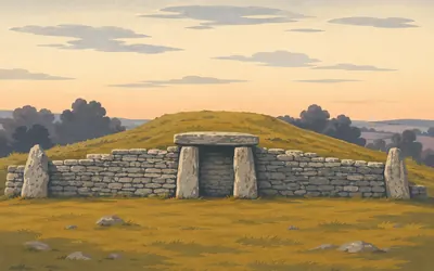
Belas Knap
A doorway that goes nowhere
A long grassy mound on the hilltop, with a stone forecourt at its northern end framing a doorway of two uprights and a lintel.
- Historic England describes the entrance as false: it never led to any internal passage.
- English Heritage dates the barrow to around 3000 BC.
- Historic England gives the mound as 70 m long and itemises thirty-seven burials, six of them under the false entrance.
37 km (23 miles) · nature
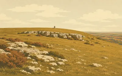
Cleeve Common
The roof of the Cotswolds, and a golf course
The trail climbs onto open limestone grassland and stays up there for miles.
- The Cleeve Common Trust calls it the largest common in the Cotswolds National Landscape and the highest point on the Cotswolds at 330 m.
- Natural England calls it one of the most extensive areas of limestone grassland in the Cotswolds.
- Natural England says Postlip Warren shows the best 'ridge-and-trough' features in Great Britain.
46 km (29 miles) · nature
Lineover Wood
A coppice stool a thousand years old
The Woodland Trust owns fifty hectares here and says two thirds of it is designated ancient woodland. Among the trees is a lime coppice stool the Trust reckons has stood for the best part of a thousand years, and a beech over six hundred years old that it believes is the third largest in England.
53 km (33 miles) · landmark
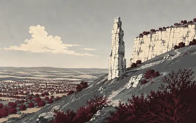
Leckhampton Hill
A pinnacle the quarrymen left behind
A thin finger of rock stands out from the quarried scarp above Cheltenham, and it is there because of what was taken away rather than what was put up.
- Cheltenham Town Council bought Leckhampton Hill in 1927, following riots over public access in 1902 and 1906.
- The Friends of Leckhampton Hill give quarrying as the likely explanation for the Devil's Chimney.
- Natural England declared the Cheltenham Escarpment a national nature reserve in June 2026.
59 km (36 miles) · heritage
Crickley Hill
A hill that kept being attacked
The National Trust says the first structures here date from 3500 to 2500 BC and were rebuilt several times before being abandoned after an attack. An Iron Age hillfort followed, burned and abandoned in the sixth century BC, with over four hundred arrowheads found at its entrance. Excavations ran every summer from 1969 to 1993.
66 km (41 miles) · nature
Cooper's Hill
Gloucestershire's steepest slope
Gloucestershire Wildlife Trust runs the fifty-four hectare reserve here and puts the matter plainly: Cooper's Hill's one-in-two gradient makes Gloucestershire's steepest slope. It sits inside the Cotswold Commons and Beechwoods national nature reserve. Every spring people throw themselves down it after a cheese, at an event no authority organises or records.
71 km (44 miles) · heritage
Painswick Beacon
A hillfort with a golf course through it
Historic England schedules a large multivallate hillfort of about 8.8 hectares here, three rampart banks and two ditches along its west and south, and notes that large multivallate hillforts are rare, with around fifty recorded nationally. It is believed to have been used as an outpost by Charles I's army during the siege of Gloucester in 1643.

74 km (46 miles) · heritage
Painswick Churchyard
Ninety-nine yews, by tradition
The churchyard at Painswick is full of clipped yews and carved tombs, and many of the tombs are listed.
- Historic England frames the count as tradition: what are traditionally reckoned ninety-nine yews, planted about 1792.
- Historic England says the churchyard contains one of England's finest collections of funerary monuments.
- The mason-carver John Bryan, who died in 1787, is buried under a pyramid in the churchyard.
80 km (50 miles) · viewpoint
Haresfield Beacon
A promontory over the Severn vale
An Iron Age hillfort of some five hectares occupies the end of the spur, cut off from the ridge behind by a substantial earthwork; a Roman coin hoard was found here in the 1830s. A toposcope stands a little way along the Cotswold Way towards Shortwood, set out to read the view. On a clear day that is a great deal.
88 km (55 miles) · nature
Selsley Common
A common with a long barrow called The Toots
Nearly forty hectares of limestone grassland above the Stroud valleys, notified as a site of special scientific interest in March 1986 for both its biology and its geology, and looked after by Stroud District Council. At its northern end Historic England schedules a Neolithic long barrow known locally as The Toots.
92 km (57 miles) · heritage
Nympsfield Long Barrow
A Neolithic tomb with the roof off
English Heritage's Nympsfield long barrow lies open to the sky at Coaley Peak, its chambers exposed, high on the Cotswold scarp near Frocester with a view over the Severn valley. Historic England schedules it. Unlike its neighbour at Uley you cannot go inside it, because there is no inside left.
94 km (58 miles) · heritage
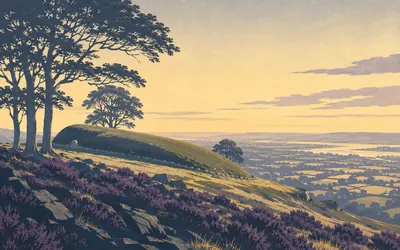
Uley Long Barrow
A tomb named after the woman who owned the field
The barrow lies along the scarp edge with a stone doorway at one end, and English Heritage lets you inside it.
- English Heritage calls it one of the best surviving of the Cotswold-Severn group of barrows, and one of the most atmospheric.
- It is named after Hester Pegler, who owned the land in the seventeenth century.
- English Heritage records between fifteen and twenty skeletons recovered from the barrow.
99 km (62 miles) · landmark
Dursley
A town hall on stilts
Historic England lists Dursley's Town Hall Grade II star, and the Cotswolds National Landscape describes it as an eighteenth-century market hall raised on pillars like stilts. The market traded underneath it. The Way comes down off the hills, through the town, and climbs straight out the other side.
103 km (64 miles) · landmark
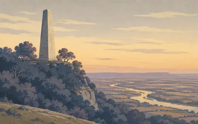
The Tyndale Monument
A tower for a man who translated a book
A plain stone tower stands on the edge of Nibley Knoll, visible for miles across the Severn vale.
- Historic England lists the monument as built in 1866 to a design by S S Teulon for the second Earl of Ducie.
- The monument's own inscription records Tyndale suffering martyrdom at Vilvoorde in Flanders on 6 October 1536.
- Historic England gives the tower as about 36 m high; National Trails gives 111 ft.
107 km (67 miles) · heritage
Wotton-under-Edge
Almshouses round a courtyard
The Hugh Perry Almshouses, listed by Historic England, are dated part 1638 and part 1712: three wings round a courtyard, with six Cotswold gables to the street. Their chapel is listed separately. Pitman House in Orchard Street carries a plaque recording that Isaac Pitman devised his shorthand here in 1837.
119 km (74 miles) · landmark
The Somerset Monument
A hundred feet for a general at Waterloo
Historic England lists this tower Grade II star: built in 1846 by Lewis Vulliamy, about a hundred feet high, with armorial bearings, a portcullis for Beaufort and elaborate strapwork under a cross on an orb. It commemorates Lord Robert Edward Henry Somerset, a general at Waterloo, who died in 1842. It is on the Heritage at Risk register.
122 km (76 miles) · heritage
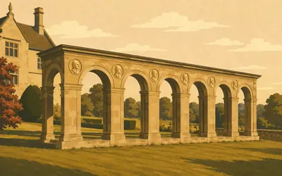
Horton Court
A twelfth-century hall and a Renaissance walk
Two buildings sit below the church at Horton, and each is listed Grade I in its own right.
- Historic England dates Horton Court's north wing to about 1140 and the rest of the house to about 1521.
- Historic England dates the detached ambulatory to about 1527 and lists it separately Grade I.
- The National Trust calls Knight's Renaissance design at Horton a very early example in the country.
125 km (78 miles) · heritage
Sodbury Camp
A rectangular fort, and a king resting
Historic England schedules a large multivallate hillfort of about ten hectares here, and National Trails describes a rectangular fort of double ditches and ramparts with the scarp slope defending its western side. In 1471 Edward IV rested here before moving on to destroy Margaret of Anjou's army at Tewkesbury.
130 km (81 miles) · heritage
Tormarton
A Grade I church and nine listed graves
The church of St Mary Magdalene at Tormarton is listed Grade I, and nine monuments in its churchyard are listed in their own right, each carrying the name of the family beneath it: Bennett, Arnold, Hatherell, Witherly, Beard, Isaac, Edwards, Watts, Brookman. The trail goes by the churchyard wall.
137 km (85 miles) · landmark
Dyrham Park
A house dropped into a fold in the hills
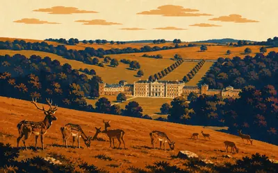
The trail comes over the top and the park opens below it, a bowl of old grassland with a great house at the bottom and deer in the grass.
- The National Trust records Dyrham as built between 1692 and 1704 for William Blathwayt, Secretary of State to William III.
- The west front is by Samuel Hauduroy; the east front, a decade later, is by William Talman.
- The National Trust says the name Dyrham comes from a Saxon word meaning valley of the deer.
145 km (90 miles) · heritage
Sir Bevil Grenville's Monument
A griffin over a battle nobody won
Sir Bevil Grenville's monument, listed Grade II star and separately scheduled, was erected in 1720 to a design by John Harvey, about twenty-five feet high and topped by a griffin holding the Grenville shield. Historic England registers the battlefield around it: on 5 July 1643 the Royalists stormed the hill, stalemate followed, and the Parliamentarians withdrew in the dark. Bath had not fallen.
147 km (91 miles) · viewpoint
Little Down Hillfort
A hillfort, a racecourse, and Bath in the valley below
Historic England schedules a large univallate hillfort of just over seven hectares on the plateau at Little Down, and the trail crosses the plateau. Beyond it it runs past Bath Racecourse and begins its drop towards the city in the valley below.
155 km (96 miles) · heritage
The Roman Baths
Where the Way ends, and the water never stops
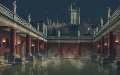
The Cotswold Way finishes at a carved stone disc set into the pavement outside the west doors of Bath Abbey, a few steps from the Roman Baths.
- The Roman Baths' operator gives the spring as 1,170,000 litres a day at 46 degrees Celsius.
- Aquae Sulis means 'waters of Sulis'; the temple to Sulis Minerva dates to the later first century AD.
- National Trails says a carved stone disc in the pavement outside the Abbey's west doors marks the end of the trail.
Take on Cotswold Way and collect these places as you reach them
Common questions
How do my walks count towards Bath?
Anything your tracker logs is picked up for you, carrying you south from Chipping Campden. At 30 km a week you reach Bath in around five weeks; at 50 km a week it comes inside a month. There is no upload step afterwards and no figure to key in.
Do I have to walk in the Cotswolds?
No. The escarpment is a measurement here rather than a location, so your local paths and pavements carry you along it. You will not get the honey-coloured villages or the view from Cleeve Hill, but you do have to cover the same 155 km before Bath appears at the end.
Is this a good first long-distance challenge?
Yes. The distance is manageable in a month at a steady walking or running pace, and the route has a clear start and a satisfying city finish, which makes it a good choice before stepping up to something longer.
How long does it take to walk?
At 30 km a week you finish in around five weeks. Building to 50 km a week brings it inside a month. Your chosen end date at setup decides how hard those weeks have to be.
Start your Cotswold Way Conquest
Connect Strava or Apple Health once and every ride, run or walk you record syncs automatically, moving you along the route without anything else to log.